Duluth, MN
Weather Forecast Office
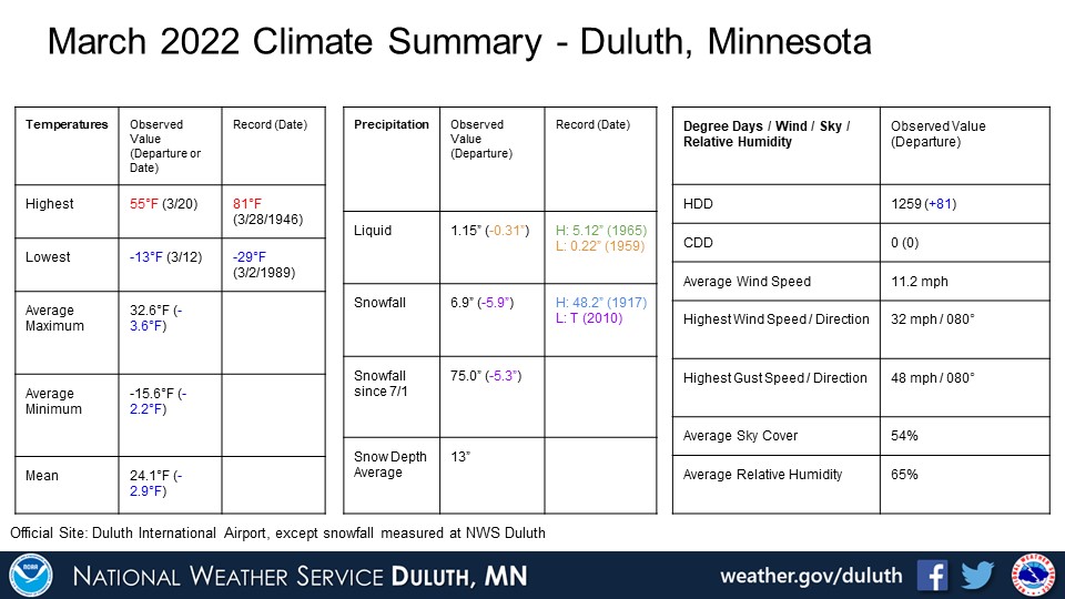
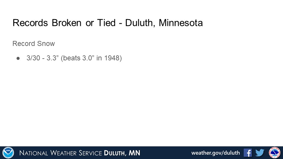
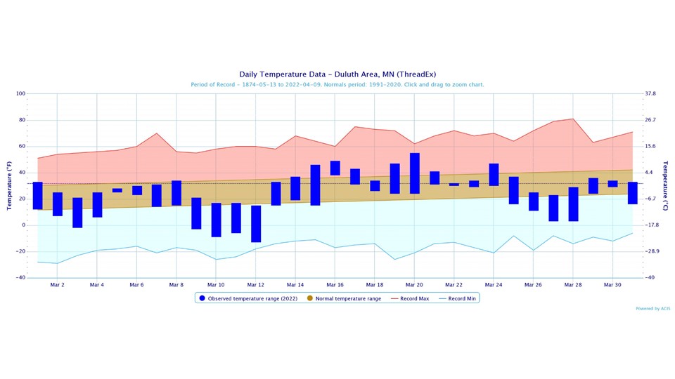
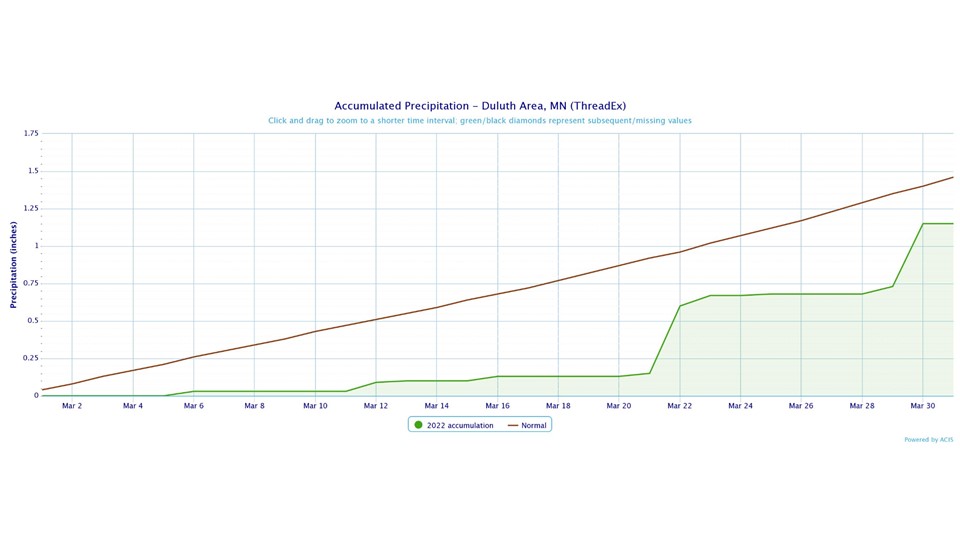
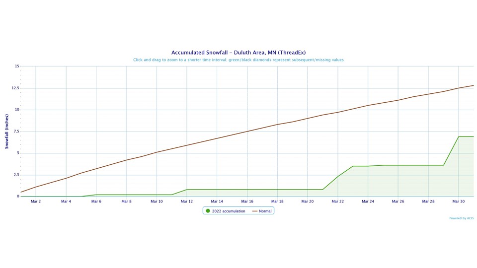
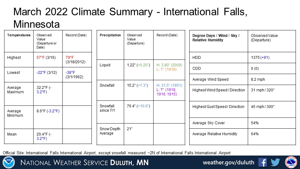
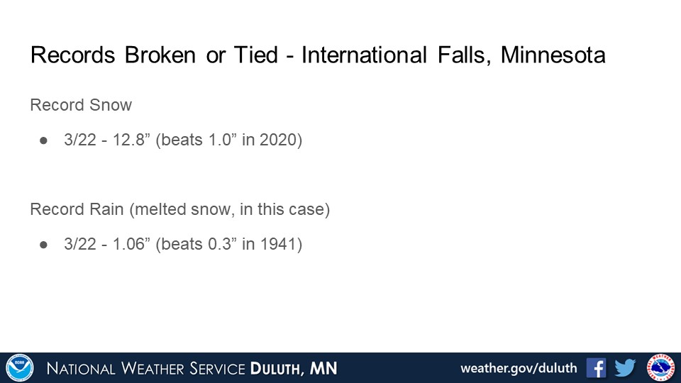
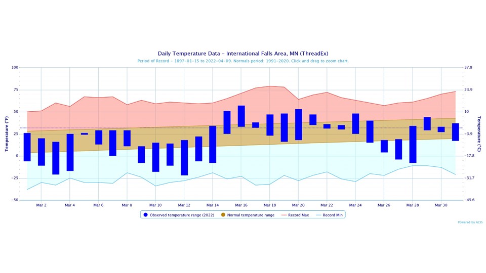
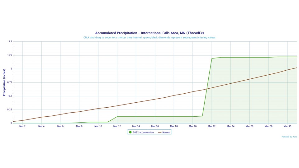
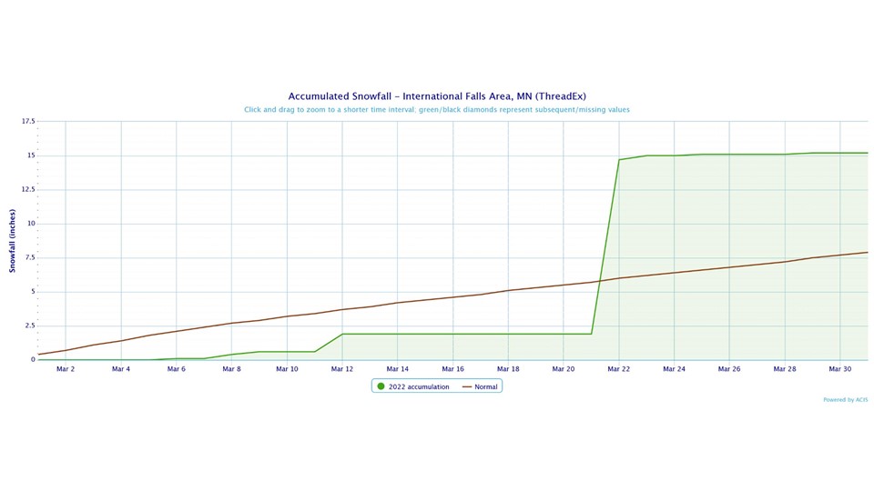
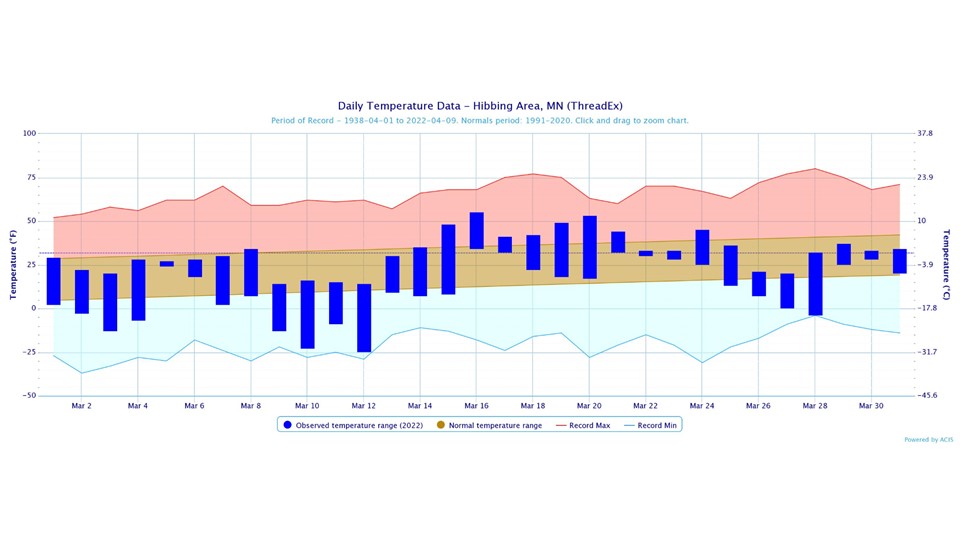
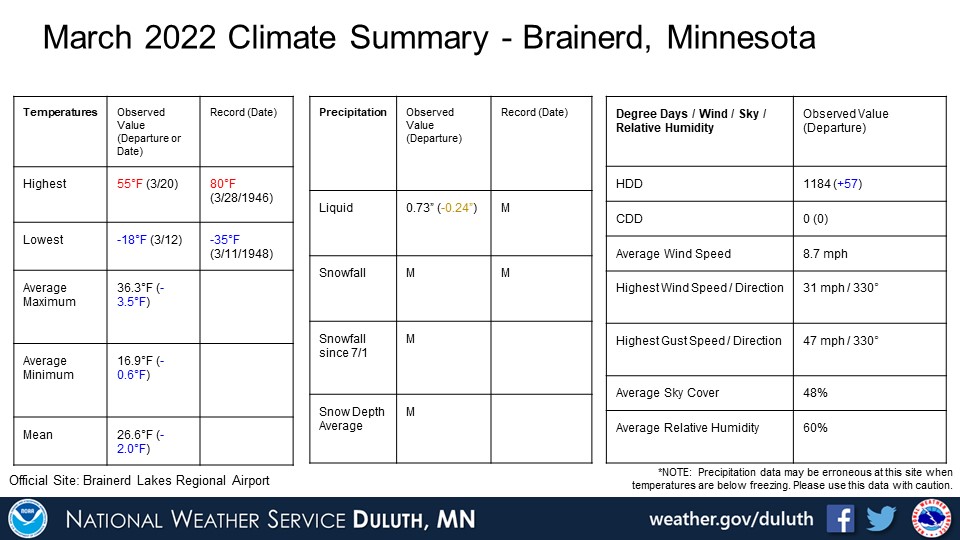
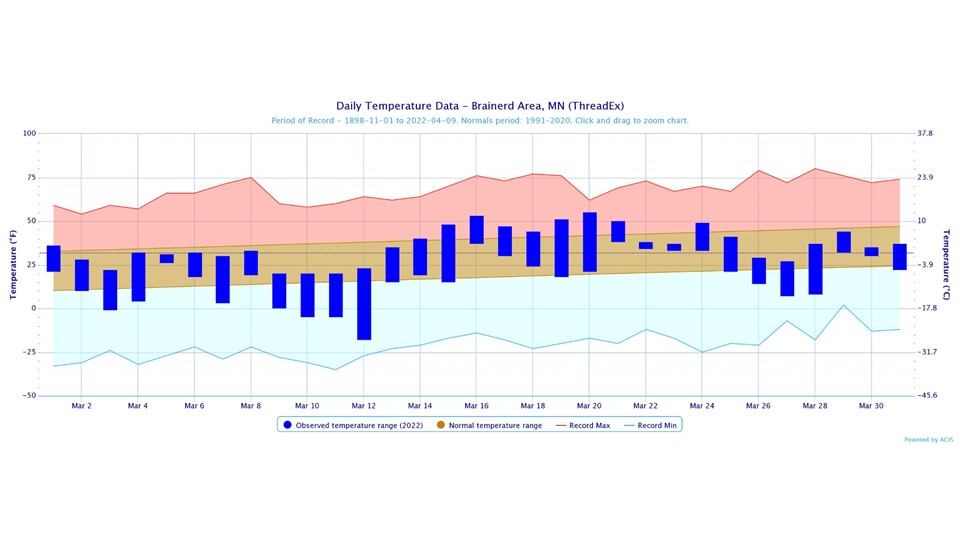
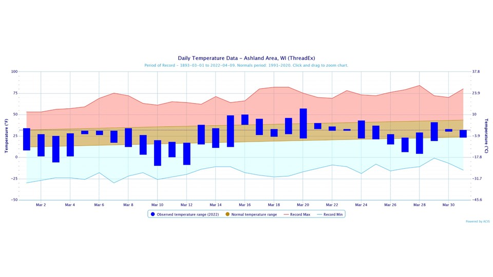
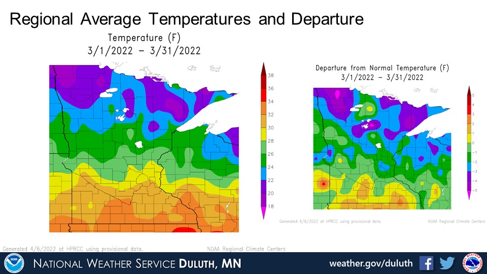
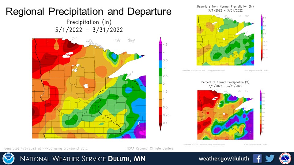
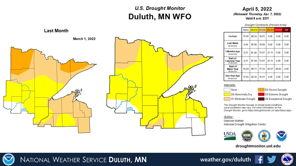
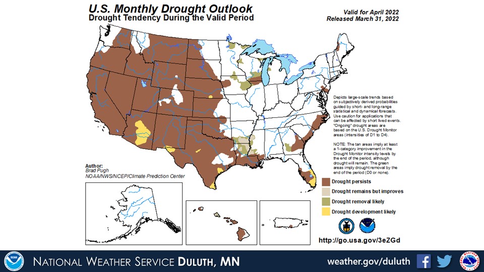
March 2022 featured several ups and downs with temperatures, starting below average at the beginning of the month, then a mid-month spring tease, followed by more colder weather towards the end. The net result was below average temperatures across the region. Precipitation was a bit below or above average depending on location, and that was largely due to the variability of storms that passed through. A snowstorm that brought 12.8” to International Falls on the 22nd only brought 1.5” to Duluth, for example, and this placed International Falls above average for precipitation and Duluth below average. With a pretty active pattern especially during the end of the month, drought conditions improved with now only abnormally dry to moderate drought conditions across the region.
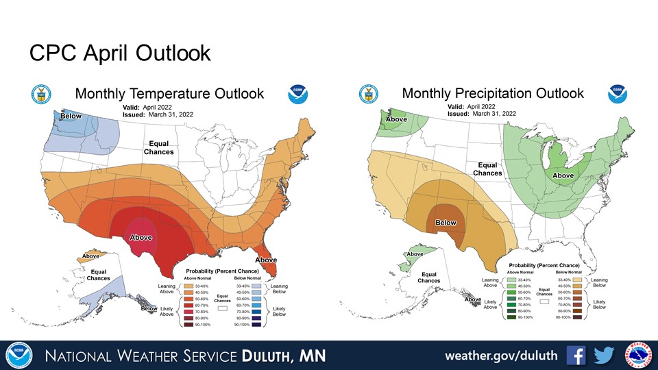
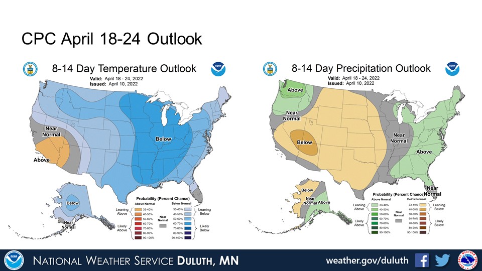
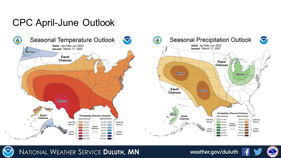
Looking ahead, the CPC forecasted above average precipitation chances for April with equal chances for above or below average temperatures (likely trending below average for the later part of the month per the 8-14 day outlook released on April 10). The three month outlooks suggest warmer temperatures and equal chances for above or below average precipitation. Our active weather pattern, which may continue for the near future, should result in continued drought improvement.
Duluth
International Falls
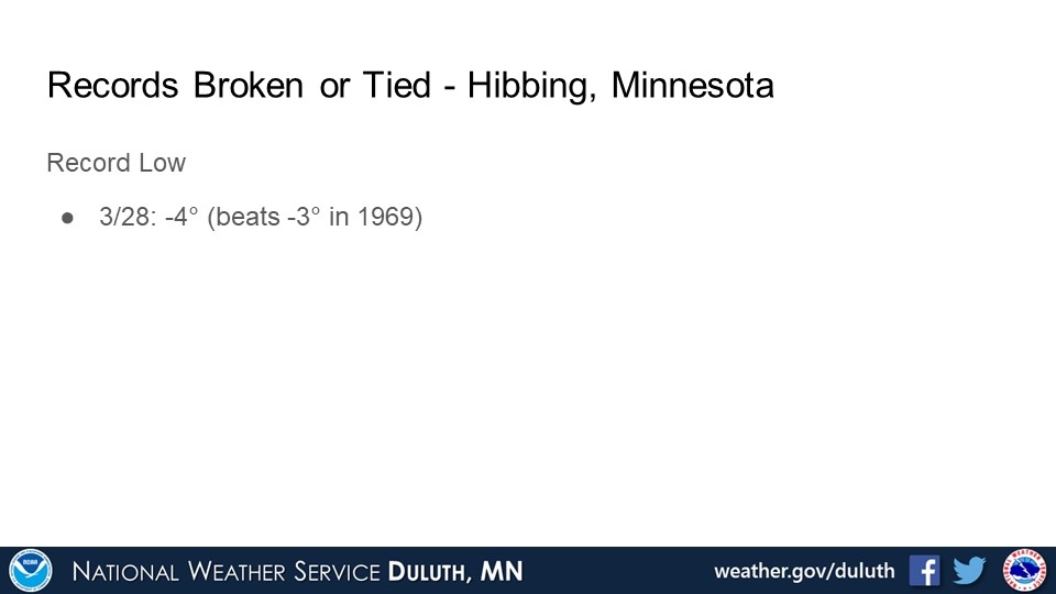
Hibbing

Brainerd
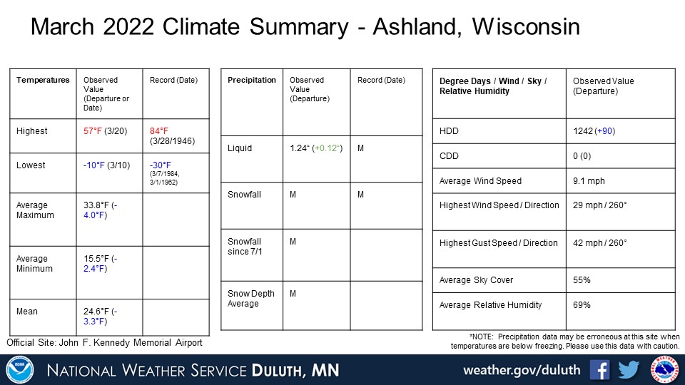
Ashland
Summary
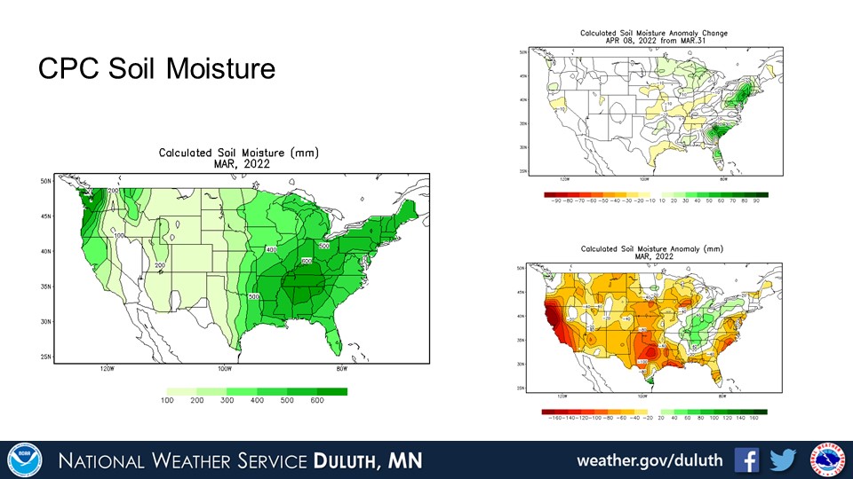
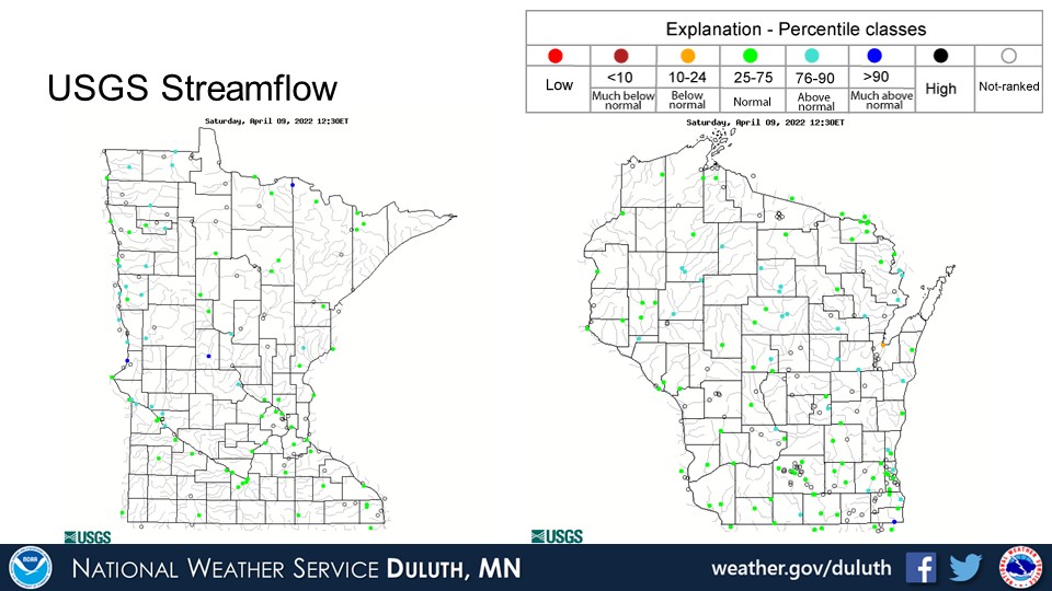
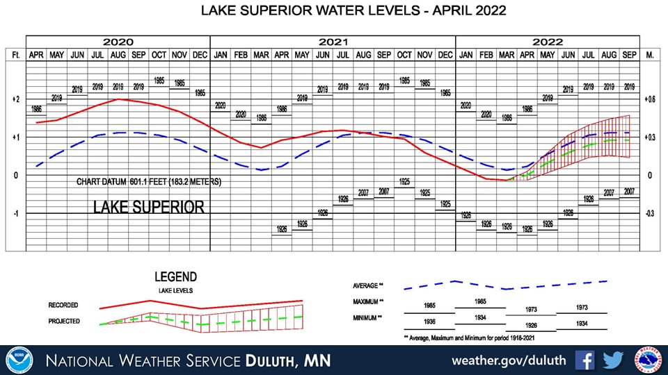
Hydro
Outlook

 |
Media use of NWS Web News Stories is encouraged! Please acknowledge the NWS as the source of any news information accessed from this site. |
|
Forecasts
Fire Weather
Great Lakes
Local Text Products
Winter Weather
Local Area Forecasts
Aviation
Marine
Rainy River Basin Page
Current Conditions
Current Observations
Public Information Statements
National Snowfall Map
NOHRSC Snow Analysis
Rain/Snow Reports
Winter Monitor
US Dept of Commerce
National Oceanic and Atmospheric Administration
National Weather Service
Duluth, MN
5027 Miller Trunk Highway
Duluth, MN 55811-1442
218-729-6697 - Duluth; 218-283-4615 - Intl Falls
Comments? Questions? Please Contact Us.

