
A heat wave over the Southwest will intensify this week, peaking and expanding into the Intermountain West and northern High Plains this weekend. Critical to extremely critical fire weather conditions are forecast from the Northwest and the northern Great Basin this weekend. Particularly Dangerous Situation Red Flag Warnings have been issued. Read More >
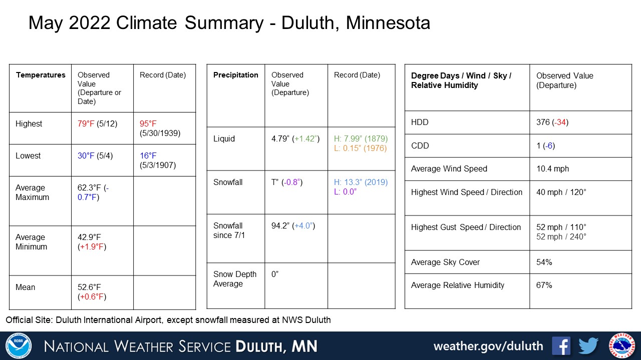
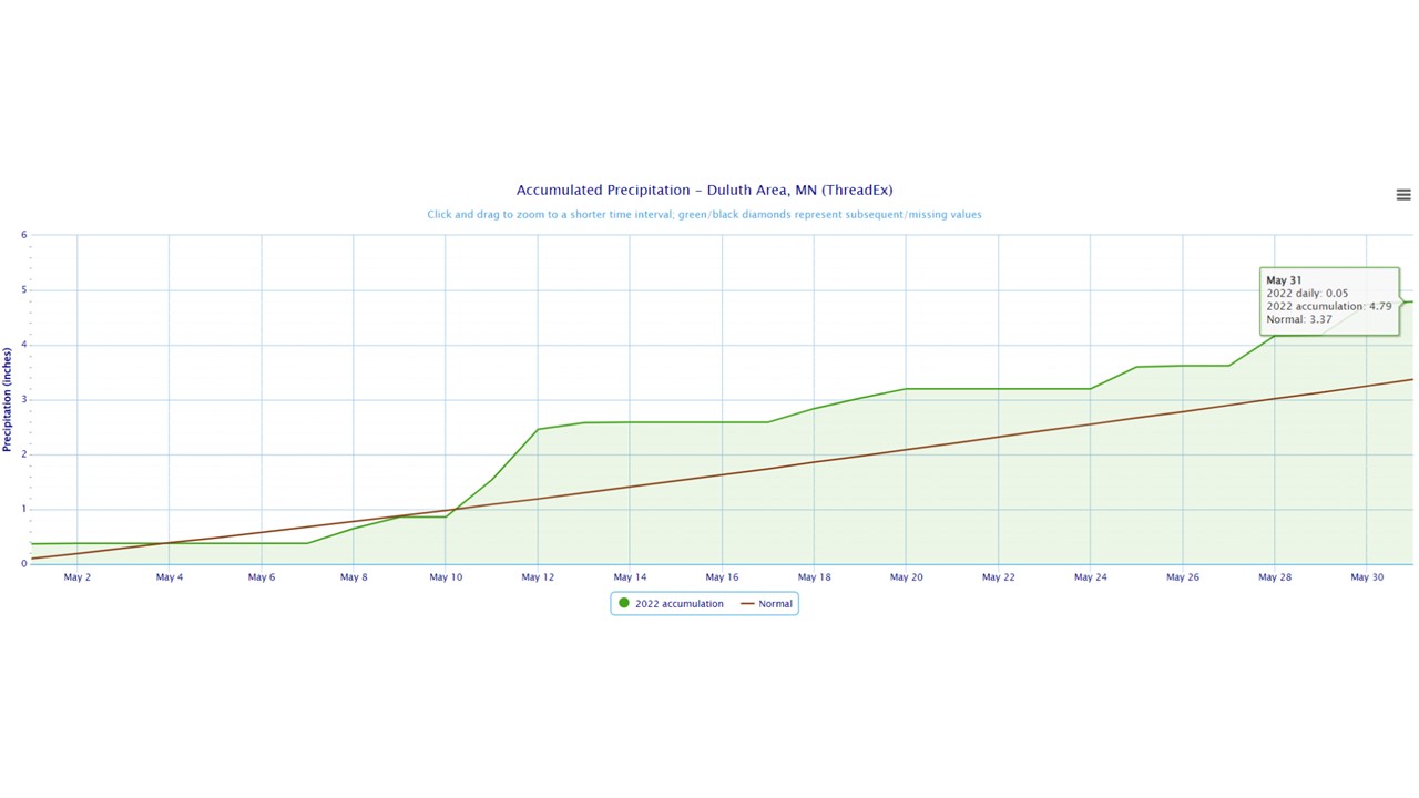
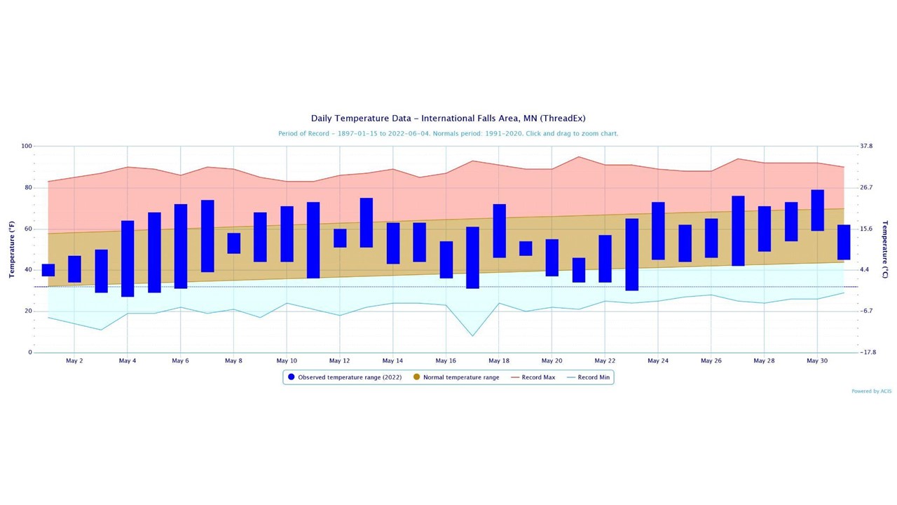
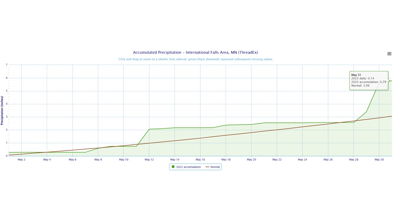
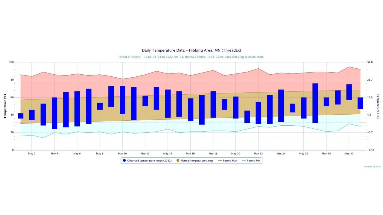
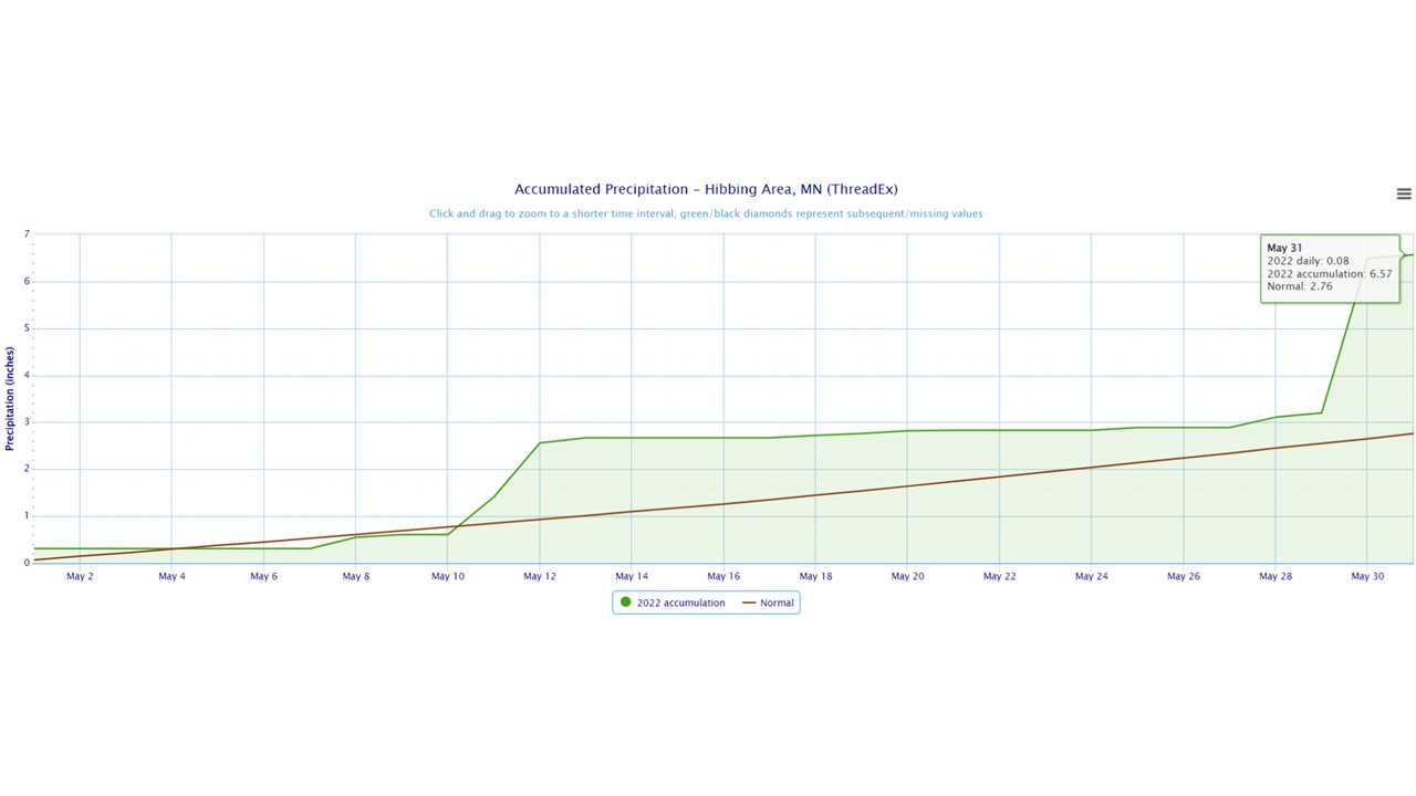
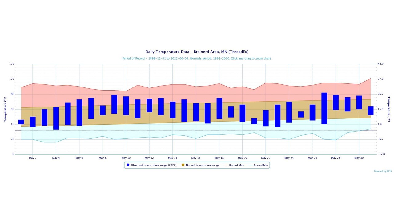
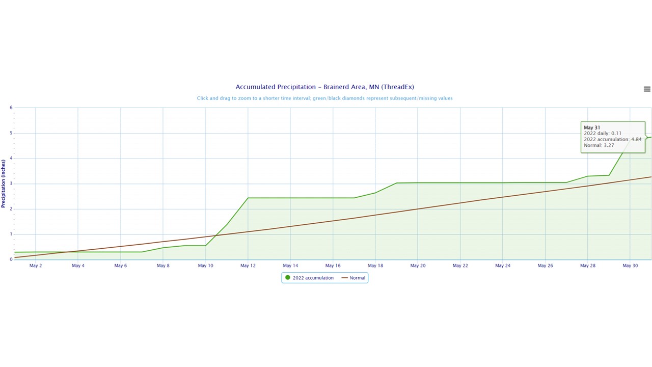
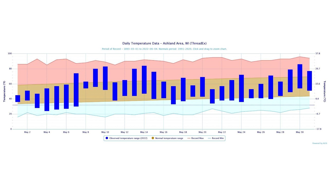
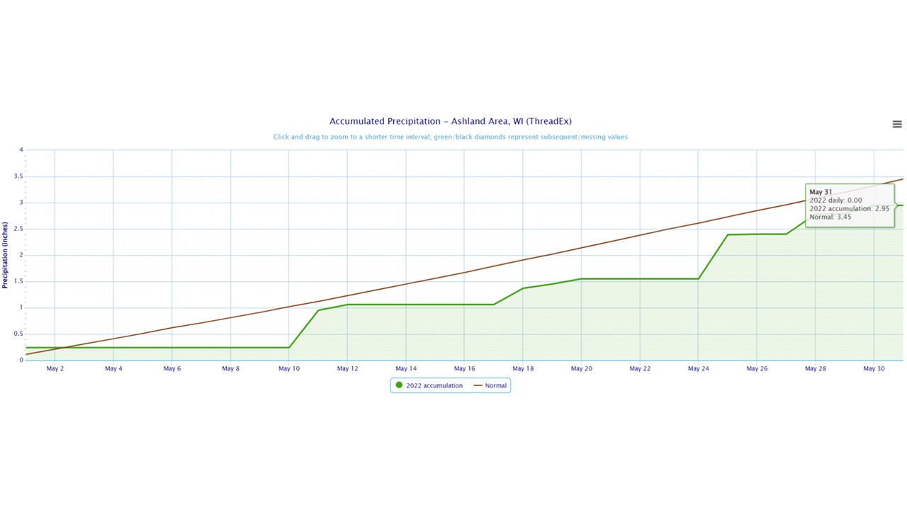
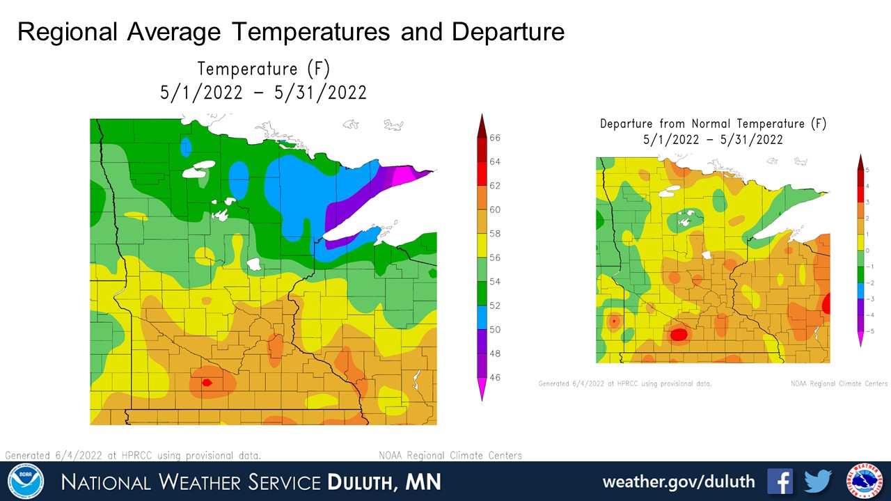
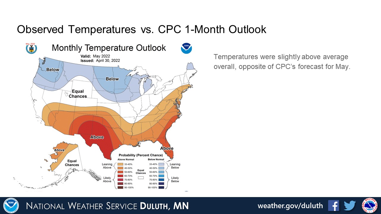
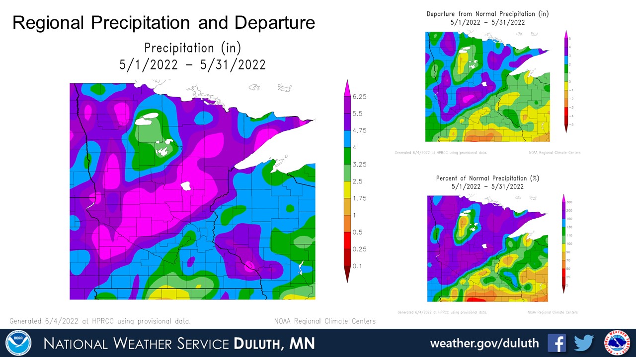
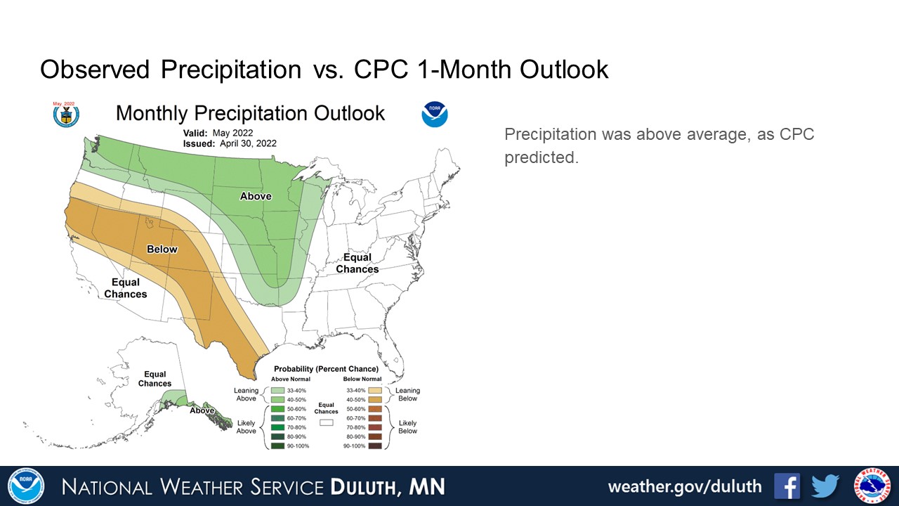
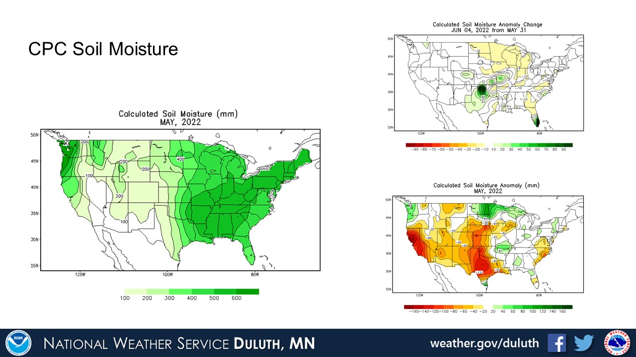
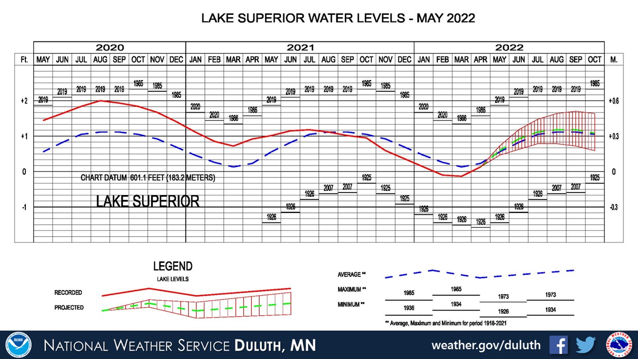
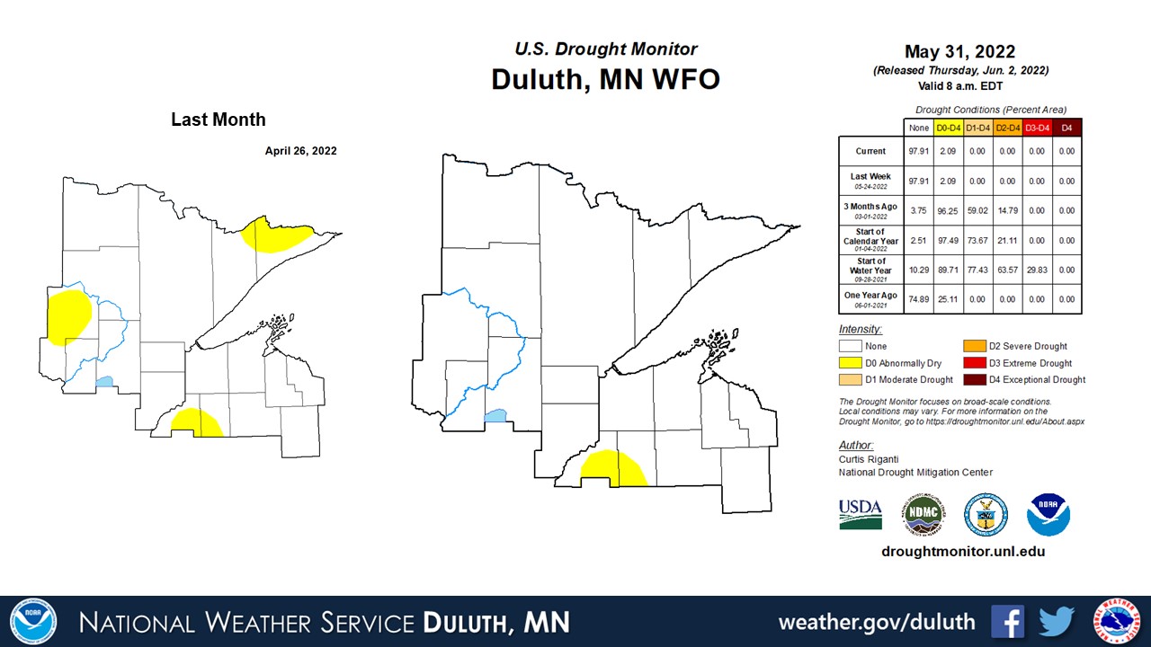
Temperatures were not very anomalous throughout May. Averages were slightly above average, but only by a degree or two, and there were plenty of ups-and-downs in temperature throughout the month. The big story was the excess rainfall that was recorded at all Minnesota climate sites. Drought conditions from last summer have completely reversed, with soil moisture and river streamflow well above average in northeast Minnesota. The result has been long-duration flooding, which continues to impact the Rainy Lake Basin. The drought from last summer, which brought Lake Superior’s water levels below average, has been replaced by excess water that has brought the lake levels to right around average.
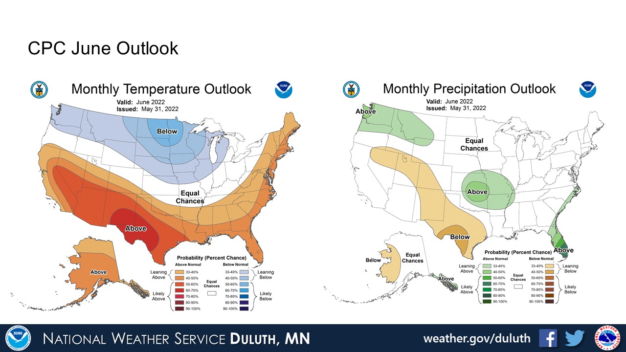
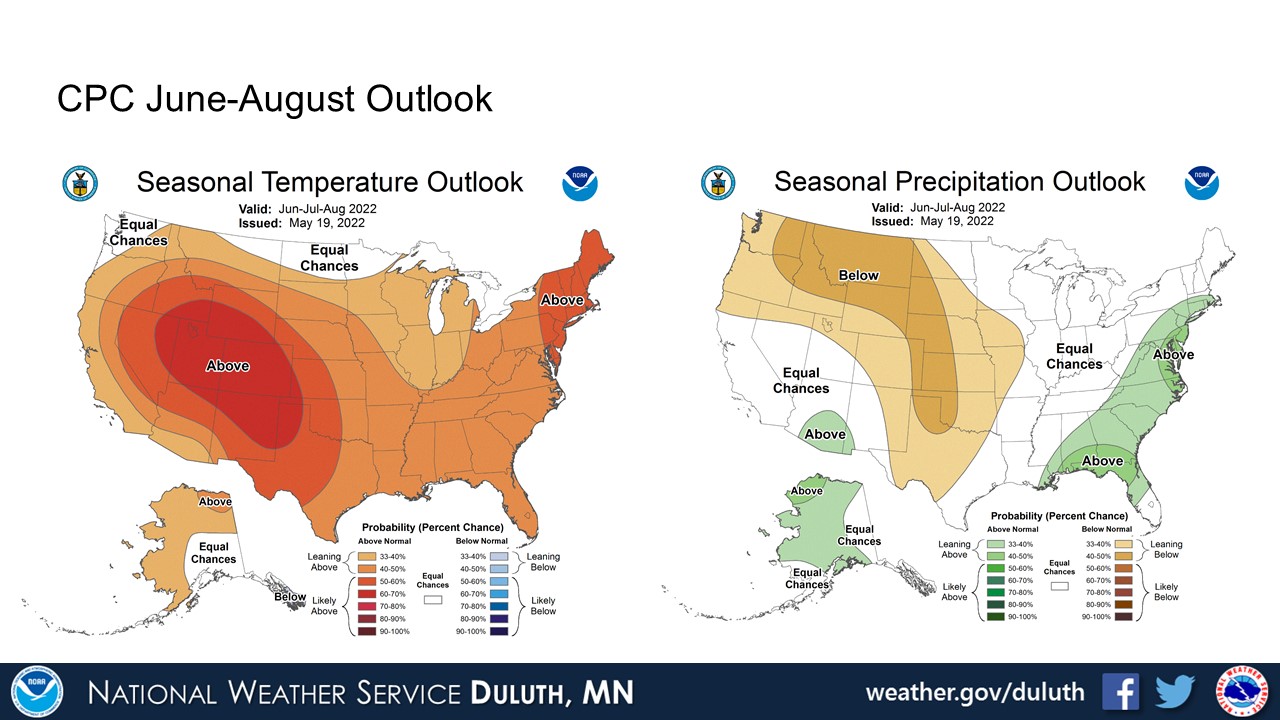
The CPC is forecasting below normal temperatures and equal chances for above or below normal precipitation for the rest of June. The CPC suggests that warmer temperatures may be possible for the rest of summer. With the excess moisture we’ve seen this past month, as well as through the spring (see ahead), drought is not expected to impact the region for the foreseeable future. A mostly dry forecast would be welcomed for the next month or so, as any additional rainfall will exacerbate flooding conditions across northeast Minnesota.
Duluth

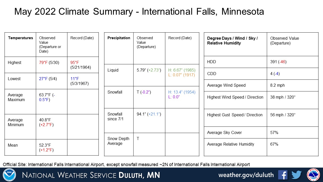
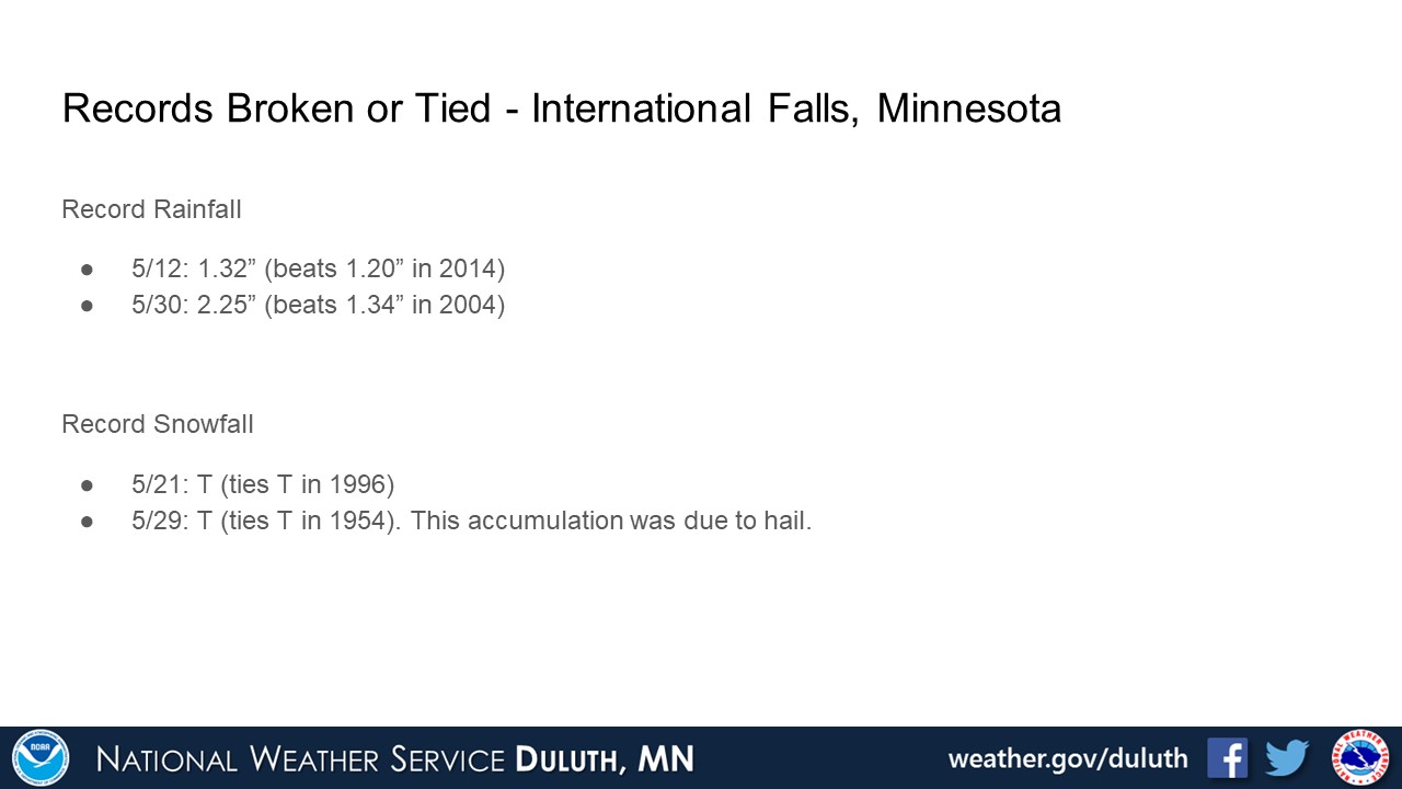
International Falls
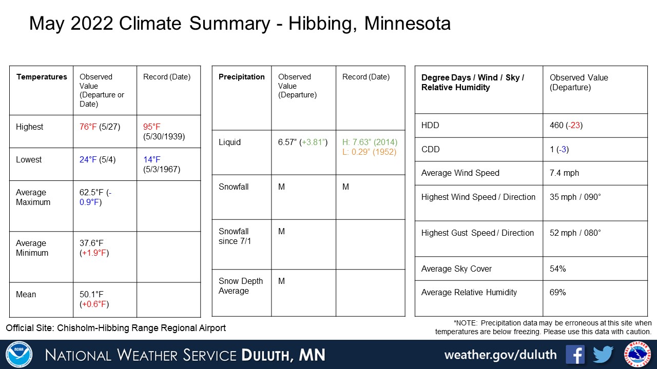
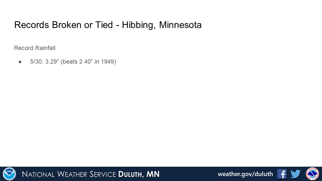
Hibbing
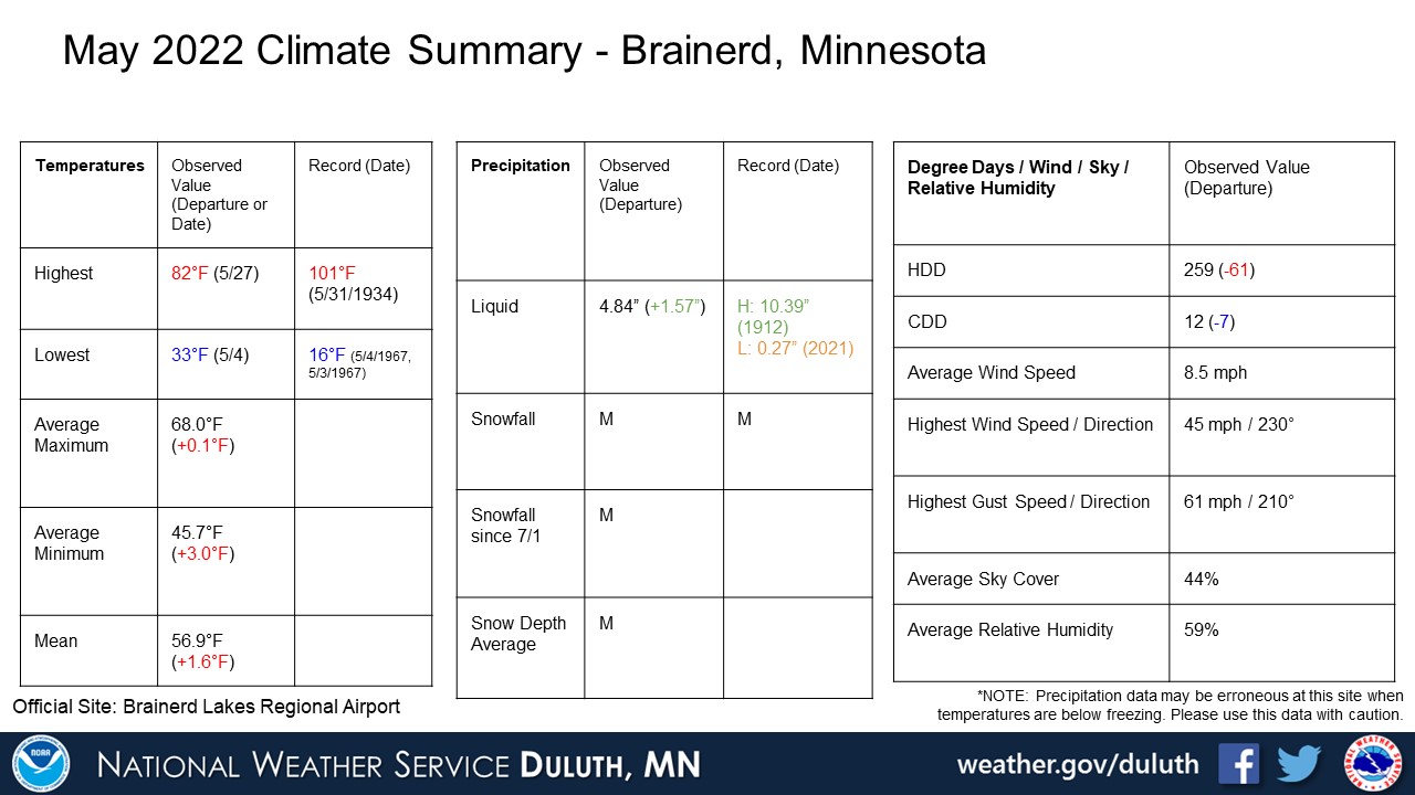
Brainerd

Ashland

Summary
Hydro
Outlook
 |
Media use of NWS Web News Stories is encouraged! Please acknowledge the NWS as the source of any news information accessed from this site. |
|

