
Dangerous heat will remain across portions of the southern U.S. through the weekend. A heat wave over the Southwest will intensify this week, peaking and expanding into the Intermountain West and northern High Plains this weekend. Severe thunderstorms will produce damaging winds and heavy rainfall over portions of the northern/central Plains into the mid/upper-Mississippi Valleys today. Read More >
Overview
|
As recorded in the August 1969 Storm Data publication: During the day and evening August 6, two relatively large storm areas (radar echoes 25 to 35 mile diameter, composed of several irregular cells) moved on a heading of 80 degrees and parallel. The centers were about 60 miles apart. The northerly storm area moved in from North Dakota between Fargo and Grand Forks; the southerly storm area of concern developed rapidly north of Wadena about 3:30pm CDT and both storms moved east across the state. From these two storm areas were spawned two major wind-hailstorms, twelve tornadoes, and one waterspout. The storm killed 15 persons, injured 106 persons, caused 4.8 million dollars property and public utility damage, 1.2 million dollar timber loss, 2.0 million crop dollars loss.
This tornado outbreak, referred to as the Northwoods Tornado Outbreak of 1969, included the deadliest F-4 tornado to ever occur in northern Minnesota. The damage, estimated at around $8 million dollars in 1969, is the equivalent of about $55 million dollars in 2019. |
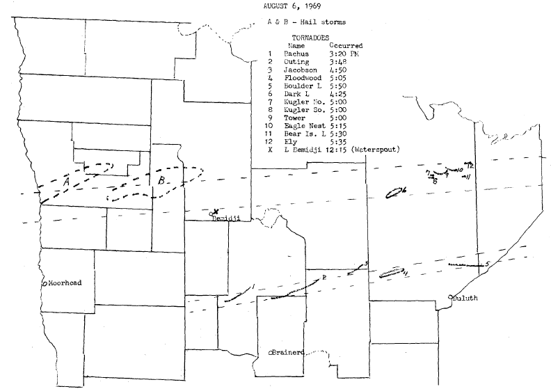 A map of the tornadoes that occurred on August 6, 1969 from historical "Minnesota Climatplogical Data" publication from the Department of Commerce and University of Minnesota Weather Bureau State Climatologist. |
Tornadoes:
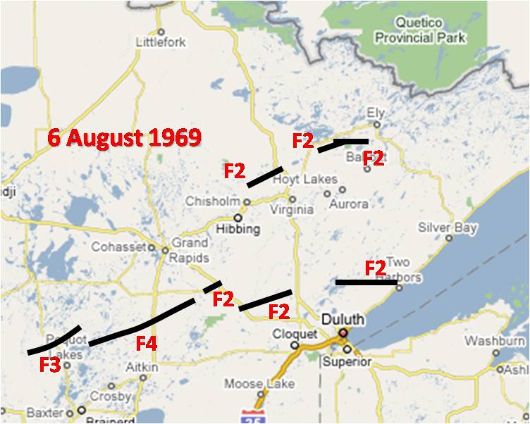
Here is a map showing the specific tornado tracks and subsequent damage based on the Fujita Scale:
| # | *Time (CDT) | Location | **Rating | Length | Width | Killed | Injured | ***Damage Estimate | Narrative |
|---|---|---|---|---|---|---|---|---|---|
| 1 | 4:20 to 4:40pm | Cass County | F-3 | 18 miles | 50-300 yards | 0 | 4 | $850k | Backus tornado moved ENE at about 55mph due west of Pine River and lifted southeast edge of Big Portage Lake. It destroyed 13 farmsteads south and east of Backus and 11 homes in the lake region east of Backus, 4 persons were hospitalized and numerous minor injuries were reported. Damage to property, timber, and utilities estimated at $850,000. |
| 2 | 4:48 to 5:28pm | Crow Wing, Cass, Aitkin Counties | F-4 | 33 miles | 1 to 1.5 miles | 12 | 70 | $2.15 million | Outing tornado moved between E and ENE at about 50 mph touched down east side of Stewart Lake moved through the Outing area about 5:05pm [CDT] and lifted just south of Hill City. On the north side of Outing 2 persons were killed on the west side of Roosevelt Lake, 9 were killed on the east side, and one person near Reservoir Lake. Damage to property, utilities, and stumpage [timber] $2,150,000. The tree damage showed circular winds on the ground with varying widths. Over Outing the tornado was nearly 1.5 miles wide. The general pattern was similar to the Floodwood tornado. |
| 3 | 5:50 to 6:03pm | Aitkin and Itasca Counties | F-2 | 11 miles | UNK | 1 | UNK | $250k | Jacobson tornado moved ENE at about 50 mph touched down west of Jacobson, lifting again near St. Louis County line. One person was killed in a small cabin west of Jacobson, several persons were injured, 2 farm homes and 7 farm outbuildings were destroyed. This tornado have been the Outing tornado touching down again some 14 miles after its lifting. Damage to property and timber estimated at $250,000. |
| 4 | 6:05 to 6:29pm | St. Louis County | F-3 | 18 miles | 1 to 2 1/2 miles | 0 | 20 | $845k | Floodwood tornado moved east to northeast at 50 mph, touched down 3 miles northwest of Floodwood and lifted 1 mile northeast of Maple Leaf Lake. There were 39 head of livestock killed and damage to property and public utilities was estimated at $845,000. The tornado was large and tree damage on the ground showed uniform circular rotation. The damage from center to a rather sharp southerly edge was generally 1/2 to 3/4 mile while damage on the north tapered off gradually with some trees blown down in a southerly direction nearly 2 miles from center. |
| 5 | 6:50 to 7:15pm | St. Louis and Lake Counties | F-3 | 21 miles | 50 to 400 yards | 2 | 3 | $128k | Boulder Lake tornado moved east at about 50 mph, touched down on east shore of Boulder Lake and lifted 1 1/2 miles west of Two Harbors. Two women in a cabin were killed on the east shore of Boulder Lake, 3 are known to have been injured, and damage to property, roads, public utilities, and stumpage [timber] was estimated at $128,000. When the tornado struck the shoreline of Boulder Lake, it was about 75 feet in diameter. Trees blown down showed a circular rotation, however, for most its path ti was about 200 to 400 yards wide with most trees downed to the northeast. The tornado skipped twice, once about one mile and again about 2 1/2 miles. |
| 6 | 5:25 to 5:38pm | St. Louis County | F-2 | 10.5 miles | 1 to 2 miles | 0 | 9 | $675k | Dark Lake tornado moved east-northeast touching down 3 miles southwest of Dark Lake and lifted 1 mile north of Big Sandy Lake or over Auto Lake. Damage to property, roads, utilities, and stumpage [timber] estimated at $675,000. Most trees were blown down to the northeast, however, on the northern side few trees layed to the south. One person in center of storm stated the winds blew with a jet-like roar about one to two minutes, first from a southerly direction then a northerly direction. |
| 7 | 6:00pm | St. Louis County | F-2 | 4 miles | 150 yards | 0 | 0 | $20k | Kugler South tornado moved east, touched down 4 miles WNW of Wahlsten and lifted 1.5 miles NNE. Damage to property and stumpage [timber] estimated at $20,000. Most trees were laying to the northwest. |
| 8 | 6:00pm | St. Louis County | F-2 | 2 miles | 150 yards | 0 | 0 | $19k | Kugler North tornado moved east, paralled and lifted about a half mile north where the Kugler South tornado lifted. Damage to property and stumpage [timber] estimated at $19,000. This tornado was very similar to the Kugler South tornado. |
| 9 | 6:00pm | St. Louis County | F-3 | 9 miles | 40 to 400 yards | 0 | 0 | $110k | Tower tornado moved about 4.5 miles to south-southeast then changed course and moved about 4.5 miles east-northeast, touched down southwest edge of Eagle Lake Number 3. Damage to property and stumpage [timber] estimated at $110,00. When the tornado started it was about 100 feet in diameter and showed a circular rotation, but as it widened to about 1/2 mile, trees were down generally to the northeast. |
| 10 | 6:15pm | St. Louis County | F-3 | 5 miles | 100 to 400 yards | 0 | 0 | $60k | Eagle Nest Lake tornado moved east-southeast touching down just before the west shoreline of Eagle Nest Lake Number 2 and lifted east of Grassy Lake. Damage to property and stumpage [timber] was estimated at $60,000. Trees blown down in this tornado were mostly toward the northeast. |
| 11 | 6:30pm | St. Louis County | UNK | 1/2 mile | 150 yards | 0 | 0 | $10k | Bear Island Lake tornado moved east, touched down just south of where Bear Island River enters into Bear Island Lake. Damage to property estimated at $10,000. [This tornado appears in Storm Data but is missing from other datasets, so the official rating is unknown.] |
| 12 | 6:35pm | St. Louis County | F-2 | 3 miles | 70 to 300 yards | 0 | 0 | $8k | Ely tornado showed 2 paths coming together as one moving east and east-northeast, touched down about one mile SSW of Burnside and lifted at Mud Lake which is about one mile south of Ely. Damage to property and stumpage [timber] estimated at $8,000. Trees layed primarily to the northeast. One person in the center stated the winds lasted about 2 minutes with a jet-like roar. |
*Times are approximate and have been converted into Central Daylight Time as this was the local time during this time of year. (The official NOAA Storm Data publication always uses Standard Time.)
**Prior to Feb 2007, tornadoes were rated on the Fujita Dmage Scale (F-Scale), but since then tornadoes are now rated using an improved version called the Enhanced Fujita Scale (EF-Scale).
**Property damage estimates are displayed in the original 1969 dollar amounts and have not been adjusted for inflation. (This can be done using a tool like the BLS CPI Inflation Calculator.)
Personal Stories
We are gracious to those who have shared their personal stories from this historic tornado outbreak with us and have given us permission to share their stories on our website. The following accounts have been edited slightly for brevity and clarity. If you would like to share your story with us, contact Joe Moore.
The following story is from Sue Moline. She is a survivor of the F4 tornado that hit Outing, Minnesota on August 6, 1969. Her family was on the east side of the lake at the Bethany cabins. Three of her family members were killed that day, and she survived after being carried into the lake. She was 17 years old.
Wednesday, August 6th was a hot and humid day. I think it started out sunny because we had been swimming and I spent the day in my swimsuit. … A radio was playing somewhere and we heard storm warnings or a tornado watch – the word “tornado” came up in the broadcast. Growing up in Minnesota we were used to tornado warnings. They required you to get to a low-lying area or a safe interior room of the house. I remember confidently saying to [cousin] Priscilla a tornado would never hit us, after all our cabin was many feet below the steep banks on either side of the lake – we were in a low-lying area and it would jump right over the lake. And then I gave it no more thought.
As skies got cloudier and the winds picked up, everyone got off the lake and went to their cabins. My dad, Toby, decided that would be a good time to run into the town of Emily, about 6-7 miles south, to buy something at the hardware store for his makeshift sail boat, and he took my brother Lon with him.
I have some blanks in my memory, and most of us do. But the next thing I remember is standing in the living room of the cabin and looking out the large picture window toward the lake, seeing small trees bending in half and a few loose items flying through the air. Right about then the Brokke family burst through our front door and one of them yelled “a tornado is coming!” There was no time to react and no where to go. Although most of us remember the sound of the tornado, I don’t. I am guessing that about the time the family ran down from the cabin on the hill, I must have developed paralyzing fear. I don’t remember the tornado sound, only Dan Brokke yelling “a tornado’s coming” and then the movement of the house.
Suddenly, I was on the floor and the entire cabin was moving! It was like a giant rug had pulled out from under us. I felt bumping, perhaps the cabin scraping the ground as we moved. The next thing I felt was water and I said to myself, “now I know which way we went, toward the lake.” And then I was under water and it seemed like moving at high rate of speed, spinning and completely out of control, eyes closed. Then suddenly I got a very quick breath of air before being pulled under water again. This happened two to three times. I thought, “I am being carried by a tornado and I am going to do die. I will be one of those statistics – me and Terry.” What an odd thought.
Suddenly I popped to the surface and was riding huge waves, surrounded by wood and debris. The waves were probably 5 to 6 feet and I was hit in the head by something flying through the air. When I looked around I saw no one else, and I screamed out loud, “God save us!” I believed in Jesus, but I think even a non-believer in the throes of a storm that powerful would have cried out to God. There had to be someone stronger than that storm. I looked around and recognized nothing – there was not a tree left standing or anything green. I wasn’t even sure where I was. I wondered where that “big pile of dirt” had come from – it was actually the hillside with no trees or houses.
And then I started seeing people – Terry and Dale and Shane came to the surface fairly close together, and behind me was Priscilla. I saw no one else. Terry had grabbed Shane, who was terribly injured, and was hanging on to him, trying to get him to the shoreline. We were in a mass of floating lumber and debris, and my next fear was of being crushed by the floating debris and big waves. I would guess I was about 300 feet away from the shoreline where the cabin had been located on the point, but maybe only 20-30 feet away from the shoreline where I had landed.
The following story is from Terry Dugan, Sue's Uncle, who was also 17 years old at the time of the tornado.
It was so hot and windy – just really hot. And of course no storm warnings, none of us knew about anything like that.
I was in the upper cabin with Diane, my mother, probably Ken and Barb, more of us who were staying up there. And we looked out the front window and saw the sky looking really strange and swirling. I didn’t see a funnel, other people said maybe they did, but I didn’t. I just saw swirling black clouds and probably more than just myself, but I was saying we should probably get to lower ground. We had no alternative. So we all go out the door and go down that steep driveway that curves around, as fast as we can. We all made it into that first cabin you come to when you get down to the point. So we had saw the tornado coming – but not exactly, you know, not as a funnel. When we’re in the cabin, I remember Dick and Priscilla’s kids, I think my mother maybe with Diane, I can’t remember – a bunch of us were in the back bedroom, we were trying get as far away from the windows as I guess we could. And we were in the back bedroom toward the side that’s by the driveway coming down. And we heard it – we heard the roaring of the wind that was beyond normal just blowing, just steadily increasing wind to the point of roar. And I remember looking out the window and seeing a boat go by, maybe from the neighboring place to the south. Trees bent out of the ground.
I remember the sound of the floor being ripped up like a million hammers pulling nails out of boards, just a screeching sound that that makes. And the back of the cabin start to pick up out from under our feet. I kind of fell forward a little bit on the ground, and then there were people screaming and dressers and things falling over. And then the thing slid – I felt like it was sliding across the ground, bumping along until suddenly there was water everywhere and wreckage, and being tumbled in a washing machine full of boards. I surfaced I think probably about a few yards out from the shore where the rope swing was, not that far. I felt like I didn’t have to do a whole lot of work to get into the shore.
Photos & Video
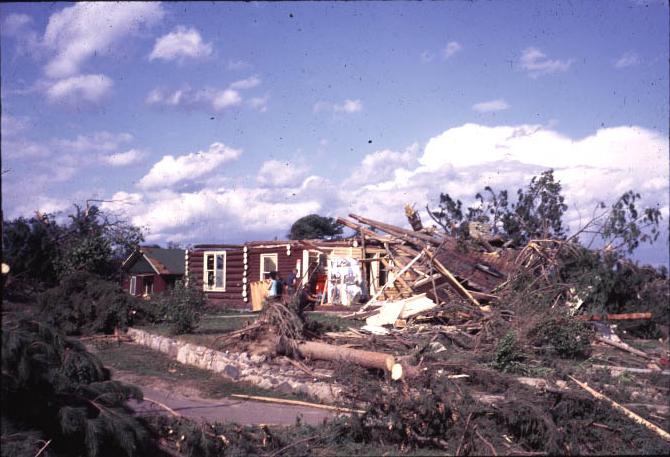
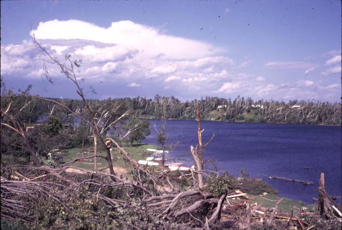
Roosevelt Lake / Outing, MN F-4 Tornado Damage
 |
 |
 |
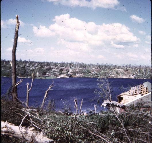 |
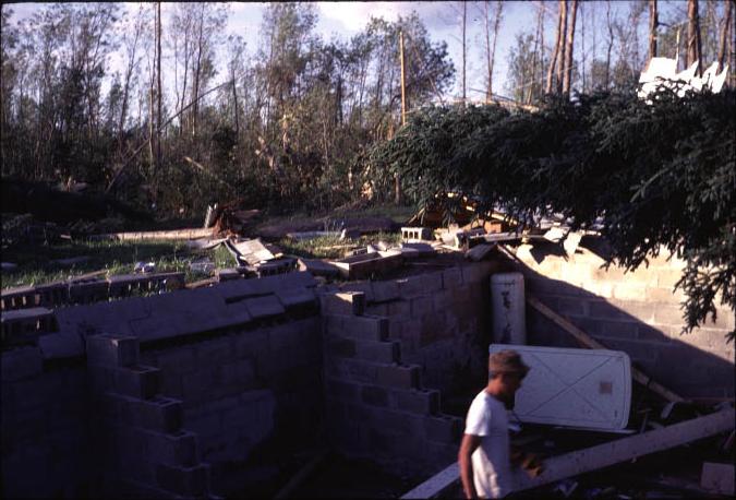
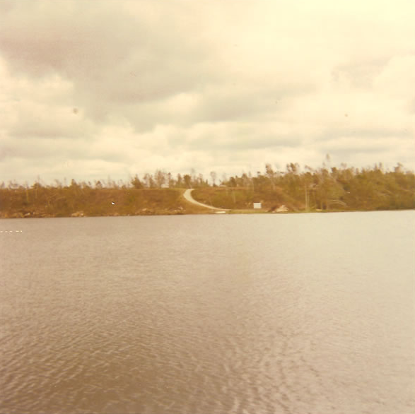
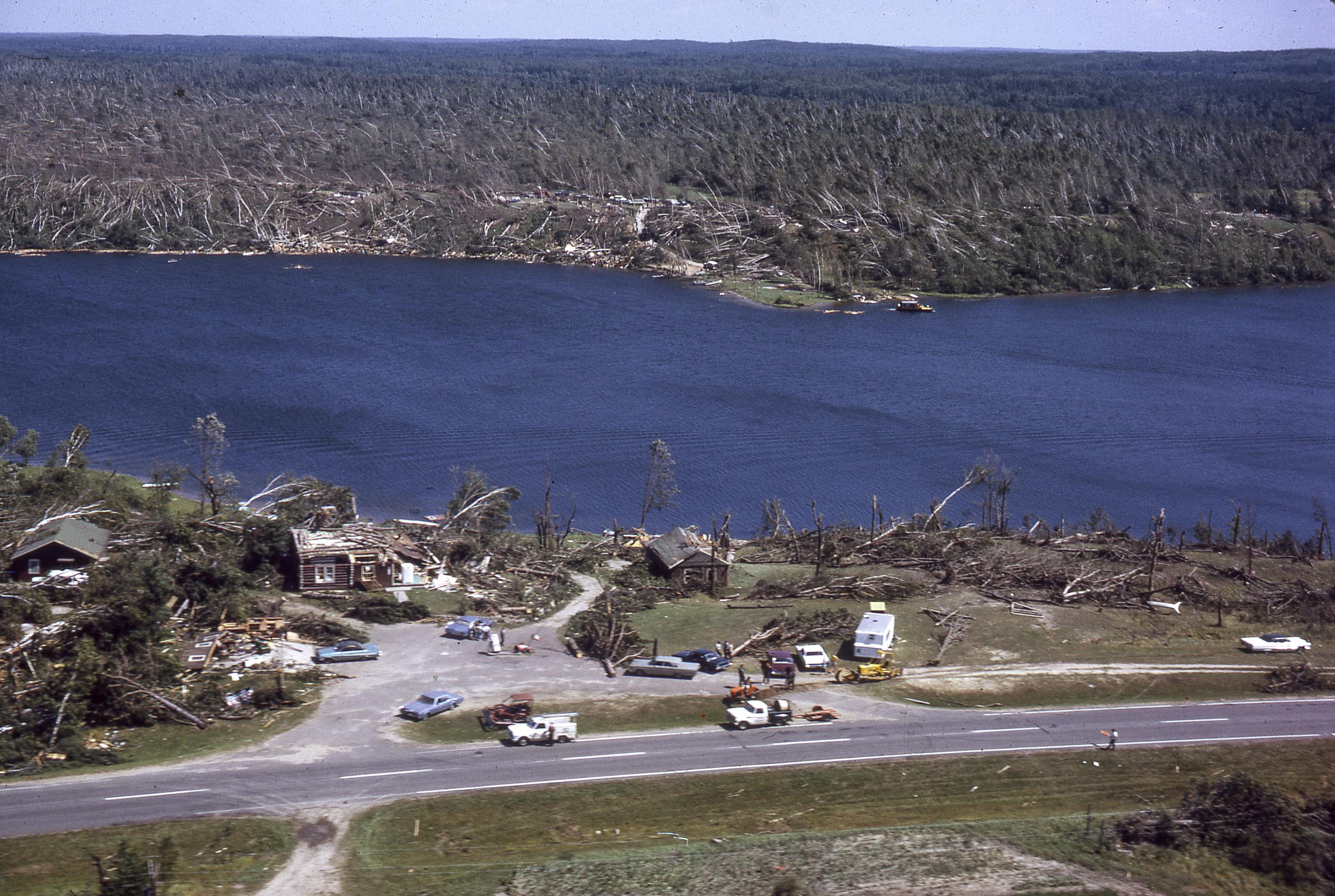
| Damage from the F-4 Outing Tornado | Damage from the F-4 Outing Tornado | Damage from the F-4 Outing Tornado | Damage from the F-4 Outing Tornado |
 |
 |
 |
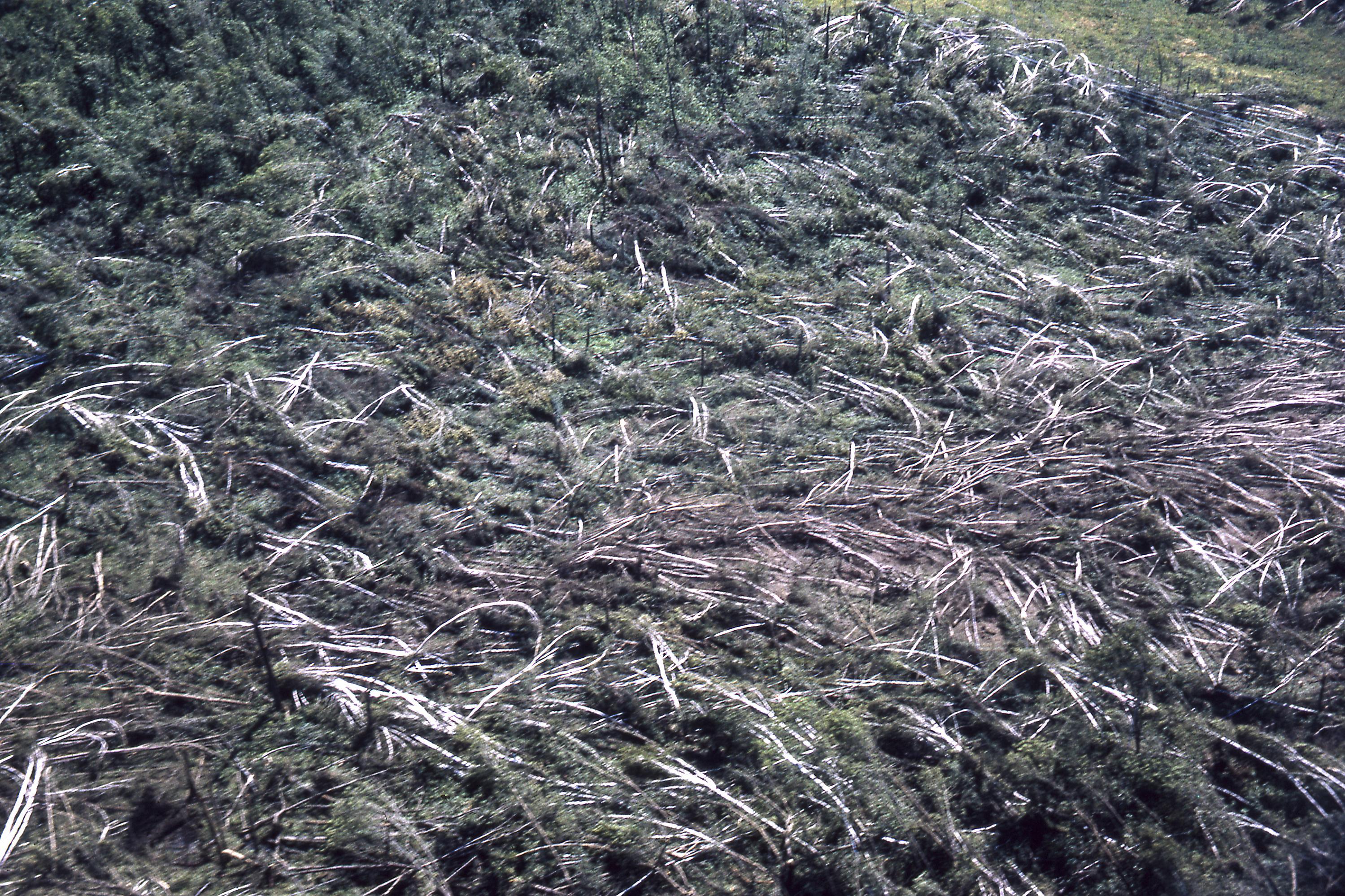 |
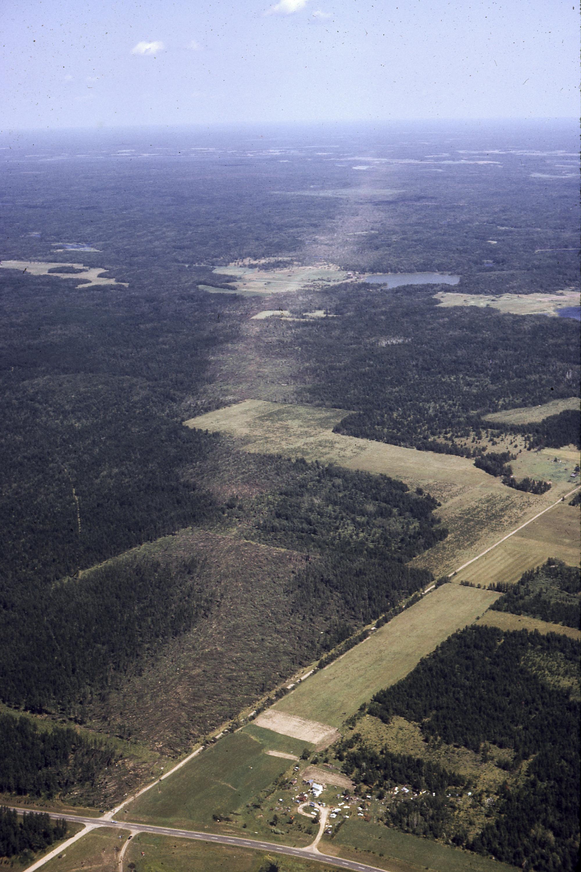
| Total destruction on Lake Roosevelt. At the bottom of the curved road, an entire cabin is missing after being swept into Lake Roosevelt. (Photo courtesy Scott Lincoln.) | A view of the same part of the lake but from the opposite side from a MN DNR Aerial Survey. (Courtesy MN DNR) | An aerial shot of the path of destruction left by the F-4 tornado. (Courtesy MN DNR) | A close-up of the timber within the path of the F-4 tornado. (Courtesy MN DNR) |
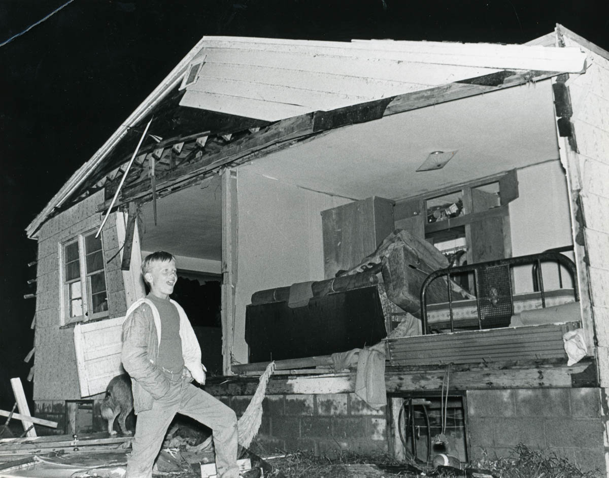
Floodwood F-3 Tornado
 |
 |
 |
 |
|
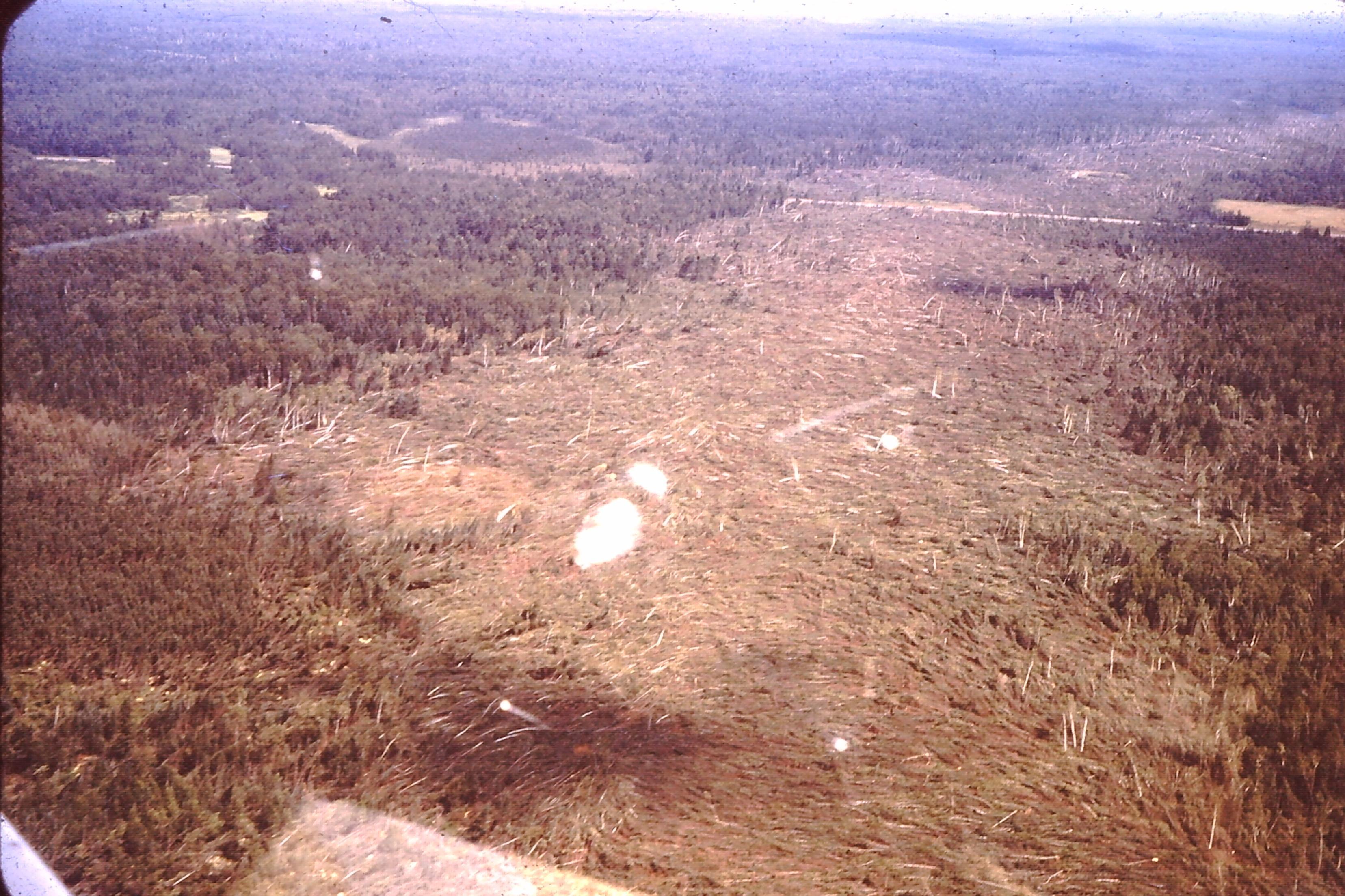
Aerial Damage Survey of the Floodwood Tornado (Source unknown, likely MN DNR) |
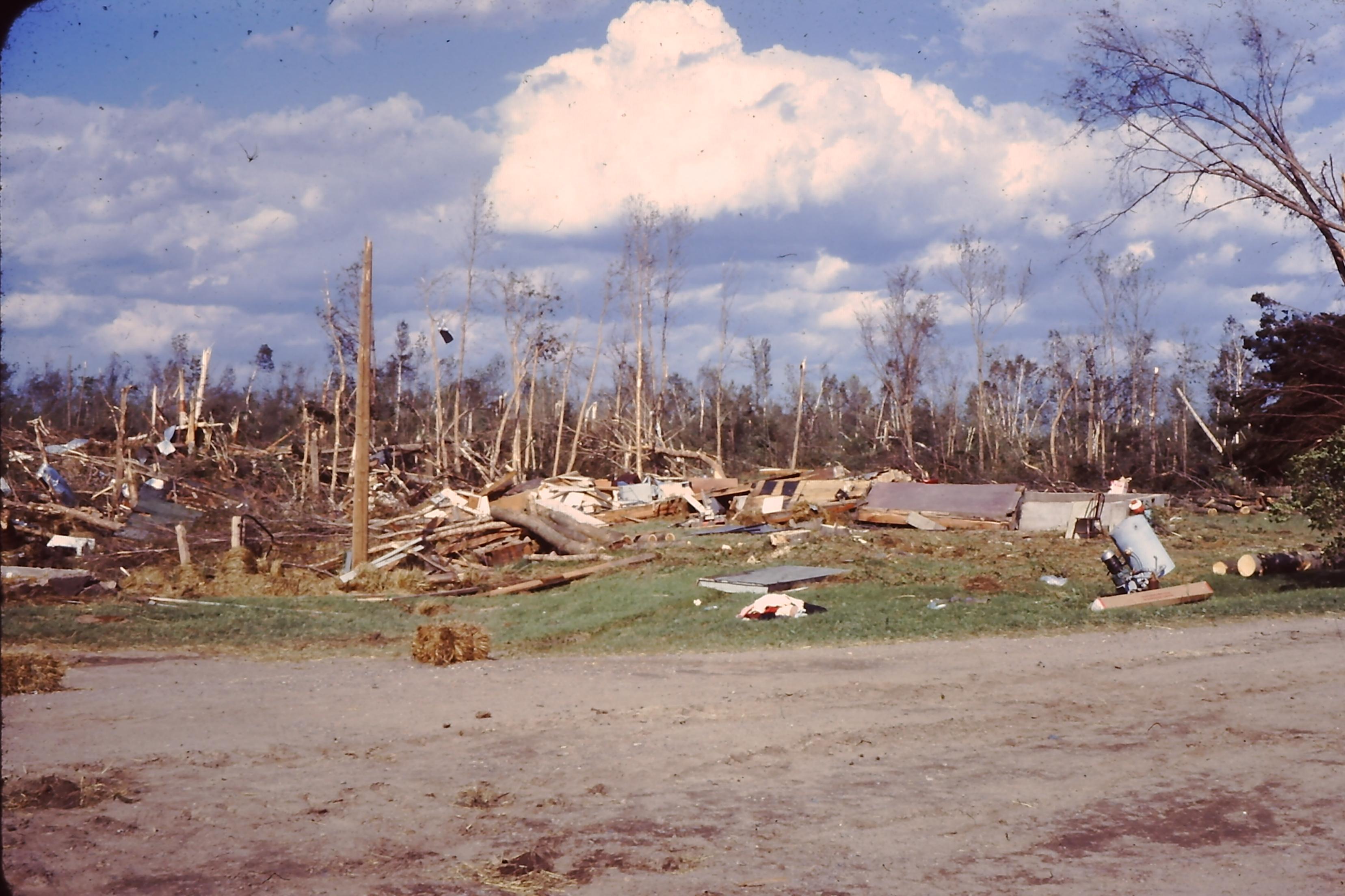
Destruction from the Floodwood tornado. While this damage was rated F-3, this damage was nearly as bad as the Outing F-4 and came from the same parent thunderstorm. (Source unknown.) | Dale Rauvola surveys damage to his parents’ home in Floodwood after a tornado touched down on Aug. 6, 1969. (Charles Curtis / News-Tribune) |
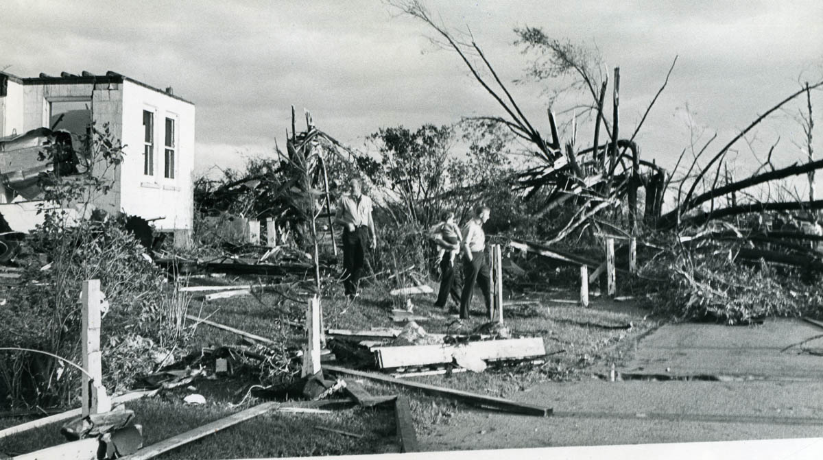
Floodwood residents survey tornado damage in the community in August 1969. (Floodwood Forum photo) |
Boulder Lake to Two Harbors F-3 Tornado
 |
 |
 |
 |
|
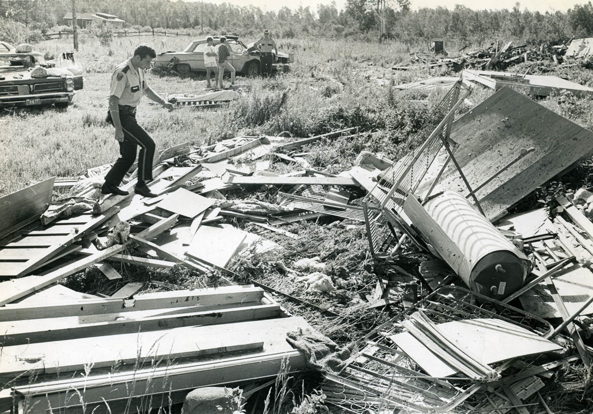
St. Louis County Sheriff’s Deputy Robert Ojard surveys debris of a Boulder Lake cabin demolished by a tornado in August 1969. (Earl Johnson / Duluth Herald) |
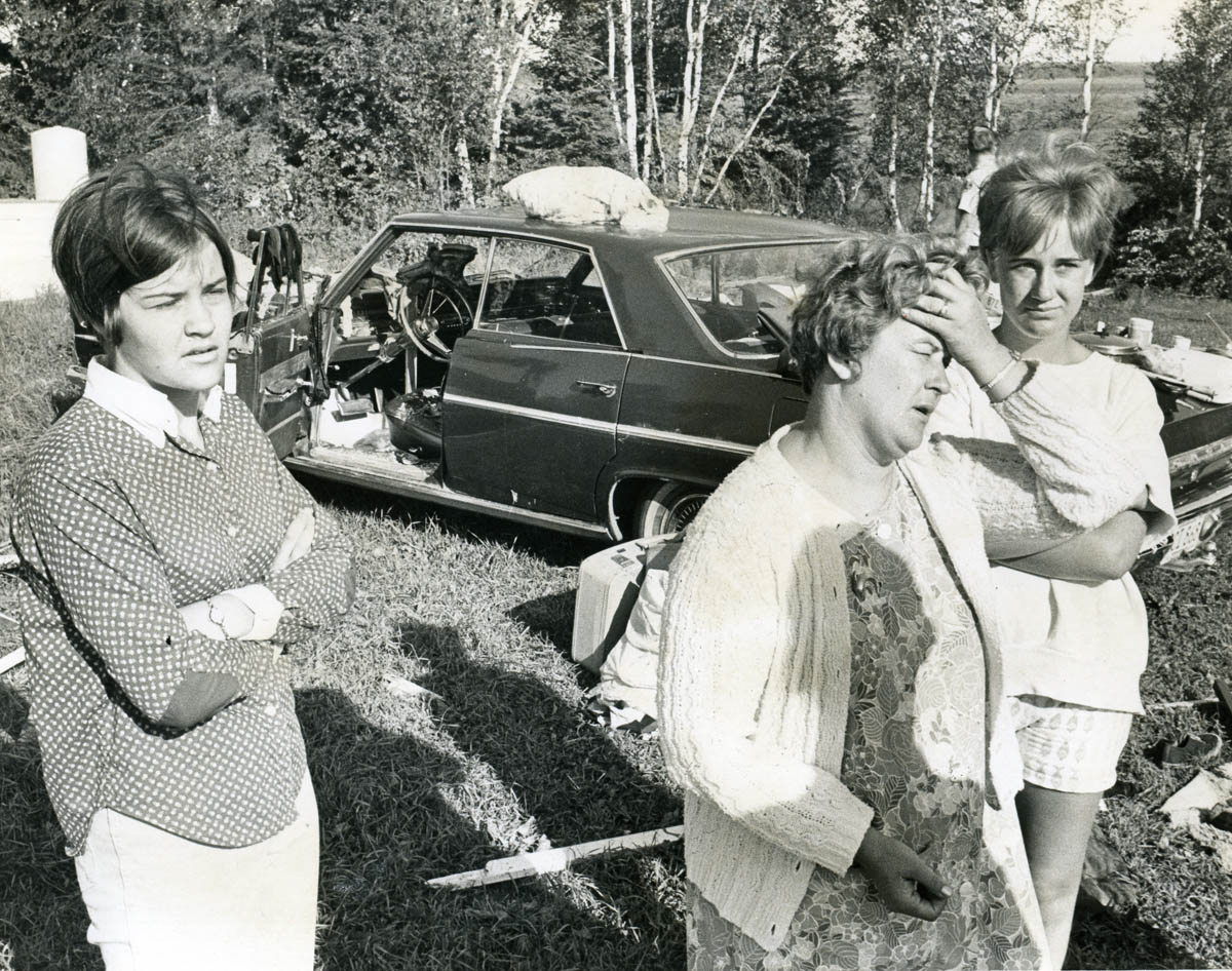
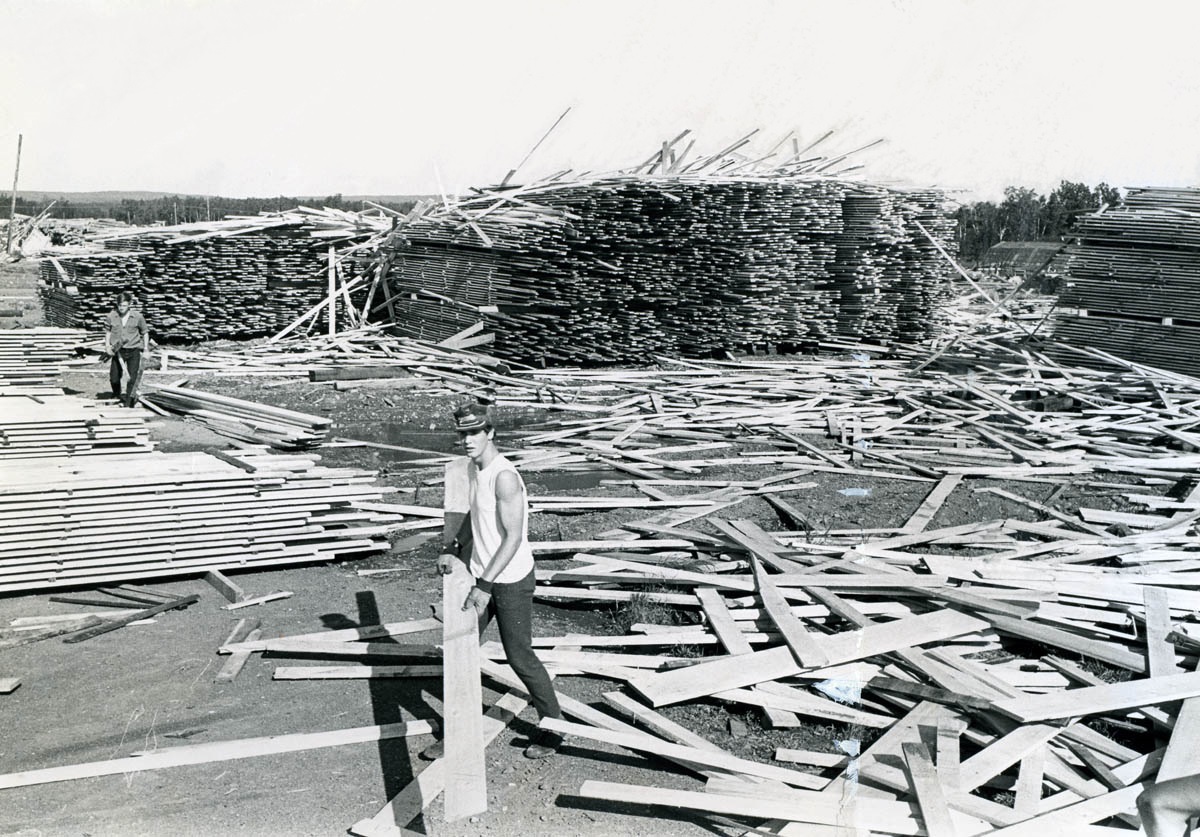
Mrs. LeRoy Korby, flanked by her daughters Debbie, left, and Louise, right, describes the tornado’s path at Boulder Lake. Her voice faltered slightly as she recalled the fear that she and Debbie experienced as the tornado uprooted giant spruce trees around their cabin on Boulder Lake’s southeastern shore at about 6:45 p.m. “We held pillows and our arms against the windows and we prayed,” she said. “It was too late to go anywhere.” (Duluth Herald photo) | Brad Anderson is among 35 young men from Two Harbors hired as extra employees to clean up lumber tossed about by a tornado at the J.C. Campbell Lumber Co. yards on August 6, 1969. (Earl Johnson / Duluth Herald) |
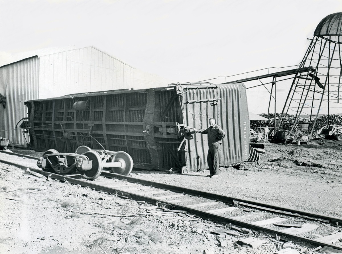
David Eggan, superintendent at the J.C. Campbell Lumber Co. near Two Harbors, inspects a boxcar tipped off the railroad tracks by a tornado in August 1969. (Duluth News-Tribune photo) |
Outing, MN Tornado
|
This video was shared with us by Steven Erickson. His grandmother, Joyce Glass formerly of the Three Lakes Resort on Bass Lake in Thunder Lake Township took video of damage from the F4 tornado that passed through Outing, Minnesota. Our thanks to Joyce and Steven for taking the video and sharing it with us. |
References and Media Coverage
Media Coverage
References/Related Content
Environment
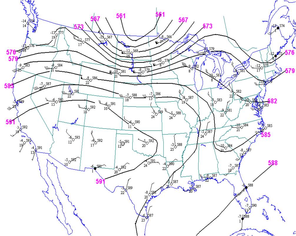
Very warm and humid air had pushed northward into southern and central Minnesota ahead of an occluded front that stretched from Lake Winnipeg in Canada to a low pressure area in north central South Dakota. Minneapolis saw a high temperature of 93º F with dew points around 70º F. Over the next 24 hours, the front would push rapidly east into the Upper Peninsula of Michigan. Along with strong upper level winds, all the ingredients for violent thunderstorms and tornadoes were present.
 |
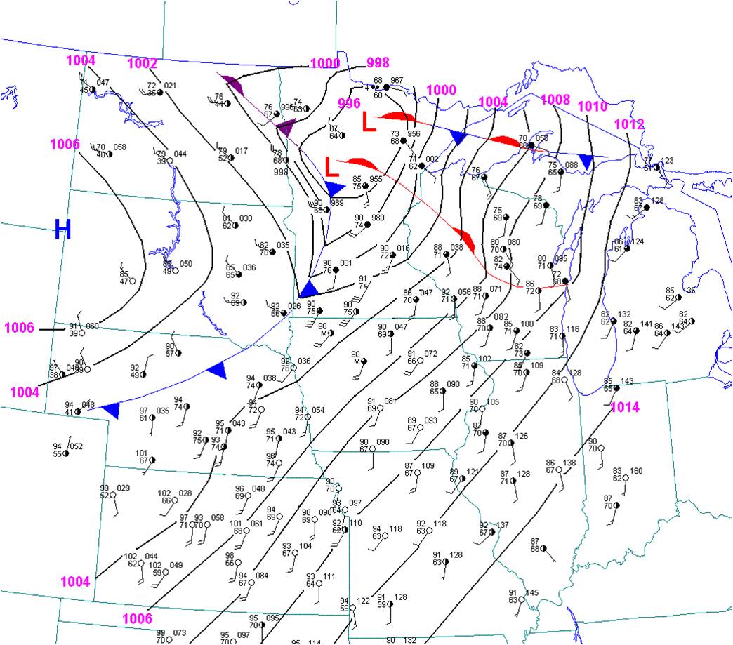 |
| 500 mb Analysis, 7 pm August 6, 1969 | Surface Analysis, 5 pm August 6, 1969 |
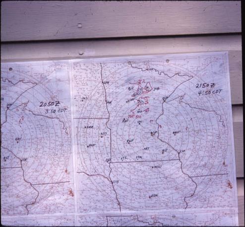
Radar Data
In 1969, the WSR-57 radar in Minneapolis was the closest radar to these storms. Archived radar images from these radars are rare because of the analog nature of the radar displays, and the following images are the only records we have at NWS Duluth of the radar data that day. (Note - our office actually did not yet exist in its current form as forecast office until the late 1990s.)
 |
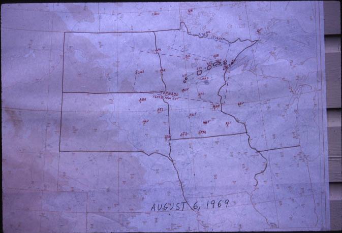 |
| A radar trace of the storms as they were occurring at 4:50pm CDT. (These radar traces were made by meteorologists physically tracing the radar screen to keep a record of the storm movement) | A paper map depicting the radar echoes and storm watches in effect on this day. A Tornado Watch had been issued on the day of the tornado outbreak. |
 |
Media use of NWS Web News Stories is encouraged! Please acknowledge the NWS as the source of any news information accessed from this site. |
|

