Duluth, MN
Weather Forecast Office
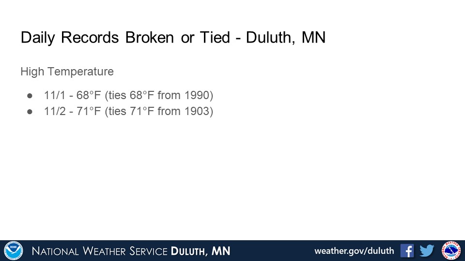
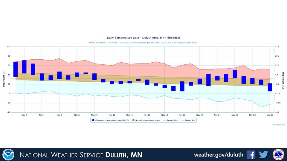
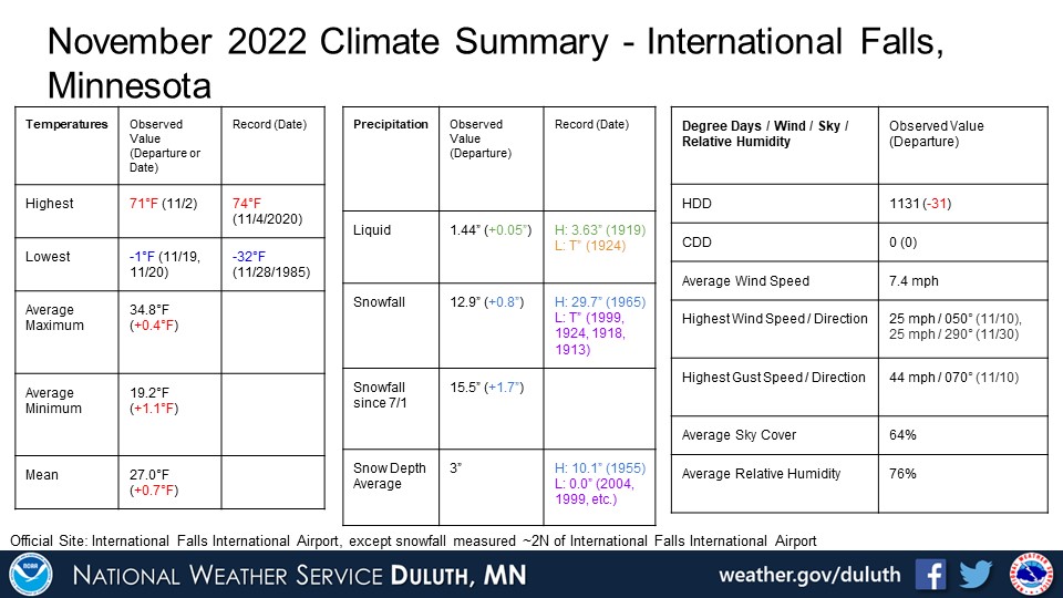
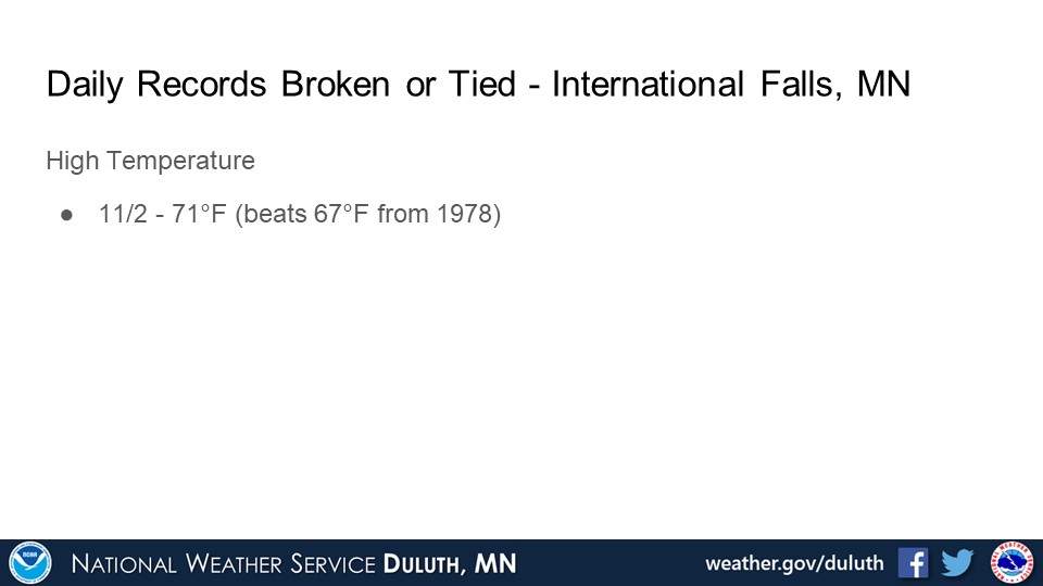
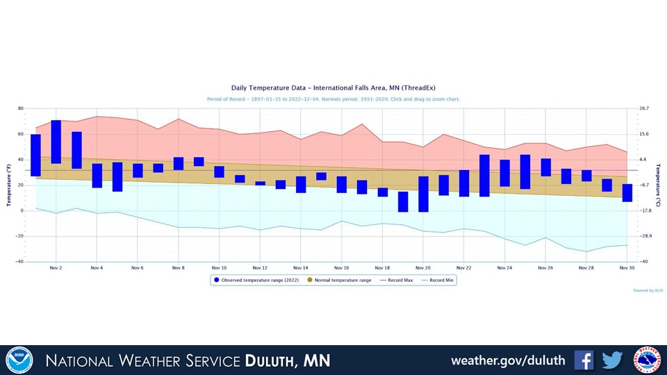
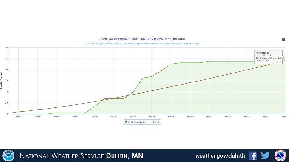
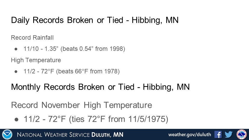
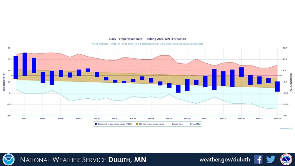
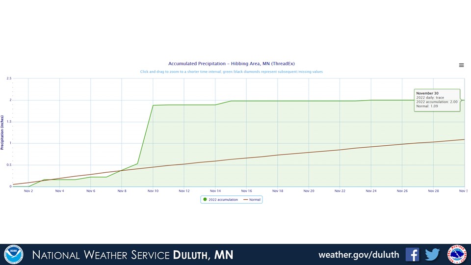
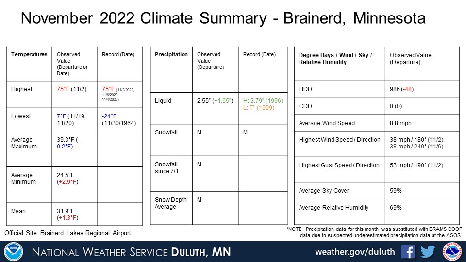
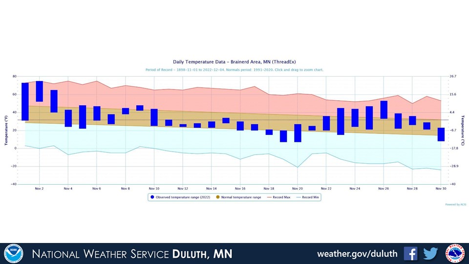
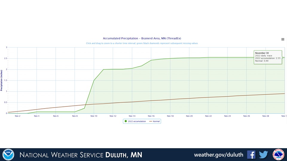
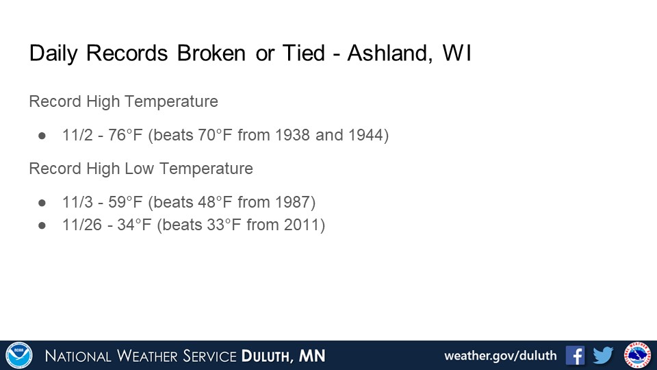
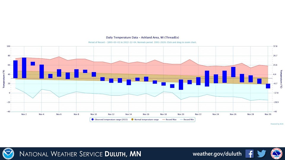
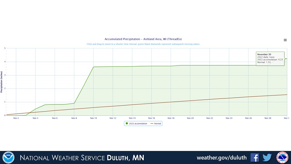
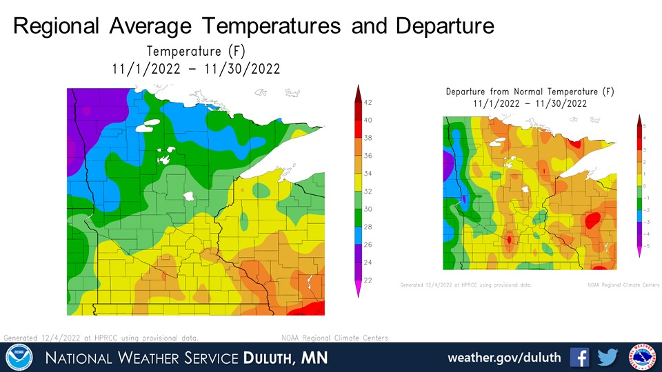
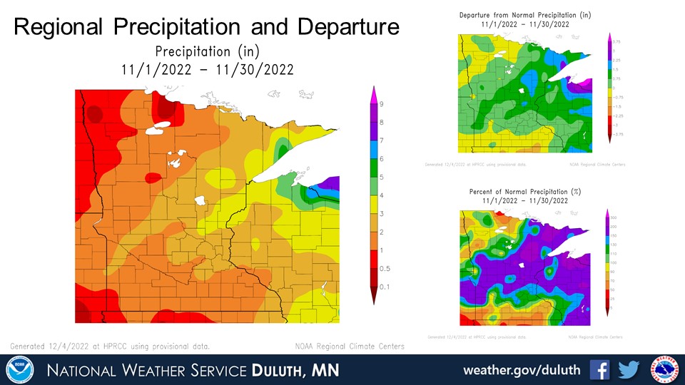
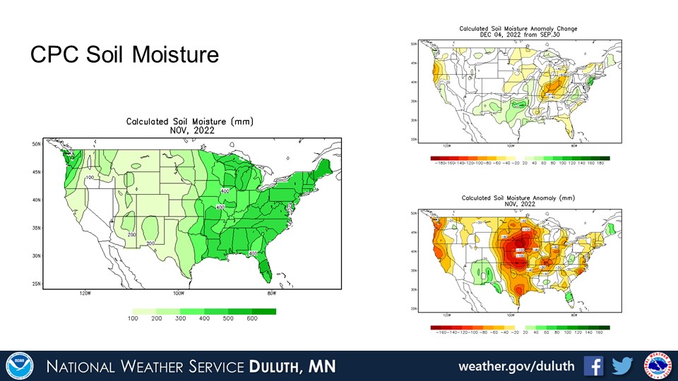
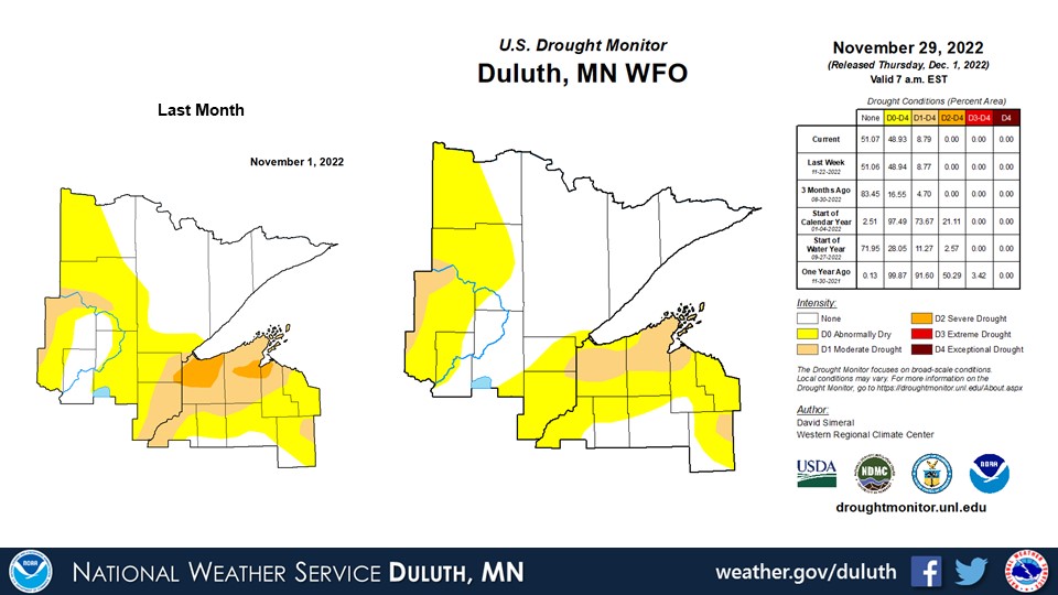
November is typically a transition month in the Northland and this November was a perfect example of that. Record daily high temperatures in the 70s were recorded at all climate sites on November 2, and monthly all-time high temperatures were tied at Brainerd (75°F) and Hibbing (72°F). Temperatures then plummeted to around average for the middle part of the month, then a bit above average by the end the month. Both rainfall and snowfall were near or above average around the Northland. This has led to some relief in drought conditions, though some abnormally dry conditions and patches of moderate drought still persist, especially in northern Bayfield and Douglas counties in Wisconsin and western Cass County in Minnesota.
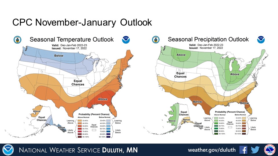
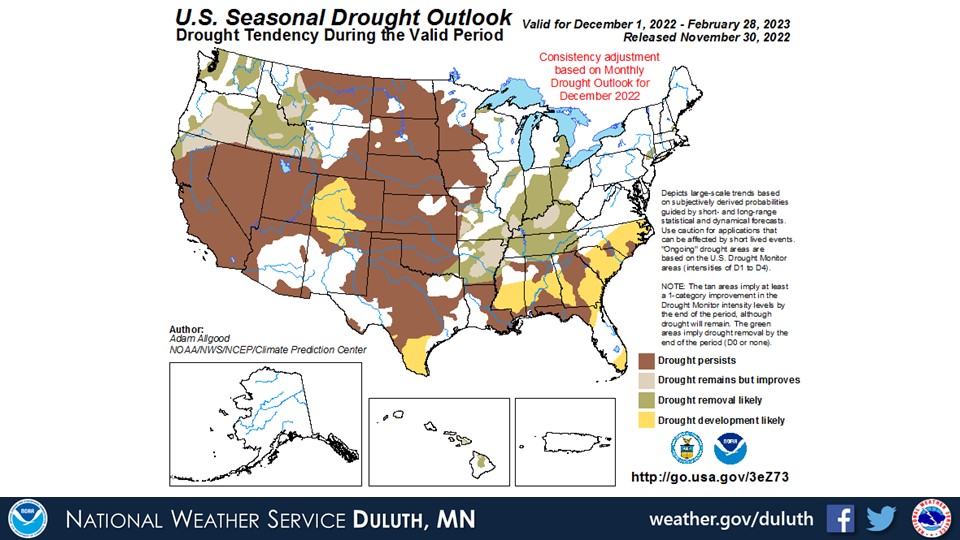
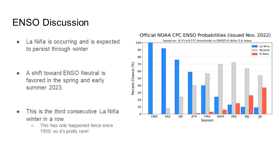
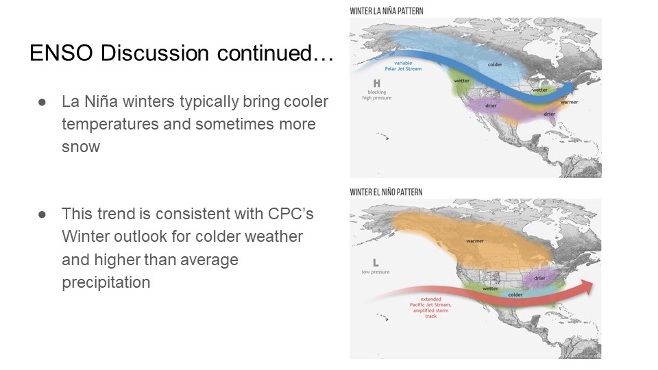
For December, the CPC is forecasting below average temperatures with equal chances for above or below normal precipitation. The CPC is forecasting below normal temperatures and above average precipitation for the December through February winter period. This forecast is consistent with the climatological pattern typically seen during a La Niña episode, which is currently occurring and is expected to continue through the winter. A transition toward ENSO neutral is projected going into spring and early summer 2023.
Duluth


International Falls

Hibbing

Brainerd

Ashland

Summary
Hydro

Outlook


 |
Media use of NWS Web News Stories is encouraged! Please acknowledge the NWS as the source of any news information accessed from this site. |
|
Forecasts
Fire Weather
Great Lakes
Local Text Products
Winter Weather
Local Area Forecasts
Aviation
Marine
Rainy River Basin Page
Current Conditions
Current Observations
Public Information Statements
National Snowfall Map
NOHRSC Snow Analysis
Rain/Snow Reports
Winter Monitor
US Dept of Commerce
National Oceanic and Atmospheric Administration
National Weather Service
Duluth, MN
5027 Miller Trunk Highway
Duluth, MN 55811-1442
218-729-6697 - Duluth; 218-283-4615 - Intl Falls
Comments? Questions? Please Contact Us.

