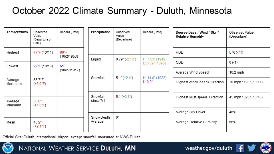
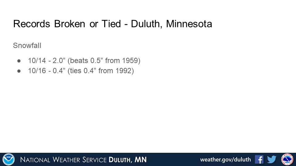
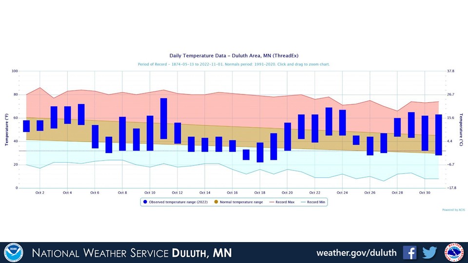
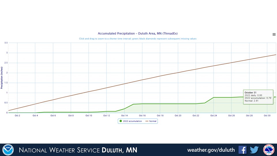
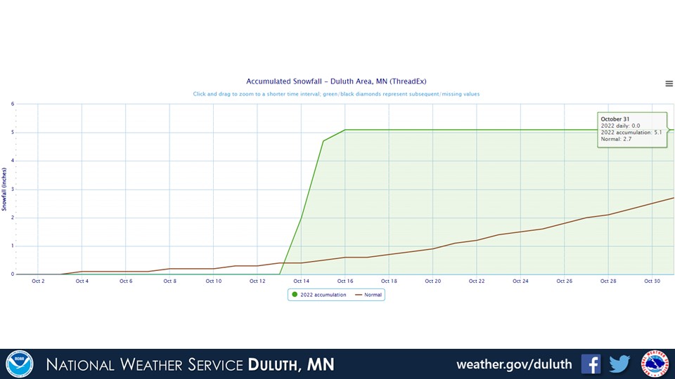
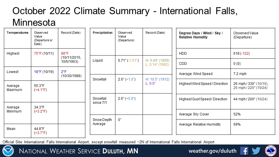
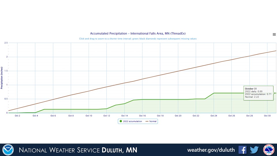
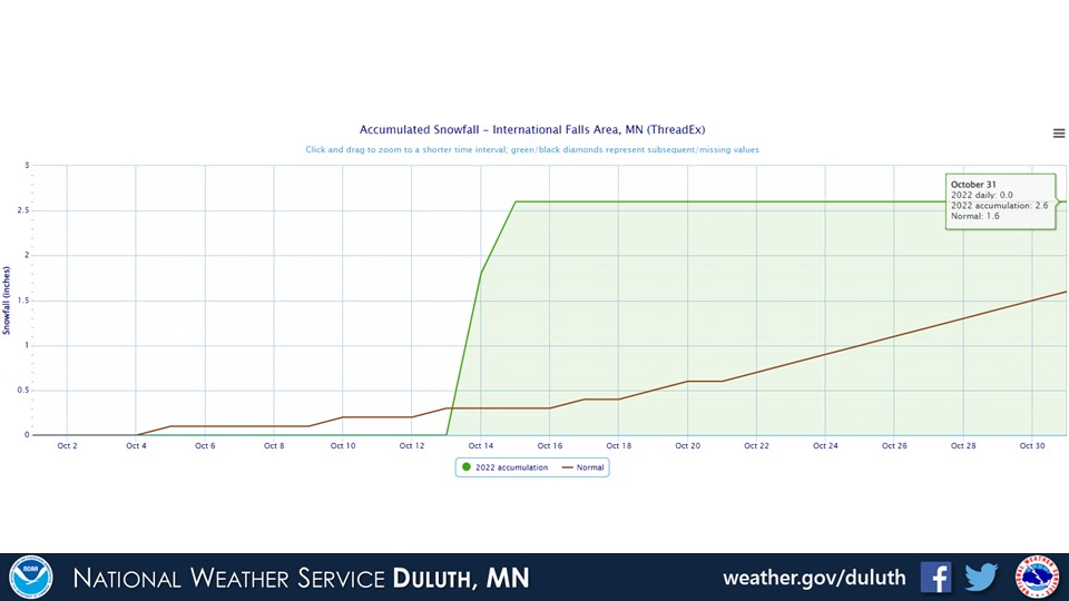
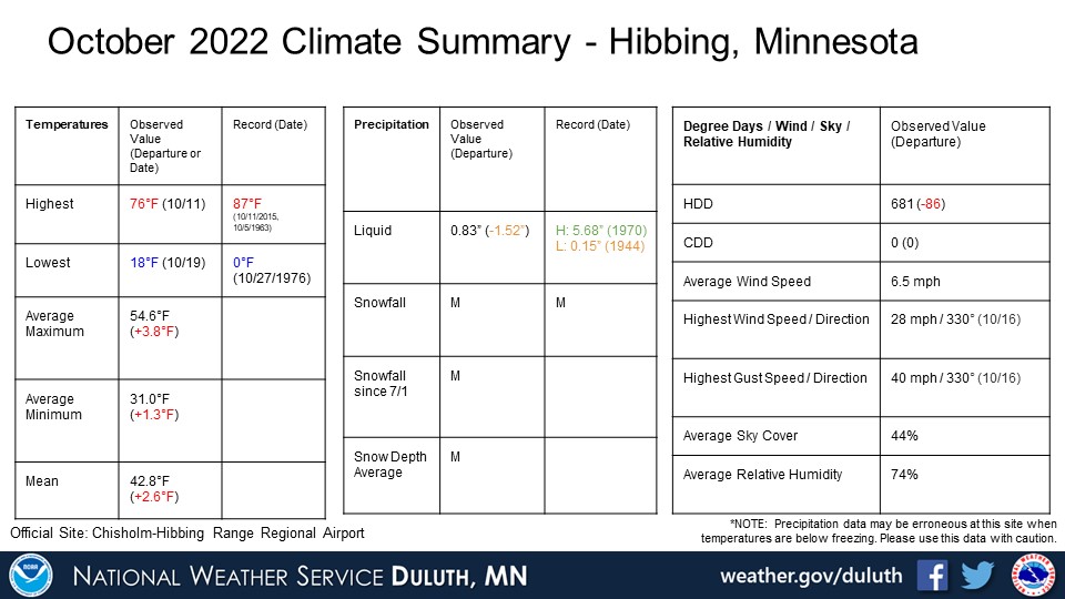
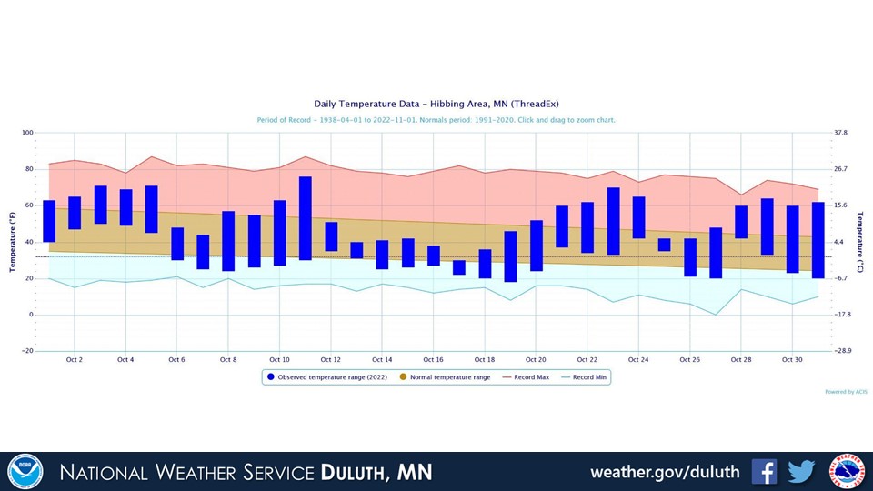
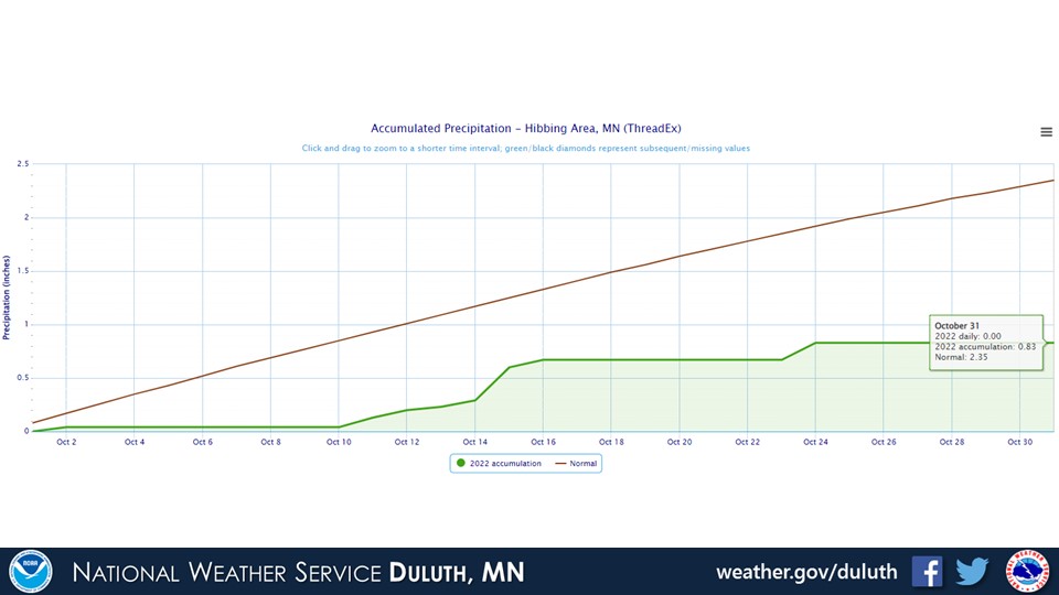
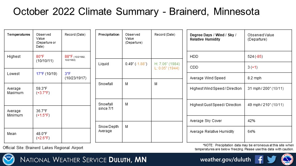
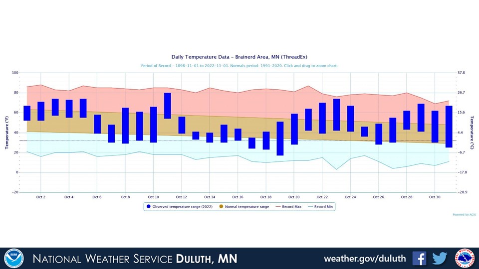
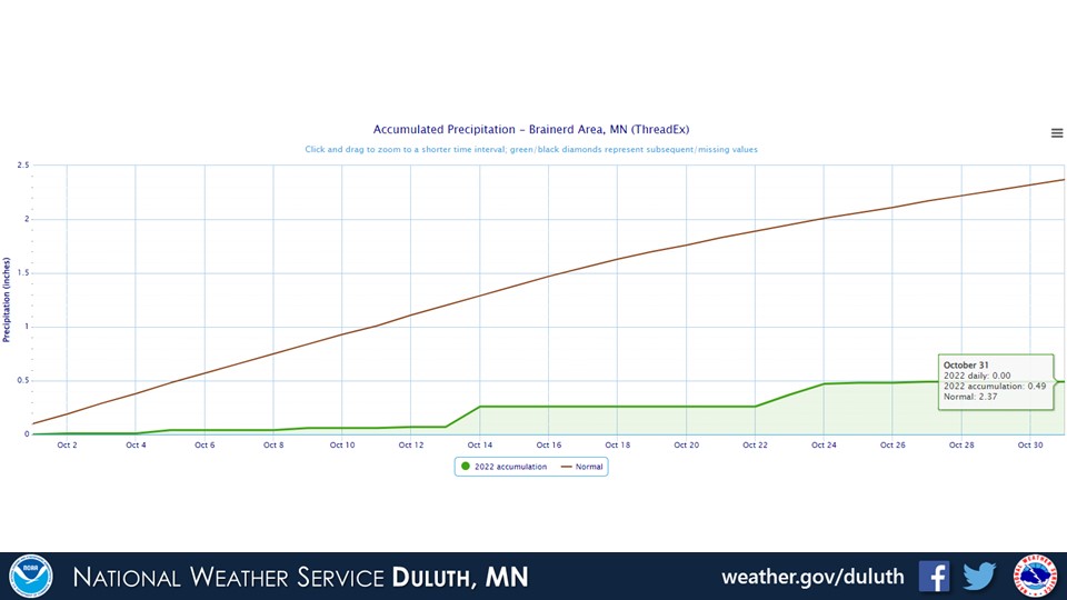
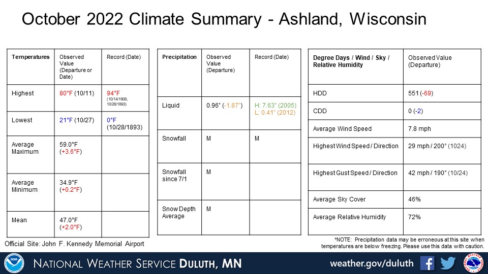
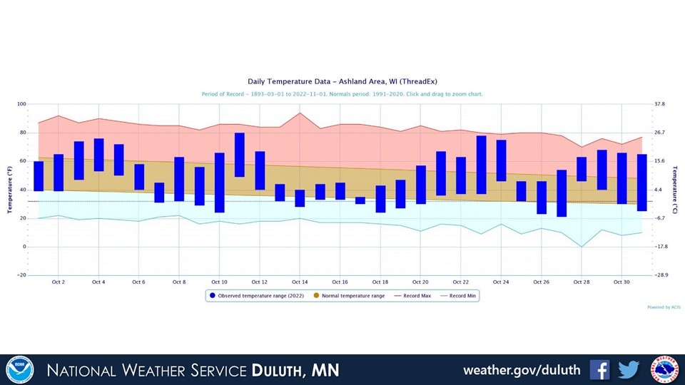
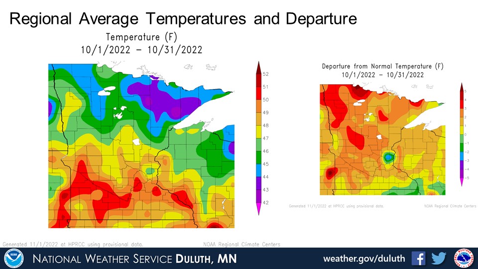
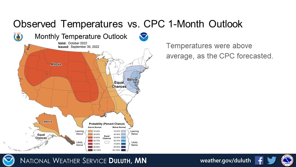
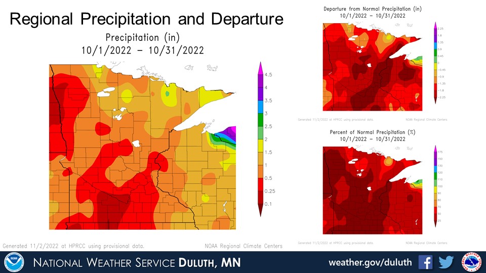
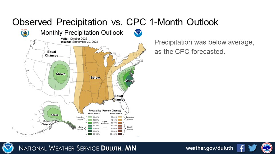
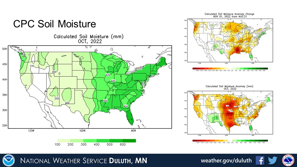
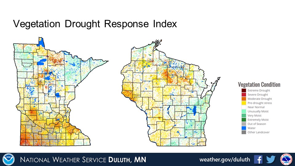
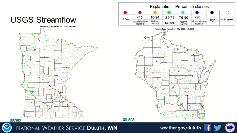
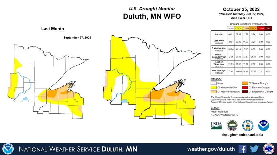
October was noticeably warm and dry across the Northland. There were some ups and downs temperature-wise throughout the month, and a cooler period mid-month also coincided with a few daily snowfall records at Duluth and International Falls. Temperatures trended above average as a whole, however, with monthly averages around 2 to 4 degrees above normal. Precipitation was also well below normal everywhere, with accumulations around 1.5-2.0” below normal (which amounts to approximately 25-50% of the normally observed precipitation for October). The warm and dry conditions have resulted in a spread of abnormally dry conditions across all of northwest Wisconsin and extending into much of northeast Minnesota, with the exception of the Arrowhead. Moderate to severe drought in and around the South Shore of Lake Superior has expanded in coverage slightly. Rivers are running around normal to below normal for much of the region.
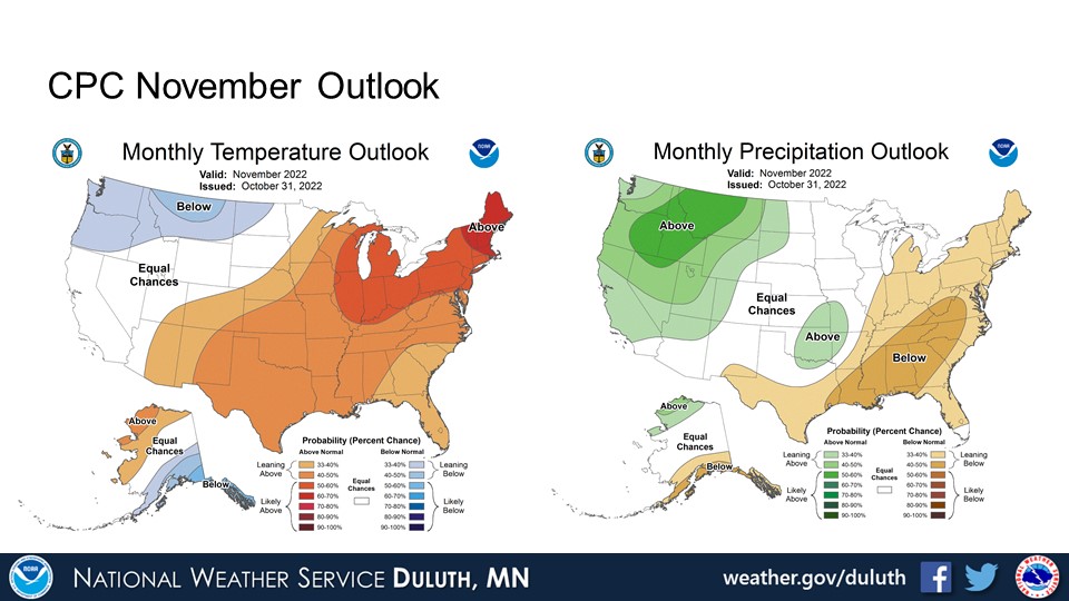
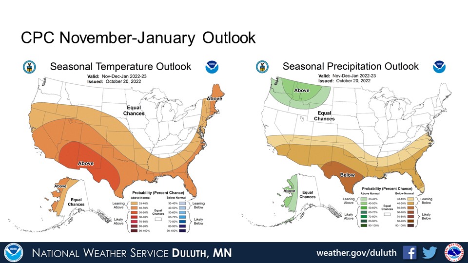
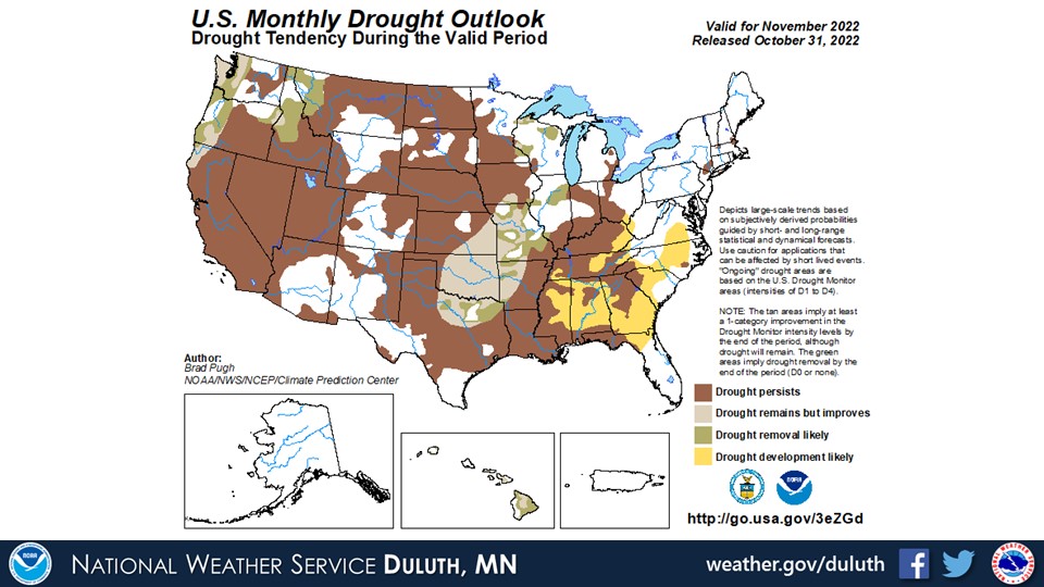
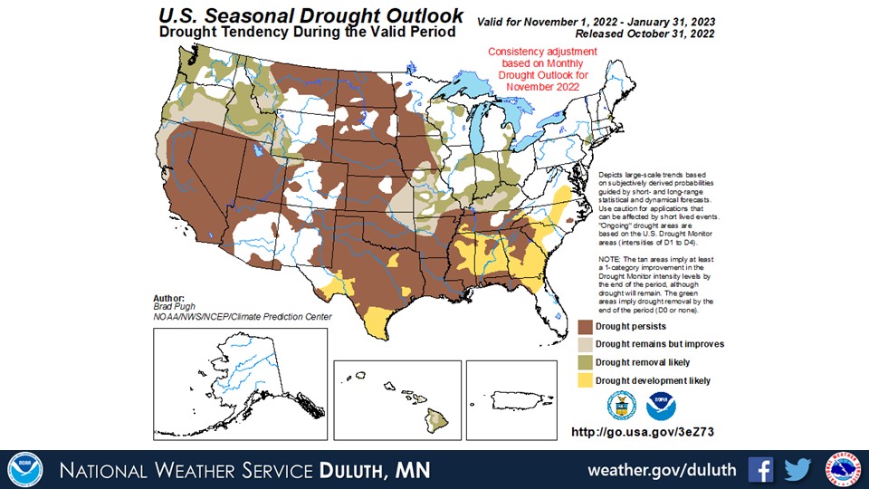
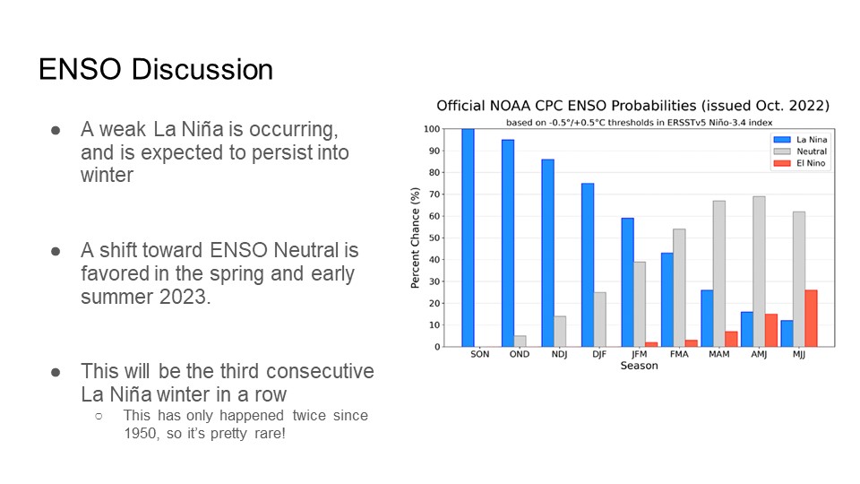
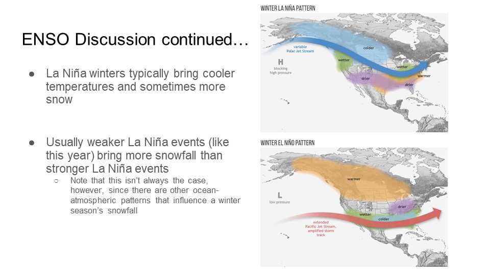
Looking ahead into November, the CPC is forecasting above normal temperatures to persist but equal chances for above or below normal precipitation. An ongoing La Niña is likely to persist through the winter before transitioning to ENSO normal this spring. This pattern has a history of bringing colder and snowier weather to the Northland (but not always). A more active pattern may develop for the beginning of November, which may result in slight improvement of drought conditions, but drought is expected to persist for some areas, particularly along and near the South Shore of Lake Superior.
Duluth
International Falls

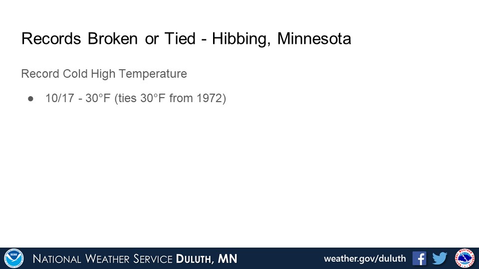
Hibbing
Brainerd
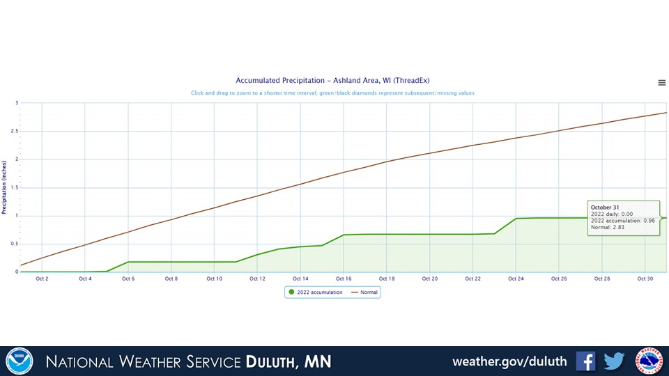
Ashland

Summary
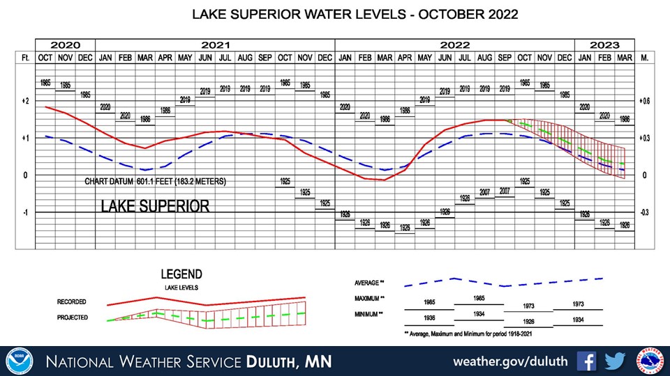
Hydro
Outlook
 |
Media use of NWS Web News Stories is encouraged! Please acknowledge the NWS as the source of any news information accessed from this site. |
|

