Explanation of Wave Height in the Nearshore Marine Forecast
Noticing this in our Nearshore Marine Forecast?
|
Thursday Southwest winds to 30 knots becoming northwest 15 to 25 knots. Snow likely during the day, then a chance of snow showers thursday night. Waves 5 to 9 feet subsiding to 3 to 6 feet. Waves occasionally to 11 feet. |
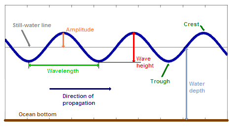
| How is Wave Height measured? |
 |
|
Wave height is the vertical distance between the crest (peak) and the trough of a wave. Some other definitions: Still-Water Line is the level of the lake surface if it were perfectly calm and flat. Crest is the highest point on the wave above the still-water line. Trough is the lowest point on the wave below the still-water line. |
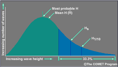
| Typical Distribution of Wave Heights |
 |
|
Explanation of the arrows being pointed to on the graph above:
For more information please see this link: Click Here |

