|
|
Summary of Arctic Blast |
||||||
|
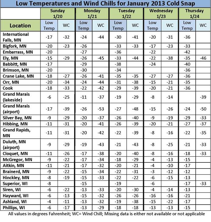
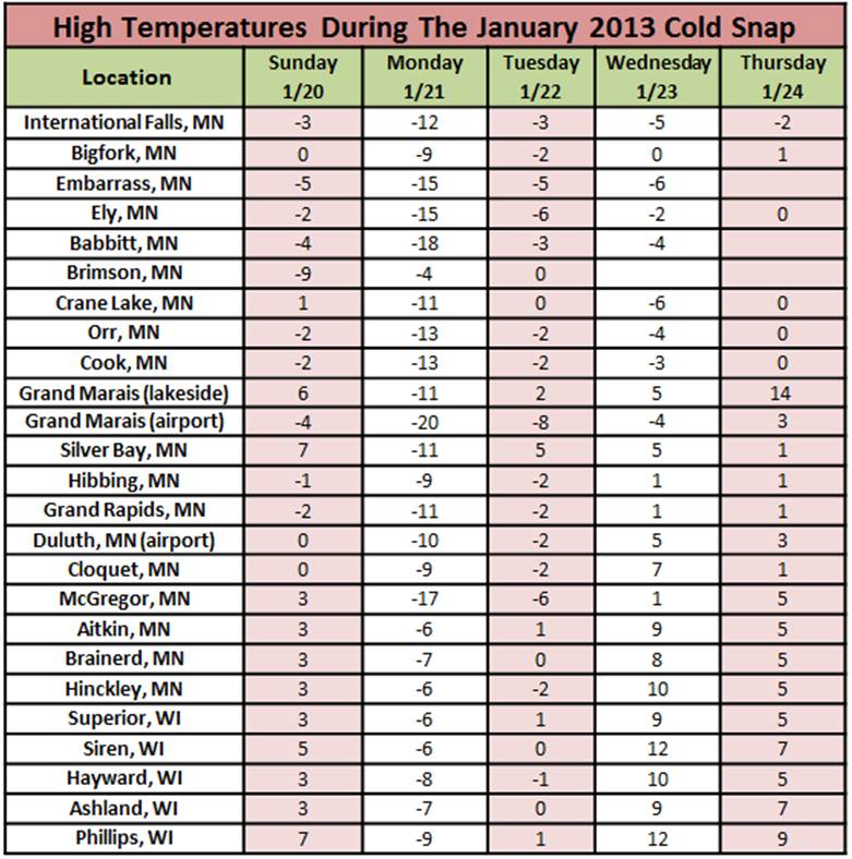
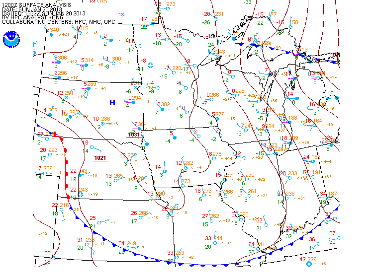
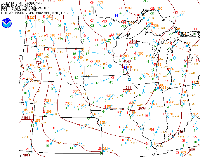
A fast moving Canadian low pressure system, commonly called a "Clipper", tracked over northern Minnesota and the Western Lake Superior region through the day Saturday, January 19th. This Clipper brought an arctic cold front that produced rapidly falling temperatures and strong northwest winds with widespread gusts of 35-45 mph. The Grand Marias, MN area saw gusts upwards of 50 mph during the overnight hours. The arctic air spilled into the region Sunday, Januay 20th; anchoring itself over the Northland through much of the following week. Below are tables of observed minimum and maximum temperatures (Temp) and wind chill values (WC) from across the Northland for the period of January 20th through 24th, 2013. |
|||||||
|
|||||||
|
Early morning temperatures on Monday the 21st bottomed out in the upper 20s below zero across the Minnesota Arrowhead Region to the negative teens across the Brainerd Lakes and northern Wisconsin areas. The coldest reported temperature Monday morning was -29 degrees F reported by a cooperative weather observer in Babbit, MN. Gusty winds overnight and through much of the day Monday contributed dangerously cold wind chill values. The coldest wind chill reading recorded in the area Monday was -53 degrees F at the Grand Marais Airport that morning. Widespread wind chill values of -30 to 40 F were felt elsewhere across the Northland into Monday afternoon. Light winds and clear skies led to favorable conditions for widespread temperature readings in the -20 to -40 F range just after daybreak on Tuesday, January 22nd, and again on Thursday morning January 24th. The mercury had a bit of relief on Wednesday night, the 23rd, when clouds passed over the region and held overnight lows generally in the negative single digits to negative 20s F. Although the Northland has not seen a cold-snap on this scale for a few years, no new daily temperature records were set at either International Falls, MN or Duluth, MN. |
|||||||
|
|
|||||||

