Overview
|
A severe thunderstorm complex packing damaging straight-line winds swept across northern Minnesota on July 5, 2016, beginning in the afternoon and ending late in the evening. Damage from the severe thunderstorm winds were reported all along the path of the storm, but the hardest hit areas were Deer River in Itasca County and the Island Lake area just north of Duluth. A private weather station in Normana Township north of Duluth recorded a 71 mph wind gust. |
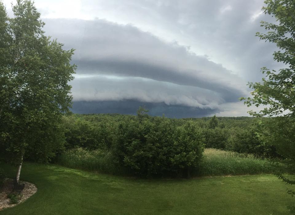
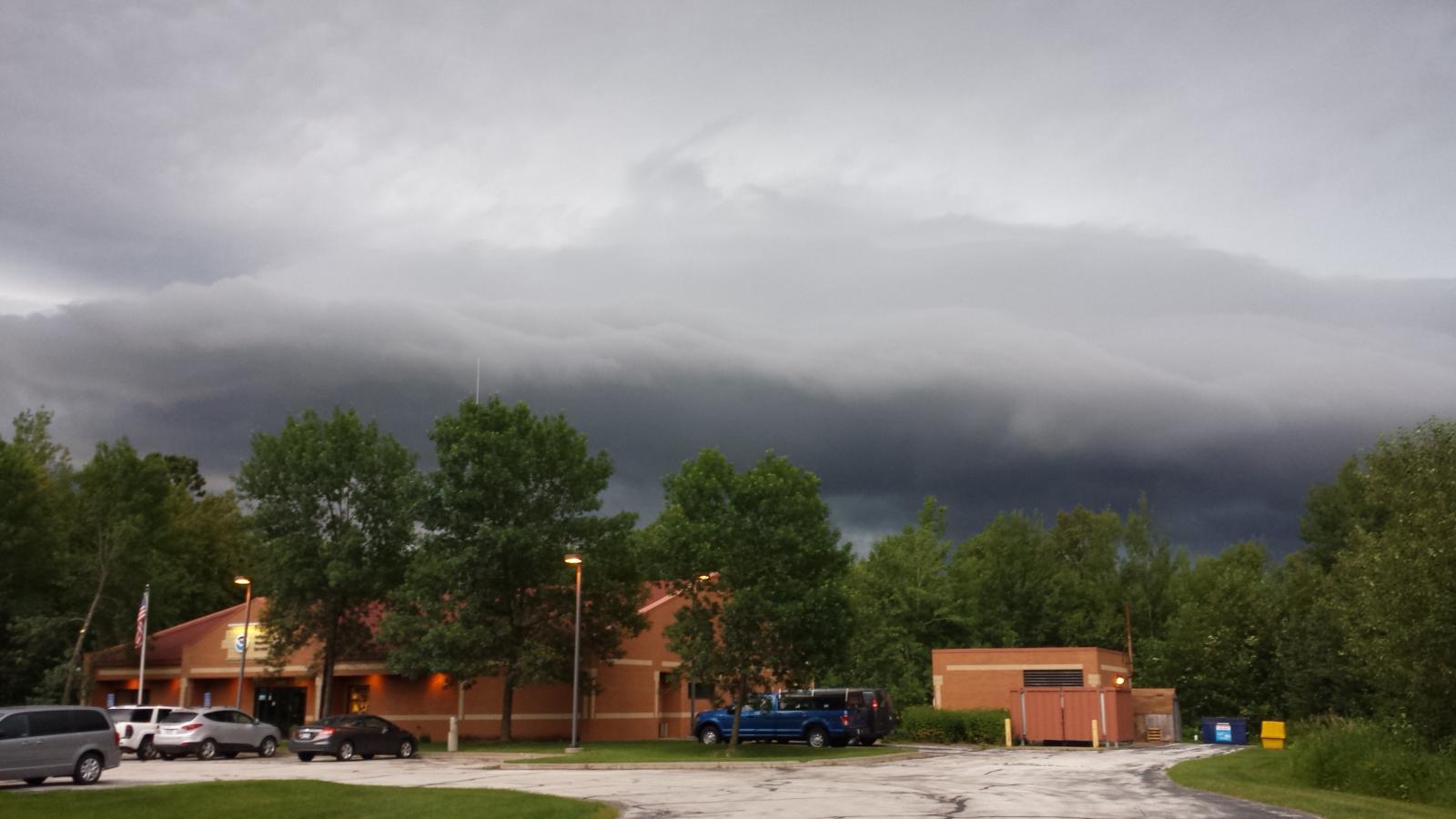 Shelf cloud nearing the National Weather Service |
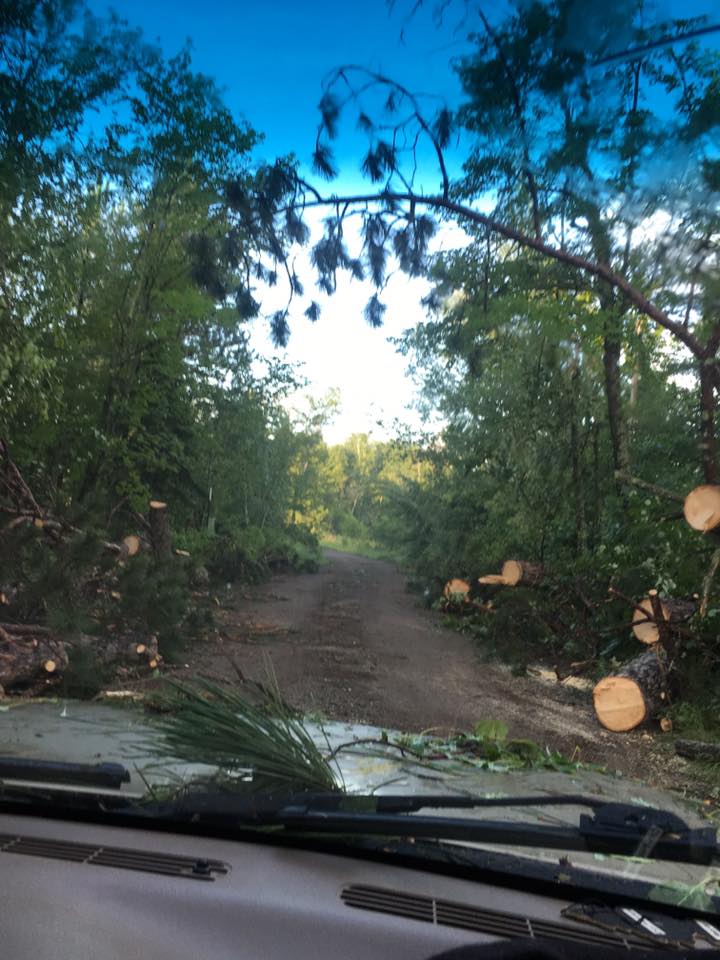
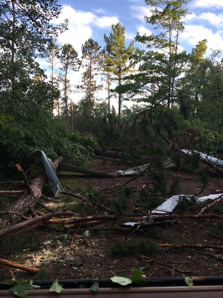
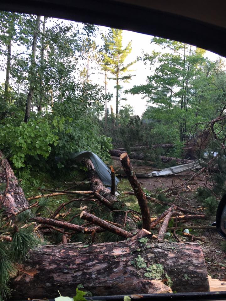
Wind Damage:
 |
 |
 |
 |
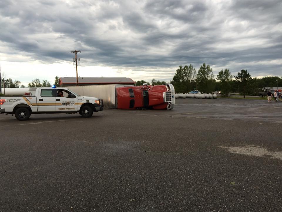
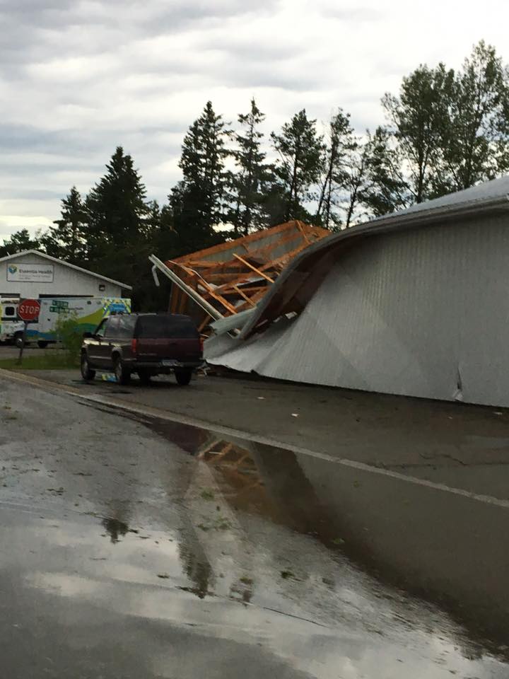
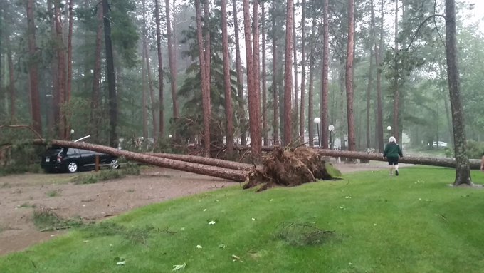
| Island Lake- Julie Packingham | Island Lake- Julie Packingham | Island Lake- Julie Packingham | Island Lake- Julie Packingham |
 |
 |
 |
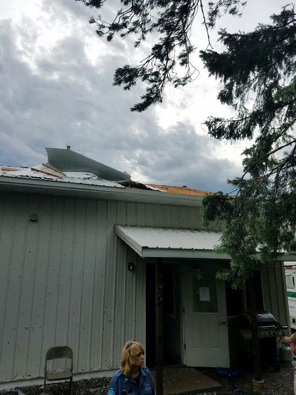 |
| Deer River- Ryan Jensen | Deer River- Ryan Jensen | Prairie Lake- Jim Edman | Deer River- Karl Gaalaas |
Shelf Photos:
 |
 |
 |
 |
| Duluth Shelf Cloud Photo Courtesy Kara Graves |
Shelf cloud over Kenwood area, Duluth Photo Courtesy Cindy Brown-Hill |
Island Lake Shelf cloud Photo Courtesy Julie Packingham |
Grand Rapids Shelf cloud Photo Courtesy Jon Libbey |
Radar:
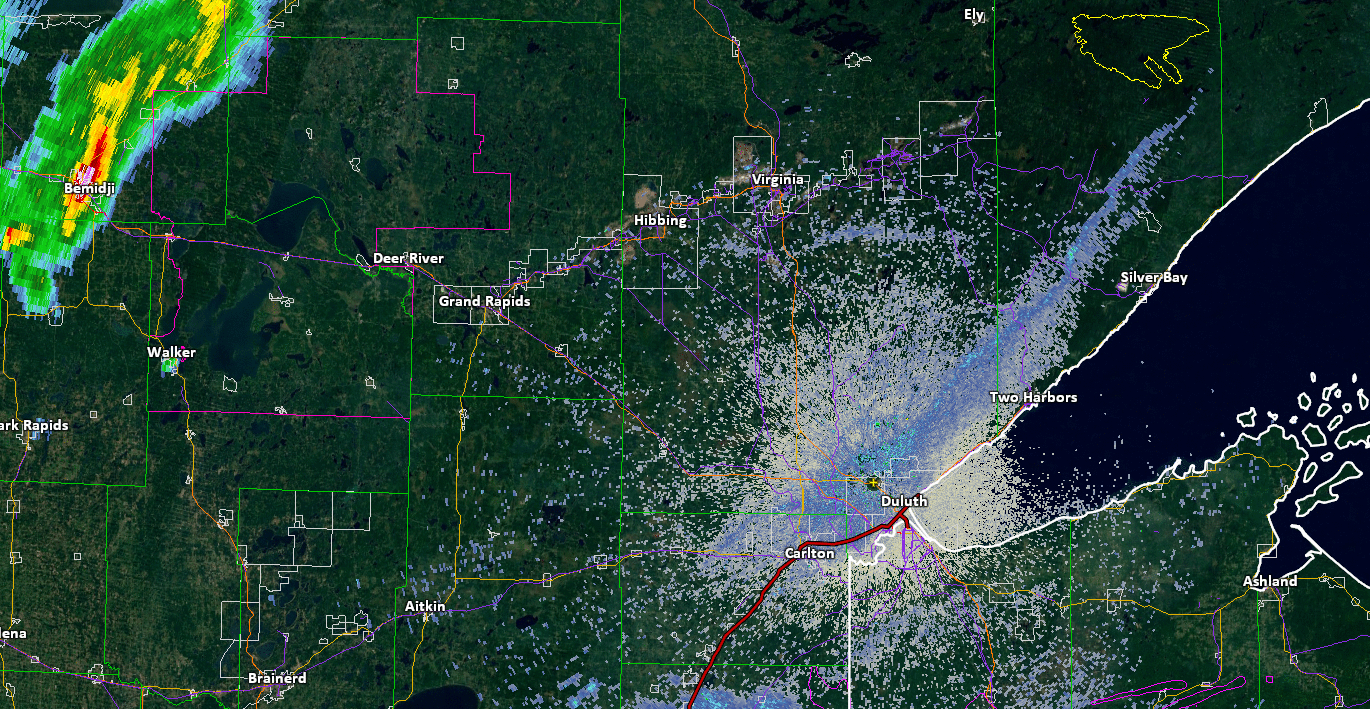 |
| Radar animation from about 4:30 pm - 8:30 pm Frame every 10 minutes Click for larger image |
Storm Reports
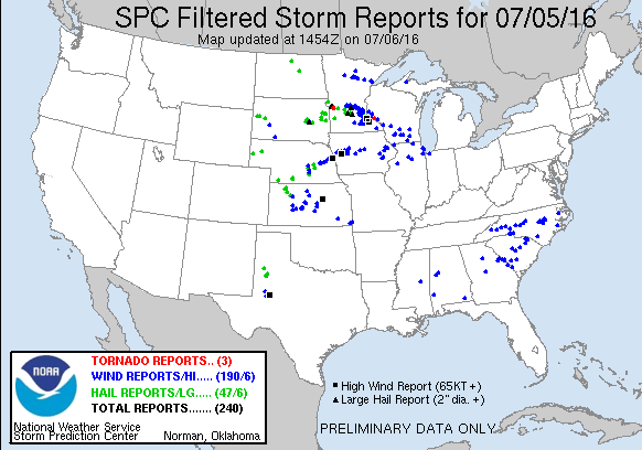
Click the image above for Storm Reports from around the country
PRELIMINARY LOCAL STORM REPORT...SUMMARY
NATIONAL WEATHER SERVICE DULUTH MN
951 PM CDT TUE JUL 05 2016

..TIME...   ...EVENT...      ...CITY LOCATION...     ...LAT.LON...
..DATE...   ....MAG....      ..COUNTY LOCATION..ST.. ...SOURCE....
            ..REMARKS..

0525 PM     TSTM WND DMG     4 ENE SIX MILE LAKE     47.33N 94.06W
07/05/2016                   CASS               MN   LAW ENFORCEMENT

            LOTS OF TREES DOWN ON HIGHWAY 2 BETWEEN MILE MARKER 145
            AND MILE MARKER 157.

0525 PM     HAIL             7 NNW BALL CLUB         47.43N 93.97W
07/05/2016  M0.88 INCH       ITASCA             MN   TRAINED SPOTTER

            LARGEST HAIL WAS NICKEL SIZE. 2 MINUTE DURATION.

0528 PM     TSTM WND DMG     7 NNW BALL CLUB         47.43N 93.97W
07/05/2016                   ITASCA             MN   TRAINED SPOTTER

            COUPLE OF 8 TO 10 INCH DIAMETER TREES DOWN. POWER OUT.

0545 PM     TSTM WND GST     1 E ZEMPLE              47.33N 93.76W
07/05/2016  E70.00 MPH       ITASCA             MN   TRAINED SPOTTER

            ESTIMATED 70 MPH WIND GUSTS. LOTS OF TREES DOWN ACROSS
            COUNTY ROADS IN AND NEAR DEER RIVER.

0545 PM     TSTM WND GST     BIGFORK                 47.75N 93.65W
07/05/2016  E55.00 MPH       ITASCA             MN   TRAINED SPOTTER

            ESTIMATED 50-55 MPH WIND GUST.

0557 PM     TSTM WND GST     2 N BIGFORK             47.78N 93.65W
07/05/2016  M59.00 MPH       ITASCA             MN   MESONET

            MESONET STATION EFFM5.

0600 PM     TSTM WND DMG     5 NNW GRAND RAPIDS      47.31N 93.55W
07/05/2016                   ITASCA             MN   PUBLIC

            PHOTOS OF MULTIPLE TREES DOWN IN THE AREA. LARGEST TREES
            WERE 2 TO 3 FEET IN DIAMETER. TIME ESTIMATED BY RADAR.

0602 PM     TSTM WND DMG     2 S GRAND RAPIDS        47.20N 93.53W
07/05/2016                   ITASCA             MN   PUBLIC

            6 TO 8 INCH DIAMETER TREES DOWN. TIME ESTIMATED BY RADAR.


0656 PM     TSTM WND DMG     1 ESE TOIVOLA           47.16N 92.79W
07/05/2016                   ST. LOUIS          MN   TRAINED SPOTTER

            14 TO 16 INCH DIAMETER MAPLE TREE SPLIT JUST ABOVE THE
            TRUNK AND KNOCKED OVER.

0738 PM     TSTM WND DMG     5 NE FREDENBERG         47.03N 92.15W
07/05/2016                   ST. LOUIS          MN   BROADCAST MEDIA

            LARGE TREES AND POWER LINES DOWNED. TIME ESTIMATED FROM
            RADAR.

0745 PM     TSTM WND GST     4 NE RICE LAKE TWP      46.95N 92.03W
07/05/2016  M71.00 MPH       ST. LOUIS          MN   AMATEUR RADIO

            MEASURED BY PUBLIC WEATHER STATION.


&&
Environment
Coming soon!
 |
Media use of NWS Web News Stories is encouraged! Please acknowledge the NWS as the source of any news information accessed from this site. |
|

