Duluth, MN
Weather Forecast Office
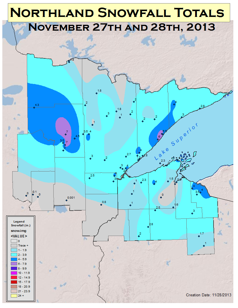
Grand Rapids and Finland recorded the highest storm total amounts of 7 inches thus far. Duluth recorded 3 inches at the airport. Elsewhere, 1-3 inches was mostly observed. Additional snow accumulations may be likely, as scattered snow showers continued across the Arrowhead and northern Wisconsin Thanksgiving afternoon. This map reflects data as of noon on November 28th.
 |
Media use of NWS Web News Stories is encouraged! Please acknowledge the NWS as the source of any news information accessed from this site. |
|
Forecasts
Fire Weather
Great Lakes
Local Text Products
Winter Weather
Local Area Forecasts
Aviation
Marine
Rainy River Basin Page
Current Conditions
Current Observations
Public Information Statements
National Snowfall Map
NOHRSC Snow Analysis
Rain/Snow Reports
Winter Monitor
US Dept of Commerce
National Oceanic and Atmospheric Administration
National Weather Service
Duluth, MN
5027 Miller Trunk Highway
Duluth, MN 55811-1442
218-729-6697 - Duluth; 218-283-4615 - Intl Falls
Comments? Questions? Please Contact Us.

