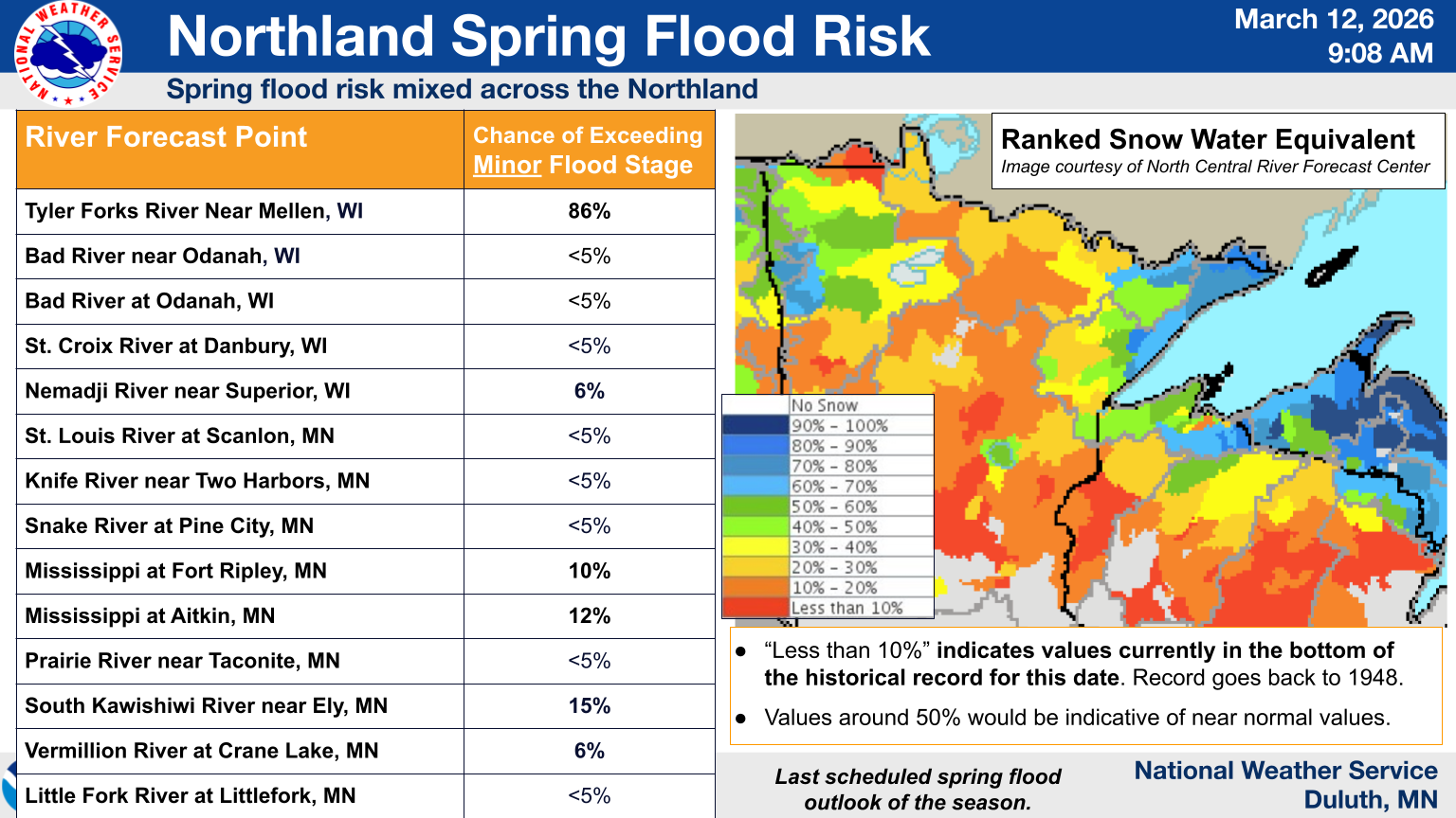
Recent melt has reduced remaining snowpack for much of the Northland away from Lake Superior.
Spring Flood Risk is:
Upper Mississippi River: Low
St. Croix: Low
Chippewa: Low
Near Lake Superior: Near normal to High
Rainy River Basin: Near normal
Ground has started to thaw and runoff into soils and area rivers has been observed on warm days.
| Threat | Impact to Potential Spring Flooding | Links |
|---|---|---|
| High River Levels | Below Normal Streamflow | USGS WaterWatch MN WI |
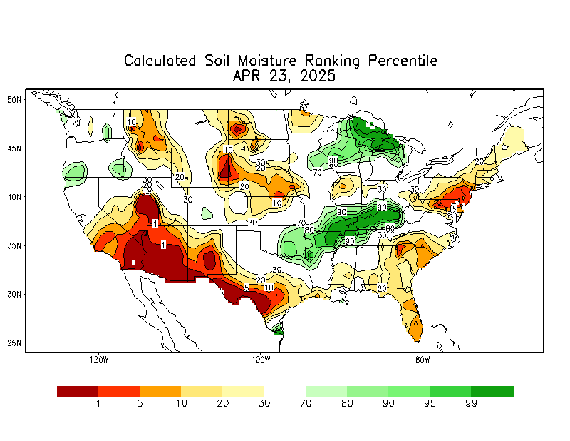
| High Soil Moisture | Around to Above Normal | CPC Soil Moisture |
| Winter Precipitation |
Lower to around normal |
6 to 10 Day 8 - 14 Day |
|
Current Snowpack/Liquid Equivalent |
Normal to Below Normal, Above Normal around Lake Superior |
|
| Rate of Snowmelt | Steady and controlled | 24, 48, & 72 hr Snowmelt |
| Frost Depth | Normal to Below Normal | Frost Depth Map |
| Spring Precipitation | Possible chance for slightly above normal. |
Point Forecast (Next 7 Days) Precip Outlook (Upcoming Weeks) |
NWS Duluth Snow Survey Data for the MN Arrowhead and Rainy River Basin:
NWS Duluth meteorologists perform snow surveys each winter to fill critical snow water equivalent (SWE) data gaps across portions of Northeast Minnesota. The latest survey was on March 3 and 4, 2026. All the latest SWE observations in the last 72 hours across the Northland can be viewed at this link. Most SWE data comes in on Mondays.
| Location | Snow Depth (inches) | SWE (inches) |
|---|---|---|
| Tofte Ranger Station | 19 | 3.7 |
| Sawbill Campground | 24 | 4.8 |
| Windy Lake (Lake Co. Hwy 7) | 23 | 4.0 |
|
Wye Lake (Lake Co. Hwy 7) |
22 |
4.0 |
| Little Isabella River Campground | 20 | 4.3 |
| South Kawishiwi River Campground | 18 | 3.5 |
| Sand Lake Campground (Lake County Hwy 2) | 19 | 4.2 |
| Wales | 22 | 5.7 |
| Big Lake Boat Launch (Echo Trail) | 15 | 3.1 |
| Lake Jeanette Campground (Echo Trail) | 15 | 3.3 |
| Echo Lake Campground (Echo Trail) | 17 | 3.4 |
| Littlefork River near Linden Grove | 15 | 3.4 |
| Little Moose Trailhead (MN State Hwy 65) | 12 | 2.3 |

