
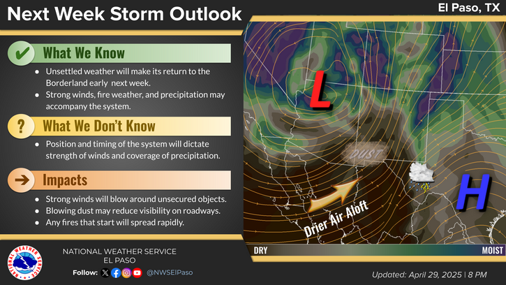
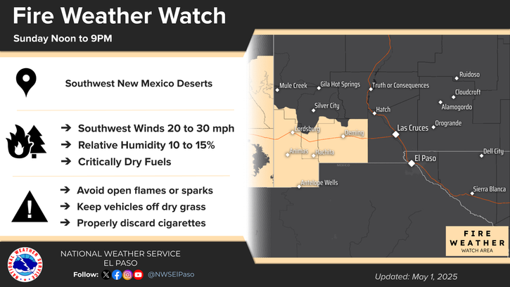
Extreme heat will continue across the Pacific Northwest into midweek before finally waning. Hot temperatures, low relative humidity, gusty winds, and isolated dry thunderstorms will bring critical fire weather into Tuesday. A refreshingly cool air mass has settled into much of the eastern two-thirds of the Rockies through the week. Read More >
Last Map Update: Mon, Aug 25, 2025 at 12:48:19 pm MDT
 Briefing |
 Forecast Discussion |
 Weather Hazards Outlook |
 Hourly Forecast |
 Gridded Forecast |
 Weather Calculator |
|
|
 Satellite |
|
 Past Weather |
 Drought |
 Hydrology |
 Wx Radio |
 Skywarn |
 Fire Weather |
Vo1lunteer |
 Aviation |
 Social Media |
 Weather Digest |
 Monsoon/Tropical |


 Radar
Radar Weather Map
 Satellite