
Extreme heat continues today from the central Plains to the lower Mississippi River Valley, over southeast Montana, and from southern California into the Southwest Deserts. Extreme Heat Warnings remain in effect. Severe thunderstorms capable of strong to severe wind gusts and large hail are possible across the Great Lakes into the Ohio Valley today into tonight. Read More >
Last Map Update: Mon, Jul 27, 2026 at 10:08:18 am MDT


 Briefing |
 Forecast Discussion |
 Weather Hazards Outlook |
 Hourly Forecast |
 Gridded Forecast |
 Weather Calculator |
|
|
 Satellite |
|
 Past Weather |
 Drought |
 Hydrology |
 Wx Radio |
 Skywarn |
 Fire Weather |
Vo1lunteer |
 Aviation |
 Social Media |
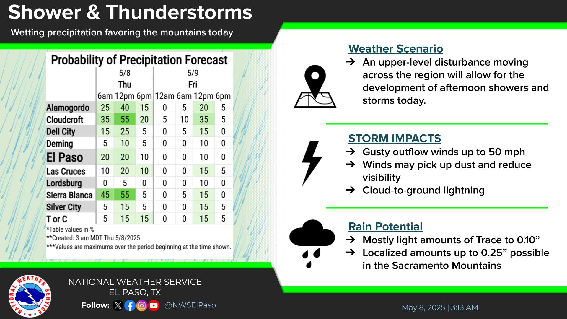
 Weather Digest |
 Monsoon/Tropical |


 Radar
Radar Weather Map
 Satellite