
Scattered thunderstorms with severe gusts, hail and a tornado risk are possible near a cold front from the Ohio Valley to the Mid-Atlantic tonight. Tropical Storm Bertha is expected to bring tropical storm conditions to portions of the Gulf Coast from the panhandle of Florida into Louisiana through Wednesday. Read More >
Media is free to use the NWS Flagstaff Event Summary information. Please acknowledge the NWS as the source of any information accessed from the site unless otherwise noted.
On the afternoon of July 15, 2017, a large debris flow and flash flood impacted the Ellison Creek drainage, north of Payson, AZ. There were 10 fatalities from a family recreating in Ellison Creek (at the Cold Springs swimming hole near the East Verde River) who were overwhelmed by the flood. This event was a tragic reminder of the threat flash flooding poses across northern Arizona.
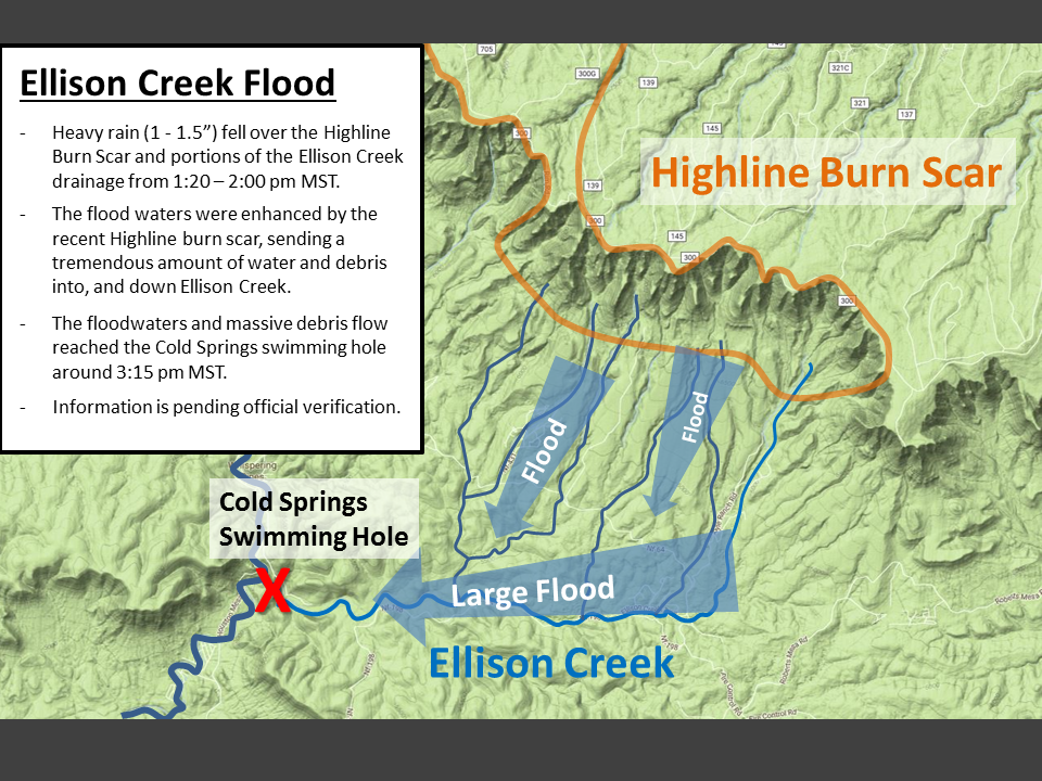
Map showing the the Highline Burn Scar, Ellison Creek, and the Cold Springs swimming hole
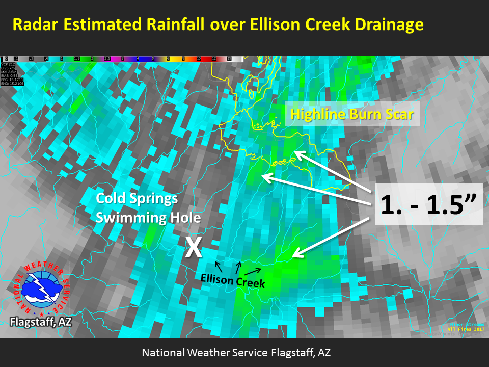
Radar Estimated Storm Total Precipitation on July 15, 2017
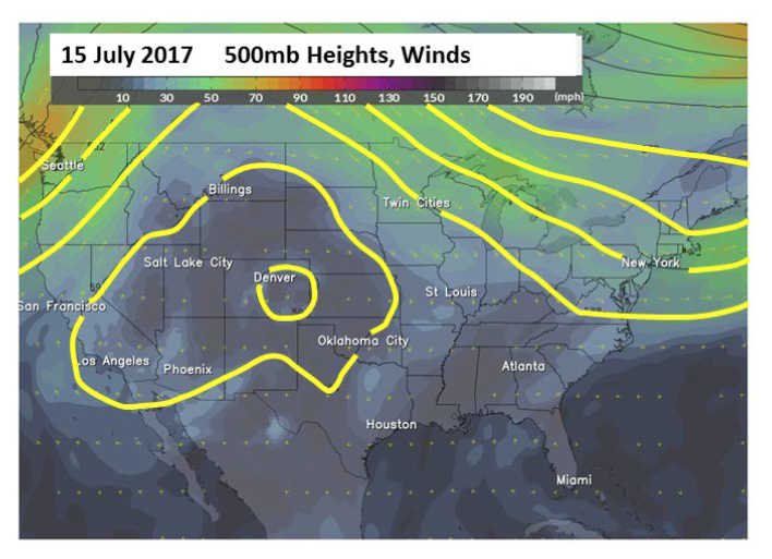
A typical monsoonal weather pattern was in place on July 15th with a ridge of high pressure centered over the southern Great Basin and central Rocky Mountains
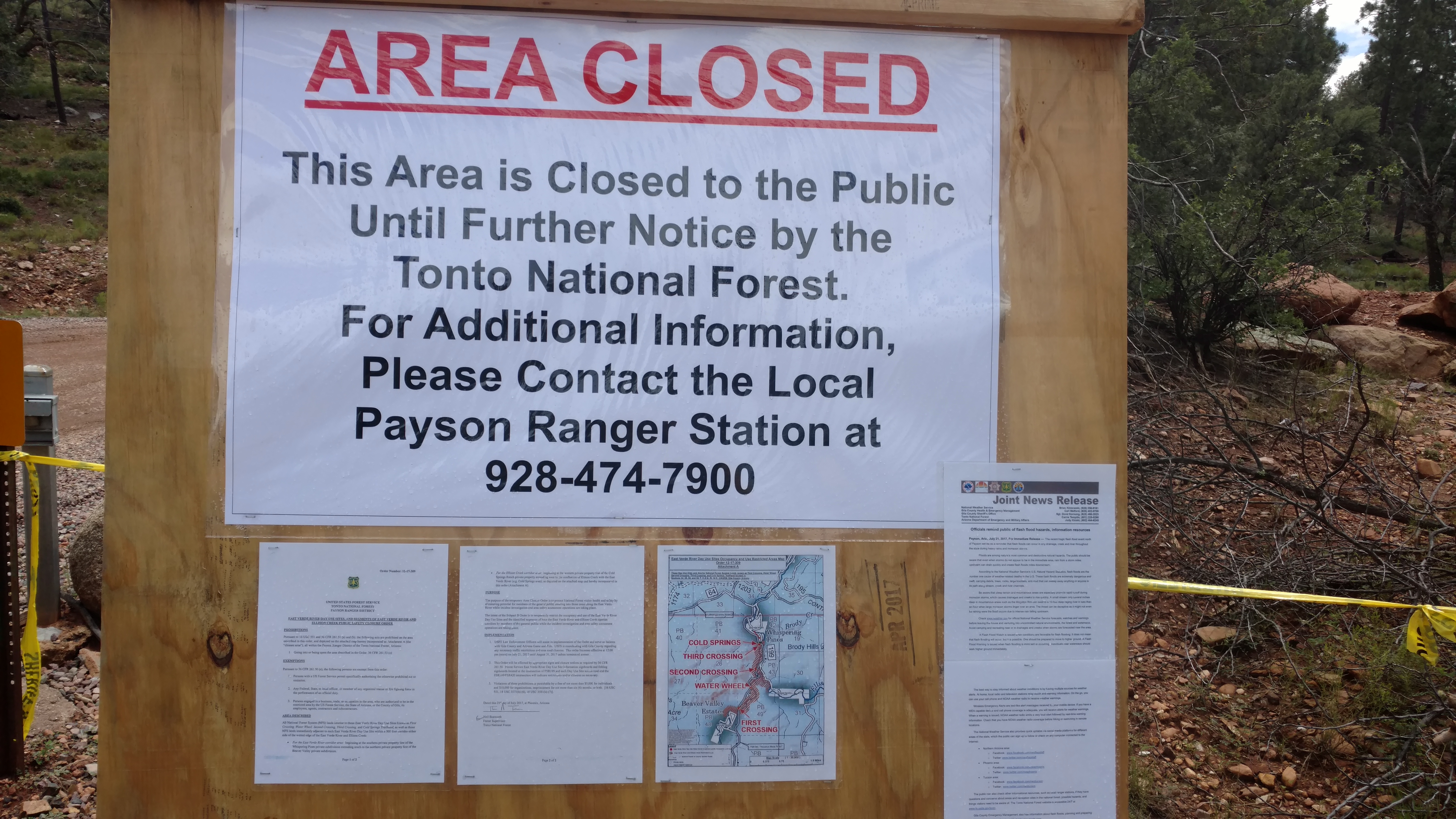
Closure sign for the Cold Springs Swimming Hole after the tragic flash flood
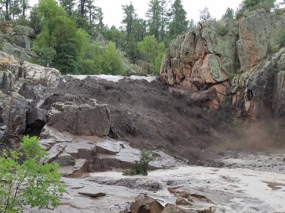
Photo Taken By Jack Lloyd of the Cold Springs Swimming Hole on July 15, 2017 showing significant flash flooding occurring.
East Verde River at Water Wheel Day Use Area. More substantial debris was noted along the banks than at First Crossing. High water mark on trees was probably more like 4-4.5 feet.
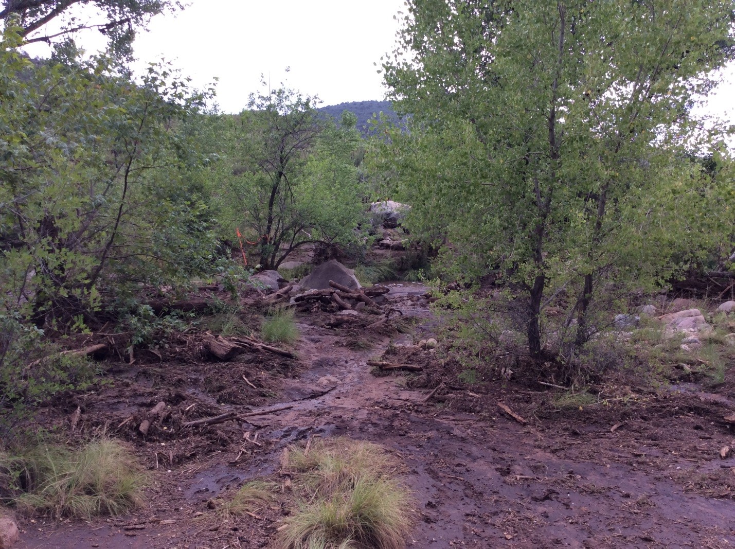
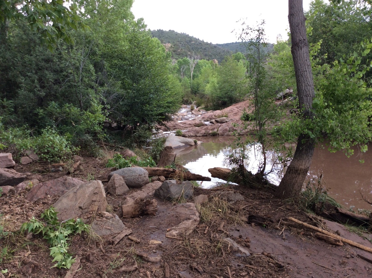
Bank of East Verde River, approximately 200 yards upstream from parking lot at Water Wheel Day Use Area. Note substantial debris.
There were four primary factors responsible for the flash flood and debris flow which rushed down Ellison Creek, impacting the Cold Springs swimming hole:
For more information on impacts and general inquiries about this event, contact by sending an email to or by calling .
Media is free to use this event summary information. Please acknowledge the National Weather Service as the source of any information accessed from the site unless otherwise noted.

