Introduction
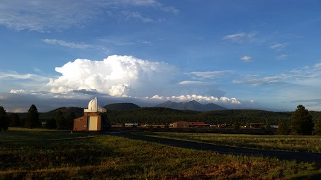
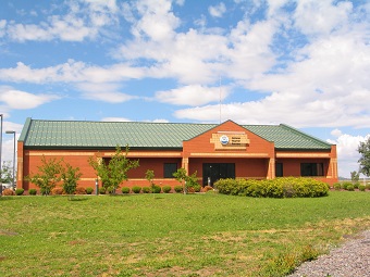
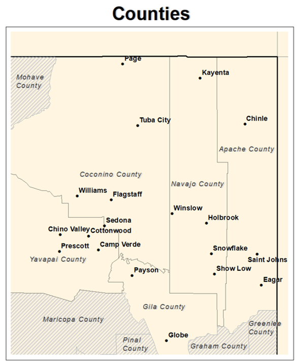
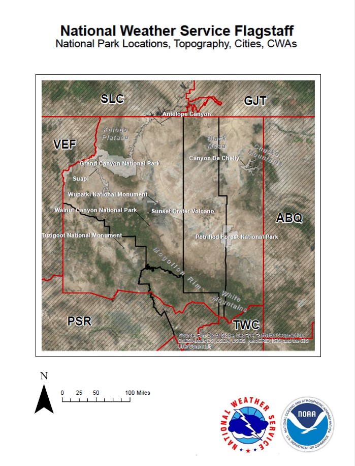
The National Weather Service office in Flagstaff serves five counties across northern Arizona: Coconino, Yavapai, Navajo, Apache, and northern Gila counties. The highest point in our forecast area is Mt. Humphreys (the highest point in the state of Arizona) at 12,633 feet above sea level; the lowest point in the area is near the town of Black Canyon City (near 2,000 feet above sea level). Due to these elevation differences, the Flagstaff office provides forecasts for a wide variety of weather conditions including heavy snowfall, bitter cold, severe thunderstorms, heavy rainfall, excessive heat and strong winds. Our office is located at Camp Navajo (Arizona Army National Guard) in Bellemont, AZ (about 10 miles west of Flagstaff).
We are on duty around-the-clock; our operations run 24 hours a day, 7 days a week. Due to the importance of our mission, NWS employees are considered essential and will continue working during government shutdowns. We are always on-the-job, protecting the public from the ever-present threats of mother nature!
Interested in touring the NWS Flagstaff office? Click here for more information
Our neighboring tribal nations are keen observers of weather and we work closely with them when they are interested in NWS support. Examples include rain gauges, hosting portable weather stations, educational programs and products for schools and community members and tribe-specific graphics.
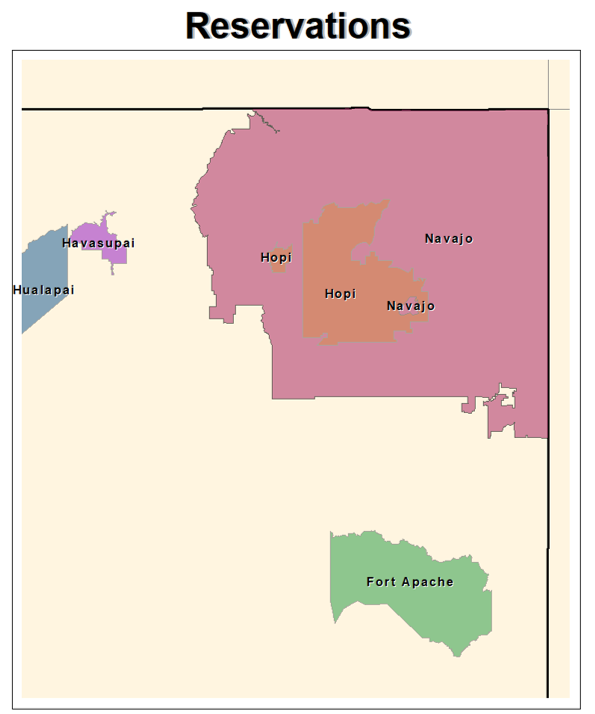
- Encompasses much of the Four Corners area of northeast Arizona including several national parks and monuments celebrating the history of the tribe.
- Unlike most of Arizona, Navajo Nation does observe Daylight Savings Time.
- Encompasses a large area of the western Grand Canyon, including the Grand Canyon West tourist center.
- Much of the area is only accessible by long hikes or driving on dirt roads.
- The reservation is located on a large tributary on the south side of the Colorado River, not accessible by road.
- The isolated community of Supai Village, located within Havasu Canyon, has become a popular hiking destination over the past several years.
- The reservation is located in Coconino and Navajo counties, spanning more than 1.5 million acres, with 12 different villages.
- Old Oraibi is the longest, continuously inhabited town in the United States.
- The reservation covers 1.67 million acres in east-central Arizona with a wide range in elevation of 2,600 feet in the Salt River Canyon to over 11,400 feet at the top of Mount Baldy.
- Currently, the tribe consists of roughly 16,000 members.
- The tribe is located in central and western Arizona.
- Currently, the tribe consists of roughly 160 members and covers less than 1,500 acres.
- The reservation covers 121,000 acres spanning from north of the Grand Canyon up to the Arizona-Utah border.
- Five tribal villages can be found throughout the reservation, along with one non-Indian community (Moccasin). Pipe Spring National Monument is also within the bounds of the reservation.
Tonto Apache Reservation
- The tribe is located adjacent to Payson and covers 85 acres, making it the smallest reservation by land size in the state.
- Roughly 150 members are enrolled in the tribe. Many of the members are under the age of 18 years old.
- Located within the Verde Valley, the tribe is made up of 5 communities: Tunlii, Middle Verde, Rimrock, Camp Verde, and Clarkdale.
- Currently, there are nearly 2,500 tribal members.
- Much of the reservation is located across the state line in New Mexico, but a small piece of reservation resides in east-central Arizona to the southeast of Holbrook.
- Most of the nearly 20,000 members that are enrolled with the tribe live in New Mexico.
Overview
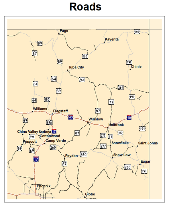
The National Weather Service Flagstaff is tasked with forecast and warning responsibilities within Apache, Coconino, Navajo and Yavapai counties; along with the northern half of Gila County. These geographic areas, about the size of the state of Ohio, provide a diverse set of forecast zones and climates.
Weather and Climate Information
High Country and Mountains
- Flagstaff Pulliam Airport receives an average of 90.1 inches of snow between October and May.
- The record 24-hr snowfall at Flagstaff Pulliam Airport is 35.9 inches.
- Winter conditions force the closure of the entire northern portion of Grand Canyon National Park and many roadways in local National Forests.
- Typical summer high temperatures range from around 75 - 90 degrees Fahrenheit.
Valleys and Basins
- Snow has been documented in the lowest elevations of the NWS Flagstaff forecast areas (around 2,000 feet MSL).
- The record 24-hr snowfall at Phantom Ranch (located in the bottom of the Grand Canyon) is 10.0 inches.
- The Little Colorado River Valley and downslope areas northeast of the White Mountains are some of the most consistently windy areas of the NWS Flagstaff forecast areas.
- Typical summer high temperatures range from around 85 - 105 degrees Fahrenheit.
To learn more about northern Arizona weather, visit our Science Corner page!