
A significant heat wave continues for the Rockies, Northern Plains, and Great Lakes into the Mid-Atlantic, peaking in intensity through midweek and lingering across parts of the Northern Plains and Midwest until this weekend. Excessive rainfall my bring life-threatening and locally catastrophic flash and urban flooding across portions of southwestern Texas through early Friday. Read More >
Media is free to use the NWS Flagstaff Event Summary information. Please acknowledge the NWS as the source of any information accessed from the site unless otherwise noted.
Strong thunderstorms trained over the Musuem Fire Scar with a second cluster of storms near Fort Valley on August 17, 2021. Very slow storm motion combined with high moisture content in the air produced extremely high rainfall rates. Over the Museum Fire Scar, 2-3.5 inches of rain was measured in one to two hours. Just to the northwest near Fort Valley, another rainfall maxima was observed with widespread 3-4 inch amounts. Both of these events combined to bring major flooding impacts to both the Museum Fire Scar and the Rio de Flag. This event prompted the first Flash Flood Emergency issued by the National Weather Service Office in Flagstaff.
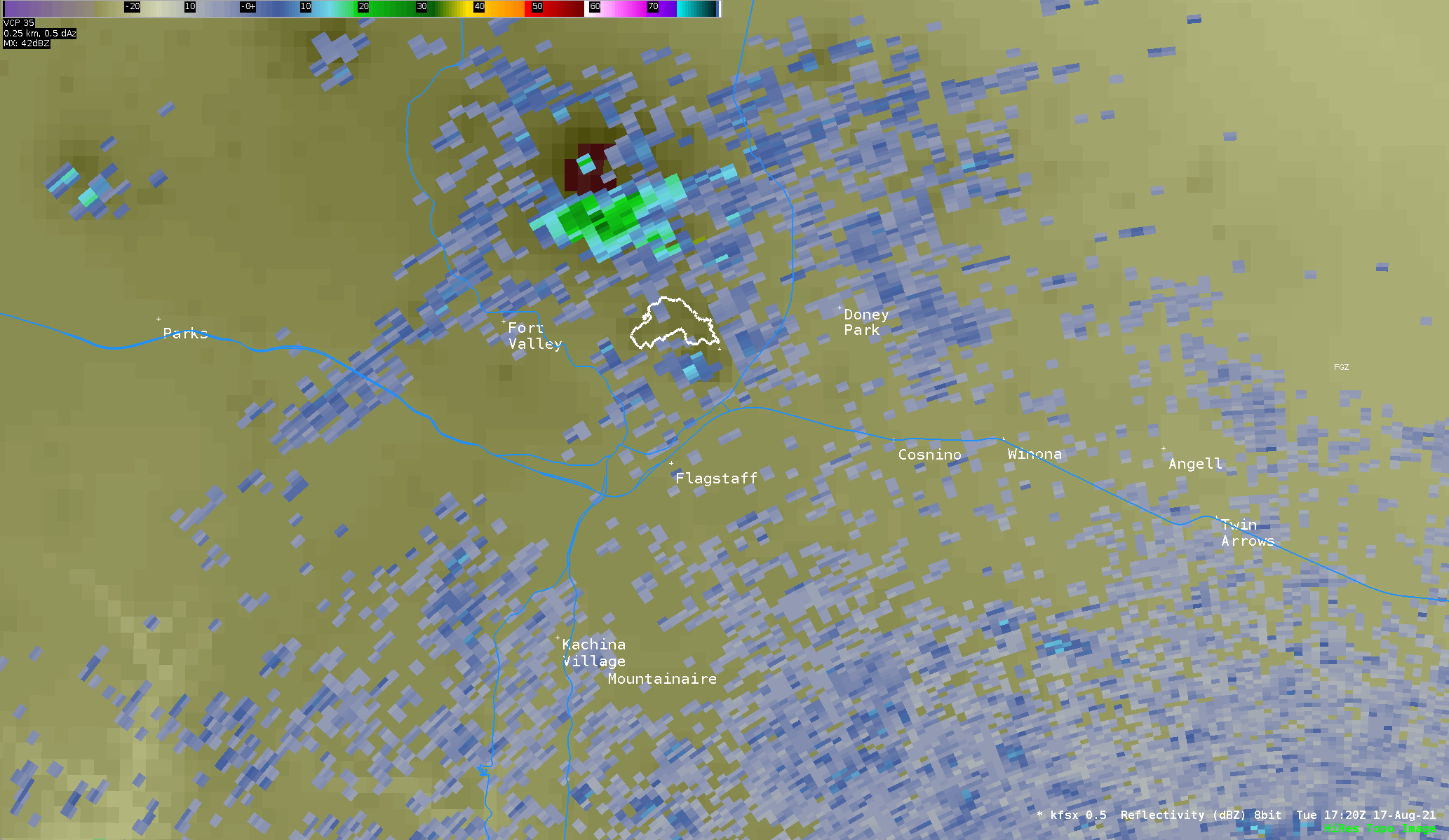 Radar loop from 11:09 AM - 2:05 PM August 17, 2021 showing very strong thunderstorms training over both the Museum Fire Scar and near Fort Valley. The white outline in the loop just north of Flagstaff is the Museum Fire Scar.
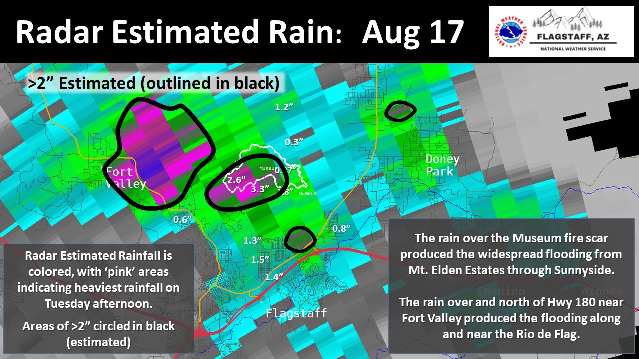 Radar estimates of well over 3-4" near Fort Valley and just north of Hwy 180 led to flooding along the Rio de Flag through much of town. Additional areas of well over 2-3.5" across the Museum Fire Scar led to additional flooding downstream of the fire into Sunnyside and the neighborhoods in northeast Flagstaff. The colored image here is radar estimated rainfall with the white numbers indicating actual rainfall measurements from rain gauges.
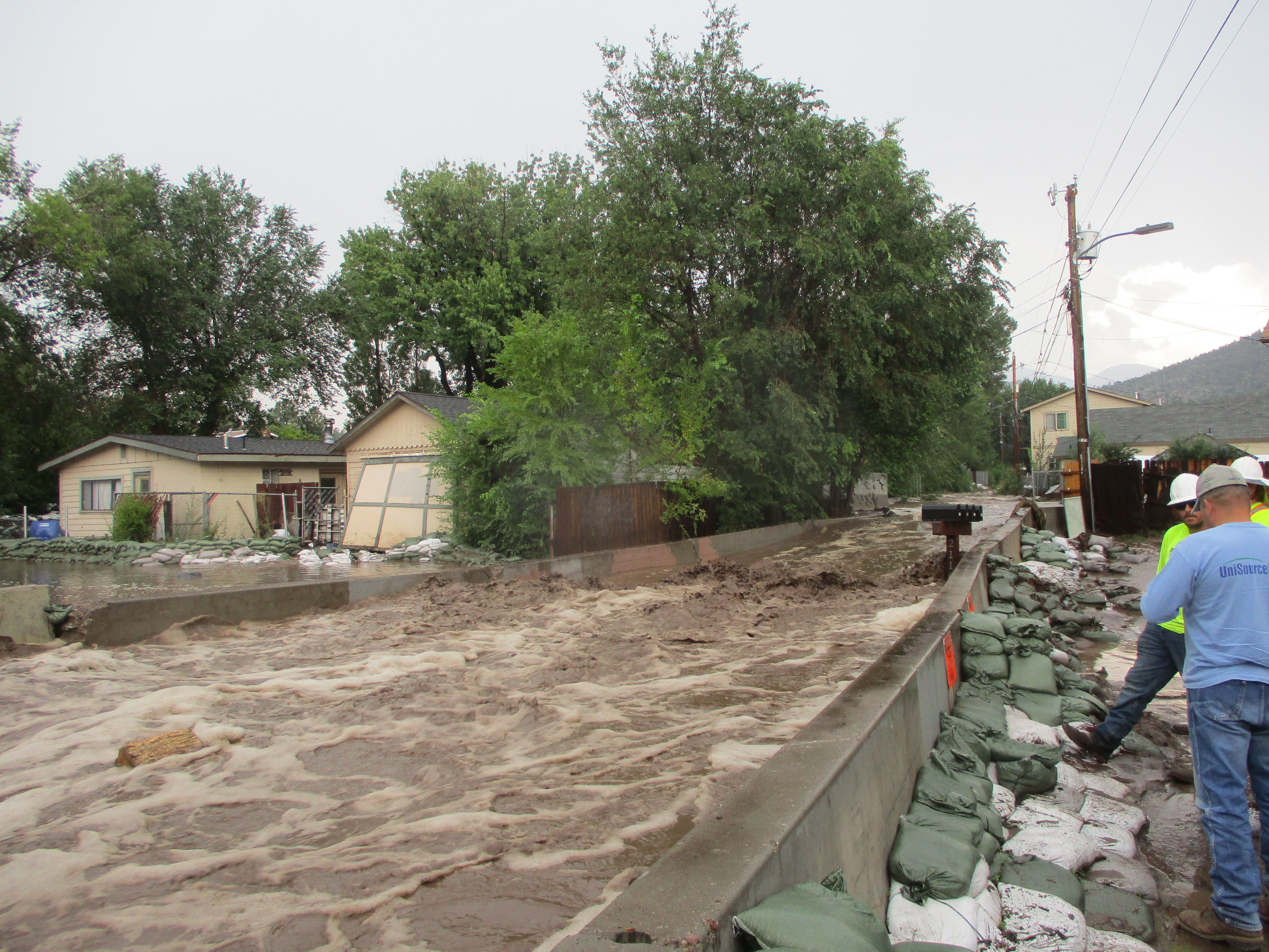
Flash flood waters were very dangerous downstream of the Museum Fire Scar. Sandbags helped prevent more substantial flood damage in some locations. Video courtesy of ABC15 Arizona
Flash flooding was observed on the Rio de Flag behind the Museum of Northern Arizona late in the afternoon of August 17th. Video courtesy of Mark Stubblefield.
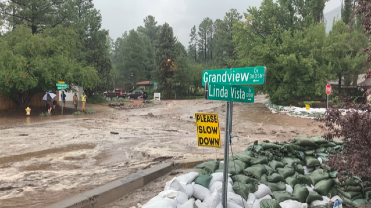
Dangerous flash flooding was once again observed on Grandview and Linda Vista from the heavy rain over the Museum Fire Scar. Image courtesy of ABC15 Arizona
Very heavy rain near Fort Valley caused flooding along the Rio de Flag especially along Highway 180 and in west Flagstaff. Image courtesy of Mark Stubblefield.
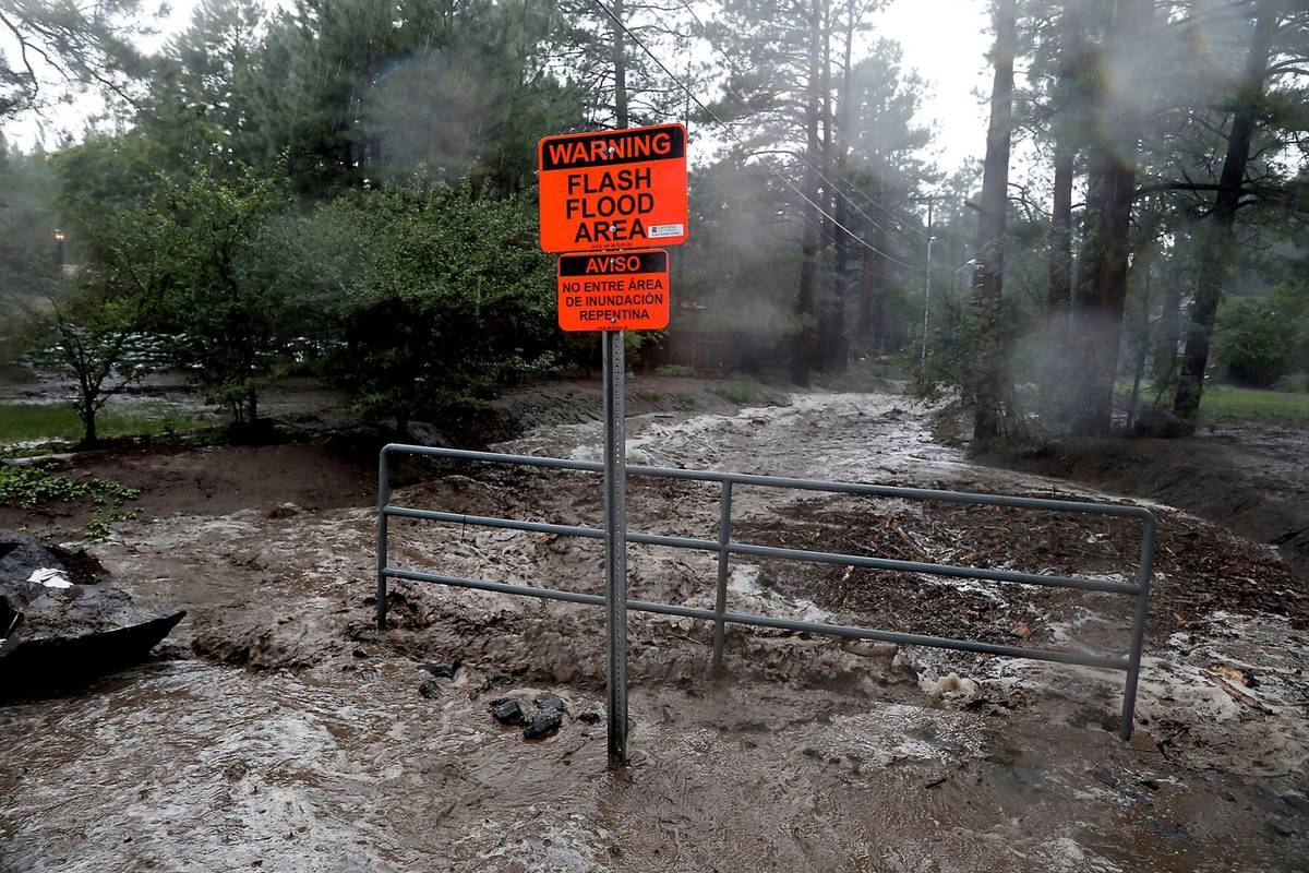
Flash flooding occurred in Paradise Wash as a result of the heavy rain over the Museum Fire Scar. Image courtesy of the Arizona Daily Sun
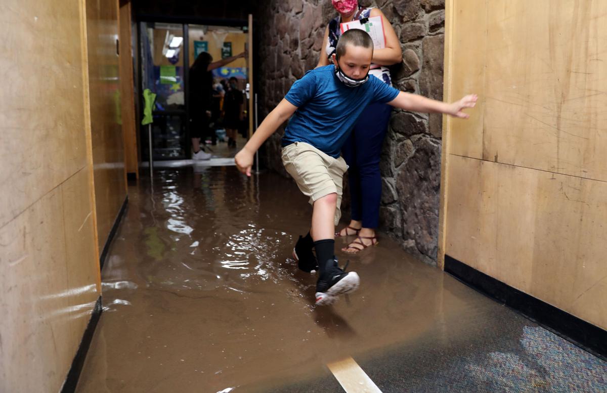
Killip Elementary School had flood waters make their way into the hallways. School was cancelled on Wednesday August 18th due to the flood damage. Image courtesy of the Arizona Daily Sun
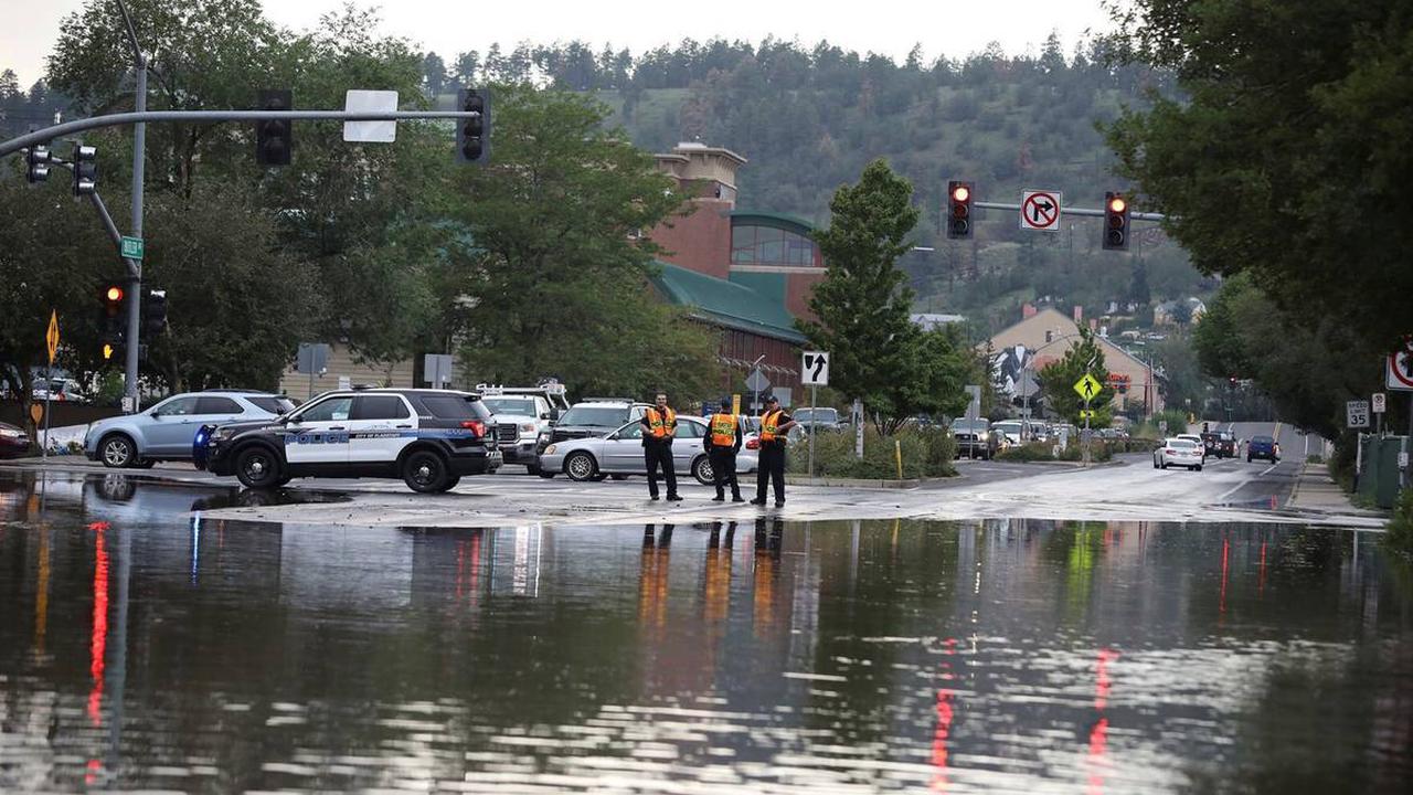
Flooding impacts were not limited to north of Route 66 in Flagstaff. Butler Avenue was closed for a period of time near downtown due to flood waters. Image courtesy of the Arizona Daily Sun
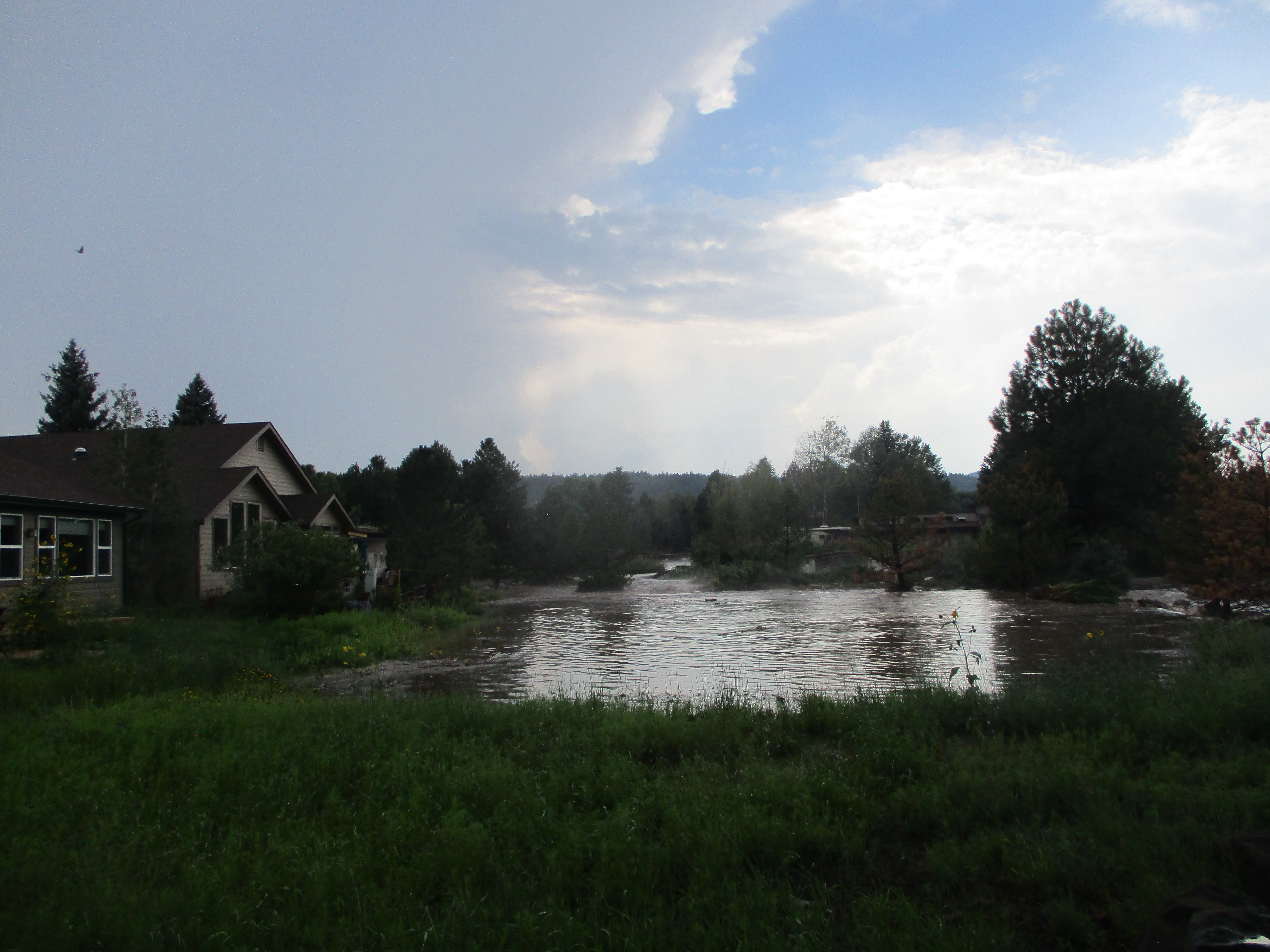
Flood waters moved down the Rio de Flag into west Flagstaff, at times threatening to flow in residents backyards. Image courtesy of Mark Stubblefield.
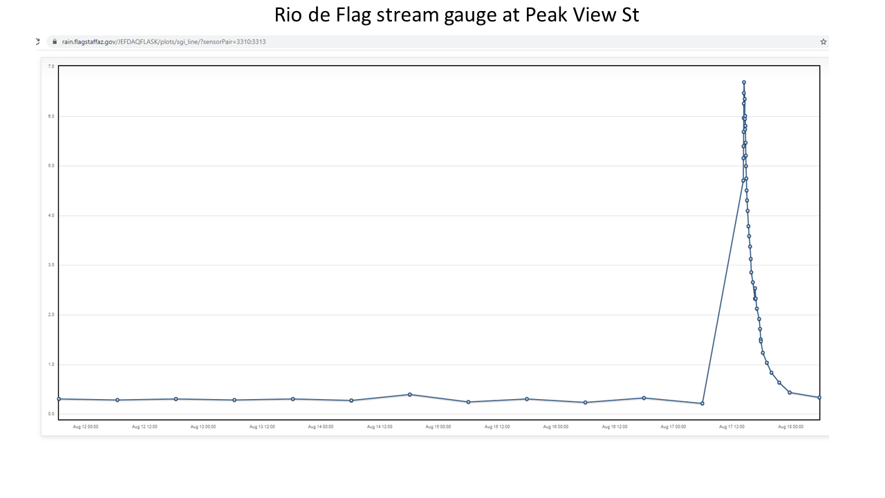
The Rio de Flag stream gauge at Peak View rose over 6 feet in a short period of time during this flood event.
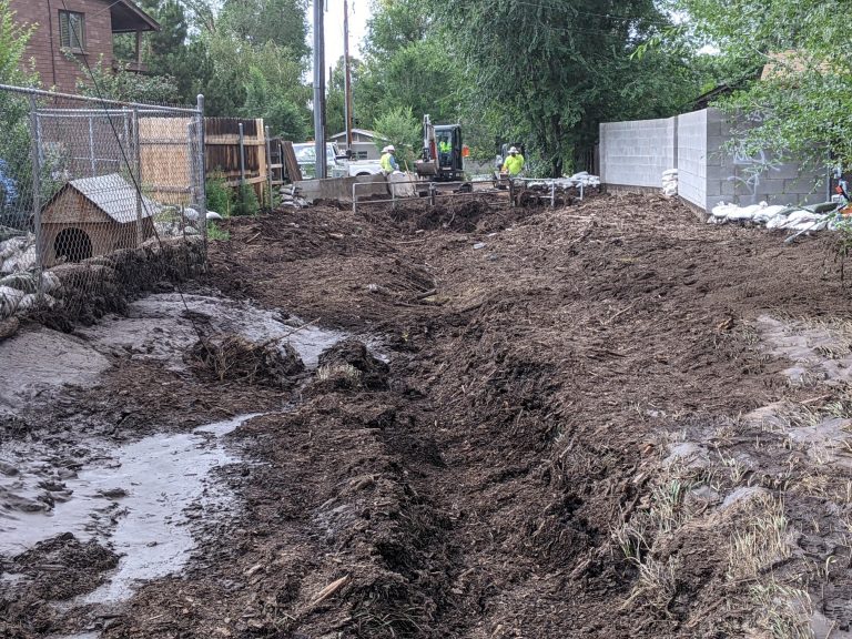
Significant flood debris was observed in the hardest hit areas. Image courtesy of the Flagstaff City Government
Deep monsoonal moisture was in place across northern Arizona on August 17th, 2021. Very weak steering flow aided in slow storm movement and promoted training of thunderstorms over the same location. Daytime heating led to the development of thunderstorms around the Flagstaff area late in the morning. These thunderstorms expanded in coverage and covered an area from Fort Valley to north Flagstaff to Doney Park. Radar estimates and automated gauges indicated rainfall rates reached 2-4 inches per hour at times. The heavy rainfall rates lasted between 1-2 hours before lightening. The rainfall totals well exceeded the "high-impact" thresholds for the Museum Fire Scar which prompted the upgrade to a Flash Flood Emergency. A separate area of heavy rainfall near Fort Valley brought over 6 foot rises on the Rio de Flag through Flagstaff. Water levels quickly receded through the evening hours after rainfall ended.
For more information on impacts and general inquiries about this event, contact by sending an email to or by calling .

