
Flash flooding threatens areas from the Tennessee Valley to the Carolinas as storms repeat along a stalled front. Monsoonal storms may trigger flooding in the Southwest. Dangerous heat expands across the Desert Southwest, Plains, mid-Mississippi Valley and Southern Tier. Critical fire weather for interior Pacific Northwest. Cooler, drier air brings brief relief to the Great Lakes and Northeast. Read More >

Media is free to use the NWS Flagstaff Event Summary information. Please acknowledge the NWS as the source of any information accessed from the site unless otherwise noted.
A series of winter storms crossed northern Arizona beginning on Friday January 22nd and continued through Tuesday January 26th. The first system brought several inches of snow over the weekend, mainly to the higher elevations.
A second, colder system significantly lowered snow levels on Monday and Tuesday, bringing heavy snowfall to areas as low as 3,000 feet. Two notable lower-elevation areas that received significant snowfall were Sedona (around 4,300') and Prescott / Prescott Valley (5,200-5,700'). The widespread heavy snowfall and intermittent near blizzard conditions brought numerous road closures and power outages to the area. This page will focus on the second, high-impact storm from early Monday January 25th through Tuesday afternoon January 26th.
 Radar Loop From 11 AM - 5 PM January 25, 2021. Periods of white out conditions were reported as the main band swept across the state from west to east.
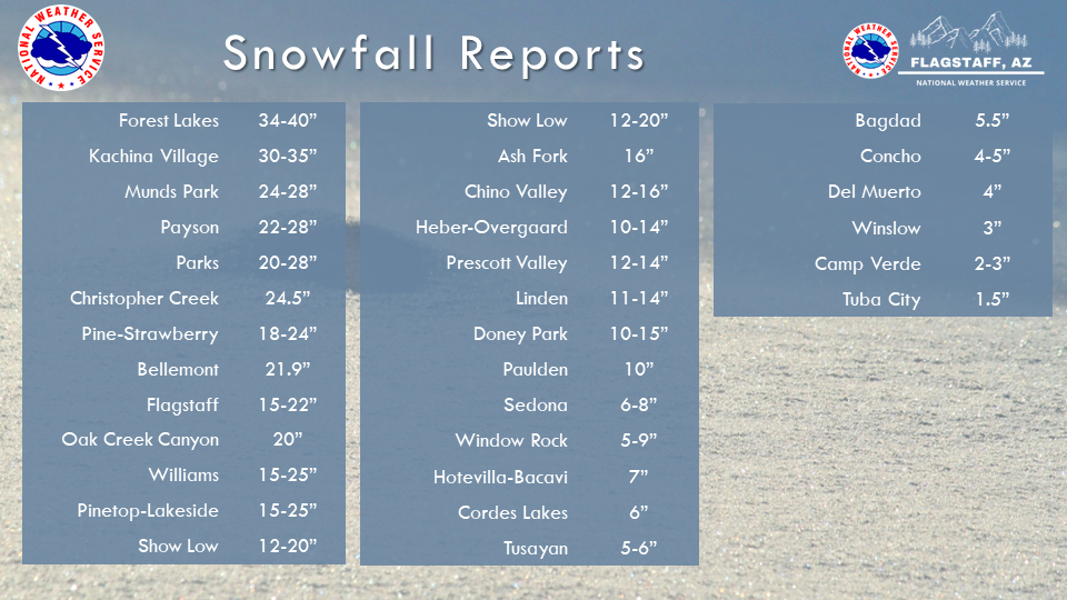 Here is a look at the reported snowfall amounts around northern Arizona from January 25th-26th. This does not take into account the first storm which dropped several inches of snow across the higher terrain.
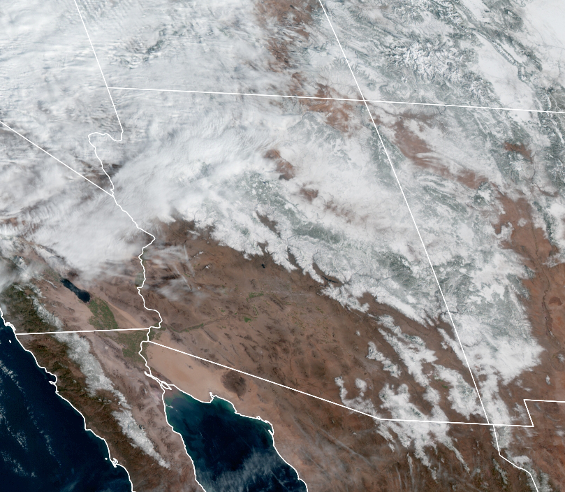 GOES-17 True Color Satellite Imagery. Images were captured in the morning hours of Wednesday, January 27, 2021 and show the expansive snowpack across northern Arizona.
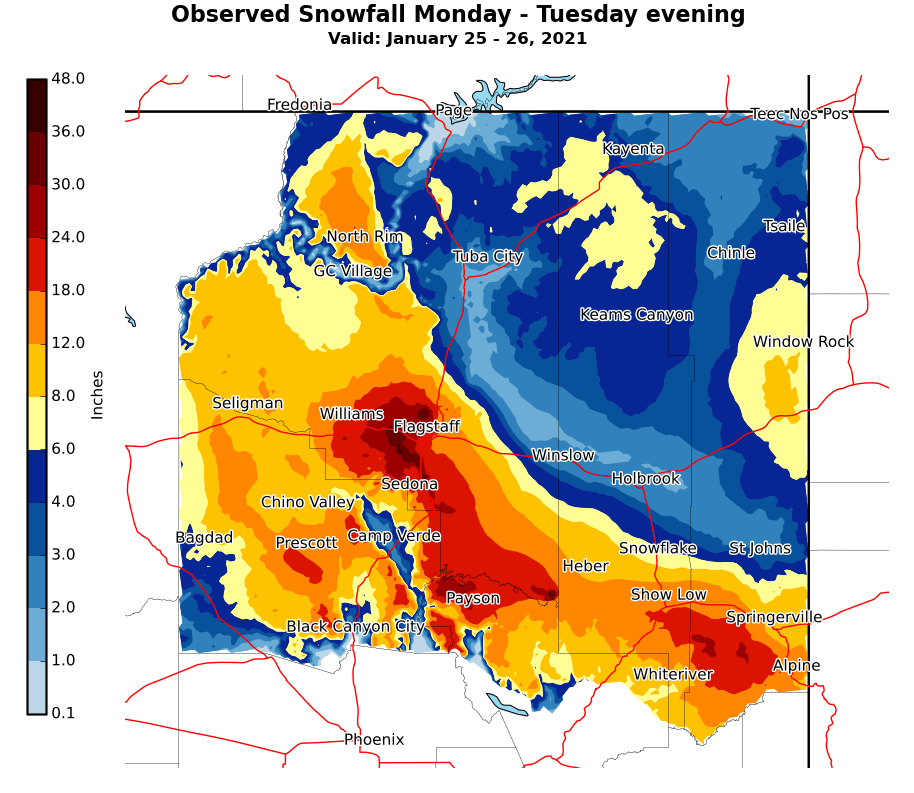 Image created using single point observed snowfall reports from Monday through Tuesday evening interpolated across the County Warning Area. Terrain influence was automatically factored in the interpolation.
Near blizzard conditions were seen at NWS Bellemont Monday afternoon as the cold front moved through
SR-89A from Flagstaff to Sedona was closed for a few days due to heavy snow and icy conditions. Image courtesy of Arizona Department of Public Safety
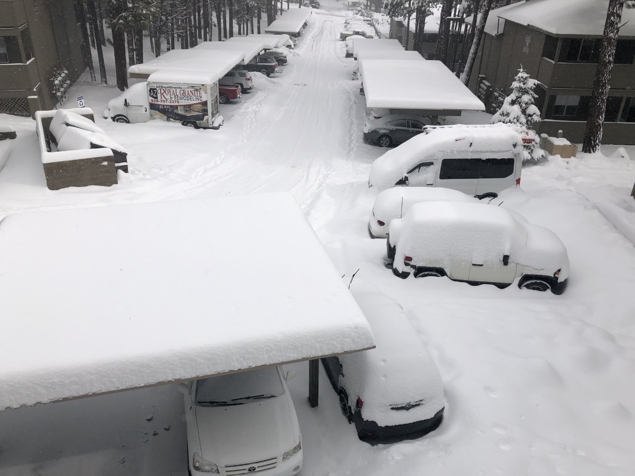
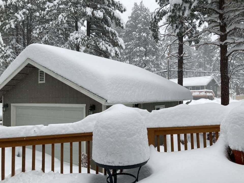
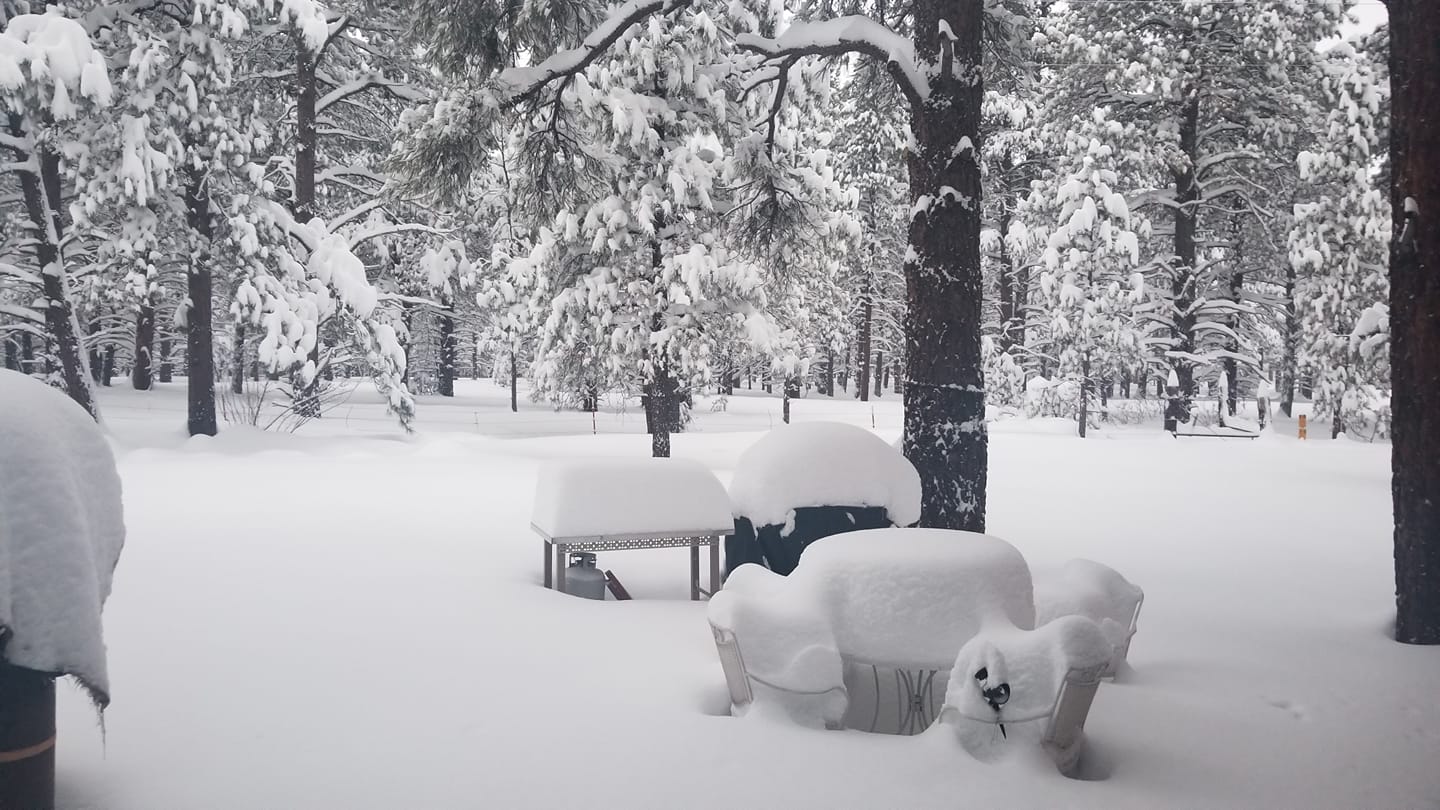
2-3 feet of snow fell in the Flagstaff area leaving many people stuck indoors. Image courtesy of Ricardo Acevedo
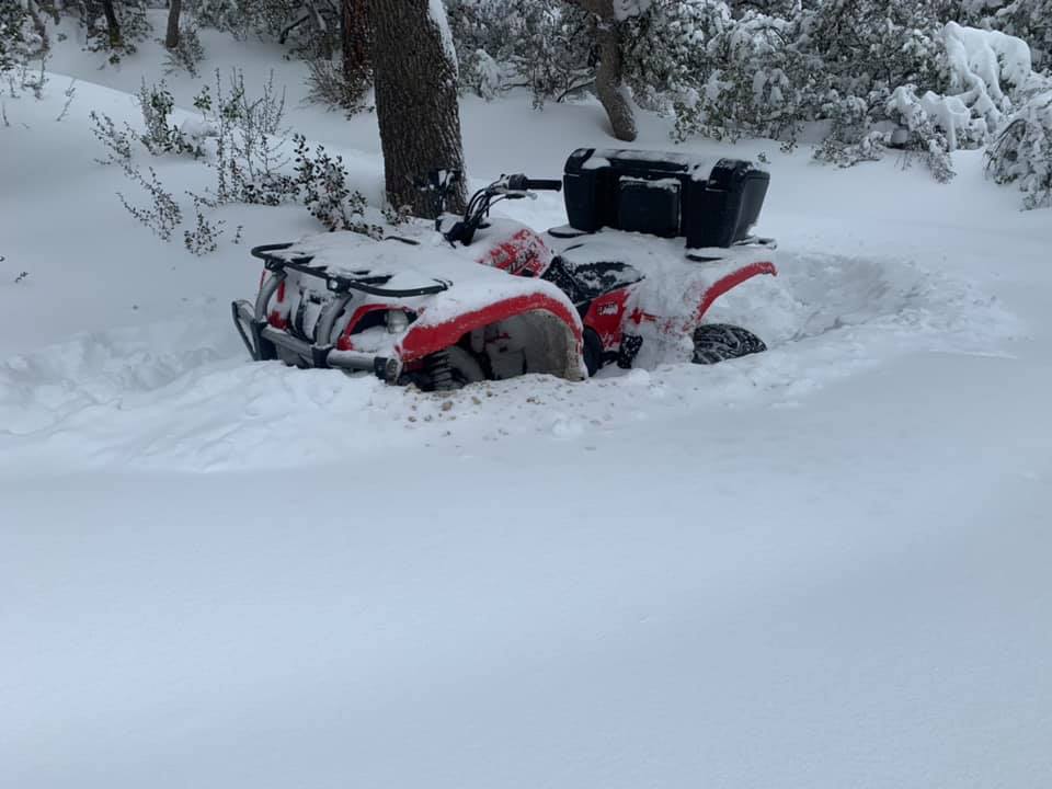
Several inches of snow was reported in Crown King as snow levels fell Monday into Tuesday. Image courtesy of Ian Dougherty
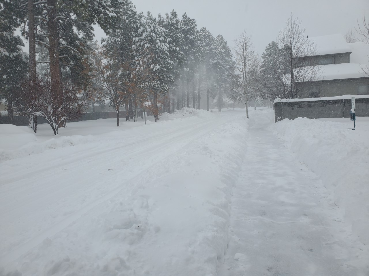
Snow blanketed the Flagstaff area with some neighborhood roads becoming impassable on Tuesday. Image courtesy of Patrick Hoyack
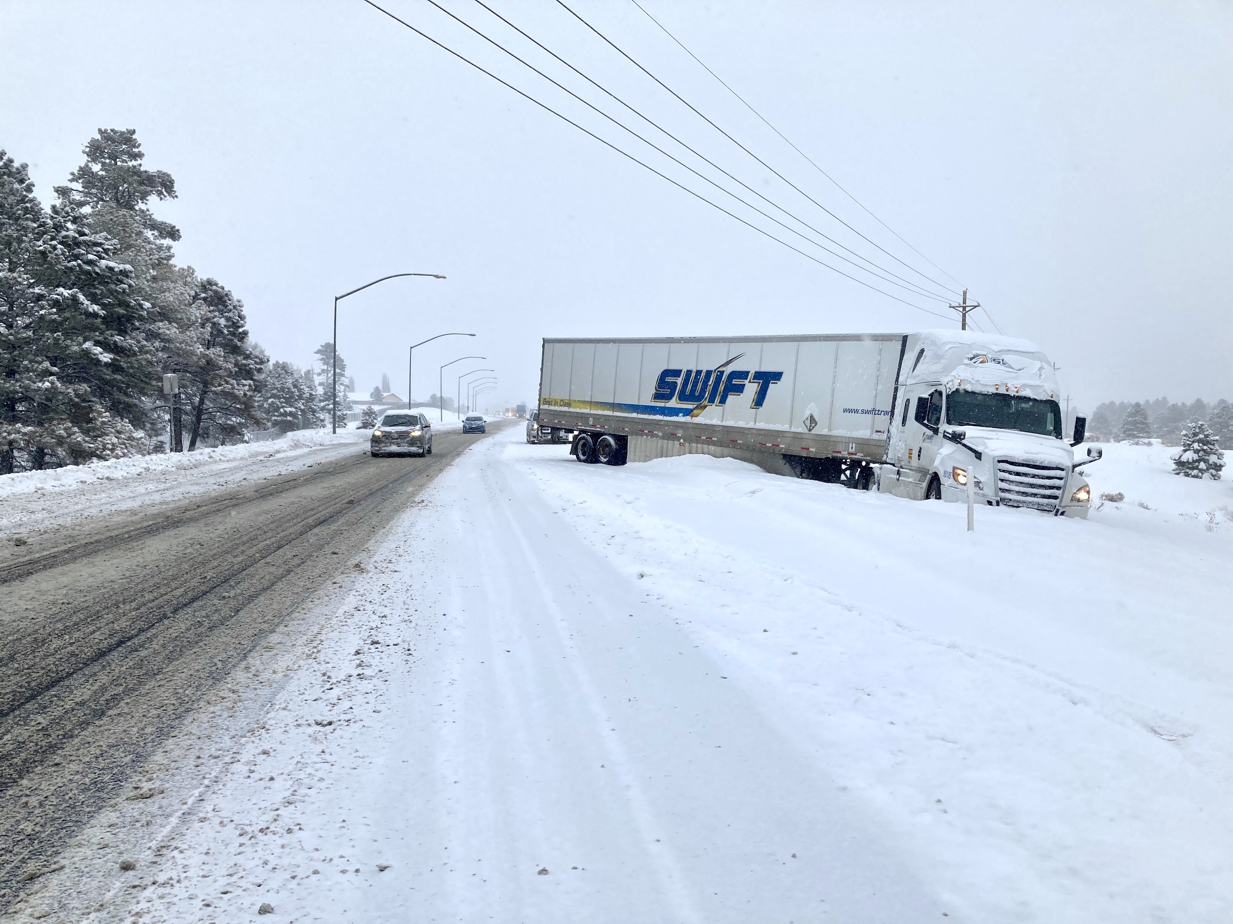
Roads became very treacherous Monday morning and travel conditions worsened through the day. This semi slid off I-40 in Flagstaff. Image courtesy of Arizona DOT
37 inches of snow was measured near the end of the event on Tuesday in Kachina Village. Image courtesy of Ann Piper
Near blizzard conditions were seen across much of northern Arizona Monday afternoon and evening as the cold front moved through. Image courtesy of Robin Perkins
A little over three feet of snow was measured in Parks by the time the storm ended on Tuesday afternoon. Image courtesy of Dennis Knoll Sr
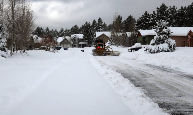
Plows were kept busy throughout the event with heavy snowfall rates and falling temperatures. This plow is seen clearing neighborhood streets in Bellemont. Image courtesy of Felicia Fonseca
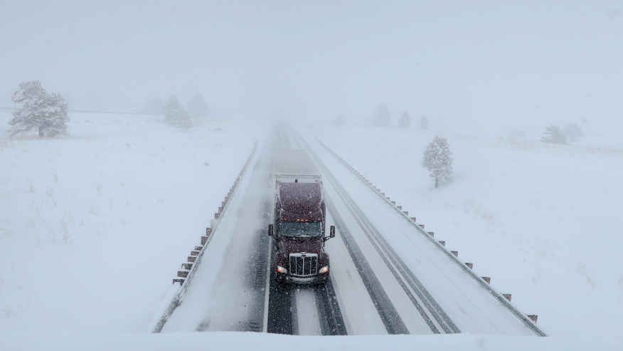
Heavy snow and gusty winds led to near impossible driving conditions at times, especially on Monday afternoon. This is a look at I-40 near Bellemont during the storm. Image courtesy of Felicia Fonseca
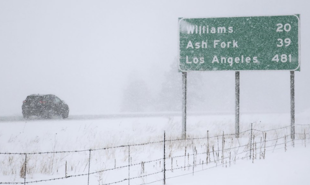
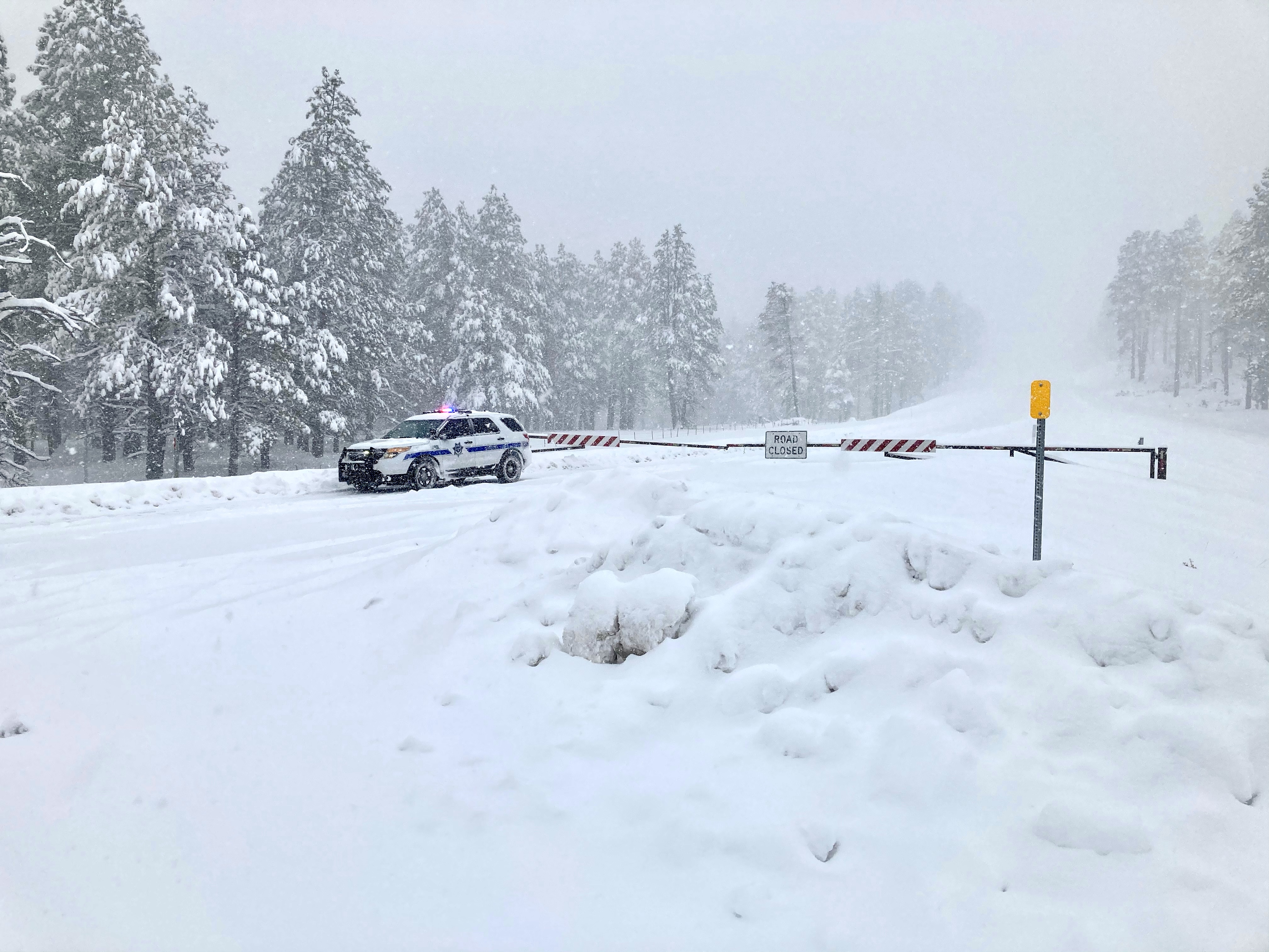
Road closures and severe travel impacts were common across much of northern Arizona as snow levels fell to as low as 2000 feet by Tuesday afternoon. Image courtesy of Felicia Fonseca
A fairly persistent La Nina like pattern controlled the weather over the Desert Southwest during the early winter months of 2020-2021. However, a pattern change began to take shape early in the week of January 18th as an area of low pressure cut off near the Baja California coast. While this system had fairly low impacts on northern Arizona, it set the stage for a series of deeper troughs to track farther west along the West Coast.
The first of these systems brought two separate impulses across northern Arizona on Friday night January 22nd and Saturday night into Sunday morning January 23rd and 24th with periods of moderate to heavy precipitation. Each successive shortwave was a bit colder. Snow levels on Friday night were around 6000 feet, lowering to around 4500 feet with the second impulse. Residual low-level moisture and a deeper, colder trough tracking farther west set the stage for the most impactful event from early Monday January 25th through Tuesday January 26th. The low-level moisture already in place combined with a fetch off the Pacific Ocean to create a broad area of heavy precipitation across northern Arizona. Additionally, a strong low level jet at 700 mb of around 40-50 knots brought gusts of 35-45 mph for a brief period along the front resulting in near blizzard conditions. Much colder air aloft (-10 to -15 degrees Celsius) at 700 mb drove snow levels down to 2000-2500 feet. Snow ratios fell to between 15-20:1 by Tuesday as the colder air advected into the region.
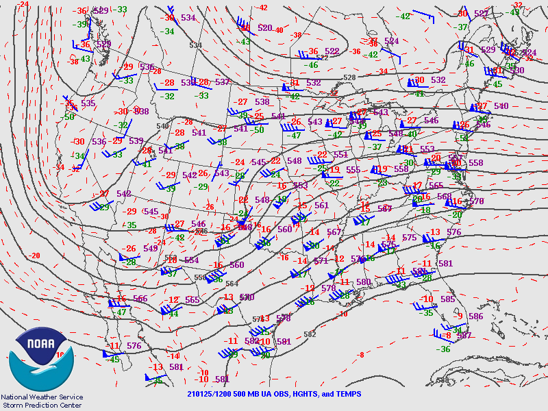 Upper Air chart from 5 AM MST on January 25, 2021 showing 500 mb heights (solid black lines), wind barbs (showing wind speed and direction) and temperatures.
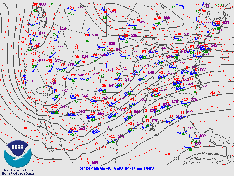 Upper Air chart from 5 PM MST on January 25, 2021 showing 500 mb heights (solid black lines), wind barbs (showing wind speed and direction) and temperatures.
For more information on impacts and general inquiries about this event, contact by sending an email to or by calling .
Media is free to use this event summary information. Please acknowledge the National Weather Service as the source of any information accessed from the site unless otherwise noted.

