
Widespread life-threatening flash and urban flooding continues in south-central Texas, with considerable flooding impacts possible across central Texas. Wildfire smoke is impacting air quality across much of the Great Lakes region into southern New England and the Mid-Atlantic. Monsoonal thunderstorms may produce isolated to scattered flash flooding across the Southwest into the Great Basin. Read More >
.png)
Media is free to use the NWS Flagstaff Event Summary information. Please acknowledge the NWS as the source of any information accessed from the site unless otherwise noted.
A cold, strong, intensifying low pressure system spread a blanket of snow over a majority of central and northern Arizona between the evening of February 20th and the night of February 22nd, 2019. Across the Mogollon Rim and other high country regions, reports of two to over three feet of snow were received. Anywhere from a few inches to over a foot of snow fell in the lower deserts and valleys of northern Arizona. For many locations across central and northern Arizona, this storm was among the top 10 greatest recorded. The single-day snowfall record was broken at Flagstaff Airport and in Show Low. As a result of the heavy snowfall, major roadways were closed, trees were downed, and power was lost in local communities.
 Radar Loop From 11 AM Wednesday February 20 - 1 AM February 23, 2019. The main snow bands began to impact central and northern Arizona during the evening of February 20th.
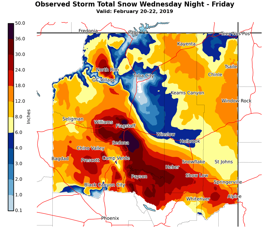 Observed Storm Total Snow from Wednesday Night to Friday. Access all local storm reports throughout Arizona for this storm.
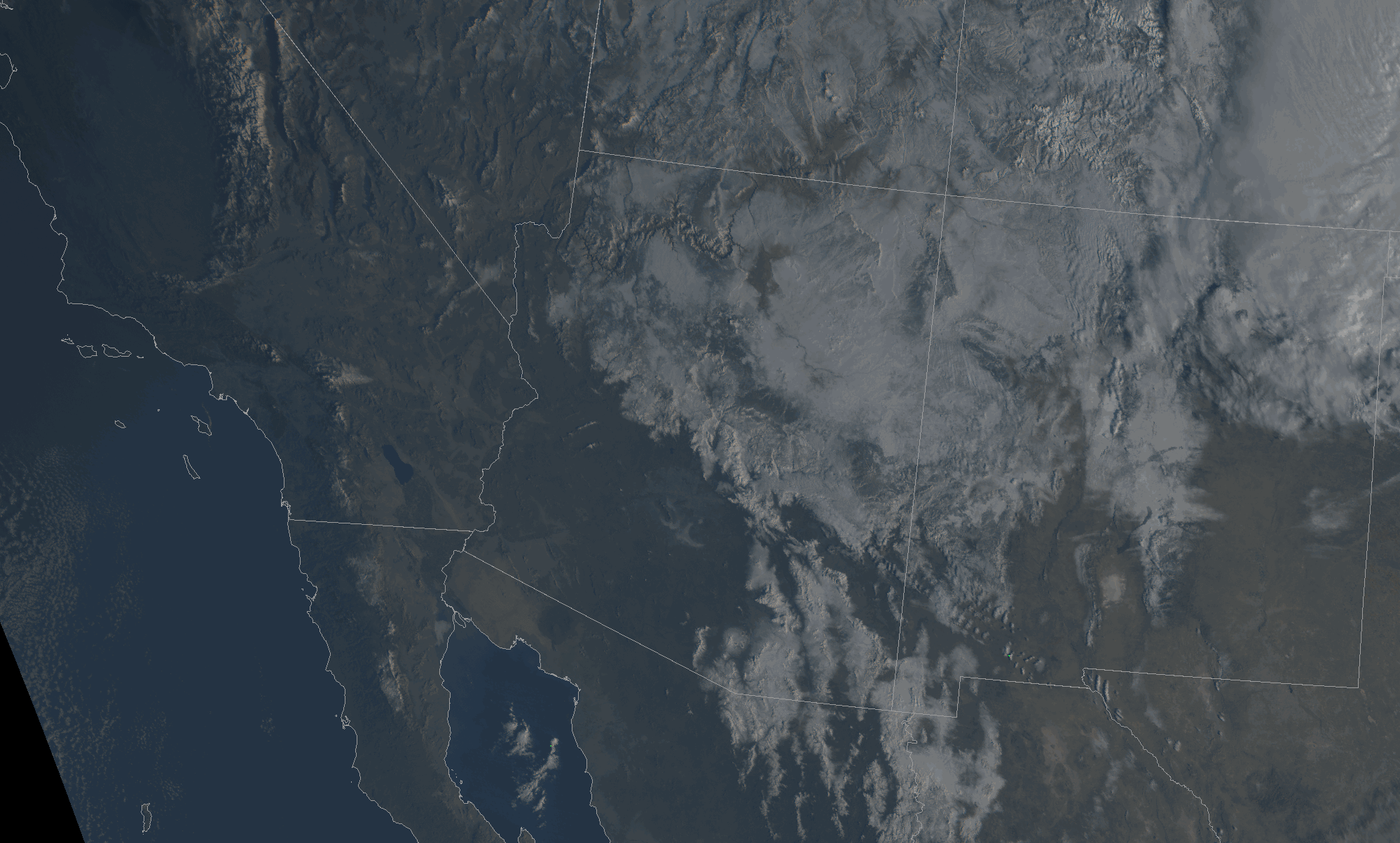 GOES-17 True Color Satellite Imagery. Images were captured in the morning hours of Saturday, February 23, 2019 and show the expansive snowpack across northern Arizona and much of the desert southwest region.
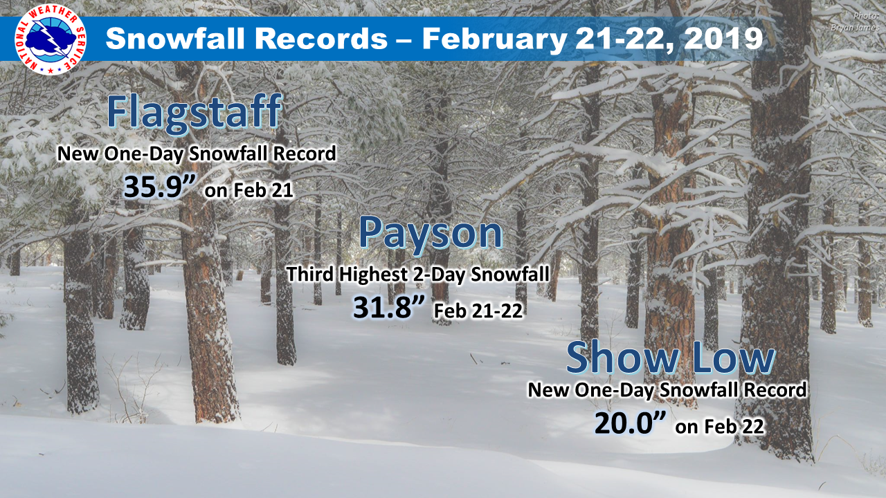 Snowfall records were broken in Flagstaff, Payson and Show Low between February 21 - 22, 2019. Flagstaff Airport and Show Low each experienced a new one-day snowfall record. Payson had its third highest two-day snowfall amount also from this storm.
Time lapse of the snow accumulating between Wednesday night and Friday afternoon outside of the NWS Flagstaff office in Bellemont, AZ.
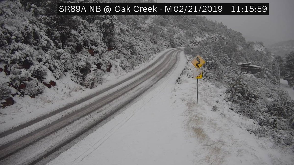
SR-89A from Flagstaff to Sedona was closed for nearly 2 days during the storm due to heavy snow and icy conditions
Near whiteout conditions were observed in Flagstaff throughout the storm
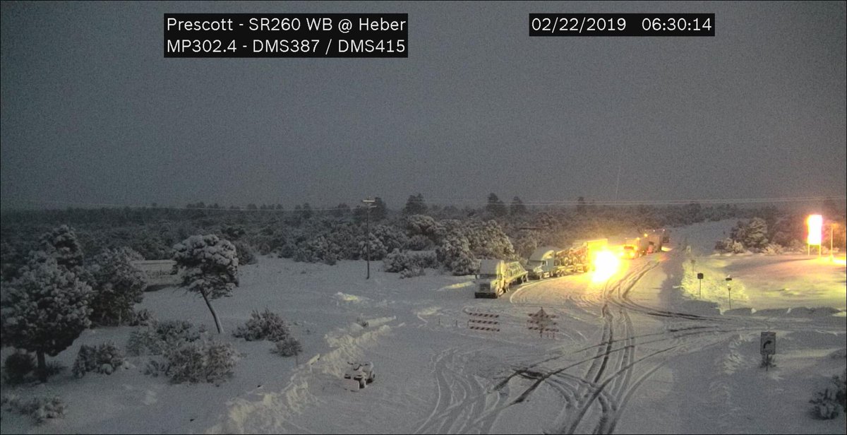
SR-260 was closed in Heber for much of the storm due to heavy snowfall and difficult to impossible travel conditions
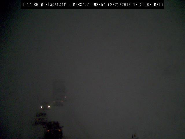
Whiteout conditions were observed along I-17 near Flagstaff on February 21st
Heavy snow and ice led to slick roadways along all of I-40 with several accidents reported throughout the storm
Two to three feet of snow in Payson created difficult to near impossible travel conditions throughout the storm

Heavy snow led to a treefall across SR-89A in Oak Creek Canyon
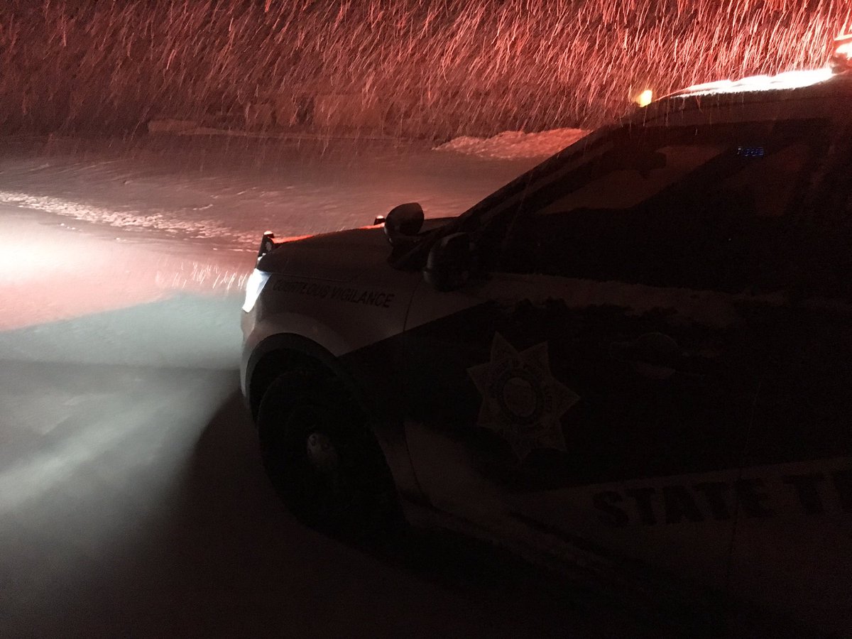
Police patrolling in the snow around Flagstaff during the early morning hours of February 21.
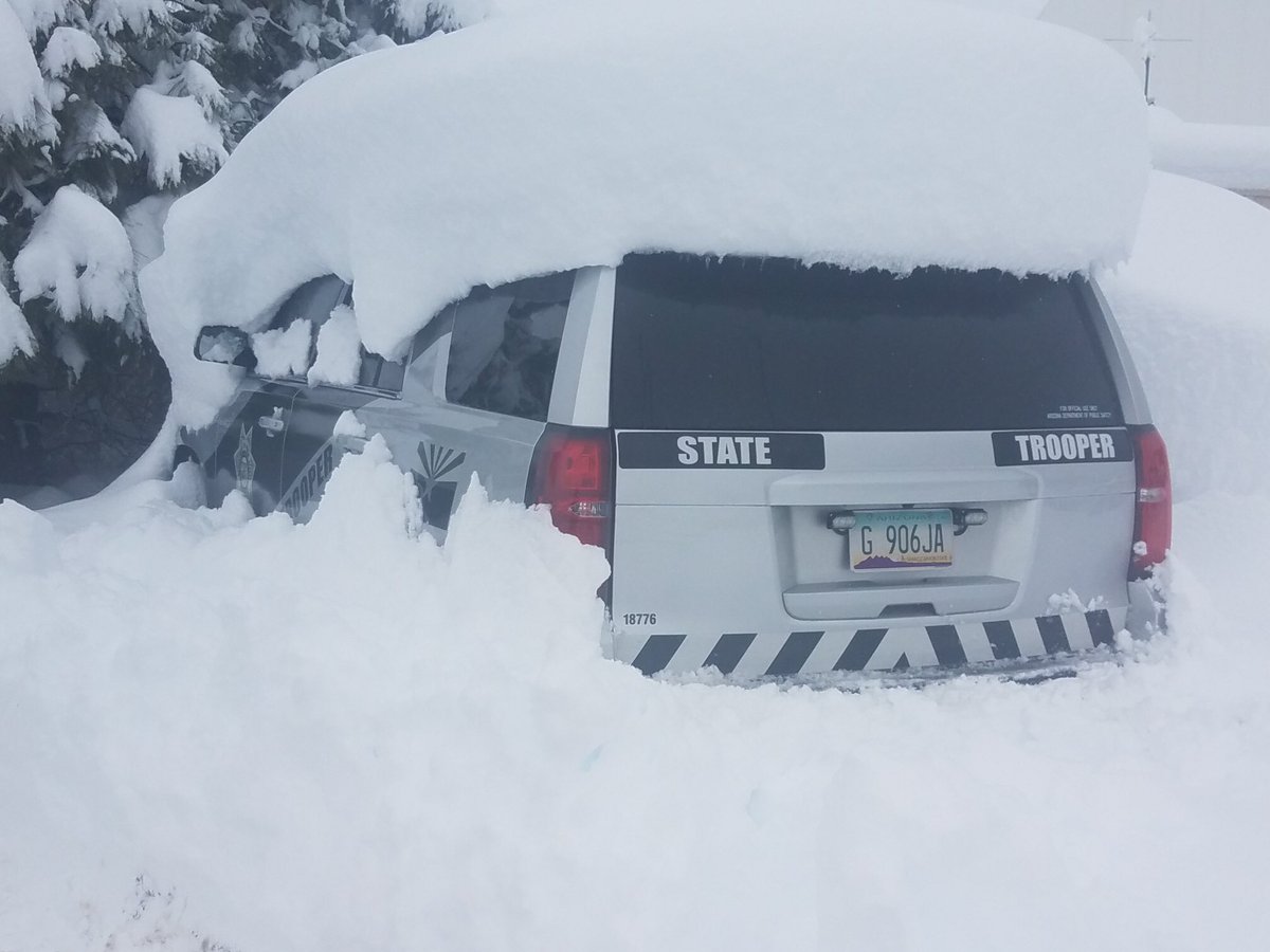
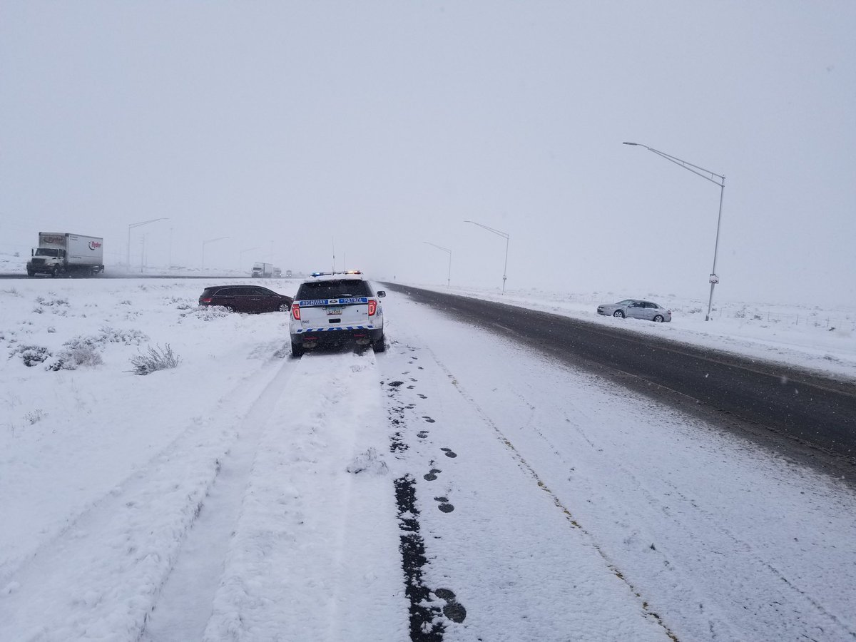
Payson received upwards of 30 inches of snow and buried an Arizona State Trooper vehicle.
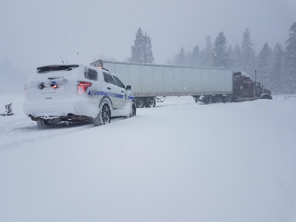
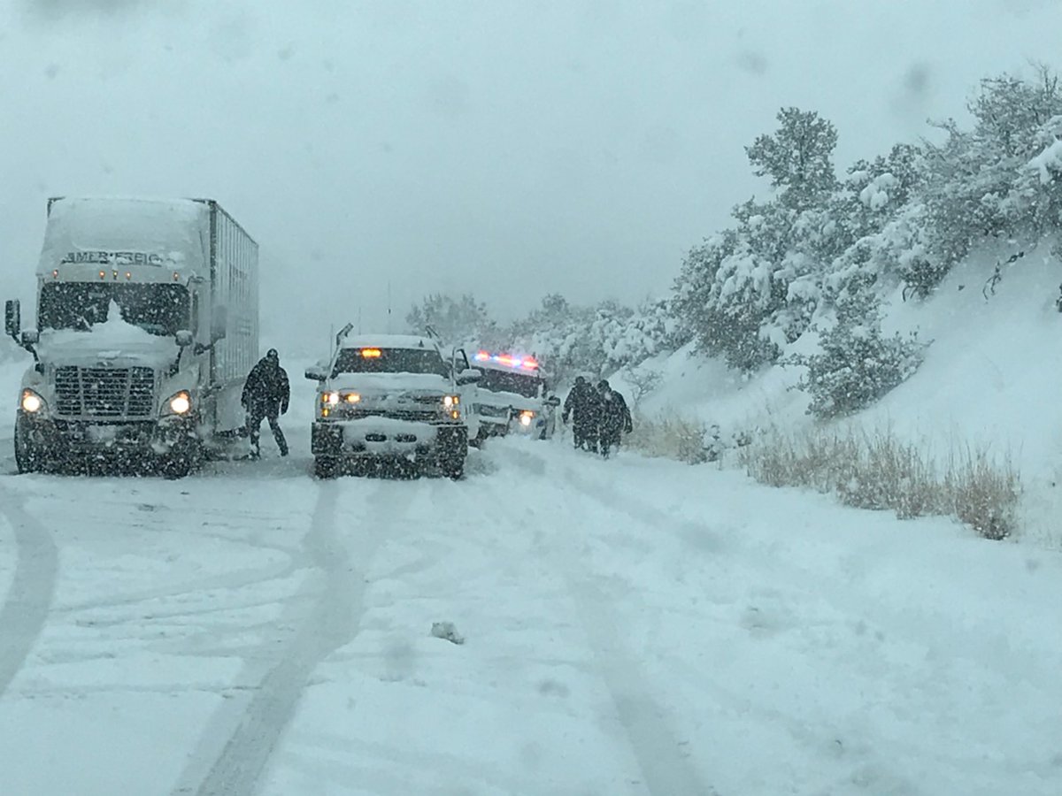
A semi was stuck on US Highway 191 near Hannigan Meadow and a local law enforcement officer is on the scene.
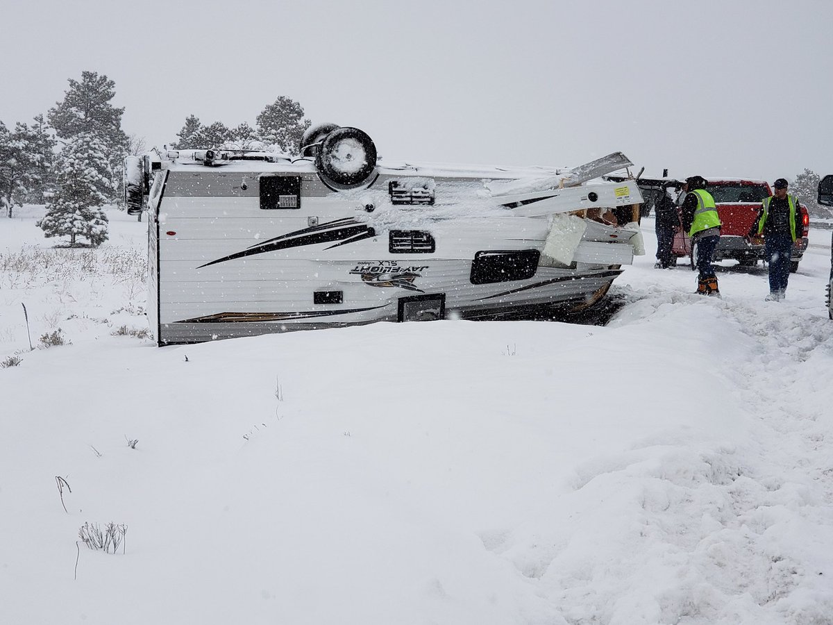
Heavy snow and poor visibility led to very hazardous driving conditions in Flagstaff throughout the storm. An RV turned over on the morning of February 21st leading to a short closure of the roadway.
Three primary ingredients are needed for heavy snow: cold air, moisture, and lift. Cold air was already in place over Arizona prior to the onset of the Feb 21-22 heavy snow event thanks to the presence of a deep trough at 500 mb which had brought several inches of snow to northern portions of the state earlier in the week. Another very cold mid-level trough moved from the Gulf of Alaska over an eastern Pacific ridge, with a strong jet streak forming from the Gulf of Alaska toward the Washington coast by Tuesday evening. This strong jet streak served to not only reinforce the trough of cold air over Arizona as it progressed southward, but also provided a mechanism for sustained lift over a broad area. Substantial precipitation was observed at low-elevation locations which don’t typically see much precipitation in events where uplift resulting from winds impacting terrain is the major source of rising motion.
Moisture was transported from the central Pacific, over the top of the eastern Pacific ridge across the Gulf of Alaska, and southward just off the U.S. west coast in association with the jet streak. Strong southwest winds aloft began transporting this moisture into Arizona around the base of the trough on Wednesday afternoon, with the most significant period of moisture transport being from early Thursday morning through Friday morning. With the very cold air in place, snow-to-liquid ratios were quite high throughout the event. This resulted in snow of a light and fluffy consistency, increasing observed snowfall amounts over what they would have been had the snow been heavy and dense.
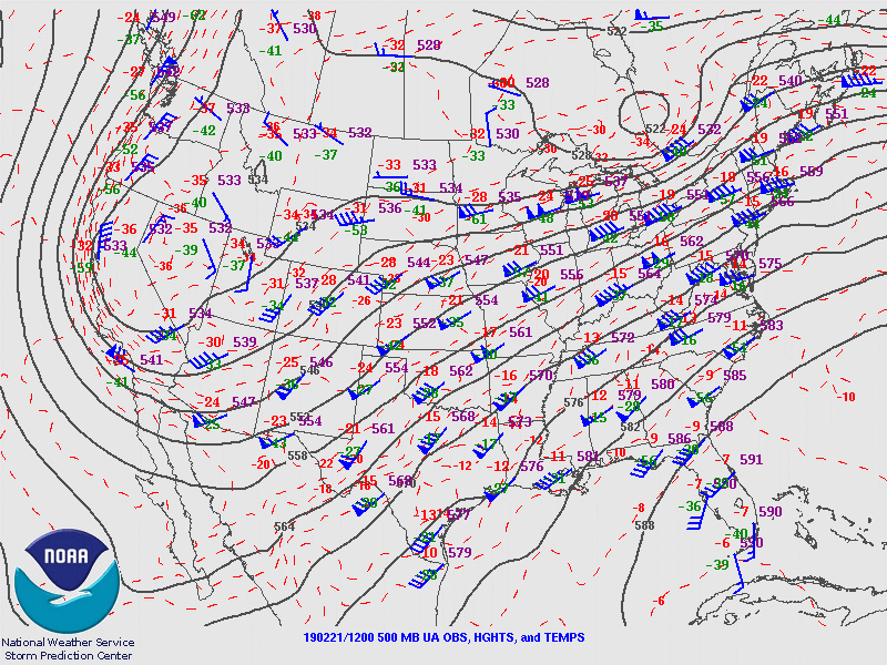 Upper Air chart from 5 AM MST on February 21, 2019 showing 500 mb heights (solid black lines), wind barbs (showing wind speed and direction) and temperatures.
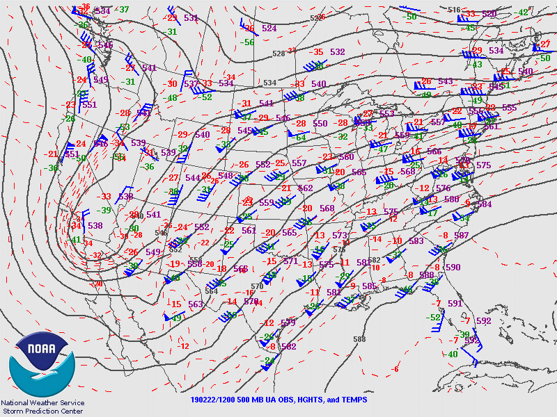 Upper Air chart from 5 AM MST on February 22, 2019 showing 500 mb heights (solid black lines), wind barbs (showing wind speed and direction) and temperatures.
For more information on impacts and general inquiries about this event, contact by sending an email to or by calling .
Media is free to use this event summary information. Please acknowledge the National Weather Service as the source of any information accessed from the site unless otherwise noted.

