Media is free to use the NWS Flagstaff Event Summary information. Please acknowledge the NWS as the source of any information accessed from the site unless otherwise noted.
The Dry Lake Hills are a mountainous terrain feature located north of the city of Flagstaff, and are generally covered in pine and upland desert vegetation. While fires are common in northern Arizona in June, the increased moisture and humidity of the seasonal monsoon typically precludes significant fire development by early to mid July. The monsoon of 2019 was late and dry, however, and led to below normal monsoonal moisture and drier than normal conditions across the greater Flagstaff region, with elevated Energy Release Components (ERCs). The Museum Fire was reported in the morning hours of July 21st, 2019 and was not fully contained until August 12th, 2019. Impacts from the fire resulted in the usage of the Ready, Set, Go! emergency information network and widespread recreational trail closures.
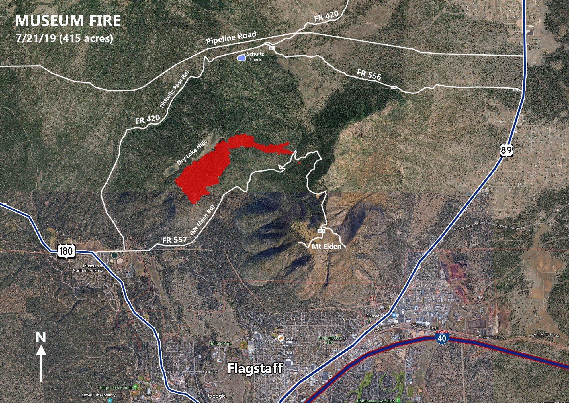 Museum Fire Perimeter Map July 21, 2019
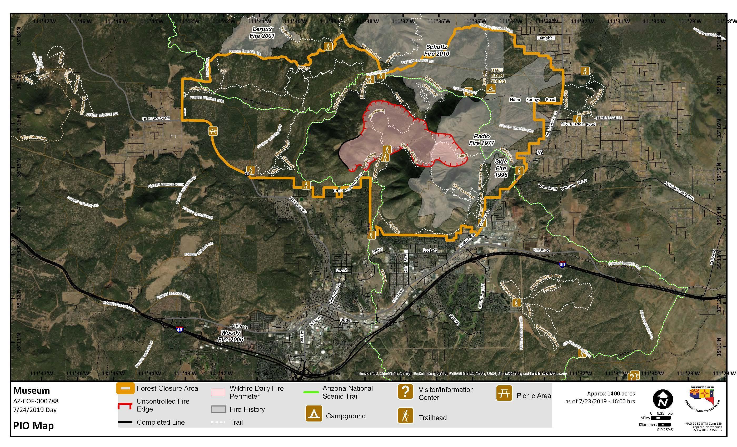
Museum Fire Perimeter Map as of July 23rd, 2019. The fire perimeter did not expand significantly after the 23rd due to increased monsoonal moisture over the fire.
× ![]()
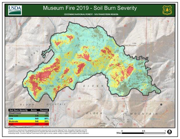 Museum Fire Burn Severity
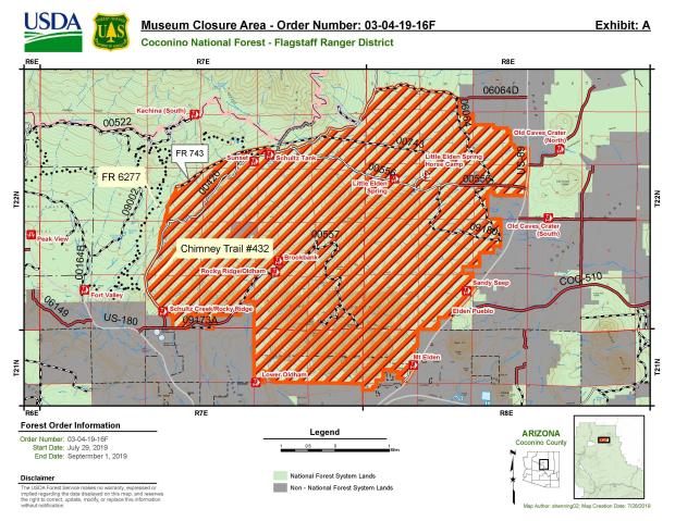 The Museum Fire led to the closure of forest areas around Flagstaff including several popular hiking trails.
× ![]()
- Sunday July 21, 2019
- Fire was first reported at 5 acres approximately 10:30 AM MST, 1 mile north of Flagstaff
- Specifically, the fire was located in the San Francisco Peaks recreation area known as the Dry Lake Hills
- On Sunday evening, a Type 1 Incident Management Team was ordered due to the complexity of the fire
- The Type 1 team, led by Rich Nieto, was scheduled to take over the fire on Monday evening at 6 PM MST
- Monday July 22, 2019:
- The fire was very active overnight into Monday, with the acreage increasing to 1,000 acres
- A heavy air attack took place on Monday to suppress the fire
- There was a concern dry thunderstorms and lightning may lead to increased fire danger Monday afternoon
- The Type 1 team took over at 6 PM MST, with the Incident Command Post located at Ft. Tuthill, just south of Flagstaff
- Tuesday July 23, 2019:
- An evacuation order was issued for the Mt. Elden Lookout Road and several nearby communities were put into the "Set" status of "Ready, Set, Go!"
- Monsoonal thunderstorms in the area helped slow the fire's spread
- Favorable weather conditions allowed fire fighters to conduct burnout operations on the north side of the fire
- As of Tuesday evening, the fire was estimated at 1,400 acres
- Wednesday July 24, 2019:
- An infrared reconnaissance flight overnight allowed for a better visual on the size of the fire. Based on the flight, the acreage was increased to 1,887 on Wednesday morning
- Weather conditions remained favorable for fire fighting efforts
- Heavy air attack and on the ground efforts continued through the day
- Several neighborhoods around Flagstaff remained on heightened alert
- While confidence continued to increase on the fire's containment, attention began to turn to potential flooding impacts downstream of the fire. A community meeting was held on Wednesday evening to address this issue.
- Thursday July 25, 2019:
- Fire suppression efforts continued throughout the day
- Weather stations were installed on Mt. Elden to assist local emergency managers in monitoring for flood potential.
- Friday July 26, 2019:
- Burned Area Emergency Response (BAER) team began to assess burn severity around the fire.
- Concern for hot and dry conditions over the weekend could lead to increased fire activity
- A new small fire start occurred west of Highway 180 and south of the Arizona Nordic Village. This was contained.
- Containment on the Museum Fire increased to 35%
- Saturday July 27, 2019:
- Still some areas of concern within the Museum Fire due to rugged terrain making access to some portions of the fire difficult.
- Fire suppression efforts continue, with the goal of increasing containment
- Some flare up was seen Saturday afternoon on Little Elden Mountain and air support provided water drops to cool these areas
- Flood preparations continue, with over 26,000 sandbags filled
- Sunday July 28, 2019:
- Containment increases to 61% and mop up duty begins on the ground to make sure any heat sources are extinguished near the fires edge.
- Monday July 29, 2019:
- It is announced that the Type 1 team will transfer command back to the Coconino National Forest on Tuesday evening at 6 PM MST.
- Fire activity has been minimal over the past couple days, with no perimeter growth.
- Tuesday July 30, 2019
- Type 3 team takes over, with continued minimal fire growth
- Wednesday July 31, 2019
- Significant monsoonal moisture sets in over the fire, with containment increased to 82%
- Thursday August 1, 2019
- Containment increases to 91% due to fire fighter efforts and increasing humidity
- Friday August 2, 2019
- The final daily update is sent out on the Museum Fire from Coconino National Forecast
- Monday August 12, 2019
- Coconino National Forest announces 100% containment on the Museum Fire
- Ready, Set, Go! emergency information network activated for areas in eastern and northern parts of the Flagstaff area.
- Eastern and some northern areas were placed in Set status to be ready to evacuate
- Limited parts of the northern Flagstaff metro were placed in Go! status and evacuated.
- Recreational trail systems and parks were closed down
- Access to Fort Tuthill County Park was limited due to the presence of the Incident Command Post.
- The Flagstaff Urban Trail System had limited access and use opportunities due to some trails being closed.
- The recreational trails within the Dry Lake Hills were closed to all public and private access, except for fire fighters.
- Smoke impacts were noticed in Doney Park and a portable particulate monitor was setup to monitor air quality.
- Over 26,000 sand bags were filled by public and community members in preparation for an enhanced threat of flooding in limited areas of East Flagstaff.
- State of Emergencies were declared for the city of Flagstaff and Coconino County by the Mayor of Flagstaff and the Coconino County Board of Supervisors.
- The American Red Cross set up a shelter at Sinagua Middle School.
- The Coconino Humane Association was boarding large animals for folks in mandatory evacuation areas.
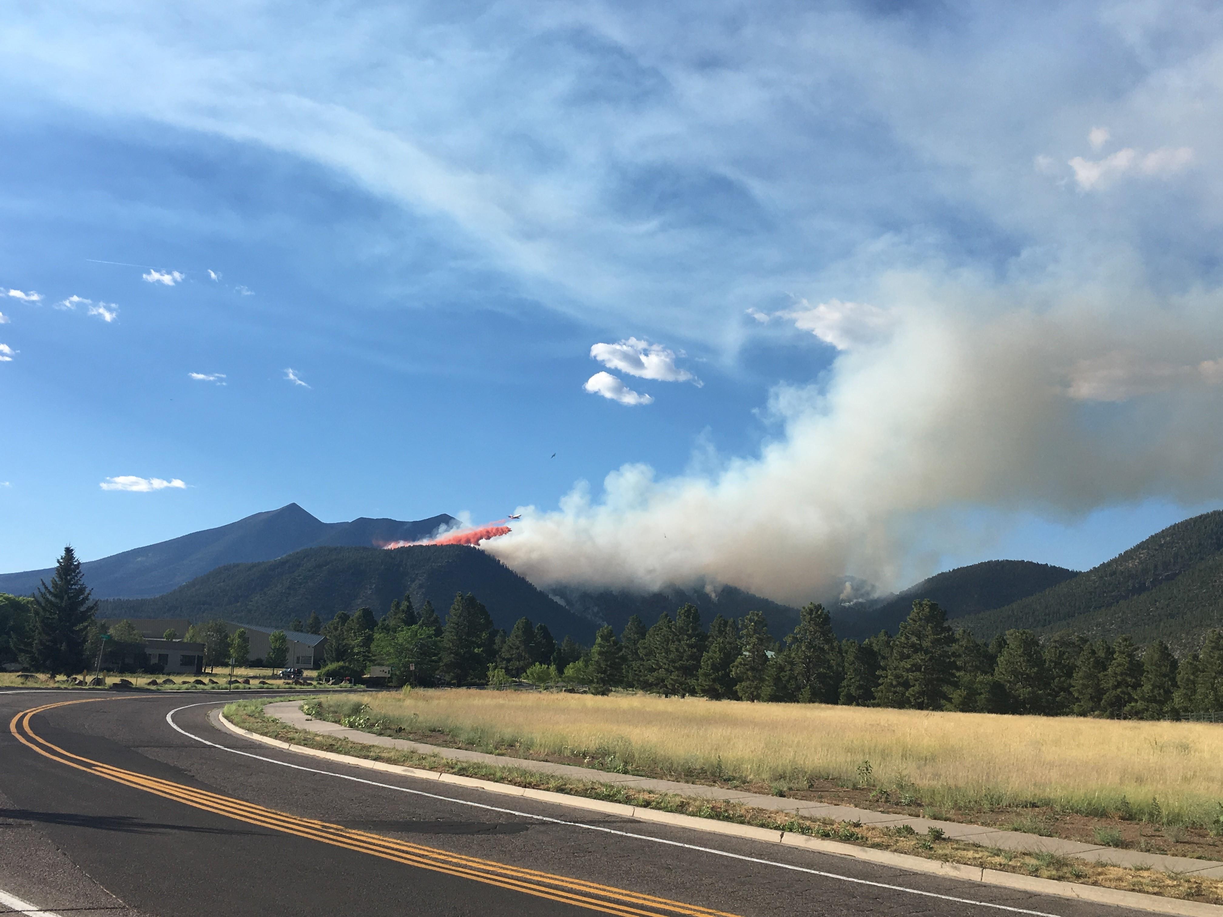
View of flames and smoke generated by the Museum Fire flames as seen along Hwy 180.
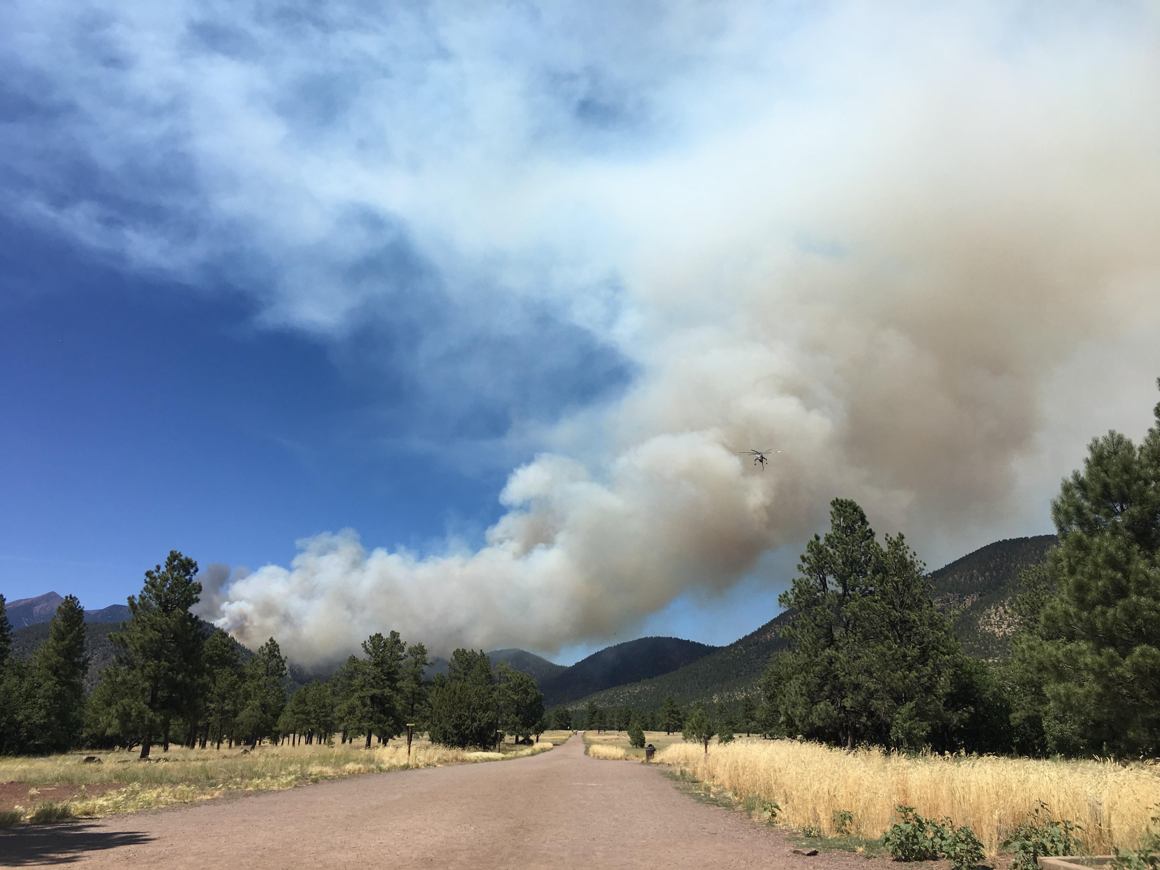
View of smoke from the Museum Fire on a Forest Service road.
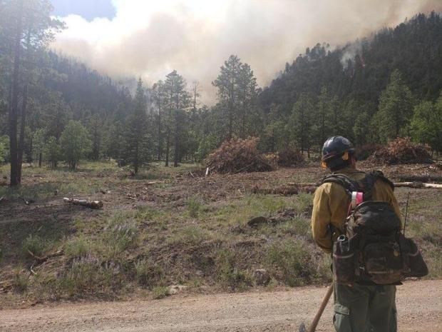
A wildland fire fighter standing on a Forest Service road with smoke from the Museum Fire in the background.
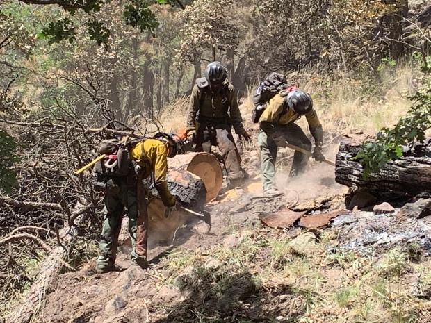
Crew of wildland fire fighters removing dead and down vegetation.
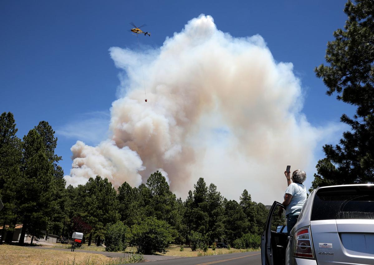
A helicopter being photographed taking water to the Museum Fire which will be used in suppression efforts.
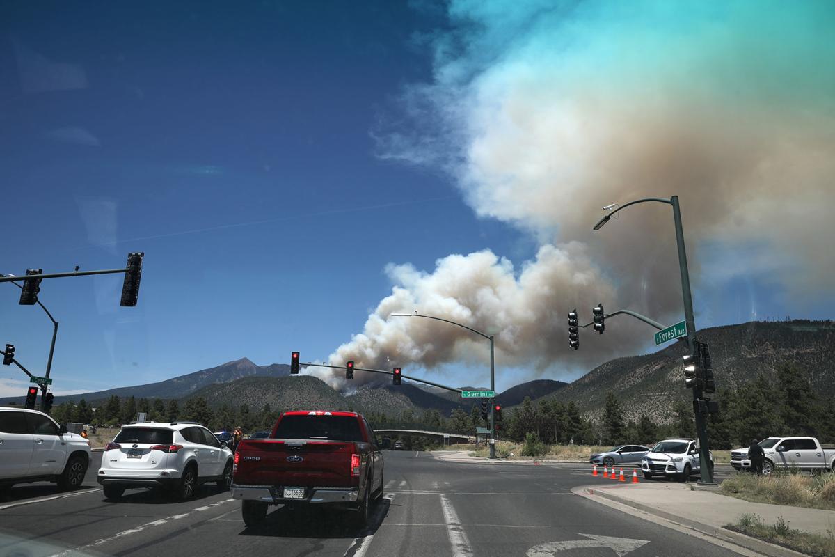
Plume of smoke generated by the Museum Fire as seen at the intersection of Forest Ave and Gemini Rd near Buffalo Park.
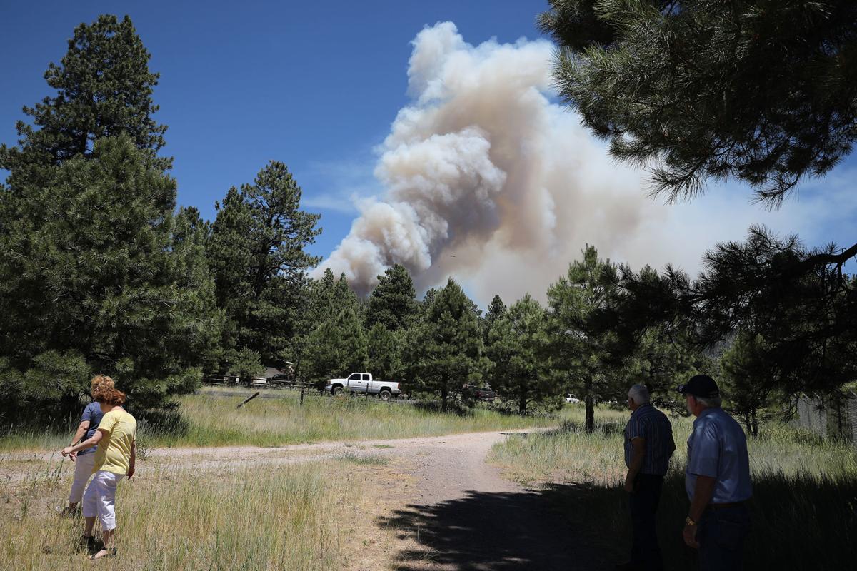
Plume of smoke generated by the Museum Fire with people standing in the foreground watching it.
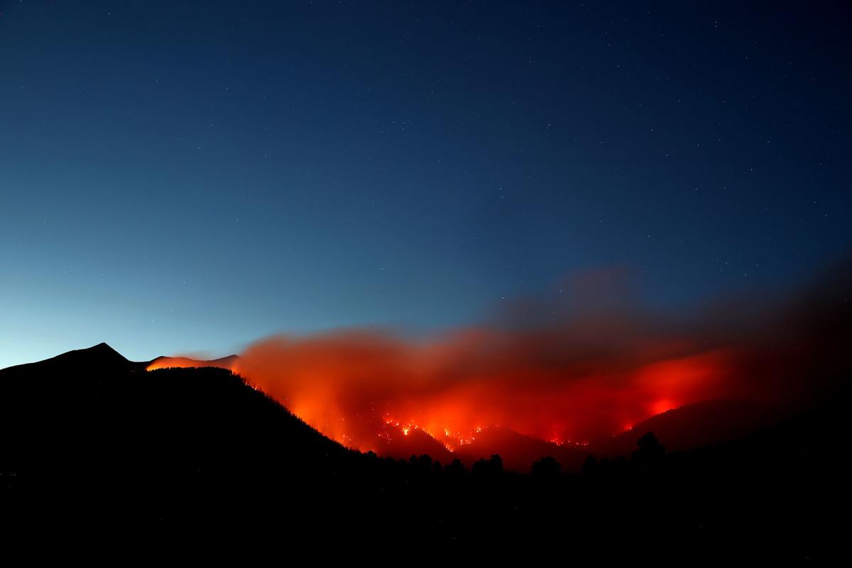
View of the Museum Fire at dusk with southwest winds transporting smoke away from Flagstaff and towards the community of Doney Park.
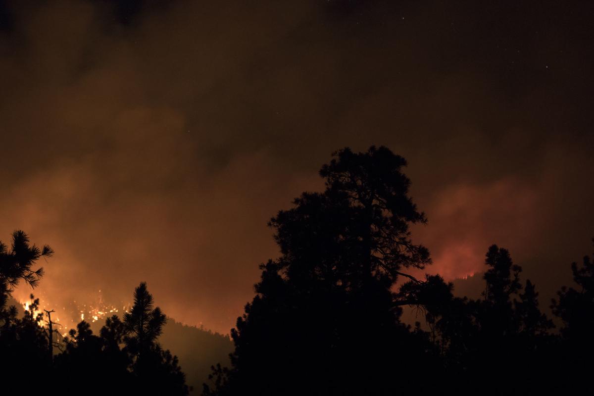
Flames visible at night from the Museum Fire.
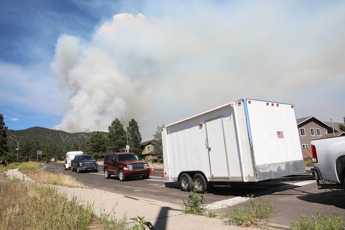
People placed in Go! status evacuating with trailers and other items.
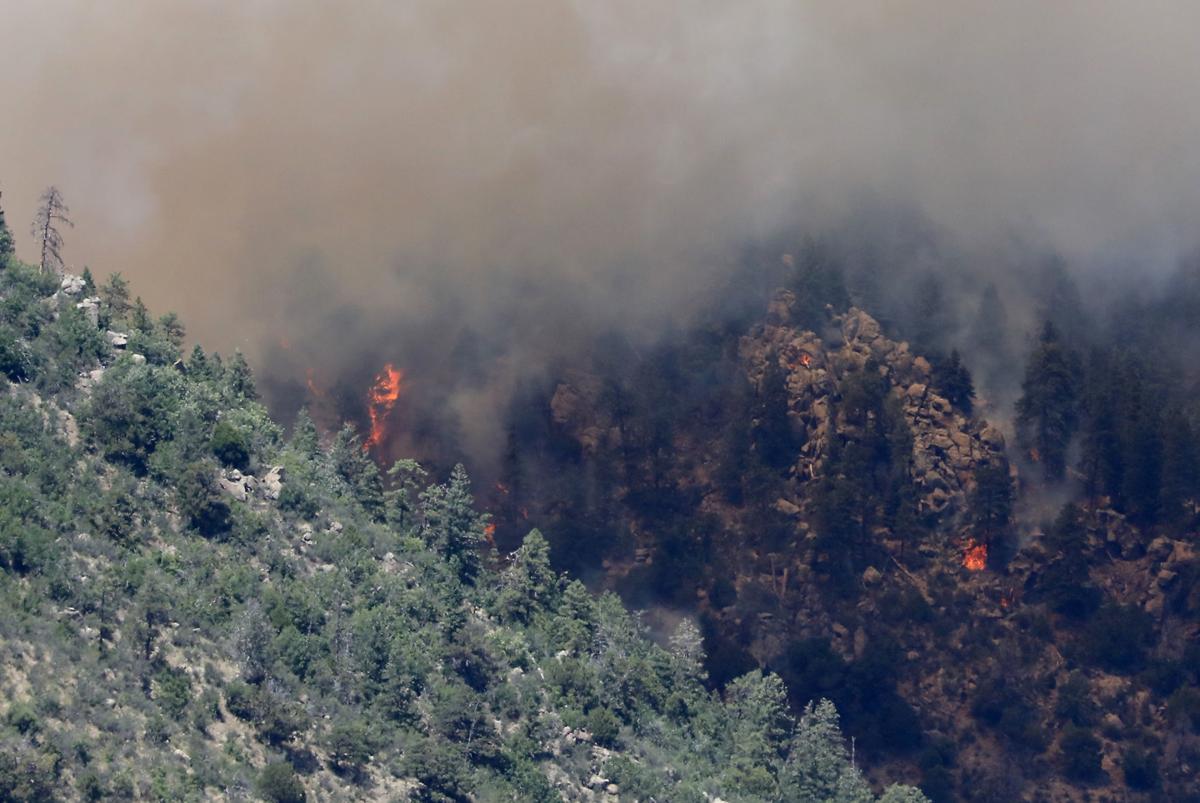
Flames and smoke from the Museum Fire as seen from the air.
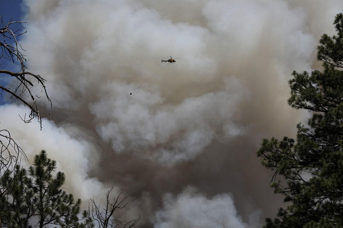
Helicopter carrying a bag of water to be dropped on the Museum Fire with a big plume of smoke in the background.
× ![]()
Normally, by mid to late July the Monsoon season has started in earnest across northern Arizona. Scattered showers and thunderstorms are a daily occurrence with wetting rains significantly lowering the threat for wildland fires. However, 2019 saw a delayed start to the Monsoon season with little in the way of precipitation from June 15th through mid July. This resulted in an extended fire weather season which played a key role in the Museum Fire. Monsoonal moisture increased over the Flagstaff area two days after the fire began which helped significantly with fire fighting efforts. Wetting rains fell in the days following, which led to further containment of the fire and lessened danger to the nearby communities.
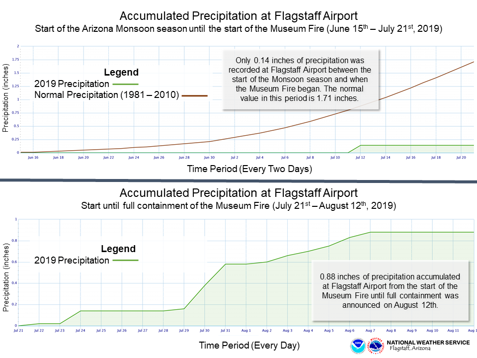 Very little precipitation fell at Flagstaff Airport (about eight miles south of the Museum Fire burn scar) from the start of the Monsoon season until the start of the Museum Fire. Greater monsoonal moisture arrived in the region as the fire was burning and allowed for an uptick in recorded precipitation at Flagstaff Airport.
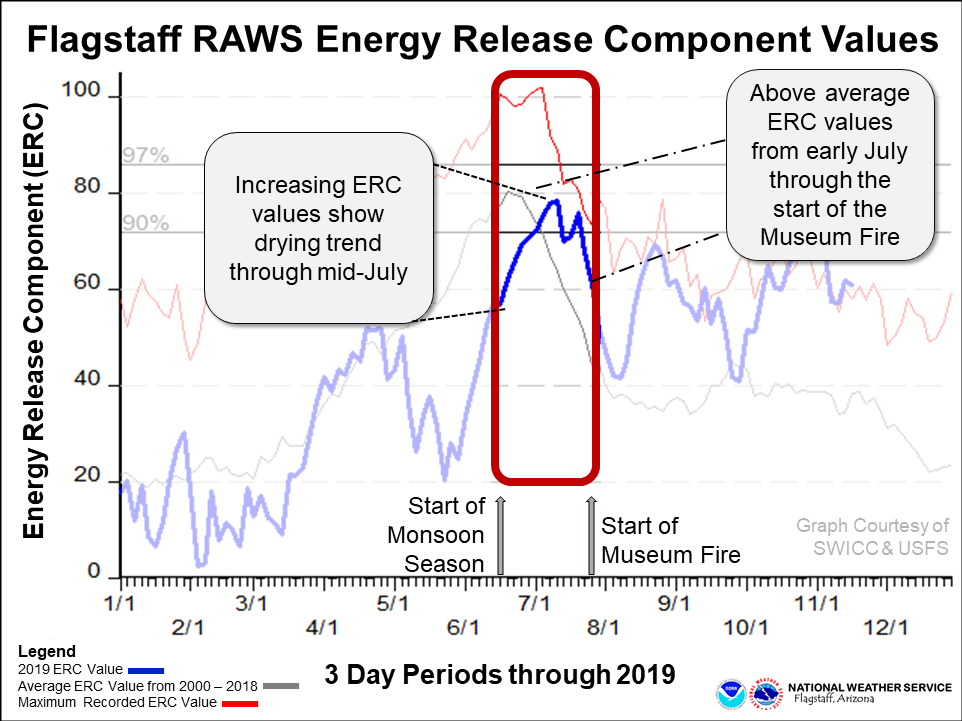
Energy Release Components at the Flagstaff RAWS station from the beginning of the Arizona Monsoon season (June 15th, 2019) until the start of the Museum Fire (July 21st, 2019).
Contact Information
For more information on impacts and general inquiries about this event, contact by sending an email to or by calling .
Media is free to use this event summary information. Please acknowledge the National Weather Service as the source of any information accessed from the site unless otherwise noted.