
Dangerous and extreme heat will remain across portions of the Central U.S. this week, persisting across the Mid to Lower Mississippi Valleys, Gulf Coast, Southern Plains and portions of Texas. A heat wave over the Southwest will intensify late this week. Severe thunderstorms and flash flooding will spread from the Great Lakes/Ohio Valley to the Mid-Atlantic and Northeast the next few days. Read More >
Media is free to use the NWS Flagstaff Event Summary information. Please acknowledge the NWS as the source of any information accessed from the site unless otherwise noted.
A wide swath of 3-6 inches of extremely heavy rain (3-6 inches) fell along the Mogollon Rim south of I-40 from Ash Fork to Parks during the afternoon and early evening of August 18th. The flooding rain moved south through various canyons and washes including Sycamore Creek before emptying into the Verde River east of Paulden. A major flood wave moved through the Verde River gauge at Clarkdale around 9 pm that night with a rise from 1.91 feet to 19.49 feet (32,047 cfs) in 58 minutes. This was second highest crest on this gauge in history. Significant flooding was noted along the river in Clarkdale and Cottonwood as the flood waters passed through. The water moved through the Verde River system overnight into Thursday with rises of several feet noted on the gauges near Camp Verde and above Horseshoe Dam. The water reached the Camp Verde gauge around 9:30 am MST Thursday morning and the Horseshoe Dam gauge on Thursday afternoon. Additional minor flooding of property was reported in Camp Verde.
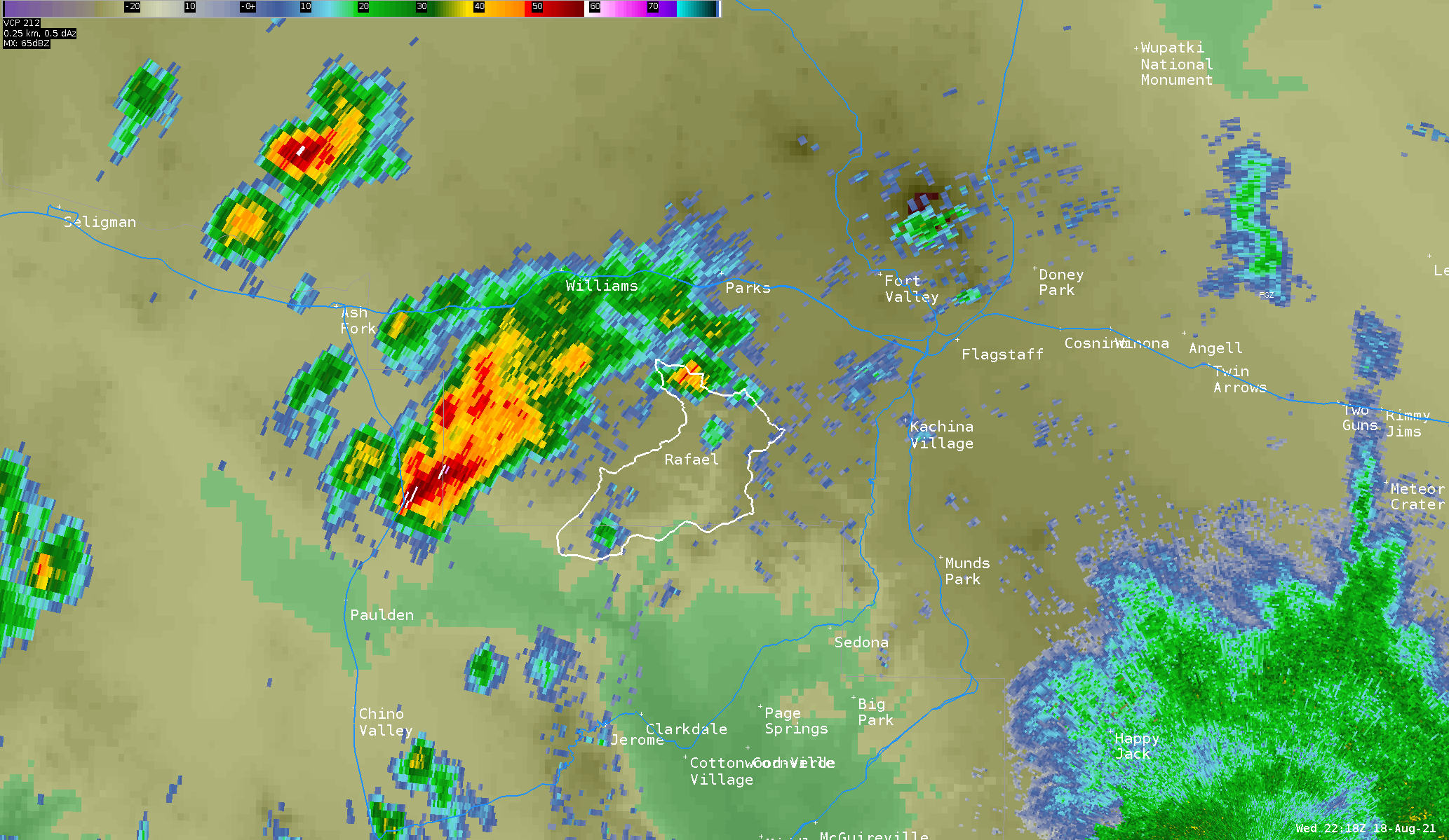
Radar Loop from 2:18 pm - 6:51 pm MST showing multiple rounds of heavy rain just to the west of the Rafael Fire Scar (outlined in white). The most significant rain fell from roughly 3:30 pm - 6:00 pm MST.
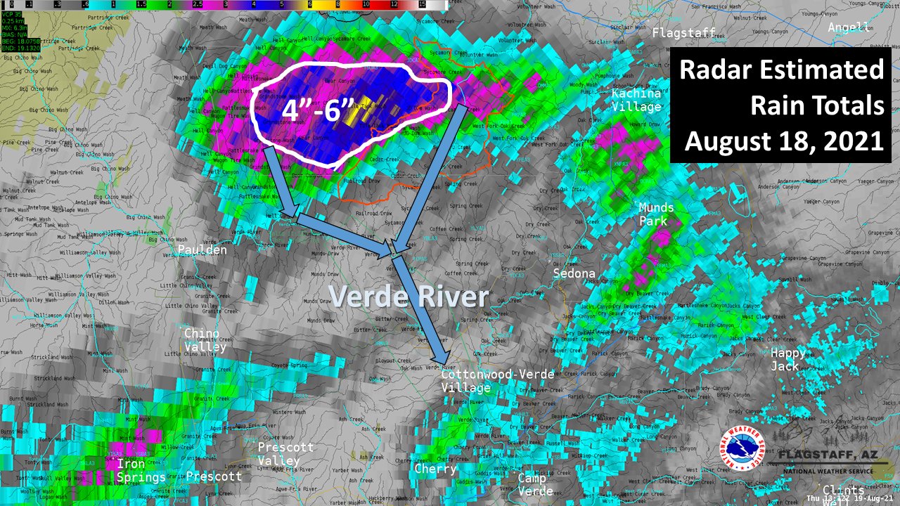
NWS radar estimated approximately 4"-6" of rain fell just west of the Rafael Fire Scar during the afternoon hours on Wednesday, August 18, 2021. The flood wave entered the Verde River near Clarkdale, and continued to travel through the Verde River system on Thursday August 19, 2021.
Wednesday and Thursday August 18-19, 2021
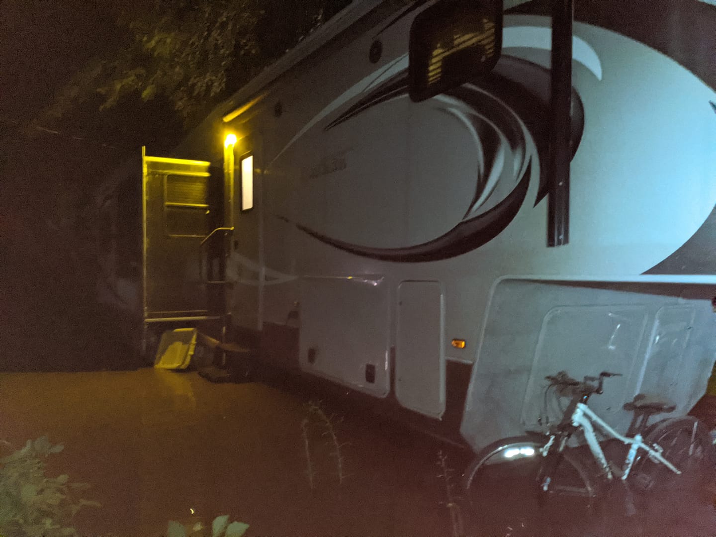
Flood waters from the Verde River entered the Rio Verde RV Park in Cottonwood. Image courtesy of Majken Schimmel on Facebook
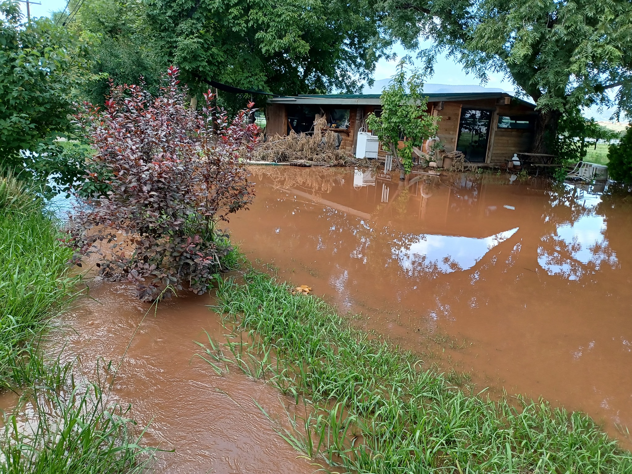
High flow and dangerous conditions were reported in Camp Verde around 1/2 mile from the White Bridge. Image courtesy of Jennifer Dutton on Facebook
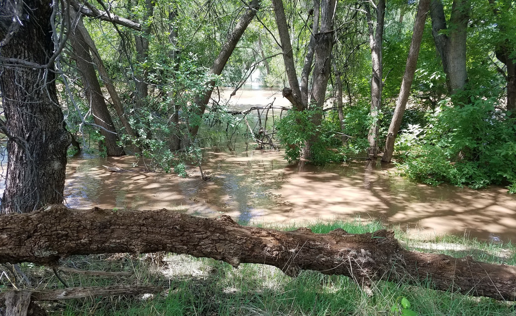
Flooding was observed Thursday morning in the Verde Valley Estates neighborhood of Camp Verde
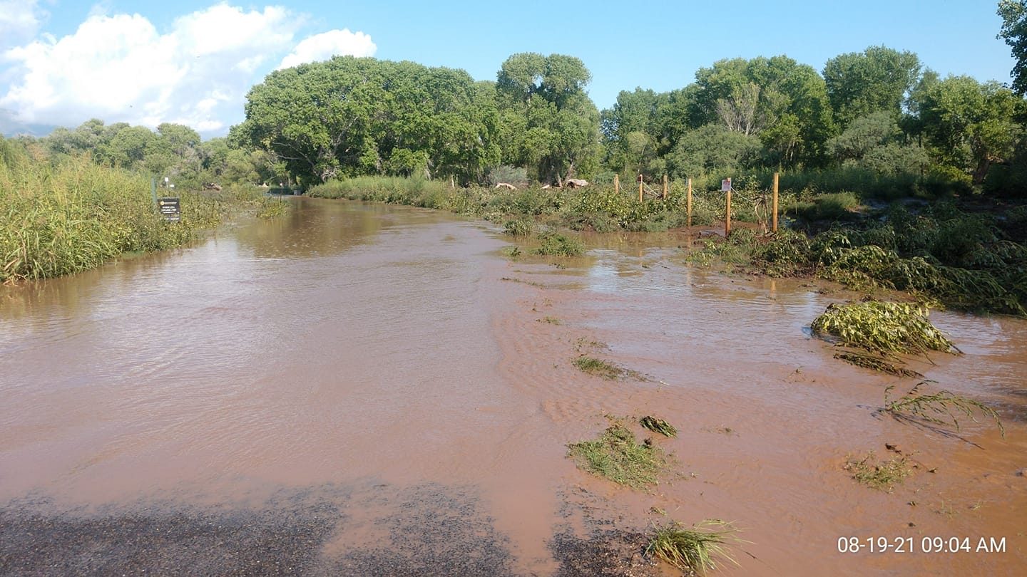
Several roads were closed near Comanche Drive and Cottonwood Ditch due to flooding overnight Wednesday into Thursday morning
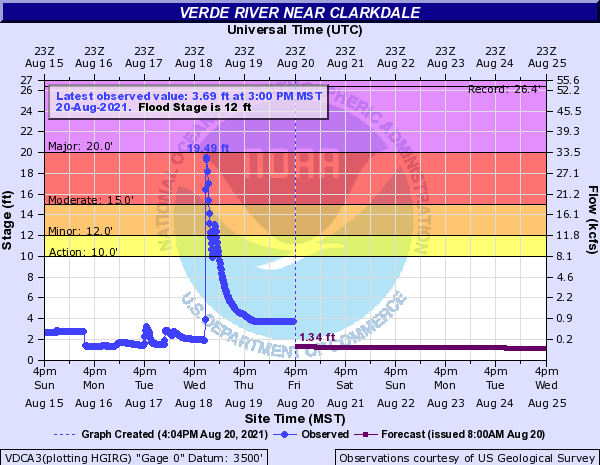
The Verde River gauge near Clarkdale rose from 1.91 feet to 19.49 feet (32,047 cfs) in 58 minutes Wednesday night. This was the second highest crest on record.
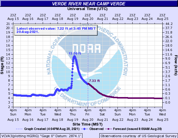
The Verde River gauge near Camp Verde rose 4.18 feet to 14.23 feet (12,629 cfs) in 4 hours and 15 minutes Thursday morning.
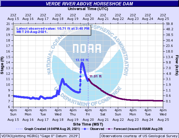
The Verde River gauge above Horseshoe Dam rose from 6.25 feet to 13.56 feet (10,400 cfs) over a 4-5 span Thursday afternoon.
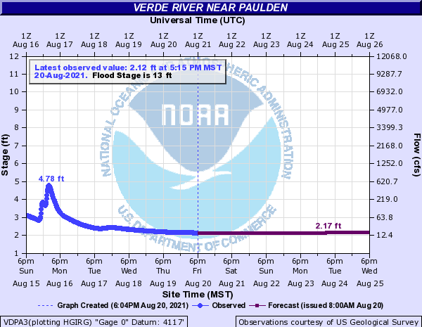
Further confirming the source of the flood waters was the lack of response from the Verde River gauge near Paulden. This verifies the water entered the Verde River between Paulden and Clarkdale from the heavy rainfall near the Rafael Fire Scar.
Deep monsoonal moisture was in place across northern Arizona, especially south of the Mogollon Rim. A trough passing to the north of the region provided additional dynamics and lift for widespread shower and thunderstorm activity. Steering flow was toward the northeast with multiple rounds of storms forming across southwest and central Yavapai County before moving over the area near the Rafael Fire Scar. Antecedent conditions also likely played a role as a very wet start to the 2021 Monsoon season may have led to more runoff than usual.
For more information on impacts and general inquiries about this event, contact by sending an email to or by calling .

