
A wet Memorial Day weekend is in store for the East, with widespread rainfall of 1 to more than 2 inches expected from the Gulf Coast to southern New England. Well above normal temperatures are forecast to build across the northern Plains. Another round of heavy to excessive rainfall is expected to impact the western Gulf Coast this weekend with Flood Watches in effect. Read More >

Media is free to use the NWS Flagstaff Event Summary information. Please acknowledge the NWS as the source of any information accessed from the site unless otherwise noted.
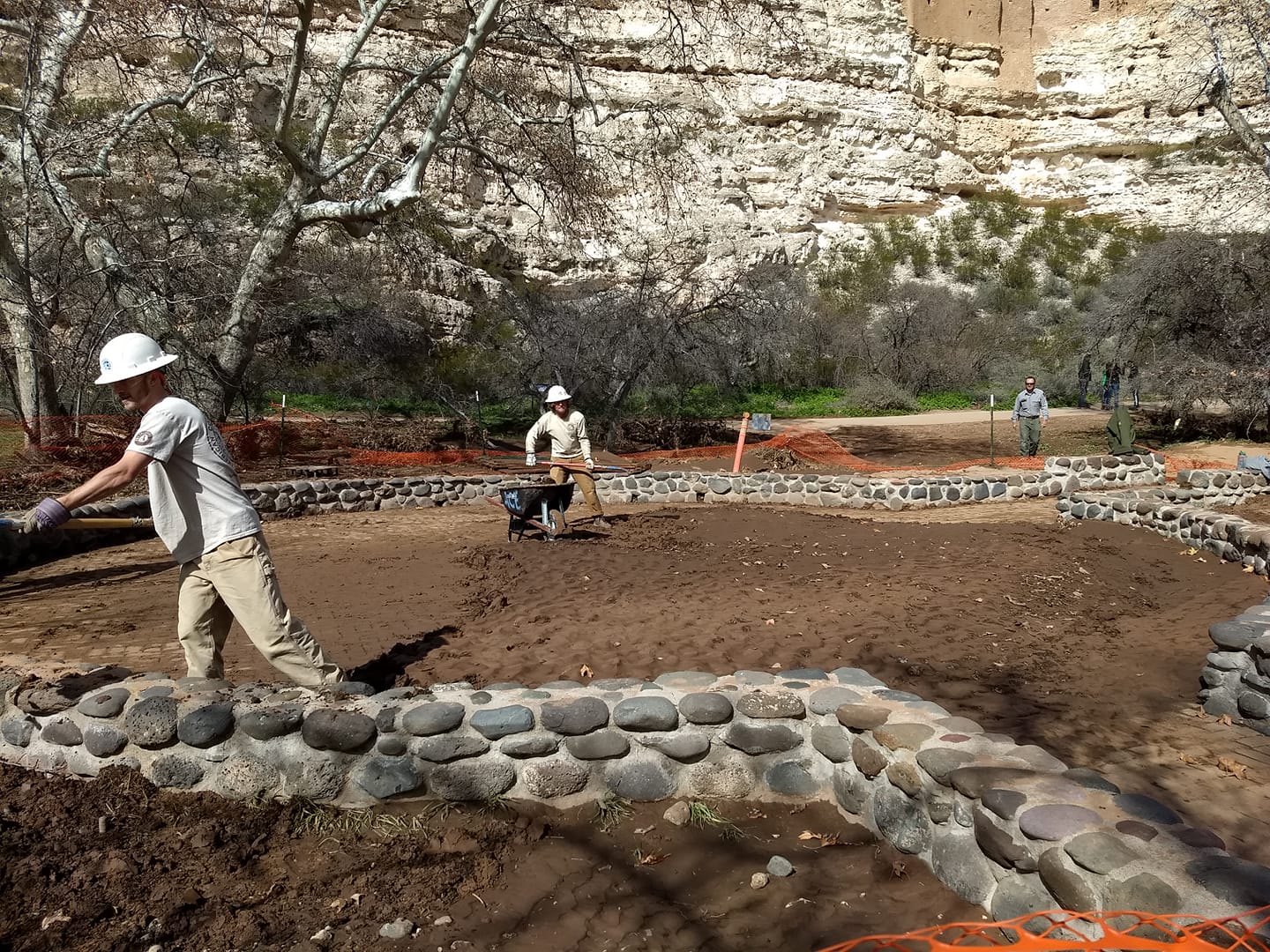
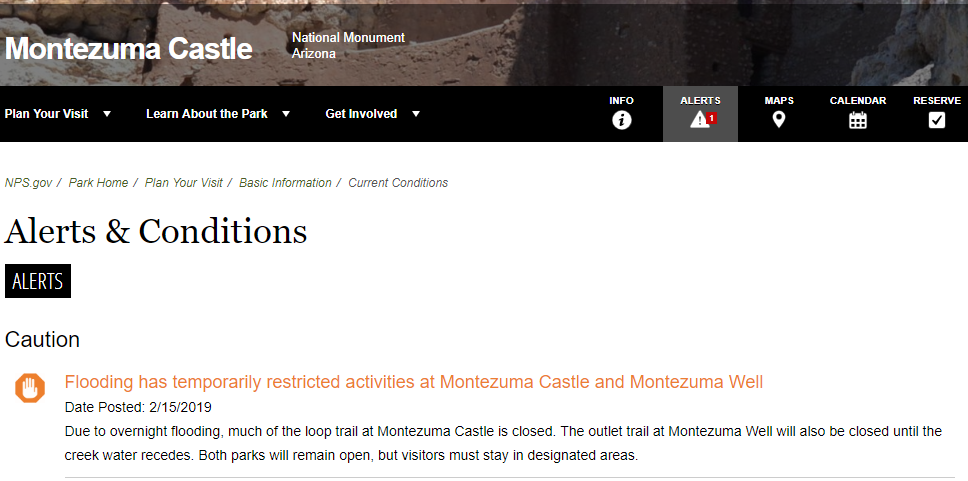
A wet Pacific storm system spread heavy precipitation across much of northern Arizona on February 14th and 15th, 2019. This system also brought very warm air into the region resulting in abnormally high snow levels for mid-February. The heavy rain combined with significant snow melt in the mountains led to widespread flooding across central Arizona, especially the Verde Valley. Water levels remained elevated on area creeks, rivers, and streams for several days following this event.
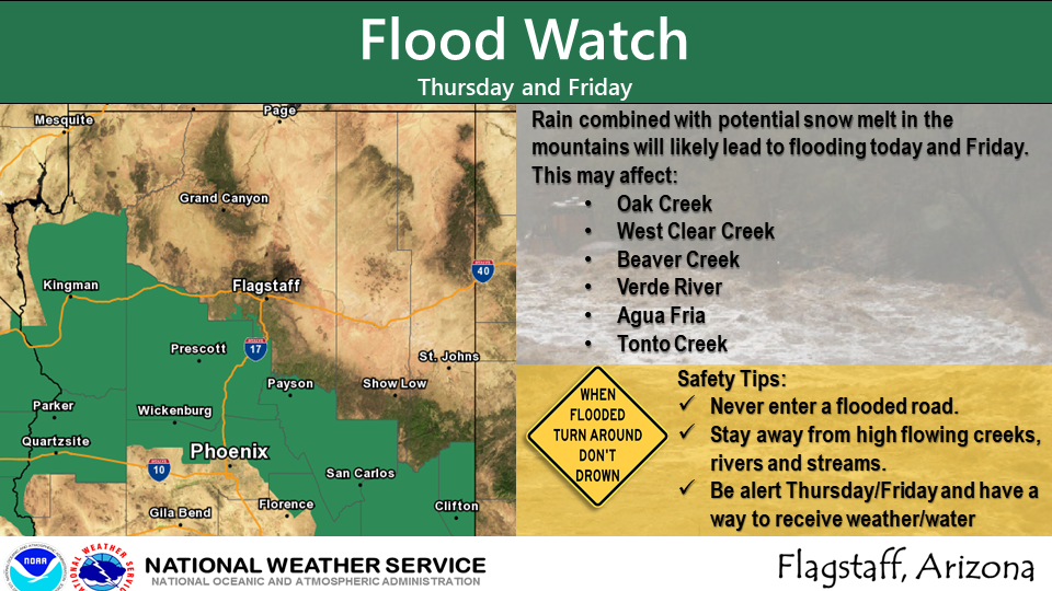
The National Weather Service in Flagstaff issued a Flood Watch a couple days in advance across portions of central Arizona
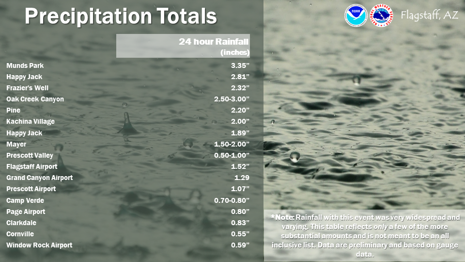
Very heavy rainfall totals were observed with this storm system leading to the flooding issues
Closure sign for the Cold Springs Swimming Hole after the tragic flash flood
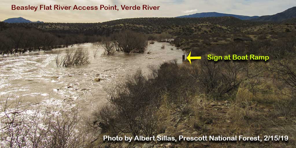
Photo Taken By Jack Lloyd of the Cold Springs Swimming Hole on July 15, 2017 showing significant flash flooding occurring.
East Verde River at Water Wheel Day Use Area. More substantial debris was noted along the banks than at First Crossing. High water mark on trees was probably more like 4-4.5 feet.
Bank of East Verde River, approximately 200 yards upstream from parking lot at Water Wheel Day Use Area. Note substantial debris.
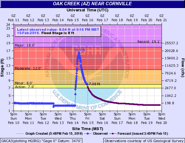
Hydrograph showing flood waters hitting the Oak Creek gauge in Cornville
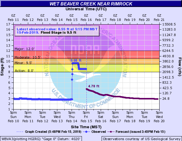
Hydrograph showing flood waters hitting the Wet Beaver Creek gauge in Rimrock
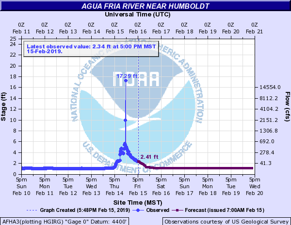
Hydrograph showing flood waters hitting the Agua Fria River gauge in Dewey-Humboldt
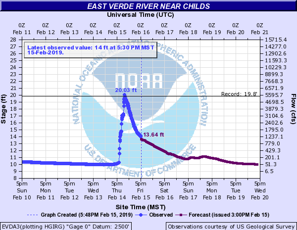
Hydrograph showing the elevated water levels on the Verde River in Childs
There were four primary factors responsible for the flash flood and debris flow which rushed down Ellison Creek, impacting the Cold Springs swimming hole:
For more information on impacts and general inquiries about this event, contact by sending an email to or by calling .
Media is free to use this event summary information. Please acknowledge the National Weather Service as the source of any information accessed from the site unless otherwise noted.

