
Dangerous heat will expand from the Gulf Coast into the Southern Plains and Desert Southwest through week's end. Additional extreme heat impacting the Pacific Northwest will shift to the northern Plains by the weekend. Tropical Storm Bertha is expected to continue to impact portions of the northern Gulf Coast from the western Florida Panhandle to southeastern Louisiana through tonight. Read More >
Media is free to use the NWS Flagstaff Event Summary information. Please acknowledge the NWS as the source of any information accessed from the site unless otherwise noted.
The Yarnell Fire burned in hilly terrain adjacent to the town of Yarnell, AZ (located south of Prescott, AZ). This event, caused by an lightning strike, lasted from June 28 - July 10, 2013 and burned over eight thousand acres of mountaineous terrain. Due to the high impacts caused by the fire, the event eventually gained a lot of attention by the local and national media and governments.
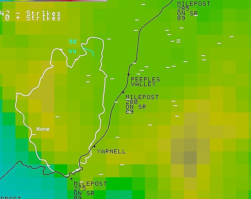
42 lightning strikes were recorded on June 28th, 2013 in the vicinity of the Yarnell Wildland Fire region. These were due to what are called dry lightning associated with weak thunderstorms that moved off the high terrain in northern Arizona and towards the southwest.
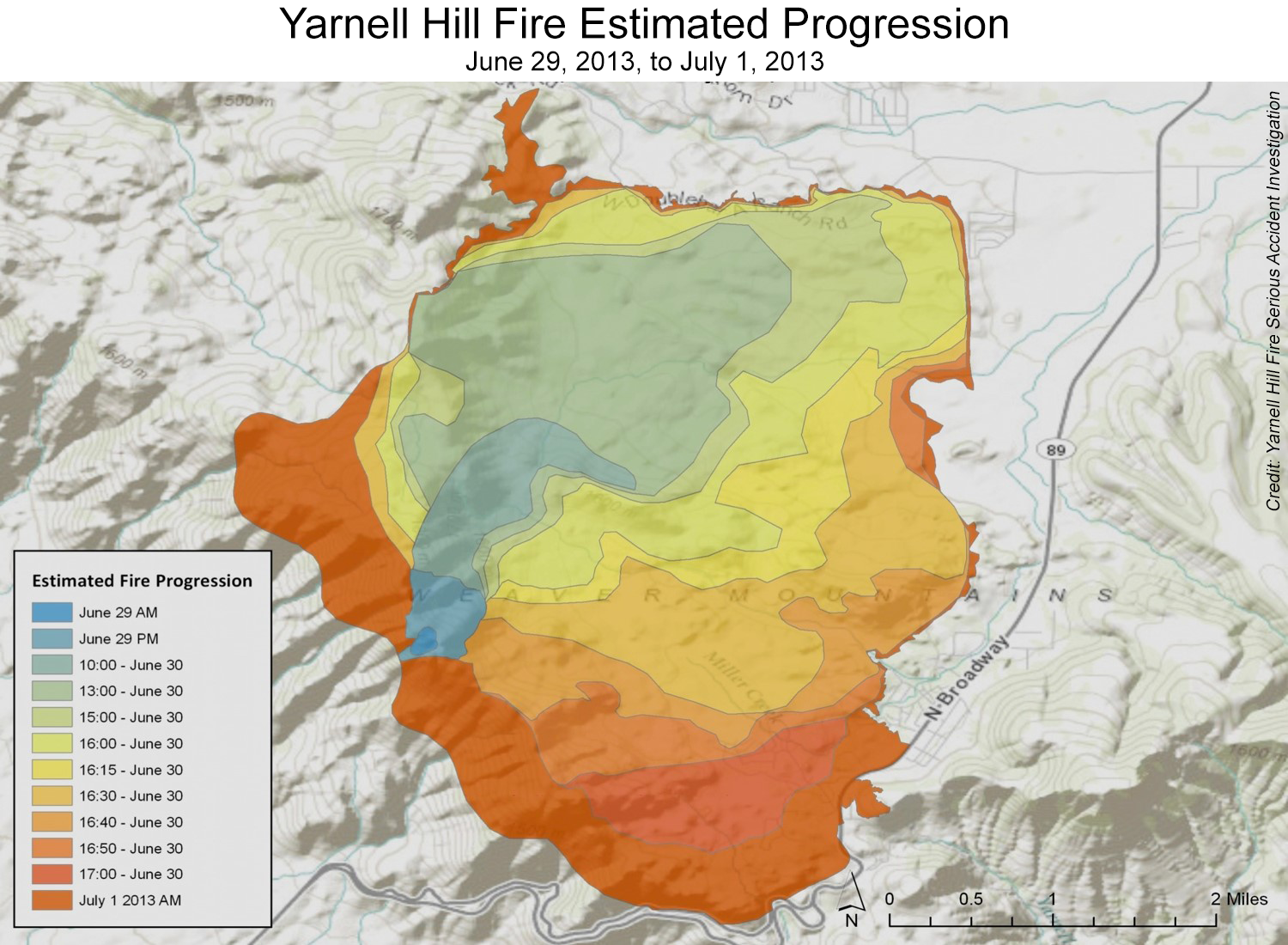
Yarnell Hill Fire Estimated Progression June 29, 2013 to July 1, 2013.
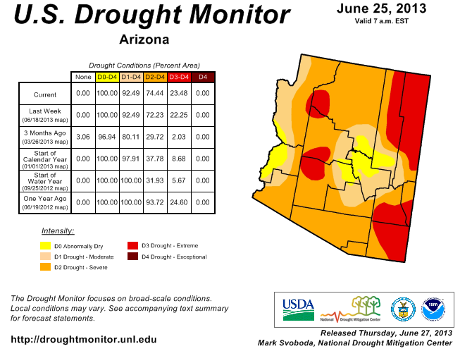
United State Drought Monitor as of June 25, 2013 for the state of Arizona
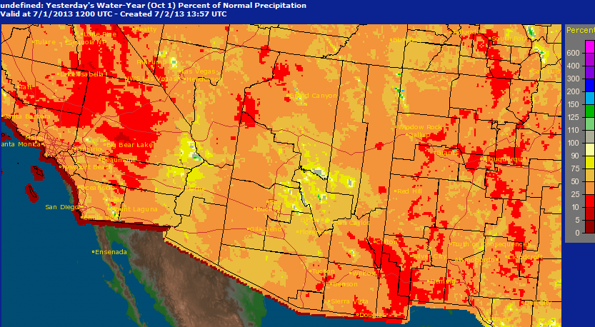
Dry water year for Yarnell, AZ region
The location of the Yarnell Fire experienced less than average total precipitation during the 2012-2013 water year. The lack of precipitation, along with seasonally dry conditions in June, led to extremely dry vegetation. As a result, combustion easily began after the lightning struck a patch of vegetation. The rapid growth conditions were likely aided by strong and erratic winds created by thunderstorm outflow.
For more information on impacts and general inquiries about this event, contact by sending an email to or by calling .
Media is free to use this event summary information. Please acknowledge the National Weather Service as the source of any information accessed from the site unless otherwise noted.

