****Below is an account from Tim Samaras, an electrical engineer who had been working on a tornado research project with the assistance of NOAA, The National Geographic Society (NGS), and Applied Research Associates, Inc. All figures and images are provided by Tim Samaras unless otherwise stated.****
Click on any of the figures below to view the enlarged image.
Our route for the Manchester tornado is east on Highway 14, then left (north) on 424th Avenue. Paralleled the tornado moving north to 206th Street, turning east into the path of the tornado. Dropped probe 3 before turning north on 425th Avenue as the tornado approached the team within 100 yards. Continued north and dropped probe 5 and the video probe. Figures 1 and 2 show the GPS coordinates of probe drops and viewing sites.
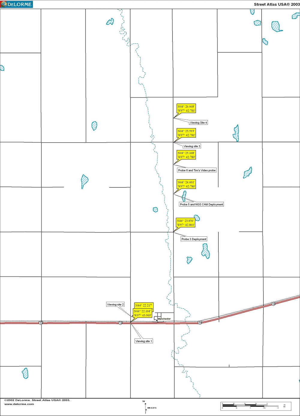 Figure 1. Filming and Deployment sites for Manchester tornado |
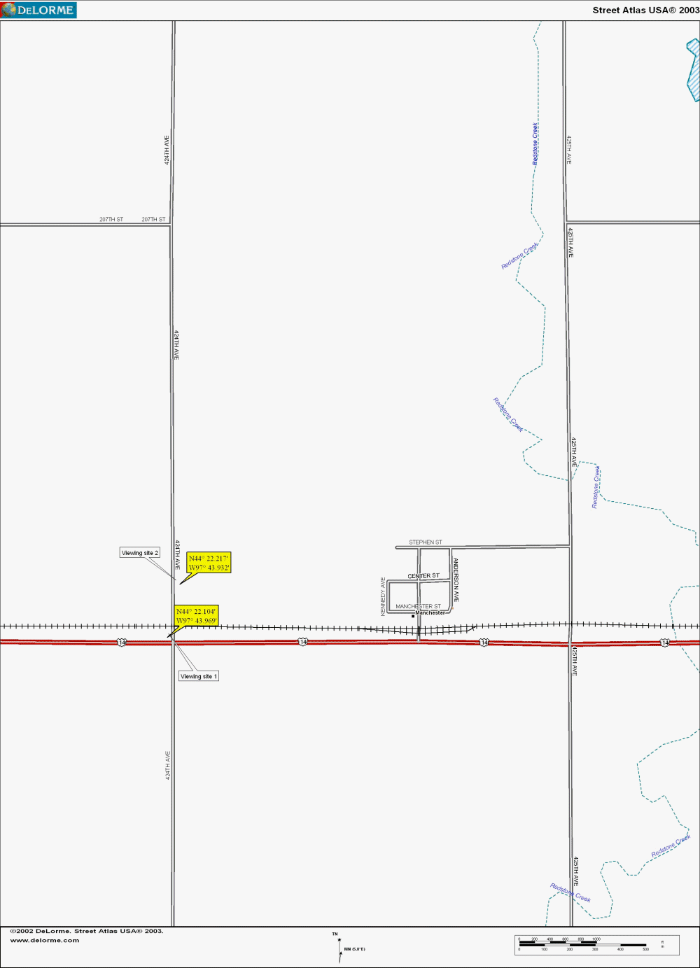 Figure 2. Closeup of first two Viewing/Video sites |
Figure 3 shows the aerial view of the tornado track. Note that the tornado was to the west of 425th, then crossed 425th at the farmhouse where probe 3 was, then crossed again from east to west exactly where probe 5 and the NGS probe were!
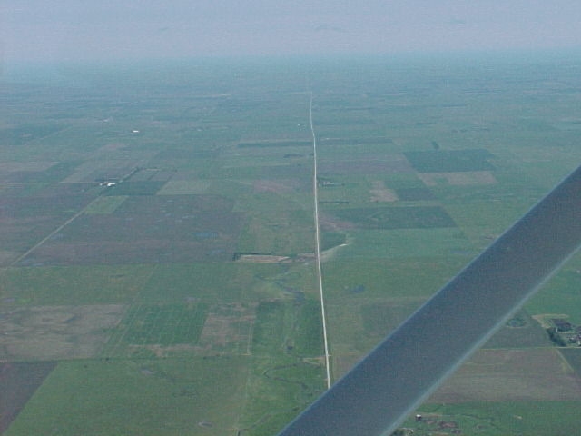
Figure 3. Aerial View of Manchester tornado track
(Courtesy of NWS Sioux Falls, SD)
Figures 4 and 5 show the actual untouched traces from Probes 3 and 5.
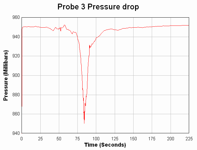 Figure 4. Pressure trace from Probe 3 (Near Farmhouse) |
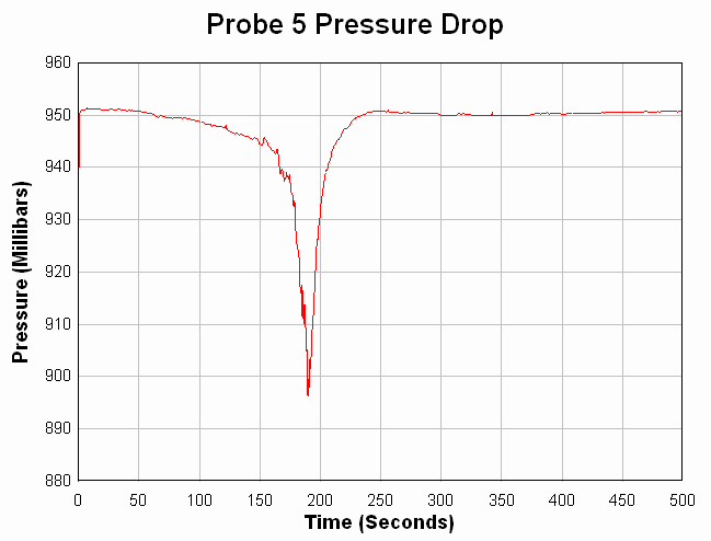 Figure 5. Pressure trace from Probe 5 (Near NGS Photo Probe) |
Figures 6-12 are video frame grabs of each location as indicated on Figures 1 and 2.
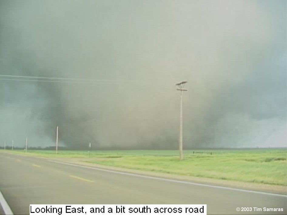 Figure 6. Frame Grab from Site 1 |
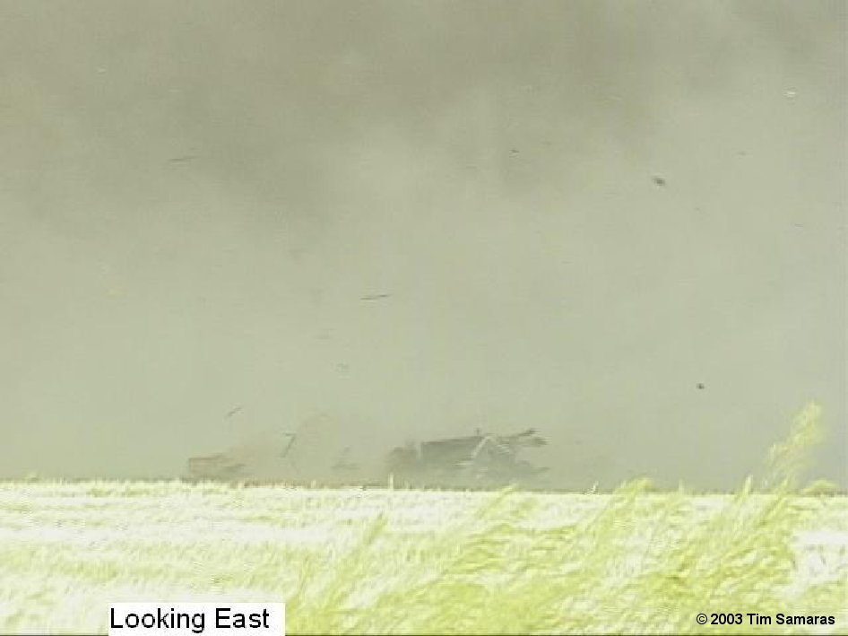 Figure 7. Frame Grab from Site 2 |
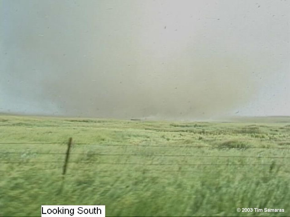 Figure 8. Frame Grab at Probe 3 |
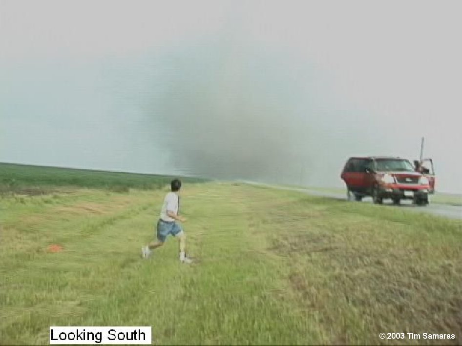 Figure 9. Frame Grab at Probe 5 |
 Figure 10. Frame of Video Probe Site |
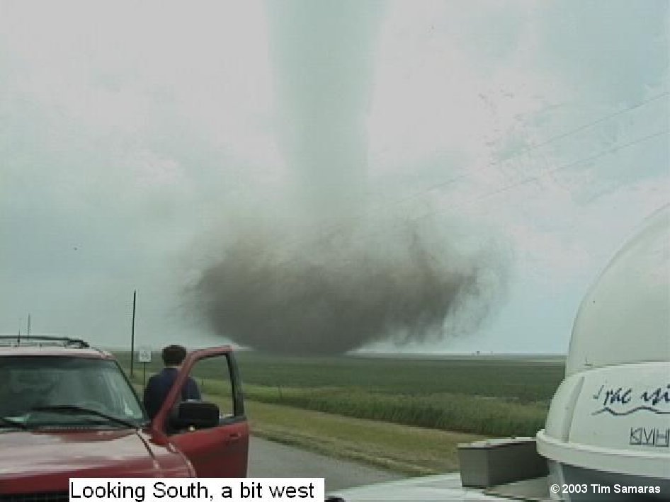 Figure 11. Frame Grab of Video Site 3 |
 Figure 12. Frame Grab of Video Site 4 |
Actual text from the National Weather Service is included below:
ABUS34 KFSD 260125
PNSFSD
PUBLIC INFORMATION STATEMENT
NATIONAL WEATHER SERVICE SIOUX FALLS SD
726 PM CDT WED JUN 25 2003
....MANCHESTER TORNADO RATED F4....
THE LARGE TORNADO THAT DESTROYED THE COMMUNITY OF MANCHESTER IN KINGSBURY COUNTY SOUTH DAKOTA IS OFFICIALLY CLASSIFIED AS AN F4 TORNADO BY THE NATIONAL WEATHER SERVICE.
THIS TORNADO...FIRST TOUCHING DOWN IN NORTHEAST SANBORN COUNTY...MOVED THROUGH MANCHESTER AT APPROXIMATELY 745 PM TUESDAY EVENING JUNE 24 2003. AS THE TORNADO MOVED THROUGH MANCHESTER IT WAS ABOUT A 1/2 MILE WIDE. THE F4 DAMAGE EXTENDED 1 1/2 MILES SOUTH OF MANCHESTER...THROUGH THE SMALL COMMUNITY... TO 2 1/4 MILES NORTH OF MANCHESTER. THE TOTAL TORNADO PATH WILL BE DETERMINED BY AN AERIAL SURVEY PLANNED FOR THURSDAY...BUT IT IS ESTIMATED TO BE AROUND 25 MILES LONG. F4 TORNADO WINDS RANGE FROM 207 MPH TO 260 MPH ON THE FUJITA SCALE.
Return to Photos from Mt. Vernon/Woonsocket/Manchester/De Smet/Spirit Lake areas


 Weather Story
 Weather Map
 Local Radar