Grassland Fire Danger Statement
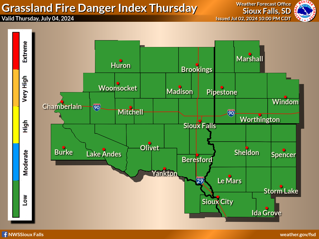
Statewide Grassland Fire Danger maps are also available for the states of South Dakota and Iowa.
Please take note of the legend beneath the maps for the color scheme.
Note: The Grassland Fire Danger statement will be issued daily from April 1st to November 15th, or as conditions warrant during the Spring and late Autumn. It will also be issued during the winter months if the index reaches High, Very High or Extreme. Please check the date on the map and the text product below to ensure you are looking at a current product.
|
Check the text product beneath the maps for detailed Fire Danger information.
|
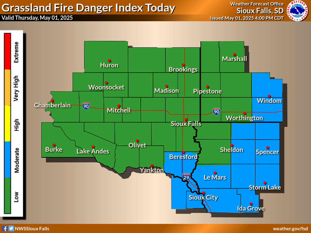
| Key for Fire Danger Maps: |
 |
Low - Green |
 |
Moderate - Blue |
 |
High - Yellow |
|
 |
Very High - Orange |
 |
Extreme - Red |
|
|
599
FNUS63 KFSD 090904
RFDFSD
Rangeland Fire Danger Statement
National Weather Service Sioux Falls SD
404 AM CDT Mon Mar 9 2026
.DISCUSSION...
Northeast to east winds 10 to 20 mph along with less critical
humidity levels will ease fire danger concerns today and Tuesday.
An area of light rain to light snow will move across the region
Tuesday night into early Wednesday, with light snow accumulations
which could linger into Wednesday afternoon.
Stronger winds and warmer/drier surface air will make a brief
appearance Thursday, with a low chance of light rain in portions
of east central South Dakota to southwest Minnesota. Depending on
how quickly the snow from Tuesday night melts, portions of the
area may see elevated to near-critical conditions by Thursday
afternoon. This would be more likely near to south of I-90, and
especially toward the Missouri River Valley.
SDZ050-057-091215-
Gregory-Brule-
...HIGH FIRE DANGER...
The Grassland Fire Danger Index will reach the high category
this afternoon. Unfavorable weather conditions and low
moisture content of grasses, and other dry organic material
on the ground, indicate that there is a high potential for
a fire to spread.. Outdoor burning should be restricted to
early morning or evening hours, when wind speeds are usually
lower and the relative humidity is higher.
OUTLOOK FOR TUESDAY AFTERNOON...The Grassland Fire Danger Index
will reach the moderate category.
The grassland fire danger product reflects fire danger for native
grasses. It is not intended for cured agricultural crops, nor
will it reflect conditions in road ditches which have been mowed.
$$
IAZ001>003-012>014-020>022-031-032-MNZ071-072-080-081-089-090-097-
098-NEZ013-014-SDZ038>040-052>056-058>071-091215-
Lyon-Osceola-Dickinson-Sioux-O`Brien-Clay-Plymouth-Cherokee-
Buena Vista-Woodbury-Ida-Lincoln-Murray-Cottonwood-Nobles-Jackson-
Pipestone-Rock-Dixon-Dakota-Beadle-Kingsbury-Brookings-Jerauld-
Sanborn-Miner-Lake-Moody-Aurora-Davison-Hanson-McCook-Minnehaha-
Charles Mix-Douglas-Hutchinson-Turner-Bon Homme-Yankton-Union-
...MODERATE FIRE DANGER...
The Grassland Fire Danger Index will reach the moderate
category this afternoon. Marginal weather conditions or
lowering moisture content of grasses, and other dry organic
material on the ground, indicate that there is some potential
for a fire to spread. Any outdoor burning should be closely
monitored.
OUTLOOK FOR TUESDAY AFTERNOON...The Grassland Fire Danger Index
will reach the moderate to high category.
The grassland fire danger product reflects fire danger for native
grasses. It is not intended for cured agricultural crops, nor
will it reflect conditions in road ditches which have been mowed.
$$
|