On the evening of June 3, 2010, a squall line moved from southeast South Dakota into northwest Iowa. As this squall line approached the Big Sioux River, which is the border between Iowa and South Dakota, damaging winds developed. In Union County, South Dakota, wind damage was confined to a few trees and remained somewhat isolated. Wind speeds in this area were estimated to be from 55 to 65 mph. As the storm crossed the Big Sioux River north of Akron, Iowa, stronger winds developed as it moved across northwestern Plymouth County. Numerous trees were uprooted or snapped with minor damage to a couple of homes. In addition, an RV was overturned resulting in 2 injuries. Wind speeds in northwestern Plymouth County ranged from 60 to 90 mph.
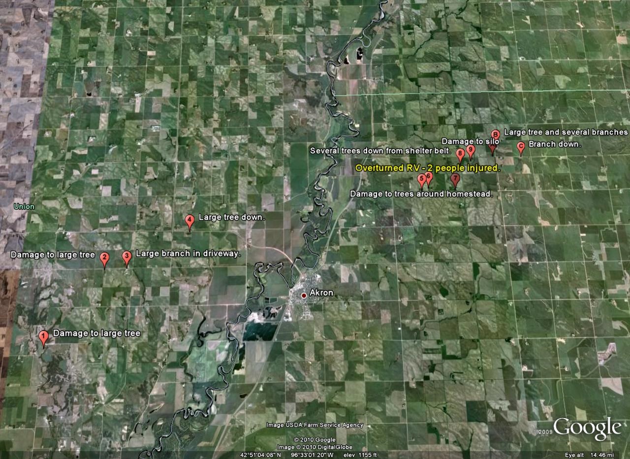
Below are two maps showing the location of damage based upon a storm survey by the National Weather Service in Sioux Falls. Below each map is a description of the damage observed, the estimated wind speed, and, if available, pictures taken by the survey team. We have also created a kmz file depicting the damage which can be downloaded and viewed in Google Earth.
Damage around Akron, Iowa
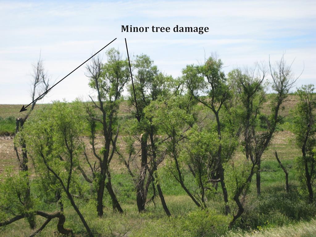
1 - Union County - There was a large 8 to 10 inch branch down within a shelter belt near Brule Creek. Most trees were undamaged. Wind speed was estimated at 60 to 65 mph.
2 - Union County - There was a one foot diameter tree split along the trunk. The wind speeds were estimated at 65 to 70 mph.

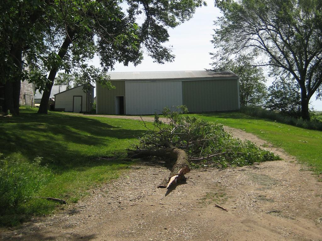
3. Large branch, approximately 8 inches in diameter down in a driveway. Wind estimated at apprxoimately 65 mph.
4. Fifteen inch diameter tree down. The tree was rotted in the middle making it easier to blow down. The estimated wind speed was 60 to 65 mph.
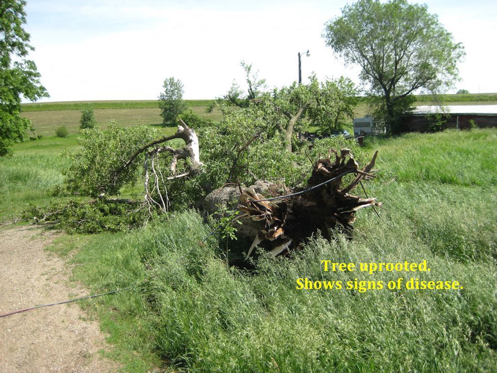
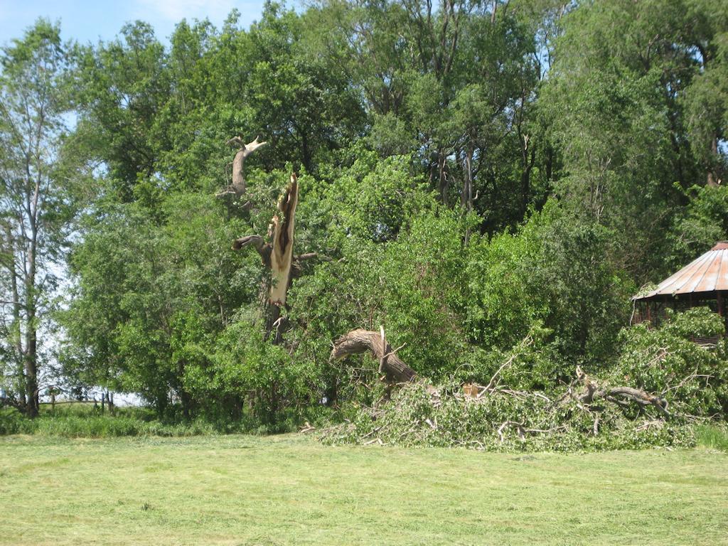
5. Two large trees down, one uprooted and another with large branches split at the base. Numerous other 3 to 10 inch diameter branches down within the yard and across the road. There were also a few shingles off of the roof. Estimated wind speed 75 to 85 mph.
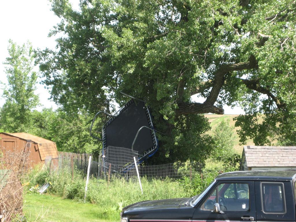
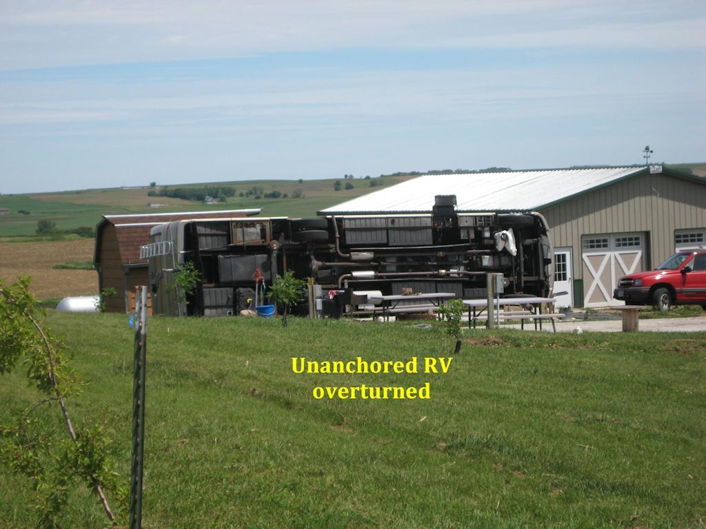
6.Unanchored RV overturned by the wind and two people were injured. Numerous 3 to 6 inch branches were also down on the property. Estimated wind speed 80 to 90 mph.
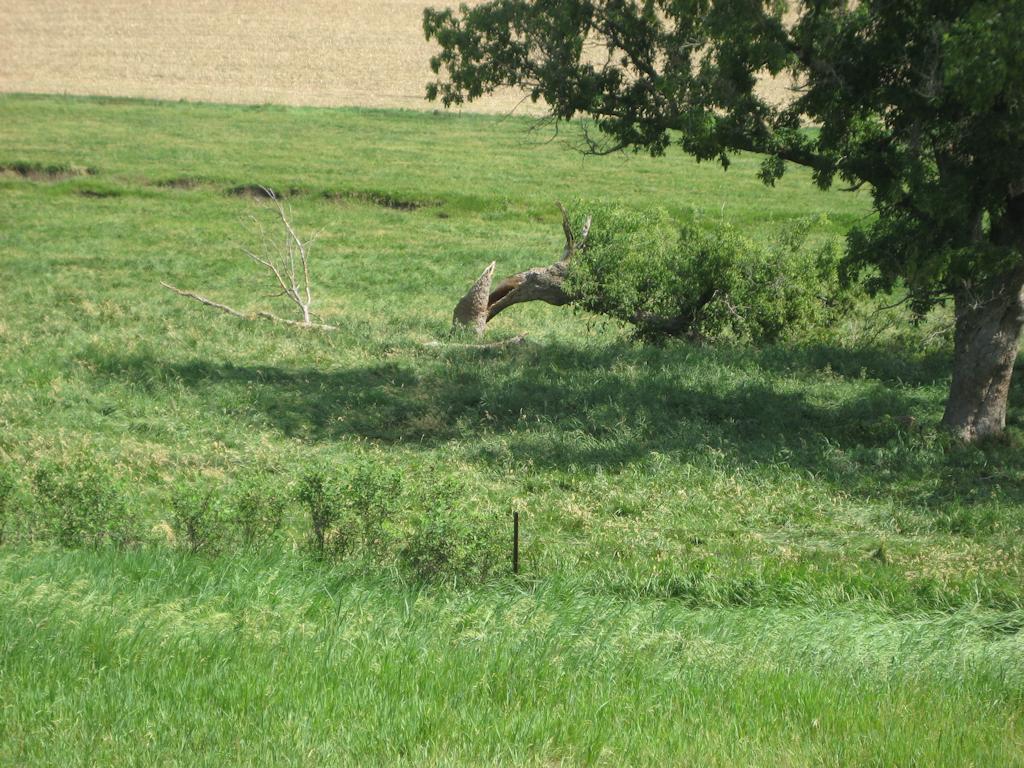
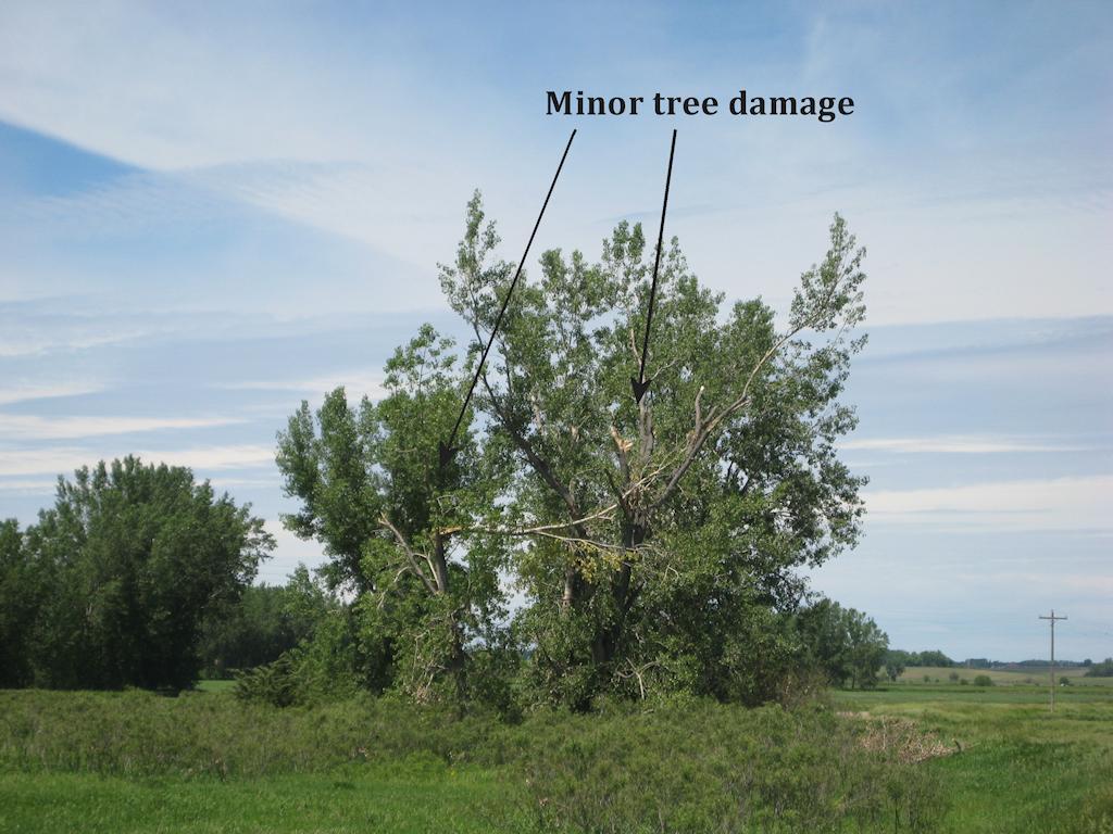
7. A few 2 to 4 inch branches, one 6 inch branch down and one 6 inch diameter tree down. Winds estimated at 60 to 70 mph.
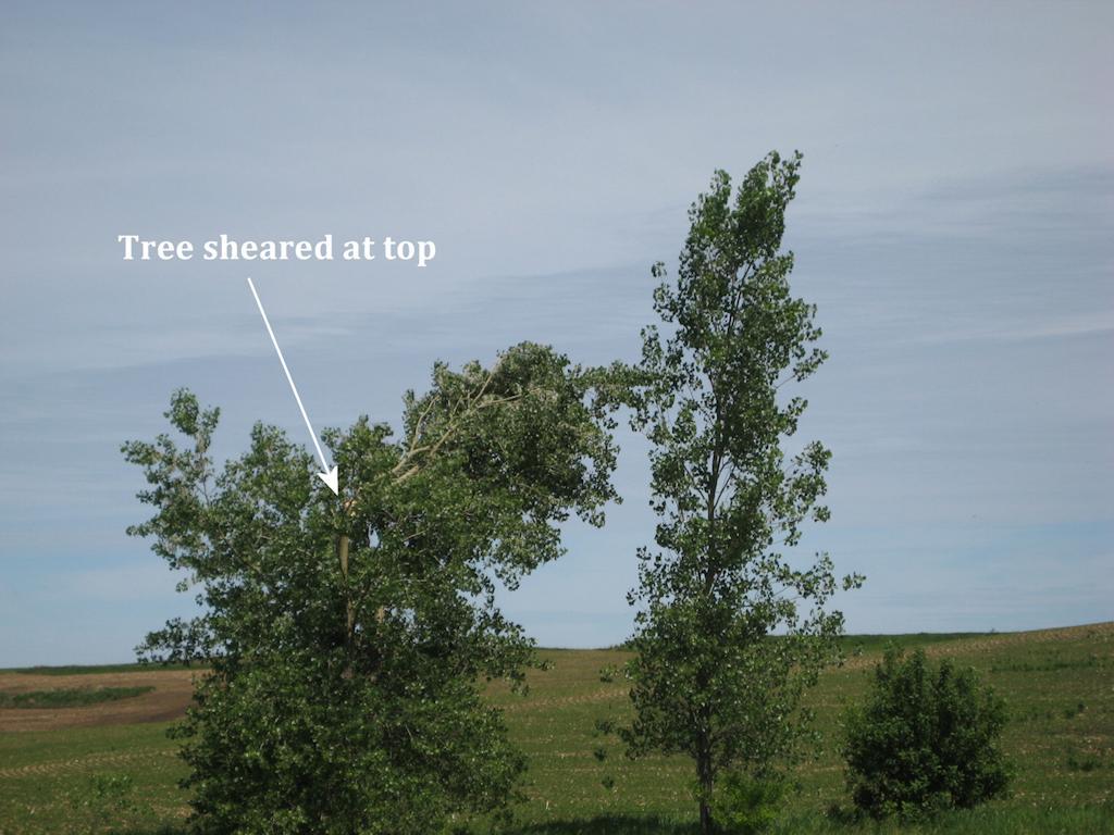
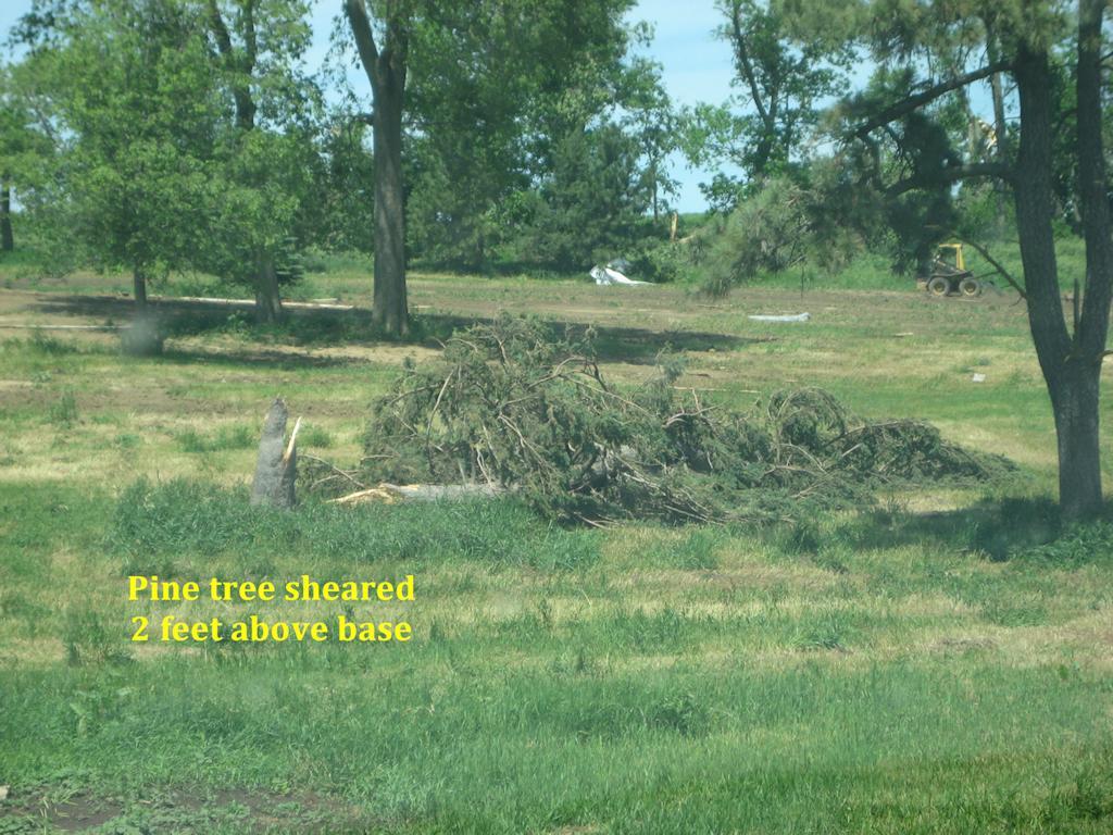
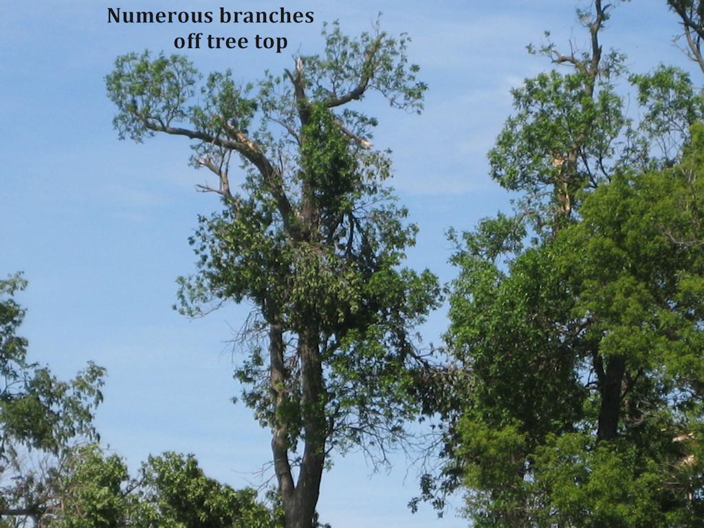
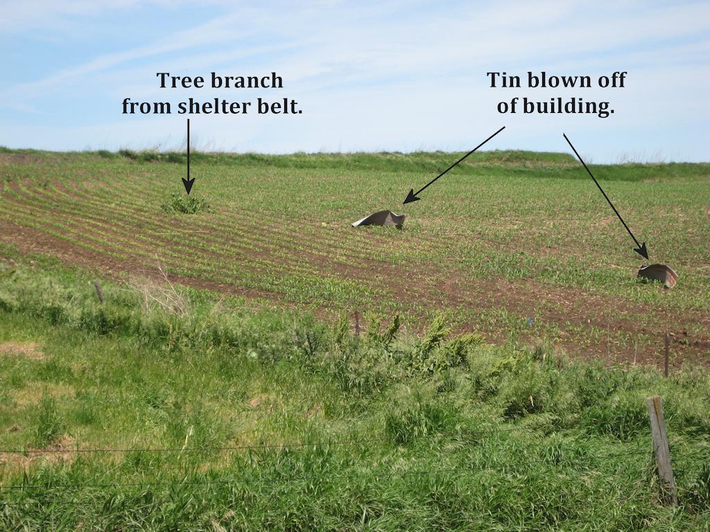
8. One pine tree down approximately one foot in diameter and large branches down. There were also two large trees down in the shelter belt that were 1 to 2 feet in diameter. Several trees had damage at their top, and there was corrugated tin across the field on both sides of the road. Estimated wind speed 80 to 90 mph.
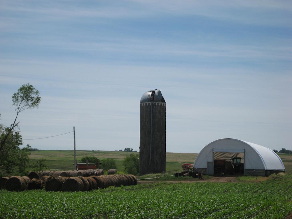
9. A few 2 to 4 inch diameter branches down and damage to the top of a silo. Estimated wind speed 60 to 65 mph.
A - 12 inch diameter tree down and a second 12 inch diameter tree topped . There were also a few large branches down. Estimated wind speed 70 to 75 mph.
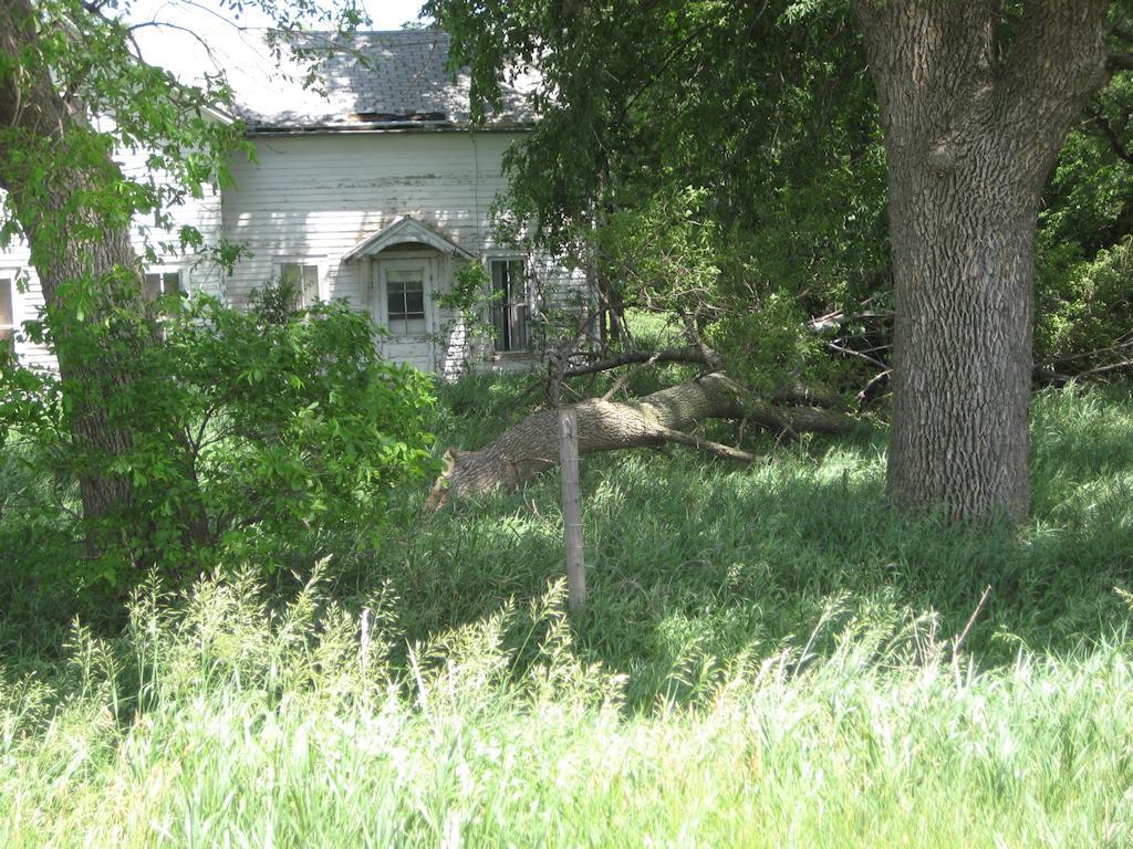
B - 2 to 3 foot diameter tree snapped about 15 to 20 feet above the ground. Numerous 2 to 6 inch diameter branches down and minor damage to the siding on the house from debris. Estimated wind speed 80 to 90 mph.
C - 6 inch diameter branch down. Wind speed estimated at 60 to 65 mph.
Damage around Alcester, South Dakota and Hawarden, Iowa
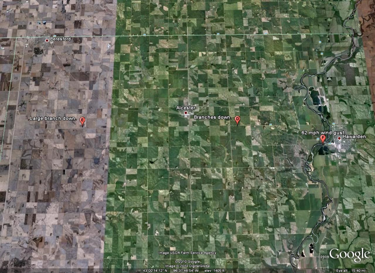
D - Two to three 6 inch branches down. Estimated wind speed 60 mph.
E - 8 to 12 inch diameter branch down. Estimated wind speed 60 to 65 mph.
F - 62 mph wind gust measured by Hawarden Civil Defense.


 Weather Story
 Weather Map
 Local Radar