A line of thunderstorms developed late on Memorial Day along a cold front that was shifting east through the region. One of the storms along the line intensified as it moved into McCook County in southeast South Dakota, creating a line of damage extending from near Bridgewater to locations north and east of Salem.
Radar
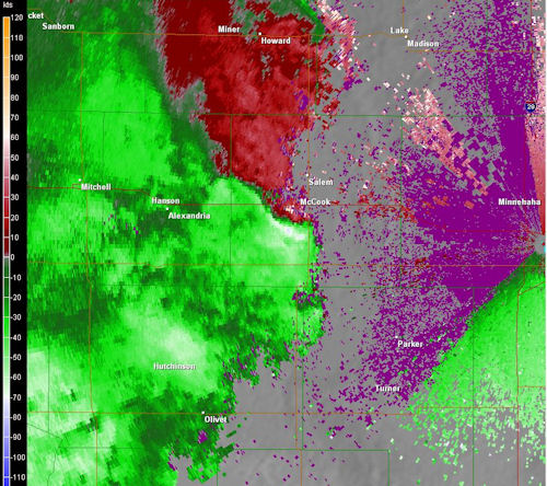
802 PM
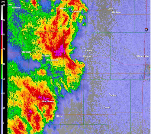
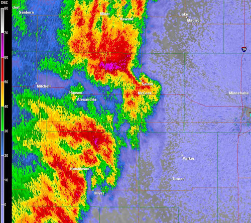
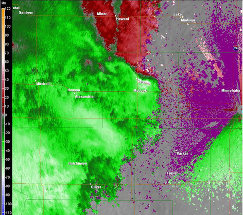
Above is the radar image as the storm was moving into McCook County. Below are the winds that were detected by the radar at the same time (802 pm). In the image, you can see the radar detected strong winds in excess of 65 knots moving towards the radar. This image was taken around the time that strong winds were moving through the community of Bridgewater, producing extensive tree damage throughout the community.
807 pm
Above is the radar image for 807 pm. The storm has continued to pivot off to the northeast towards the Interstate 90 corridor where two campers were pushed into each other at a rest area. A few farmsteads were also damaged as the storm continued to move off to the northeast towards the town of Salem.
Below is the velocity image for the same time. As can be seen from the image, winds in excess of 65 knots were detected along the Interstate 90 corridor.
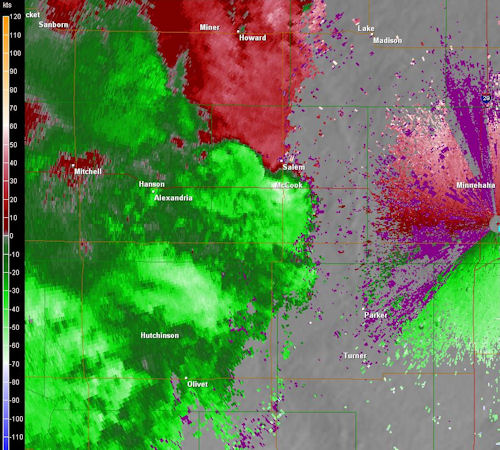
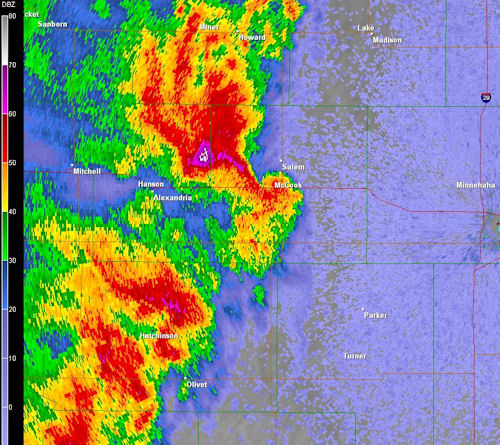
812 pm
Above and below are the reflectivity and velocity images for 812 pm. As the storm continued to move north and east, the core of strongest winds missed the community of Salem just to the east. At least two farmsteads to the east and north of Salem sustained damage to grain bins, silos and out buildings as the storm continued to move north and east.
Damage Photos
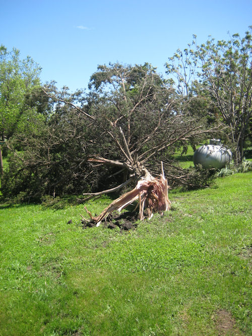
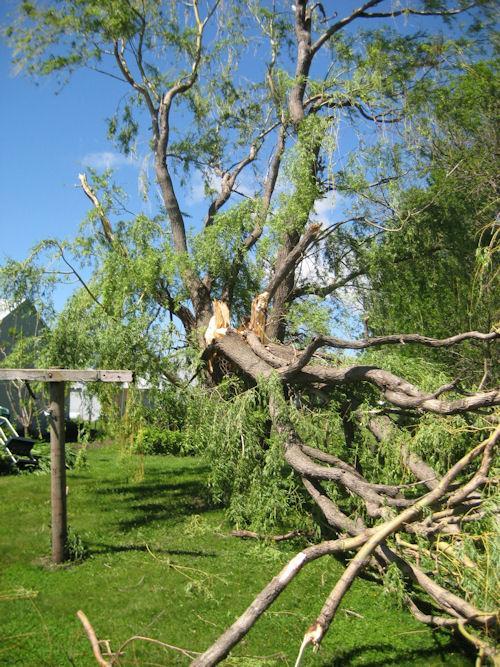
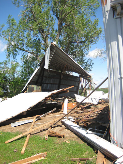
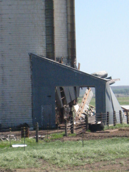
The above images were taken at a residence near Interstate 90, where wind speed were estimated at 80-90 mph. Three pine trees and a willow tree were knocked over by the wind. An open garage with a south facing exposure was destroyed. A silo on the property was also shifted on the south side 6-8 inches, while the north side remained anchored in place. The silo's structure is now bowed.
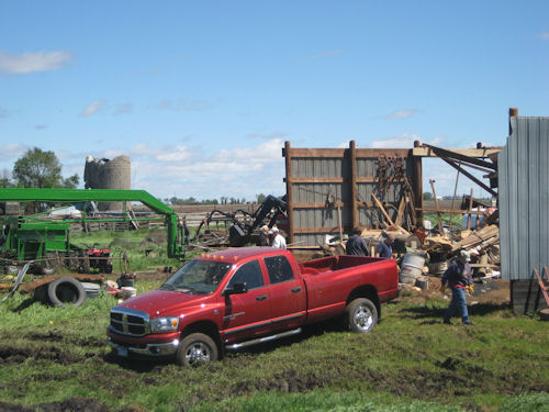
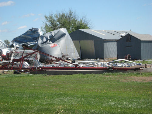
Grain bins, a storage shed and an empty silo were destroyed by the winds as the storm continued to move northeast. Winds were estimated between 80 and 90 mph.
Additional damage occured at another farmstead to the northeast of Salem where five grain bins were destroyed, one of which was lofted over a storage shed and carried approximately 100 yards to the east northeast. The grain bin damaged the roof of the storage shed as it was lofted.
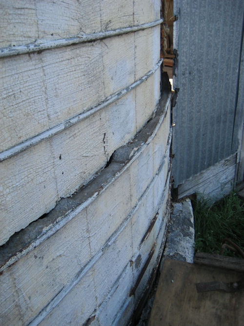
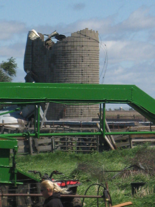
A silo on the property was also shifted approximately four feet from the base, which was also coincident with the height of the silage in the silo. The transfer depot attached to the silo (facing the west) was also severely damaged.


 Weather Story
 Weather Map
 Local Radar