Overview...
Several tornadoes developed as low pressure moved across the Northern Plains states on Friday, October 4, 2013. Details on additional tornadoes from this evening can be found at the link below.
| EF Scale Rating | EF-4 |
| Estimated Peak Wind | 170 mph |
| Path Length in statute miles | 25 |
| Maximum Path Width | 1.5 miles |
| Fatalities | 0 |
| Injuries | 0 |
| Start Date | October 4, 2013 |
| Start Time | 6:35 pm CDT |
| Start Location | 2 miles southwest of Climbing Hill, Woodbury County, Iowa |
| Lat/Lon | 42.332oN 96.110oW |
| End Date | October 4, 2013 |
| End Time | 7:17 pm CDT |
| End Location | 2 miles west of Washta, Cherokee County, Iowa |
| Lat/Lon | 42.582oN 95.762oW |
This violent tornado started 2 miles southwest of Climbing Hill, Iowa, flattening corn crops and snapping tree trunks. As the tornado moved northeast, it intensified and struck a farmstead approximately 5 miles west-northwest of Correctionville, Iowa. Sheds and other buildings were severely damaged or destroyed with the residence being severely damaged. At this point, the tornado continued to increase in both size and magnitude as it continued on its trek northeast. The tornado reached its maximum intesnity 2.5 miles south of Pierson, Iowa, when two farmsteads were struck by this mile wide tornado. Numerous outbuildings and barns were destroyed, with farm equipment being tossed over 400 yards. It was here that the tornado was rated EF-4. The tornado stayed southeast of the town of Pierson, Iowa, and to the west of Washta, Iowa. Before lifting, the tornado produced more tree damage and downed power poles and lines 2 miles west of Washta, Iowa.
EF Scale: The Enhanced Fujita Tornado Scale classifies tornadoes into the following categories:
EF0: Wind speeds 65 to 85 mph
EF1: Wind speeds 86 to 110 mph
EF2: Wind speeds 111 to 135 mph
EF3: Wind speeds 136 to 165 mph
EF4: Wind speeds 166 to 200 mph
EF5: Wind speeds greater than 200 mph
Note: Information in this statement is preliminary and subject to change pending final review of the event and publication in NWS Storm Data.
Map of Pierson, Iowa tornado track
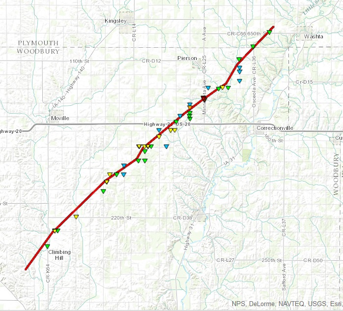
Click on map to download a kmz file that will display this path in Google Earth. If you download the kmz file and import it into Google Earth, each triangle will link to a description of the damage that was observed and may also include photos of the damage..
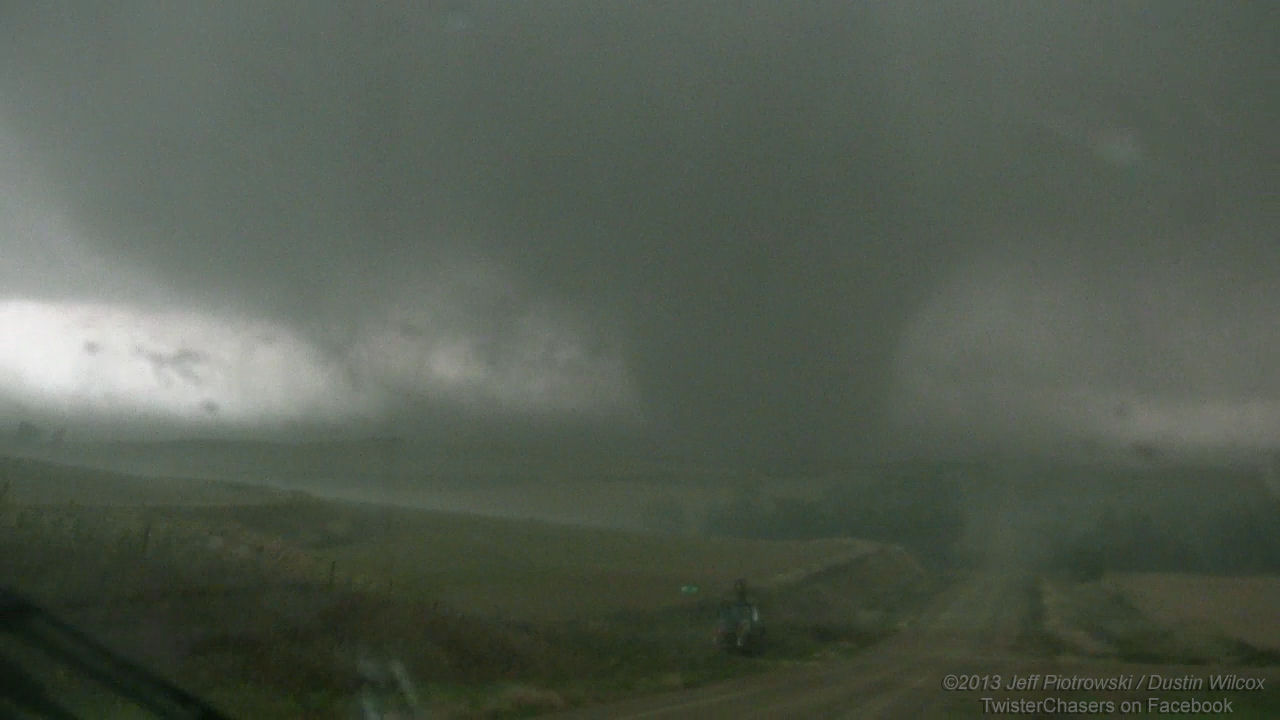
Photo of the tornado when it was approximately 6.5 miles southeast of Moville, Iowa. This photo was taken by Jeff Piotrowski and is reproduced here with his permission. An enlarged version of this photo can be seen by clicking on the photo.
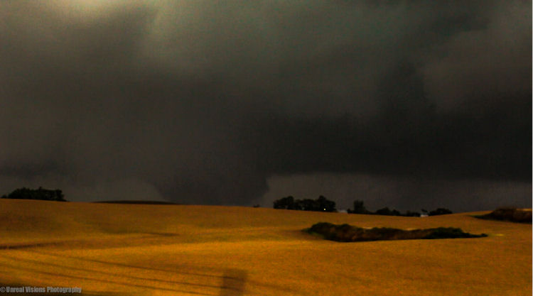
Another photo of the tornado taken when it was southeast of Moville, Iowa. This photo was taken by Ethan Schisler and is reproduced here with his permission.
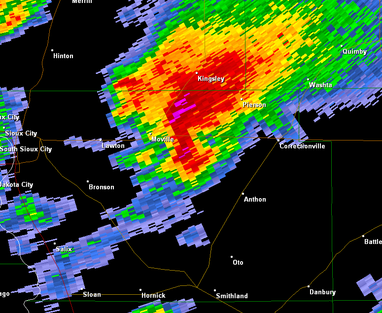
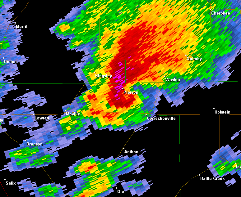
Radar images of the tornadic supercell as it approaches Pierson, IA
|
This radar picture is from 6:54 pm CDT, October 4, 2013. The hook echo southeast of Moville, IA is the approximately location of the tornado at this time. |
This radar picture is from 7:07 pm CDT, October 4, 2013. The tornado was at its strongest at this time with winds estimated at 170 mph south of Pierson Iowa. |
Click on the images for larger versions.
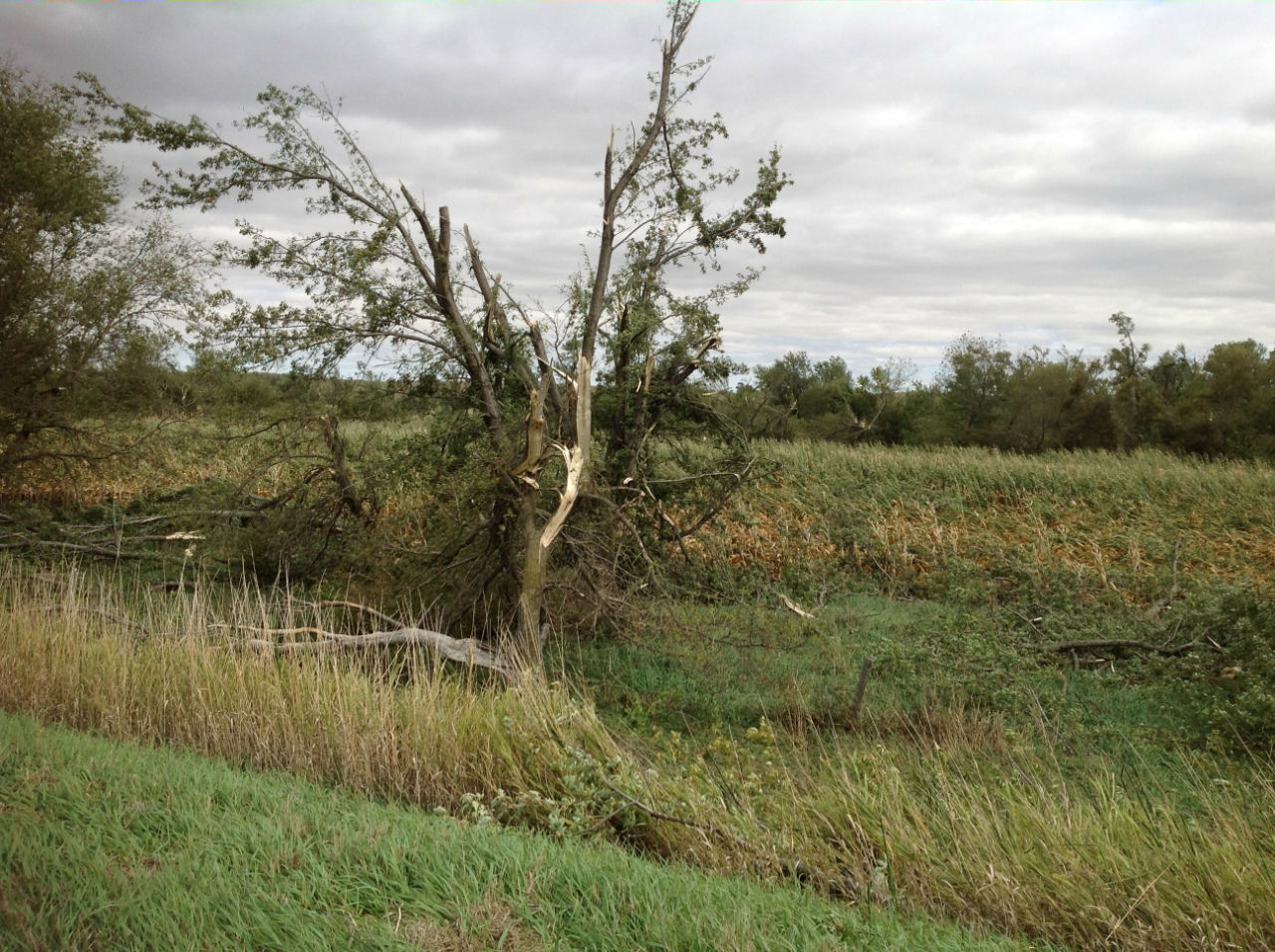
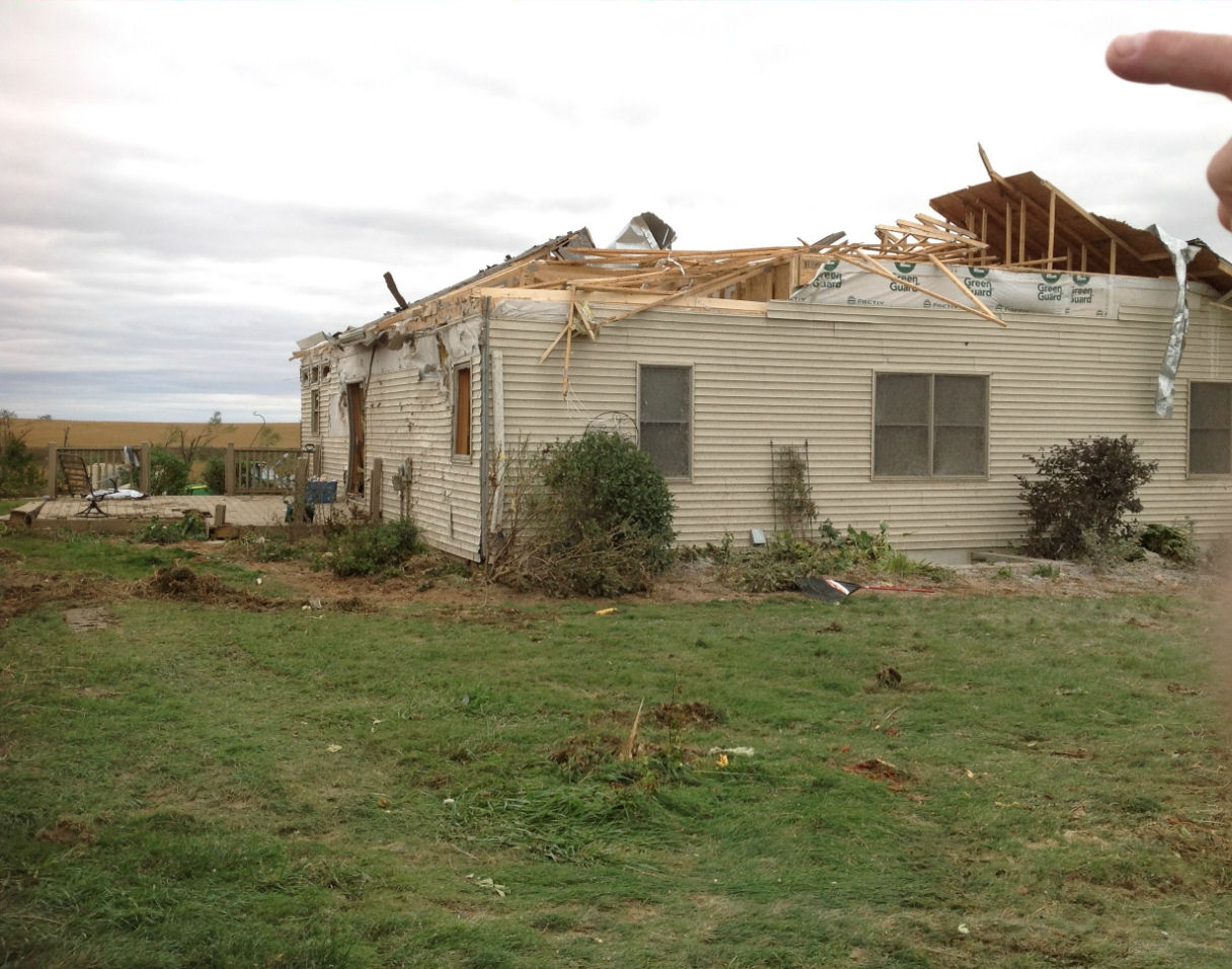
Photos of tornado damage associated with the Pierson, Iowa tornado
|
A large area of damage to trees was found 2 miles north of Climbing Hill, IA with branches down and some trees snapped at the base. The winds were estimated at 100 mph and the tornado was rated EF-1 at this point. |
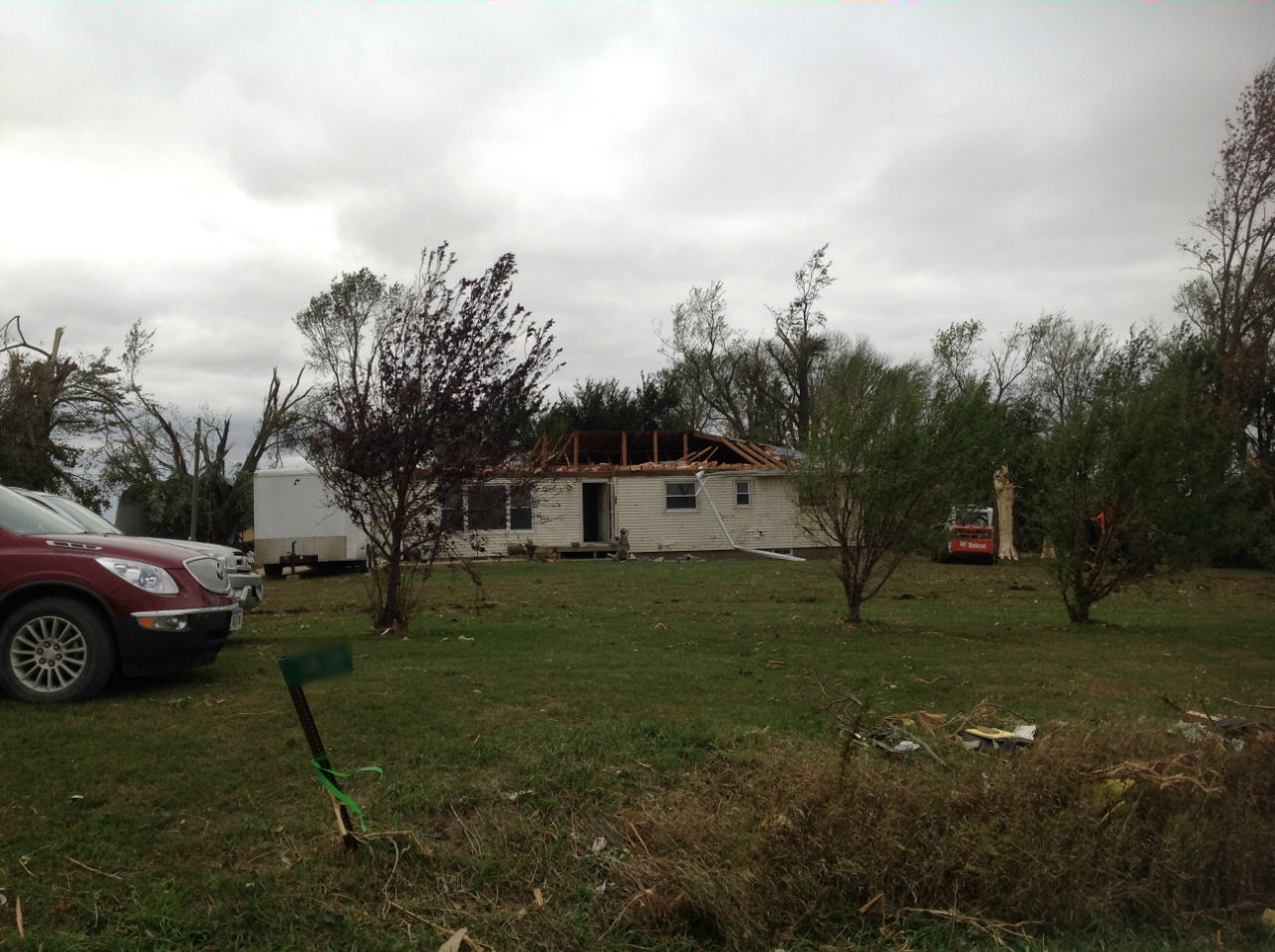
This home, located 6 miles southeast of Moville, IA, lost over half of its roof as the tornado went by to the south of it. The winds were estimated at 135 mph and the tornado was rated EF-2 at this point. |
|
This is the front of the home. The garage was on the right side of the house and was destroyed by the tornado. In addition, several farm buildings and grain bins were destroyed behind the house. Numerous trees were also snapped. |
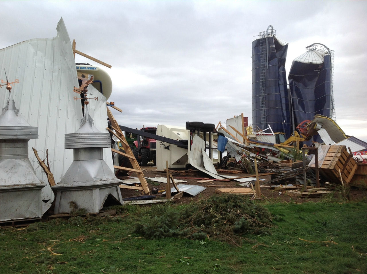
Two silos were significantly damaged and several farm buildings were destroyed 7.5 miles west of Correctionville. Homes on the property had damage to roofs and several trees and branches were also down. Wind speeds were estimated at 120 mph and the tornado was rated EF-2 at this point. |
|
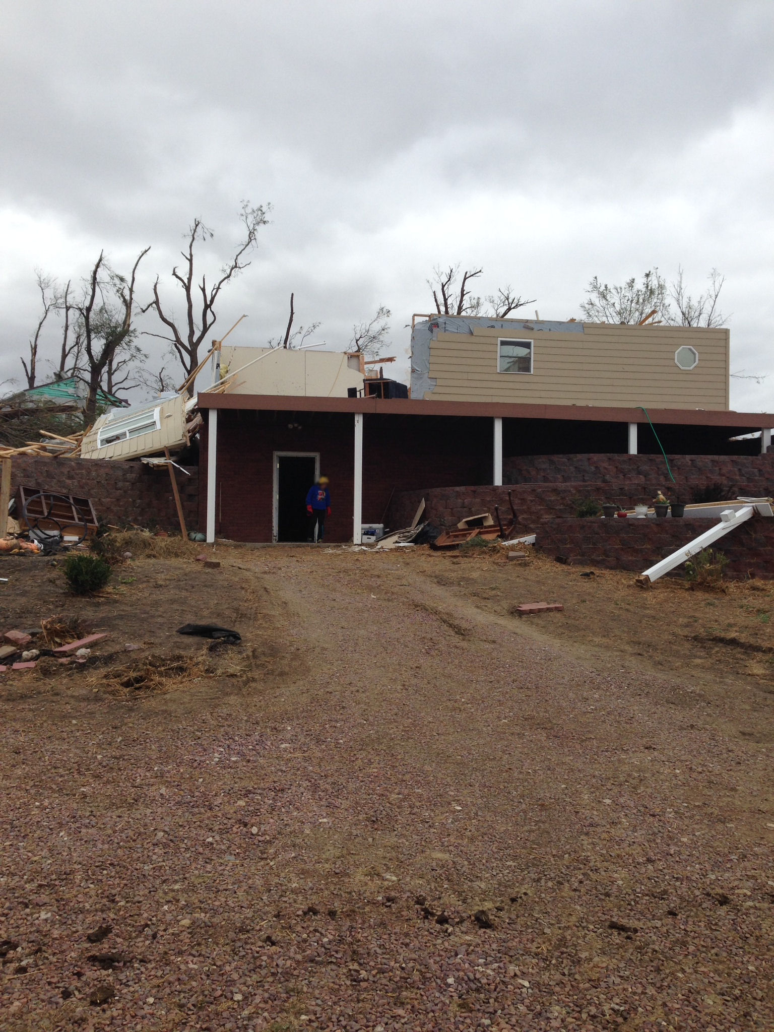
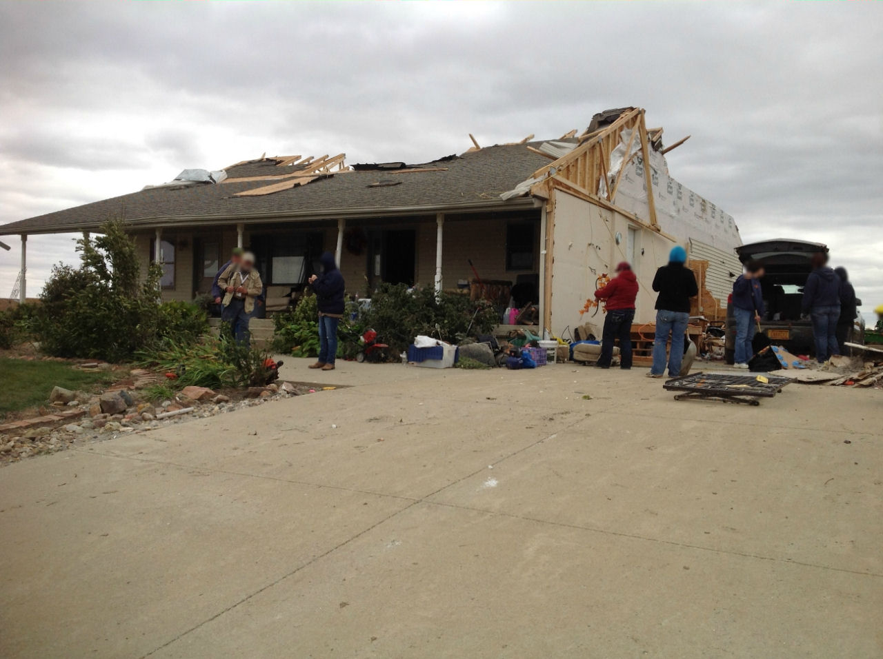
This home, located 7 miles west of Correctionville had its garage destroyed and the roof and outer walls taken off the east side of the house. Several trees were snapped by the tornado as well. This damage occurred about the same time as the damage to the silos above and indicates the tornado was between one-half mile and one mile wide. The winds were estimated at 135 mph and the tornado was rated EF-2 at this point. |
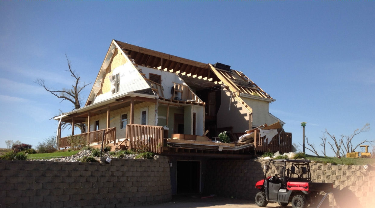
This home, located 3.5 miles south of Pierson, IA, lost most of its roof. In addition, all the outbuildings were destroyed and farm equipment and trailers were tossed, some several hundred feet. The tornado moved across the south portion of the property where most of the farm equipment was located. Winds were estimated at 140 mph and the tornado was rated EF-3 at this point. |
|
This home, 2.5 miles south of Pierson, IA, lost the entire south wall and roof. The foundation was also shifted. All trees were stripped of leaves and most small branches, and most small trees were snapped off near the base. The strongest portion of the tornado went ~400 yards south of here and was at its strongest at this point. Winds at this location were estimated at 160 mph and rated EF-3 at this point. |
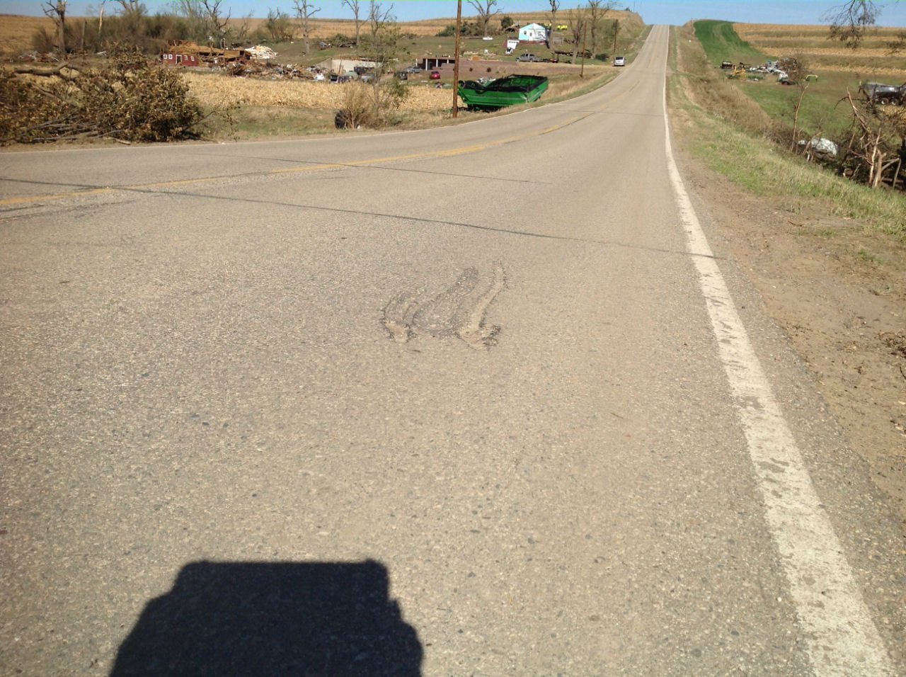
The gouges in the road, seen in the foreground, were caused by a grain wagon (seen in the background) as it was dragged across the road and deposited on the side of the road with its axle and wheels broken off. The wagon was dragged approximately 400 yards by the tornado. |
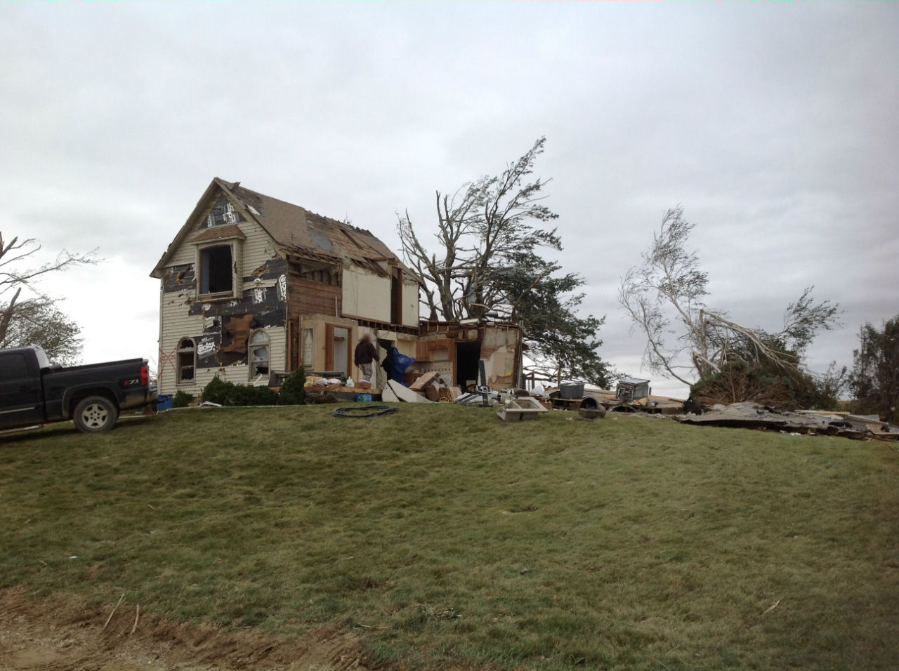
This home, also located 2.5 miles south of Pierson, was destroyed by the tornado. The roof is off the house and the west wall as well as most of the north and wall were taken off. All of the interior walls were also removed from the home. Photo courtesy of Jenny Friedel. |
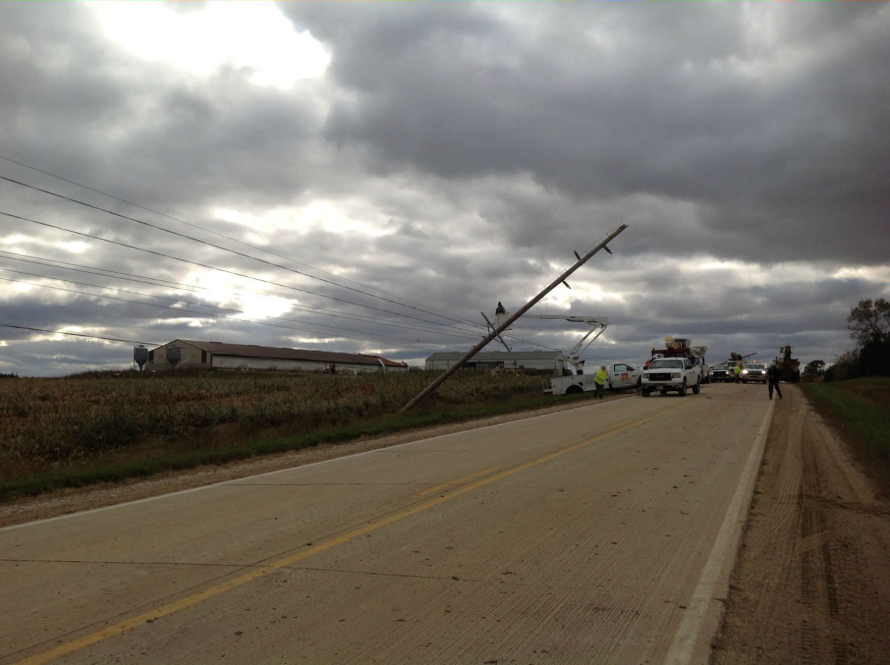
Several power poles were snapped or leaning 3 miles west of Washta, IA. Nearby farm buildings also had damage to roofs from the tornado. The tornado lifted shortly after this time as the storm continued to move northeast. The winds were estimated at 100 mph and the tornado rated EF-1 at this point. |
Click on images for enlarged versions of any photo.


 Weather Story
 Weather Map
 Local Radar