Overview
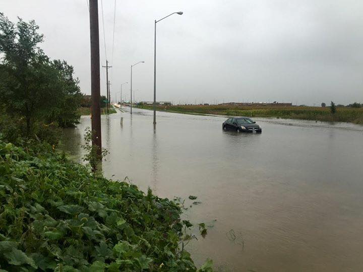
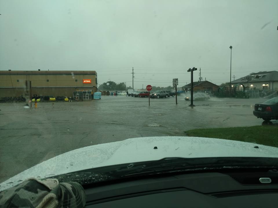
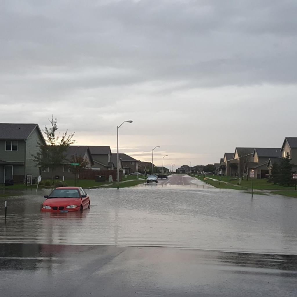
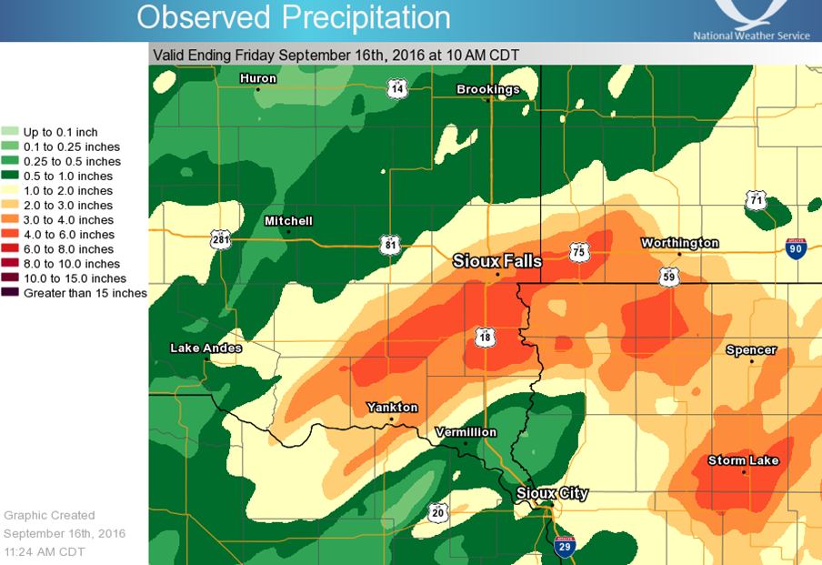
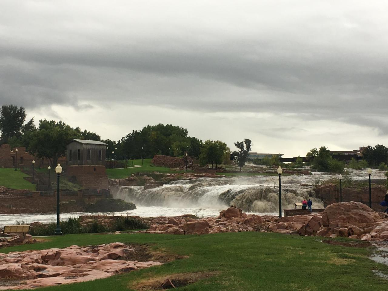
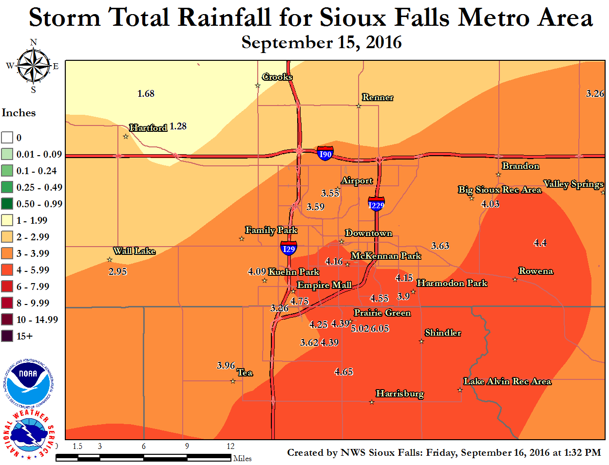
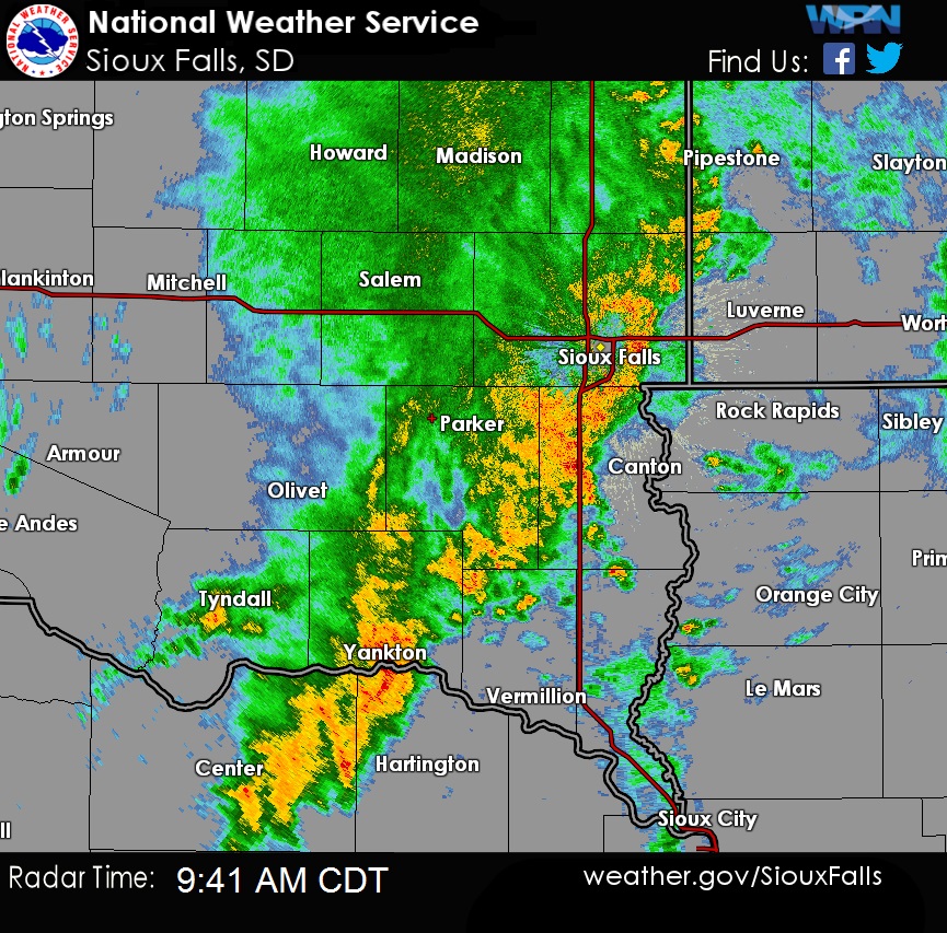
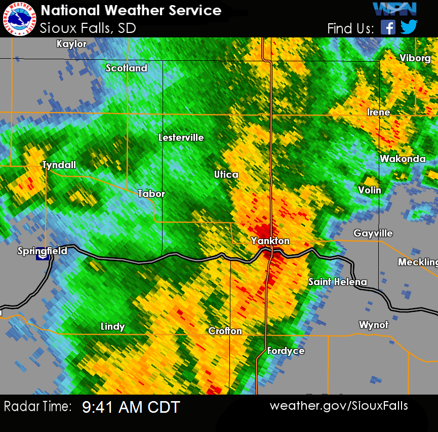
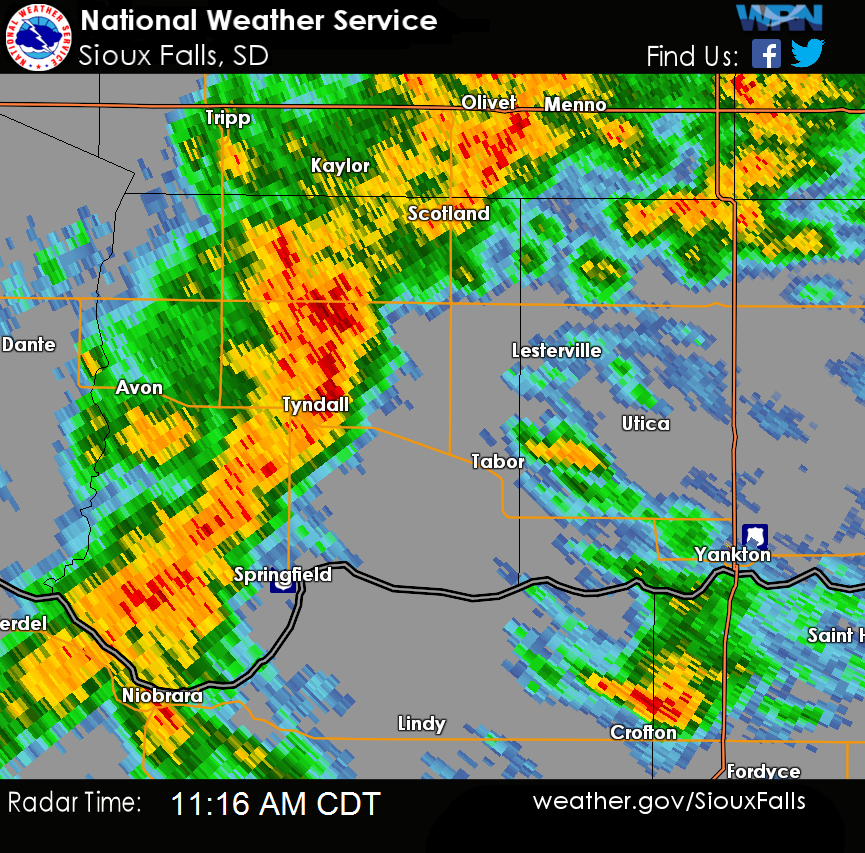
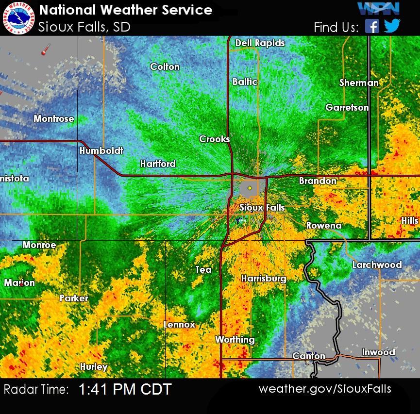
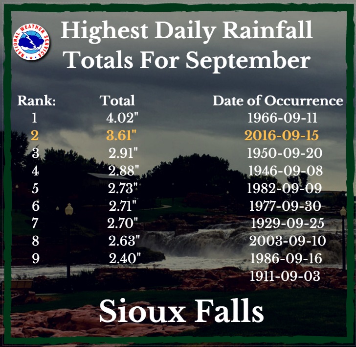
Heavy rainfall fell across portions of southeastern South Dakota into southwestern Minnesota and northwestern Iowa. Up to 6 inches of rain fell in 6 hours producing street flooding in Sioux Falls, Tyndall, and Yankton. This heavy rainfall closed roads in the region, and led to rapid rises in area streams, creeks and rivers.
Photos & Video:
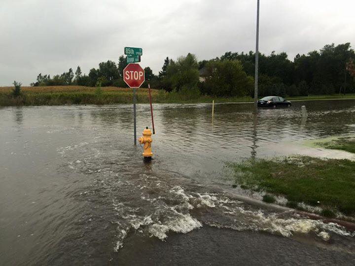
Images From Around the Region
 |
 |
 |
 |
| Photo Near 85th and Grange in Sioux Falls (Kyle Weisser) |
Photo Near 85th and Grange in Sioux Falls (Kyle Weisser) |
Flooding in Sheldon, IA
(Evan De Hoogh) |
Flooding in Tea, SD
(Adrian Hosli) |
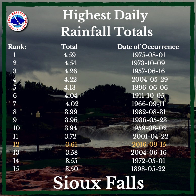
Rain Reports and Historical Records
|
Iowa rainfall reports
Minnesota rainfall reports
Nebraska rainfall reports
South Dakota rainfall reports
Location
|
Amount
|
Iowa
|
| Buena Vista County |
| 2 E Storm Lake |
4.31 in |
| Alta |
4.21 in |
| 2 WSW Lakeside |
3.72 in |
| 4 E Sioux Rapids |
3.12 in |
| Linn Grove |
2.22 in |
| Cherokee County |
| Cherokee |
1.72 in |
| 2 NNE Cleghorn |
1.48 in |
| 4 N Cleghorn |
1.45 in |
| Clay County |
| Everly |
3.36 in |
| 3 WSW Spencer |
2.94 in |
| 3 WNW Everly |
2.84 in |
| Peterson |
2.82 in |
| Spencer Municipal Airport |
2.49 in |
| Dickinson County |
| Spirit Lake |
3.64 in |
| Vicks Corner-spirit Lake Iow |
2.85 in |
| 3 SSE Lake Park |
2.49 in |
| Spirit Lake |
2.21 in |
| Spirit Lake |
1.99 in |
| 3 SSE Lake Park |
1.83 in |
| Lake Park |
0.86 in |
| Ida County |
| Holstein |
1.49 in |
| Lyon County |
| Rock Rapids |
3.73 in |
| Lester |
3.31 in |
| O`Brien County |
| 1 NW Hartley |
5.53 in |
| Sheldon |
4.52 in |
| Osceola County |
| Sibley |
3.88 in |
| Plymouth County |
| Le Mars |
0.96 in |
| Remsen No. 2 |
0.90 in |
| 3 SSW Hinton |
0.73 in |
| 3 SSW Hinton |
0.73 in |
| Millnerville |
0.37 in |
| Sioux County |
| 2 NNW Sioux Center |
2.27 in |
| Orange City |
1.59 in |
| Orange City Airport |
1.26 in |
| Alton |
1.02 in |
| 2 S Orange City |
0.98 in |
| Sioux Center |
0.88 in |
| Woodbury County |
| Sioux City Ang |
0.62 in |
| Sioux Gateway Airport |
0.62 in |
| 3 N Sioux City |
0.60 in |
| Hornick |
0.50 in |
| Holly Springs 1nw |
0.49 in |
| Hiway 77 Bridge |
0.45 in |
Minnesota
|
| Cottonwood County |
| 2 WNW Windom |
0.93 in |
| Windom Muni Airport |
0.81 in |
| Jackson County |
| 7 E Heron Lake |
1.43 in |
| Lakefield |
1.40 in |
| Jackson Airport |
1.03 in |
| Lincoln County |
| 5 E Ivanhoe |
0.95 in |
| 2 W Arco |
0.37 in |
| Tyler |
0.15 in |
| Lyon County |
| Redwood Rvr |
0.84 in |
| Marshall |
0.63 in |
| Marshall 0.6 S |
0.59 in |
| Minneota |
0.57 in |
| Marshall Municipal Airport |
0.56 in |
| Marshall |
0.54 in |
| Marshall |
0.49 in |
| Tracy Airport |
0.39 in |
| Nobles County |
| 4 ESE Worthington |
2.34 in |
| Worthington |
1.87 in |
| Worthington Airport |
1.83 in |
| Pipestone County |
| Edgerton |
1.45 in |
| Pipestone Airport |
0.61 in |
| Pipestone |
0.45 in |
| Pipestone |
0.35 in |
| Rock County |
| Luverne |
3.67 in |
| Rock Rvr |
3.11 in |
| Luverne Airport |
2.32 in |
| Jasper |
1.09 in |
Nebraska
|
| Dakota County |
| 2 SW Hubbard |
0.41 in |
| Hubbard 0.1 NW |
0.38 in |
South Dakota
|
| Aurora County |
| White Lake |
0.65 in |
| Beadle County |
| Hitchcock 7.5 WSW |
0.24 in |
| Huron Regional Airport |
0.19 in |
| Bon Homme County |
| Tyndall |
4.84 in |
| 3 SSE Tabor |
3.60 in |
| 3 S Tabor |
1.72 in |
| ...Brookings County... |
| Aurora 7.5 N |
0.87 in |
| Brookings 0.8 ESE |
0.86 in |
| 1 ESE White |
0.82 in |
| 2 SE Astoria |
0.77 in |
| Brookings |
0.75 in |
| 1 S Brookings |
0.72 in |
| 2 NE Brookings |
0.72 in |
| 5 N Brookings |
0.68 in |
| Volga |
0.61 in |
| 4 ESE Bruce |
0.61 in |
| 3 SW Toronto |
0.55 in |
| Aurora |
0.46 in |
| Bruce |
0.44 in |
| ...Brule County... |
| 1 S Pukwana |
0.11 in |
| Chamberlain |
0.04 in |
| Chamberlain Municipal Airport |
0.01 in |
| Charles Mix County |
| Platte |
0.05 in |
| 1 E Platte |
0.04 in |
| Lake Andes Raws |
0.01 in |
| Clay County |
| 1 ESE Vermillion |
0.14 in |
| Vermillion |
0.14 in |
| 2 N Vermillion |
0.13 in |
| Davison County |
| Mitchell 1 SE |
0.42 in |
| Mitchell |
0.36 in |
| Mitchell Municipal Airport |
0.35 in |
| 6 SSE Mitchell |
0.21 in |
| 2 W Ethan |
0.12 in |
| Mitchell 1.1 N |
0.10 in |
| Douglas County |
| 7 WSW Dimock |
0.33 in |
| 10 W Dimock |
0.04 in |
| Gregory County |
| Burke 10.5 SSE |
0.37 in |
| 7 WNW Naper |
0.18 in |
| Bonesteel |
0.18 in |
| 4 E Gregory |
0.18 in |
| Butte |
0.12 in |
| 8 S Dallas |
0.06 in |
| Hutchinson County |
| 4 SE Olivet |
2.48 in |
| 5 NNW Tripp |
0.35 in |
| Kingsbury County |
| Oldham 0.9 E |
0.88 in |
| De Smet |
0.70 in |
| Lake Preston 10.5 NNE |
0.34 in |
| Arlington 9.0 SSW |
0.04 in |
| Lake County |
| 3 SSW Nunda |
1.04 in |
| Chester 2n |
0.53 in |
| Madison Airport |
0.30 in |
| 2 E Madison |
0.25 in |
| Lincoln County |
| 4 SSE Sioux Falls |
4.98 in |
| Harrisburg 2.5 NW |
4.65 in |
| Sioux Falls 4.5 SSW |
4.25 in |
| Sioux Falls 4.1 SSE |
4.25 in |
| Canton |
4.10 in |
| 3 ENE Lennox |
4.04 in |
| 1 NNW Tea |
3.96 in |
| 3 SSW Sioux Falls |
2.20 in |
| McCook County |
| 5 NW Montrose |
0.92 in |
| Bridgewater |
0.27 in |
| Miner County |
| Howard |
0.74 in |
| Howard 10.3 NNE |
0.68 in |
| Howard 5.3 W |
0.55 in |
| Fedora 10s |
0.10 in |
| 9 NNE Fulton |
0.10 in |
| Minnehaha County |
| 1 NE Rowena |
4.40 in |
| Sioux Falls |
4.16 in |
| 3 ESE Sioux Falls |
4.15 in |
| 4 ESE Sioux Falls |
4.15 in |
| 3 ESE Sioux Falls |
4.11 in |
| Sioux Falls 3ese |
4.11 in |
| 3 W Sioux Falls |
4.09 in |
| 5 SW Sioux Falls |
4.09 in |
| 1 SW Sioux Falls |
4.06 in |
| Sioux Falls 3.4 WSW |
3.91 in |
| 4 SE Sioux Falls |
3.90 in |
| 3 WNW Rowena |
3.73 in |
| Sioux Falls Airport |
3.59 in |
| Sioux Falls Nws |
3.55 in |
| Garretson 4.2 SSE |
3.26 in |
| 3 SW Sioux Falls |
3.26 in |
| 4 NNE Tea |
3.07 in |
| Wall Lake |
2.95 in |
| 1 NE Sioux Falls |
2.70 in |
| Sioux Falls Oak View Library |
2.57 in |
| 4 W Sioux Falls |
2.46 in |
| 3 SSW Sioux Falls |
2.02 in |
| 5 ESE Baltic |
1.84 in |
| 2 NE Crooks |
1.73 in |
| Wall Lake |
1.68 in |
| 2 NNE Hartford |
1.68 in |
| 6 ESE Baltic |
1.25 in |
| 2 SSW Crooks |
1.17 in |
| 2 ENE Hartford |
0.60 in |
| Moody County |
| 5 E Chester |
0.82 in |
| 8 S Brookings |
0.74 in |
| 5 ESE Flandreau |
0.63 in |
| Flandreau |
0.33 in |
| Turner County |
| Hurley |
5.35 in |
| Marion |
2.81 in |
| Marion |
2.75 in |
| 3 NNE Parker |
1.34 in |
| Union County |
| Beresford |
2.15 in |
| 2 W Westfield |
0.17 in |
| Yankton County |
| 2 SE Yankton |
3.23 in |
| 1 W Gayville |
2.92 in |
| Yankton Airport |
2.33 in |
|
|


 Weather Story
 Weather Map
 Local Radar