Overview
|
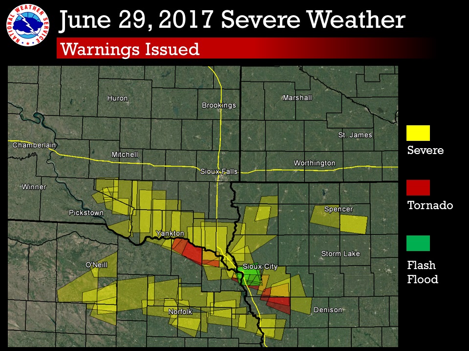
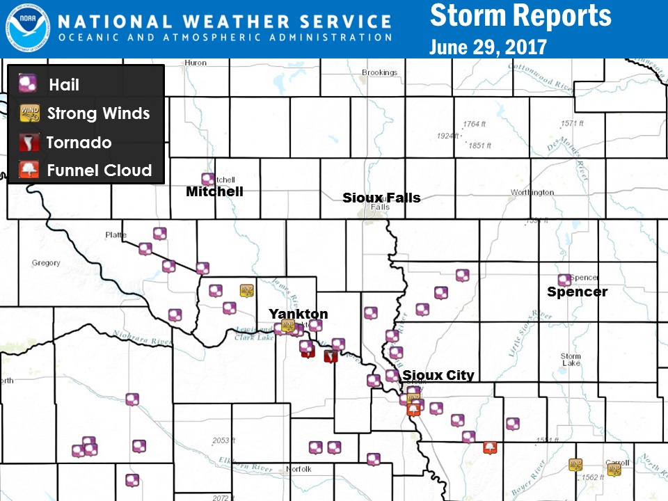
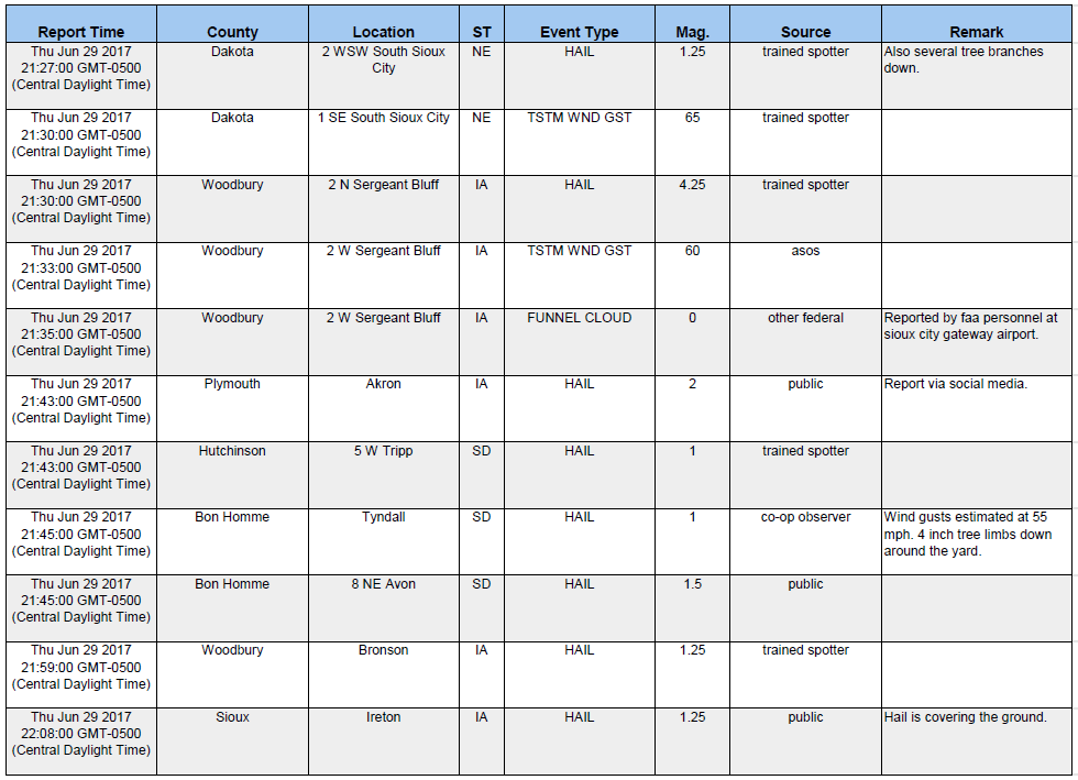
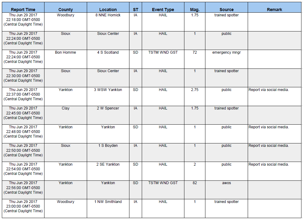
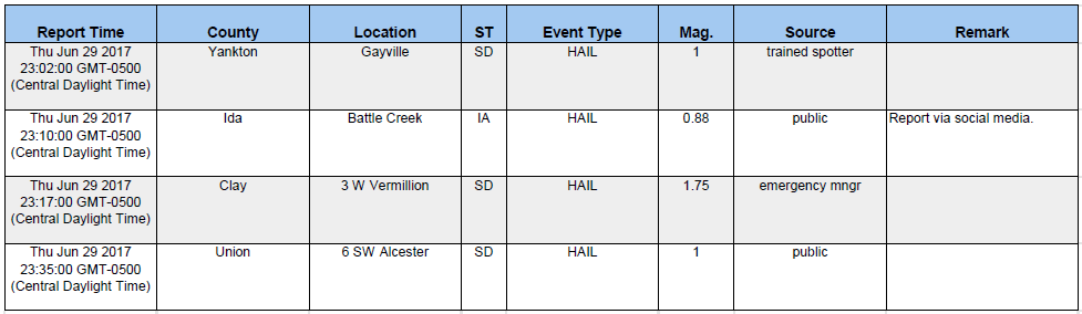
Severe thunderstorms developed along the Missouri River Valley and northwest Iowa during the afternoon of June 29, 2017. These storms produced large hail, damaging winds from 60 to 85 mph. The strongest wind gust was reported at Yankon Airport with 82 mph. The largest hail reported was softball size (4.5") near Sergeant Bluff, Iowa. There were two brief tornadoes south of the Missouri River in Nebraska. Also, funnel clouds were reported around the Sioux City area. |
Photos & Video:
 |
 |
 |
 |
|
Large Hail near Avon, SD (Photo Courtesy of Amanda Gimbel) |
Large Hail near Lewis and Clark State Recreation Area west of Yankton, SD (Photo Courtesy of Linda Anderson) |
Large Hail near Lewis and Clark State Recreational Area west of Yankton, SD (Photo Courtesy of Shayla Barr) |
Large Hail south of Yankton, SD (Photo Courtesy of James Schindler) |
 |
 |
 |
|
All warnings issued by the NWS Sioux Falls, North Platte, Omaha, and Des Moines. |
Storm Structure near Ponca, Nebraska |
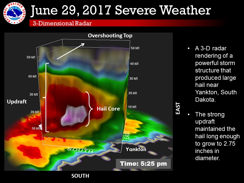
Storm Structure near Yankton, South Dakota |
Radar:
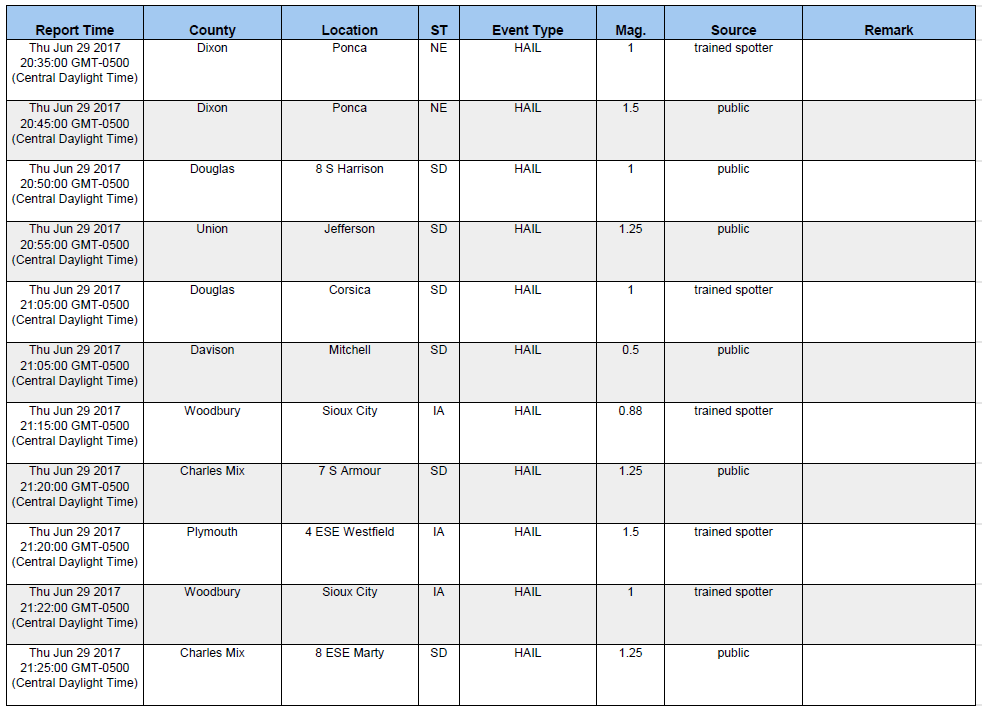
Storm Reports
 |
Media use of NWS Web News Stories is encouraged! Please acknowledge the NWS as the source of any news information accessed from this site. |
|


 Weather Story
 Weather Map
 Local Radar