Overview
A classic early spring weather system brought moderate rain to the region before a band of snow set up primarily over southwest Minnesota.
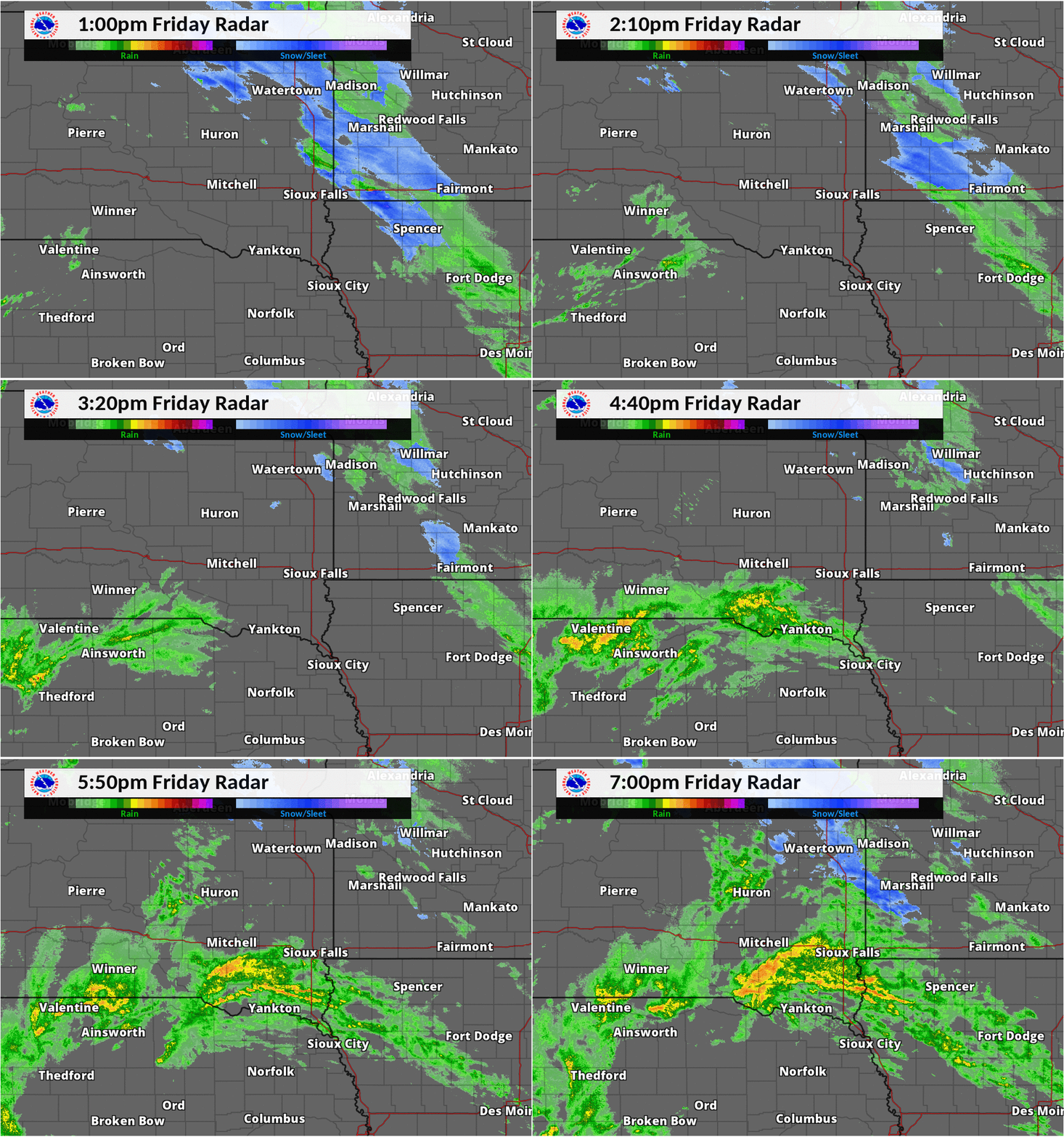
Precipitation began early Friday morning with a mix of freezing rain, sleet and snow. Later in the afternoon hours, a line of moderate to heavy rain quickly developed along the Missouri River Valley, which spread gradually northeast across the area. Widespread rainfall was reported, with isolated thunderstorms and some sleet mixed in. A strong band of snow developed in southwest Minnesota and adjacent areas late in the evening, producing heavy snow, and even thunder snow in some locations.
Highest snowfall amounts were reported east of the I-29 corridor with snow totals ranging from 4 to around 10 inches. Lincoln, Lyon, Murray and Cottonwood counties in Minnesota received the highest snow totals.
Snow:
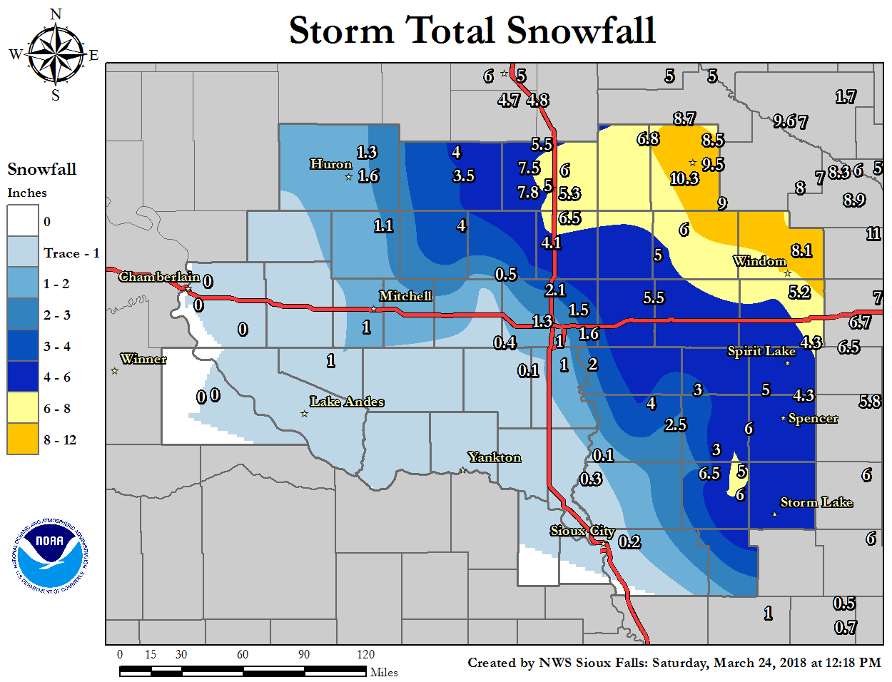
       ...SNOWFALL REPORTS ...

LOCATION                     AMOUNT       TIME/DATE
Marshall                     10.3 in   0836 AM 03/24
Marshall 0.6 S               9.5 in    0700 AM 03/24
4 N Currie                   9.0 in    0744 AM 03/24
Minneota                     8.7 in    1121 AM 03/24
Marshall                     8.5 in    0832 AM 03/24
Aurora                       8.5 in    1249 PM 03/24
1 S Brookings                8.2 in    0700 AM 03/24
2 WNW Windom                 8.1 in    0800 AM 03/24
8 S Brookings                7.8 in    0730 AM 03/24
Brookings                    7.5 in    1018 AM 03/24
2 NE Brookings               6.9 in    0800 AM 03/24
Ivanhoe                      6.8 in    0946 AM 03/24
Colman 10.6 N                6.5 in    0830 AM 03/24
3 NE Cherokee                6.5 in    1145 AM 03/24
Brookings                    6.0 in    0700 AM 03/24
Cherokee                     6.0 in    1012 AM 03/24
Sutherland                   6.0 in    1116 AM 03/24
Lake Wilson                  6.0 in    0800 AM 03/24
5 W Bruce                    5.5 in    0800 AM 03/24
Luverne                      5.5 in    0949 AM 03/24
1 SW Brookings               5.3 in    0800 AM 03/24
Lakefield                    5.2 in    0700 AM 03/24
6 ENE Nunda                  5.0 in    0715 AM 03/24
Edgerton                     5.0 in    0730 AM 03/24
3 WNW Everly                 5.0 in    0700 AM 03/24
Cherokee                     5.0 in    0800 AM 03/24
Spirit Lake                  4.3 in    0700 AM 03/24
Spencer                      4.3 in    0737 AM 03/24
Chester 2n                   4.1 in    0700 AM 03/24
1 W De Smet                  4.0 in    0700 AM 03/24
Howard                       4.0 in    0630 AM 03/24
2 NNW Sioux Center           4.0 in    0700 AM 03/24
De Smet                      3.5 in    0700 AM 03/24
4 N Cleghorn                 3.0 in    0600 AM 03/24
Sheldon                      3.0 in    0700 AM 03/24
Orange City                  2.5 in    0700 AM 03/24
2 NE Crooks                  2.1 in    0700 AM 03/24
Canton                       2.0 in    0700 AM 03/24
3 SSW Arthur                 2.0 in    0728 AM 03/24
3 SSE Lake Park              2.0 in    0700 AM 03/24
Sioux Falls 3ese             1.7 in    0700 AM 03/24
3 ESE Sioux Falls            1.7 in    0700 AM 03/24
4 ESE Sioux Falls            1.6 in    0800 AM 03/24
3 ESE Sioux Falls            1.6 in    0800 AM 03/24
1 S Huron                    1.6 in    0700 AM 03/24
Sioux Falls NWS              1.5 in    1100 AM 03/24
Huron Regional Airport       1.3 in    0655 AM 03/24
Wall Lake                    1.3 in    0800 AM 03/24
Forestburg                   1.1 in    0700 AM 03/24
Armour 4.6 W                 1.0 in    0700 AM 03/24
1 SE Tea                     1.0 in    0913 AM 03/24
3 SW Sioux Falls             1.0 in    0700 AM 03/24
10 W Dimock                  1.0 in    0800 AM 03/24
5 NW Montrose                0.5 in    0700 AM 03/24
Marion                       0.4 in    0700 AM 03/24
Marion                       0.4 in    0700 AM 03/24
2 W Westfield                0.3 in    0900 AM 03/24
Sioux Gateway Airport        0.2 in    0652 AM 03/24
Hurley                       0.1 in    0600 AM 03/24
Akron                        0.1 in    0700 AM 03/24

Observations are collected from a variety of sources with varying
equipment and exposures. We thank all volunteer weather observers
for their dedication. Not all data listed are considered official.

$$
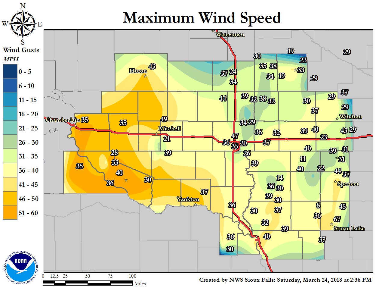
Wind:
Photos & Video:
 |
 |
 |
 |
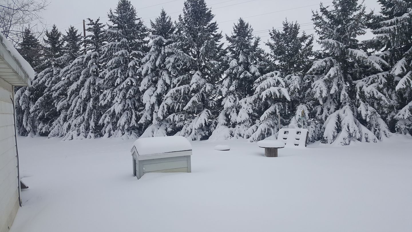
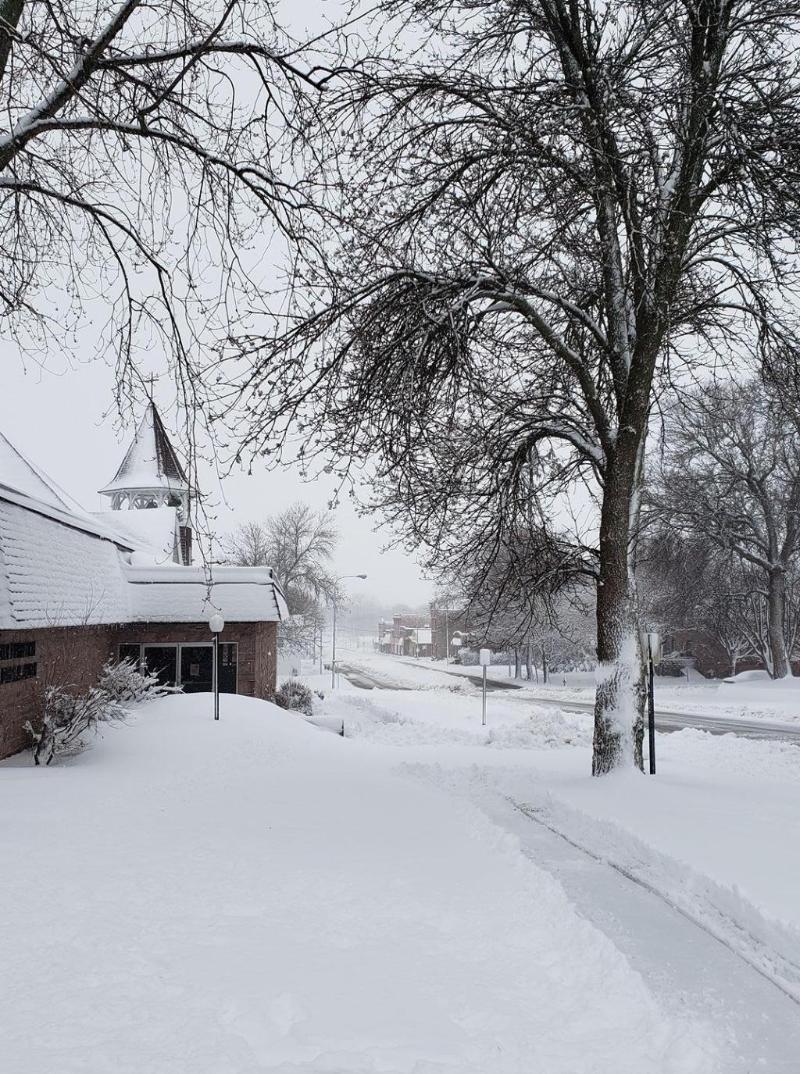
| Marshall, MN received 10 to 11 inches of snow. Highest snowfall amounts reported across the forecast area. (Credit: Joshua S. Smith) |
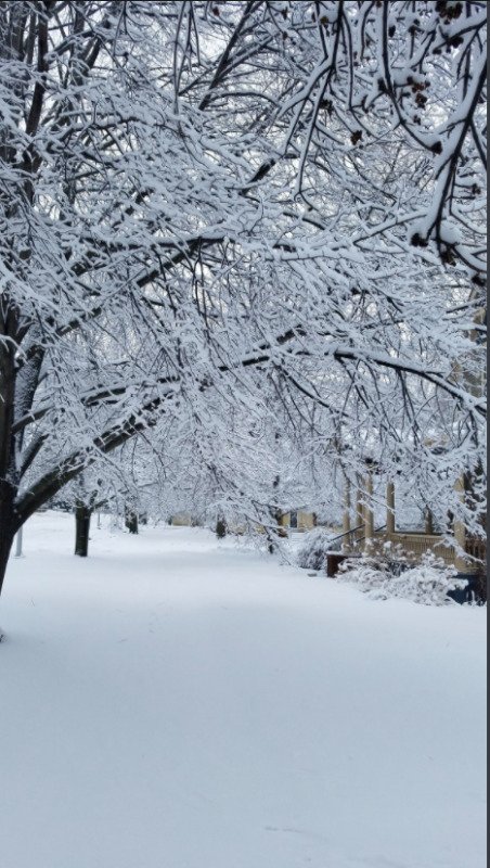
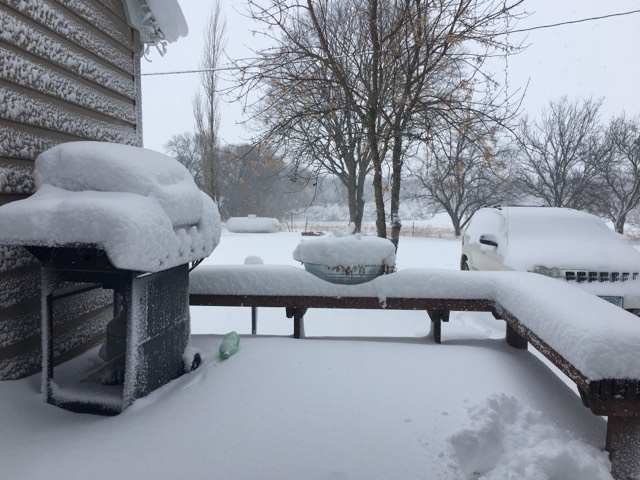
Madison, SD received around 5.5 inches of snow. (Credit: Rogue Storm Chasers) |
Photo from Jasper, MN where 5 to 7 inches of snow were reported (Credit: Tammy Wohlwend Thompson) |
Photo of 6 to 8 inches of snow northwest of Bruce, SD (Credit: Travis Koropatnicki) |
|
| Marshall, MN received 10 to 11 inches of snow. Highest snowfall amounts reported across the forecast area. (Credit: Joshua S. Smith) |
Radar:
 |
 |
 |
 |
|
Hourly Radar Loop 10 am Friday to 12pm Saturday |
Precipitation Type - Radar Loop Friday Afternoon |
Precipitation Type - Radar Loop Friday Evening |
Precipitation Type - Radar Loop Saturday Morning |
Environment
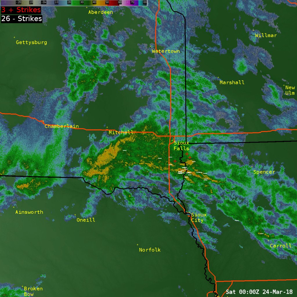
A strong upper level wave from the Rockies moved east across Nebraska, then northeastward across the region Friday evening into Saturday morning. This wave brought a strong warm front in the middle levels of the atmosphere with helped to provide sufficient lift/forcing. This resulted in isolated thunderstorms and enhanced snow rates. Thunder snow was reported across southwest Minnesota early in the morning hours.
 |
 |
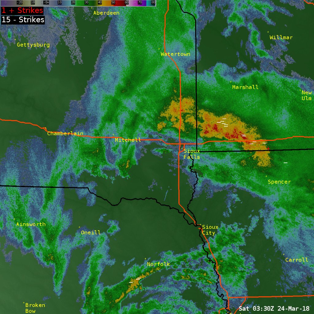 |
| Radar loop showing lightning strikes within the heaviest rainfall/reflectivity values. (Lightning Data courtesy of Earth Networks Total Lightning Network) |
Isolated thunderstorms developing south of Sioux Falls area (Lightning Data courtesy of Earth Networks Total Lightning Network) |
Lightning strikes in southwest Minnesota Friday evening during transition to heavy snow. (Lightning Data courtesy of Earth Networks Total Lightning Network) |
SPC Convective Outlook and Mesoscale Analysis
 |
 |
|
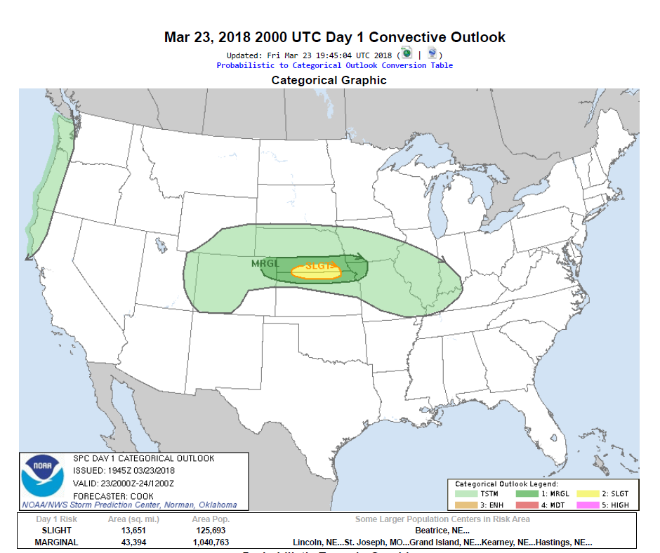
Day 1 Convective Outlook from NWS Storm Prediction Center showing parts of the CWA under the general thunderstorm area |
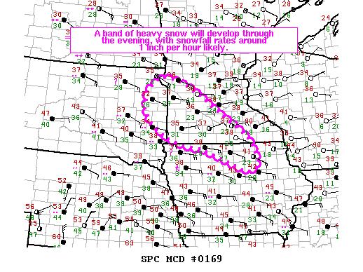
Mesoscale Discussion from NWS Storm Prediction Center regarding the potential for heavy snow |
 |
Media use of NWS Web News Stories is encouraged! Please acknowledge the NWS as the source of any news information accessed from this site. |
|



 Weather Story
 Weather Map
 Local Radar
 Follow us on X
 Follow us on Facebook
 Follow us on YouTube
 FSD RSS Feed