Overview
|
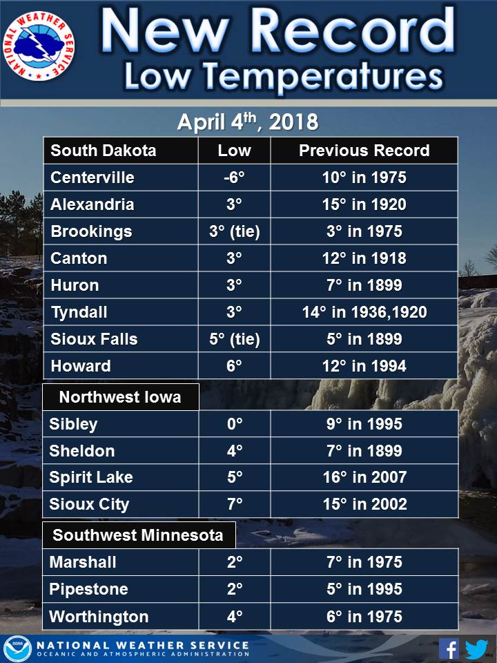
A broad area of snow moved across the area April 2-3, with an embedded heavier band that affected parts of extreme southeast South Dakota and northwest Iowa. Snowfall amounts were generally 2 to 5 inches, with amounts of 5 to 8 inches within the heavier band. Gusty north winds drew unseasonably cold air into the region behind the snow, allowing for numerous record low temperatures on the morning of April 4, 2018. |
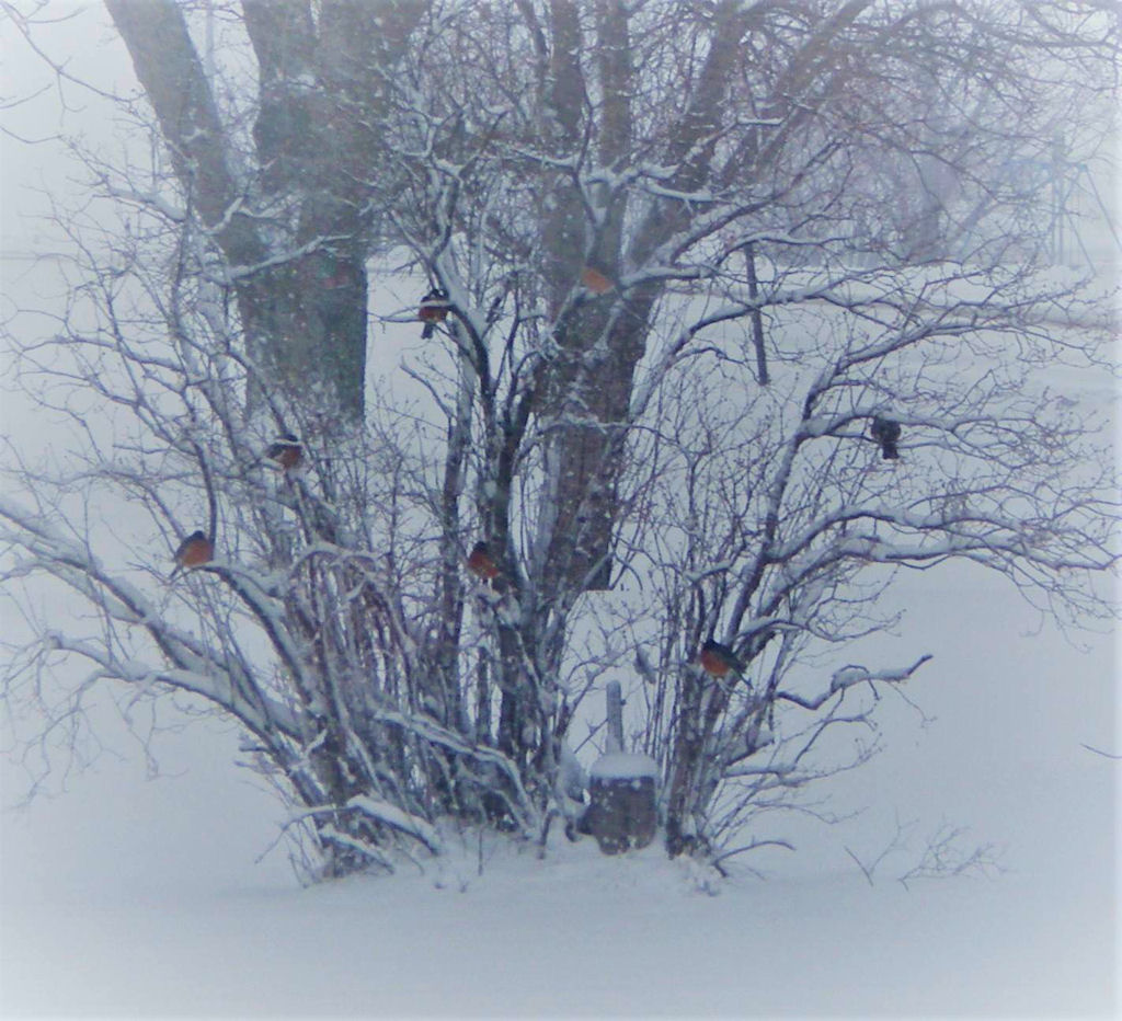 Robins wait out the snow in Round Lake, MN (photo courtesy of Ida Reimer) |
Snow/Ice
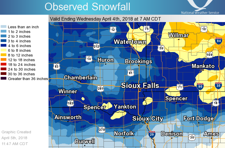
...Snowfall Reports...

Location                     Amount
1 ESE Spirit Lake            8.5 in
1 N Yankton                  8.0 in
6 SSE Centerville            7.0 in
Wakonda                      7.0 in
Rock Valley                  7.0 in
3 ESE Sioux Falls            6.3 in
4 NNE Sibley                 6.0 in
Parker                       6.0 in
Lake Park                    6.0 in
Sibley                       6.0 in
3 N Sioux Falls              5.9 in
Marion                       5.7 in
Tabor                        5.5 in
4 N Currie                   5.5 in
Minneota                     5.5 in
Tyndall                      5.2 in
Jackson                      5.0 in
3 ENE Dante                  5.0 in
1 NNW Marshall               5.0 in
Hills                        4.9 in
4 SW Sioux Falls             4.8 in
1 NW Canton                  4.7 in
4 SW Burke                   4.6 in
1 E Wall Lake                4.5 in
Lake Wilson                  4.5 in
3 NW Windom                  4.3 in
2 N Chester                  4.1 in
Bridgewater                  4.0 in
13 WNW Platte                4.0 in
Sheldon                      4.0 in
6 NNE Elk Point              3.8 in
9 S Dallas                   3.5 in
Orange City                  3.5 in
2 SE Vermillion              3.4 in
5 S Chamberlain              3.2 in
Hurley                       3.2 in
1 S Brookings                2.7 in
1 NE Cherokee                2.5 in
2 WSW Garretson              2.5 in
Alexandria                   2.5 in
De Smet                      2.5 in
1 NNE Howard                 2.5 in
Clayton                      2.5 in
Huron-18mi.e                 2.4 in
2 NNW Huron                  2.0 in
7 SSW Chamberlain            1.8 in
White Lake                   1.5 in
1 WSW Sergeant Bluff         1.0 in
3 N Hornick                  1.0 in
10 W Dimock                  0.8 in
1 NE Brookings               0.3 in
Radar & Photos:
Header
 |
 |
 |
 |
| Radar Loop early Tuesday Morning showing heavier snow band across extreme SD & northwest IA |
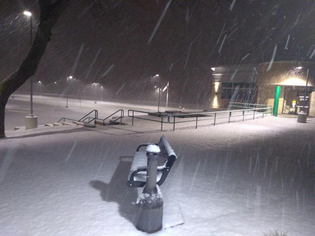
Wet snow falling in Le Mars, Iowa (courtesy of Jason Bonestroo) |
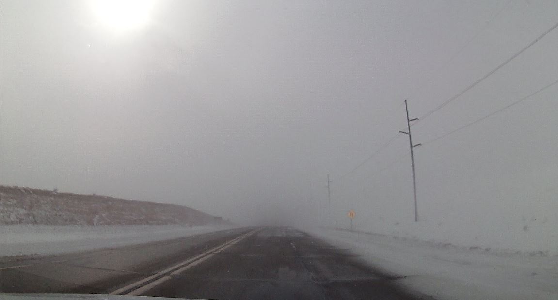
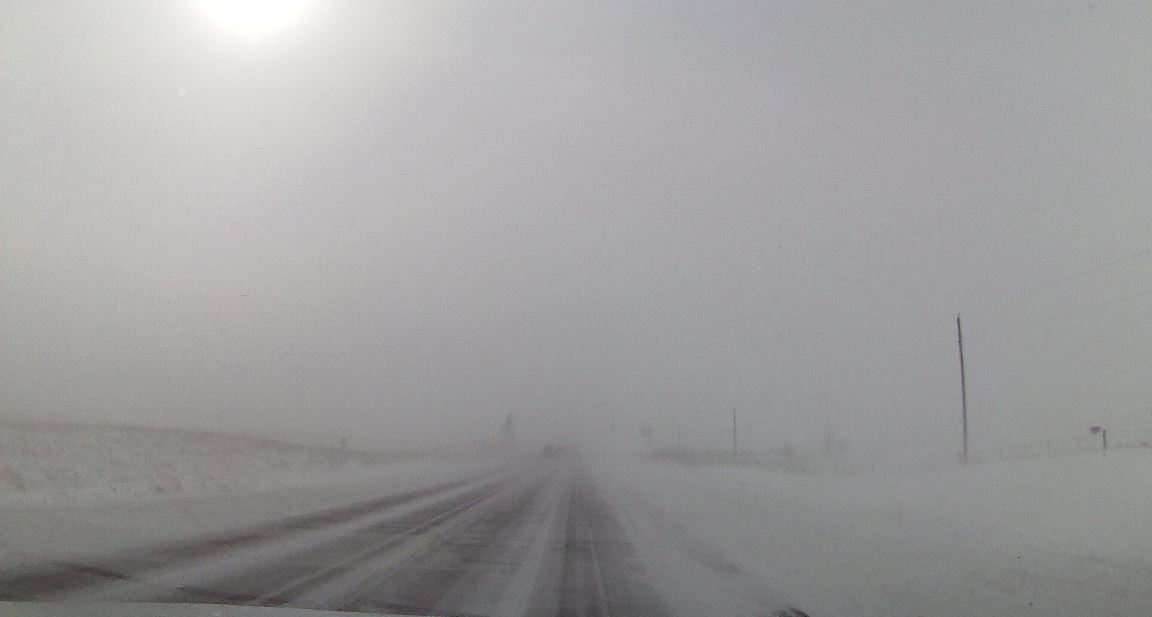
Varying road conditions along Highway 9 between Spirit Lake & Lake Park, IA by late afternoon (courtesy of Dickinson County Emergency Management) |
|
Record Lows
 |
Media use of NWS Web News Stories is encouraged! Please acknowledge the NWS as the source of any news information accessed from this site. |
|


 Weather Story
 Weather Map
 Local Radar