Overview
|
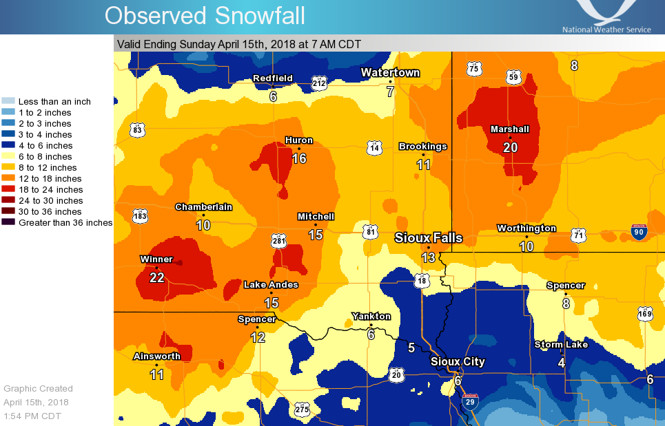
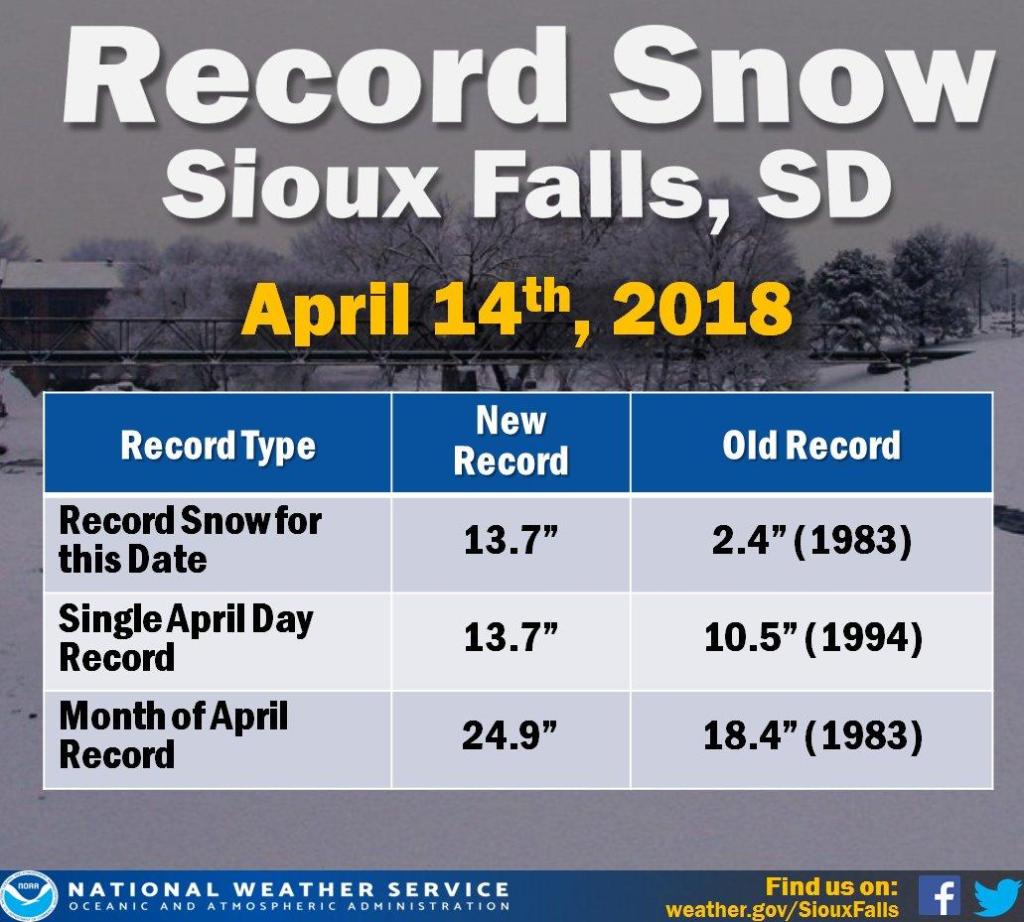
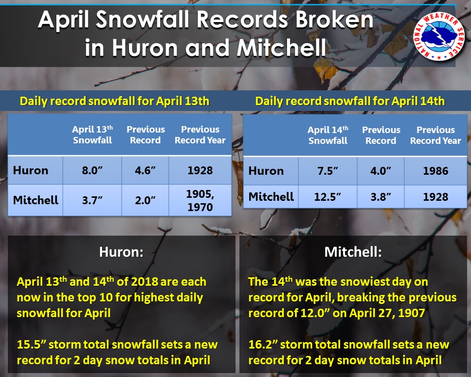
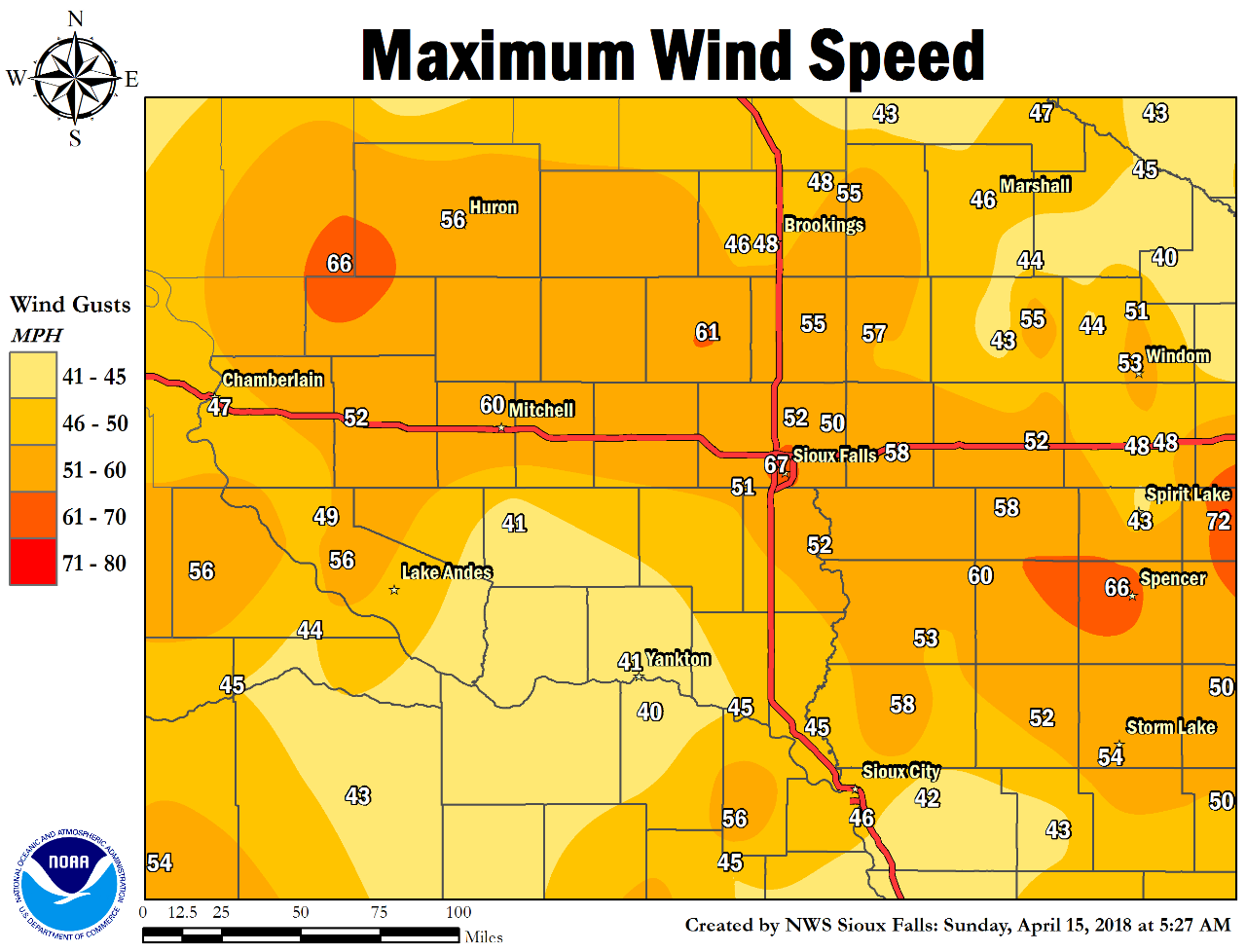
A powerful early Spring storm system brought back Winter with a vengeance on April 14, 2018. The storm unleashed an historic blizzard which produced wind gusts of 45 to 65 MPH along with record-setting snowfall amounts which topped 1 foot in many locations. |
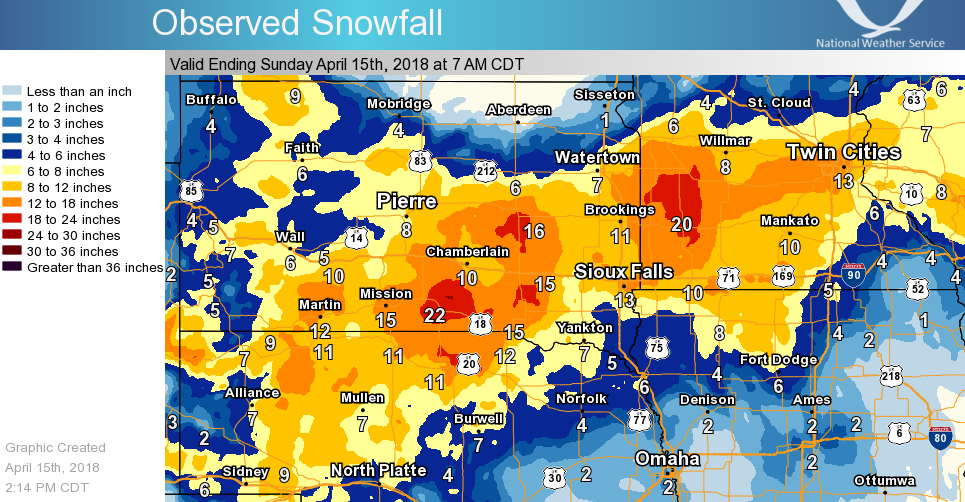 Regional 3-Day snowfall map from the April 13-15, 2018 Blizzard |
 |
 |
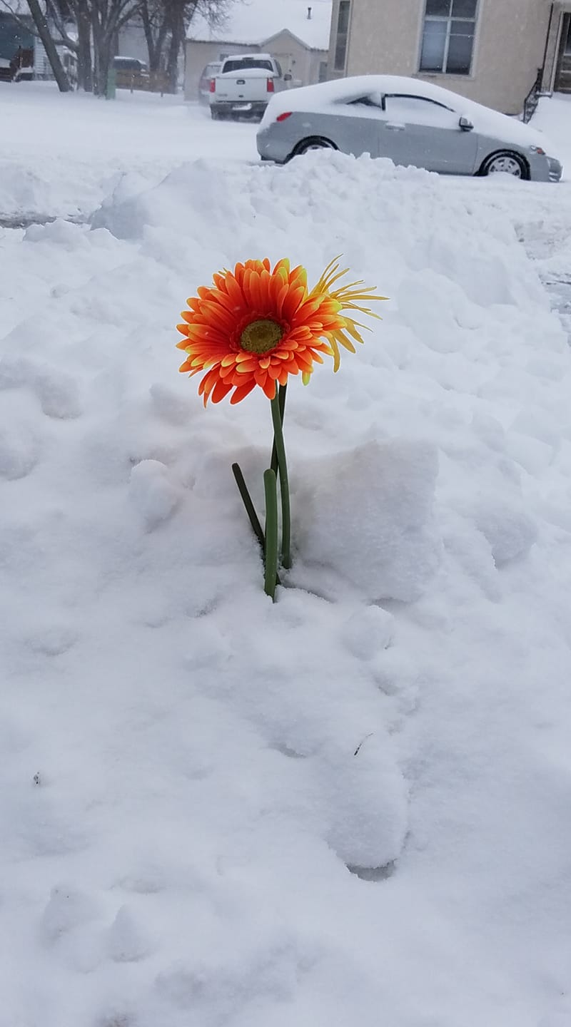 |
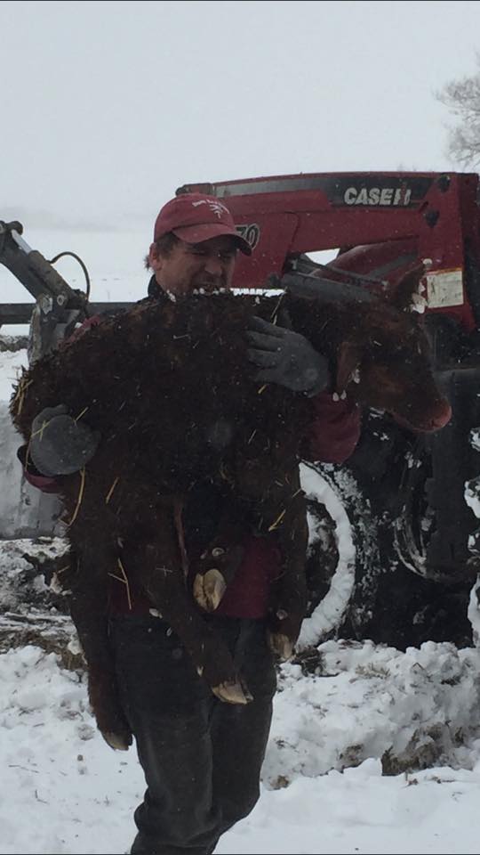
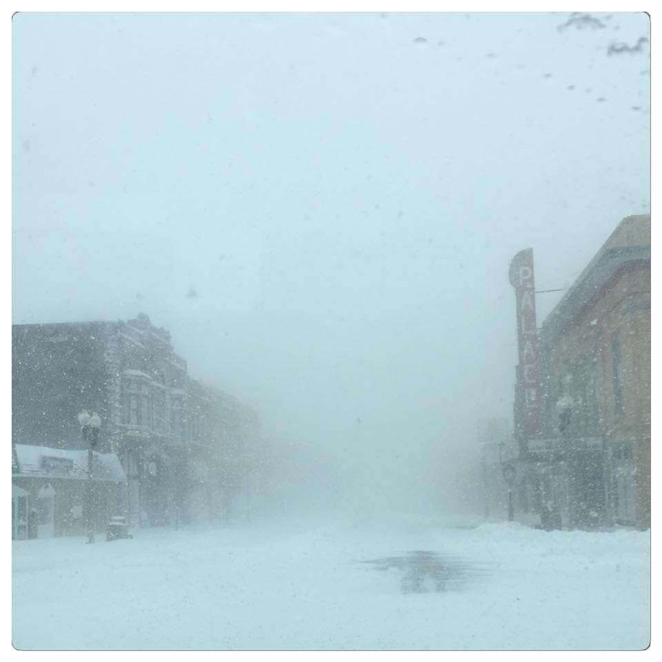
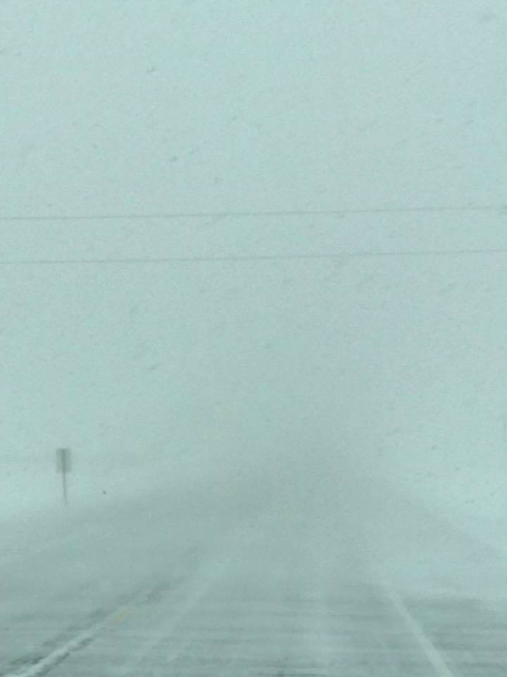
| The blizzard struck during calving season, causing many farmers to go to extreme measures to protect the newborn livestock. (Photo near Lake Andes South Dakota, courtesy of Tabitha Ann) | The fierce winds and heavy snow dropped visibility to near zero, even in towns like Luverne, Minnesota. Imagine what it must have been like in the open country! (Photo courtesy Nikki Marie) | Abby Perez-Cassutt of Mitchell South Dakota found a bright spot on an otherwise dreary day, while cleaning up after the blizzard. |
Snow/Ice
Public Information Statement
National Weather Service Sioux Falls SD
1130 AM CDT Sun Apr 15 2018

...SNOWFALL REPORTS FROM HISTORIC APRIL 2018 BLIZZARD...

Location                     Amount    Time/Date
Lake Wilson                  19.0 in   0800 AM 04/15
Huron 1 NE                   19.0 in   1140 PM 04/14
Marshall 0.6 S               17.8 in   0700 AM 04/15
2 SSW Lynd                   17.5 in   1030 AM 04/15
Lake Benton                  16.9 in   1100 AM 04/15
Mitchell                     16.2 in   1100 PM 04/14
Huron Regional Airport       15.6 in   0655 AM 04/15
1 SE Tea                     15.0 in   0930 AM 04/15
Sioux Falls NWS              14.3 in   0600 AM 04/15
4 SW Burke                   14.1 in   0700 AM 04/15
Madison                      14.0 in   1030 AM 04/15
Minneota                     14.0 in   0900 AM 04/15
Lakefield                    13.4 in   0700 AM 04/15
Chester 2n                   12.7 in   0700 AM 04/15
De Smet                      12.0 in   0700 AM 04/15
8 S Dallas                   12.0 in   0700 AM 04/15
Howard                       11.0 in   0630 AM 04/15
7 WNW Naper                  10.0 in   0700 AM 04/15
White Lake                   10.0 in   0700 AM 04/15
2 WNW Windom                 9.6 in    0800 AM 04/15
Wall Lake                    9.0 in    0800 AM 04/15
Wagner                       8.5 in    1000 AM 04/15
Yankton 2E                   8.0 in    0630 AM 04/15
Spencer Iowa                 8.0 in    0700 AM 04/15
7 NNE Dante                  7.5 in    0945 AM 04/15
5 W Bruce                    7.3 in    0800 AM 04/15
Gayville 1.8 SSW             7.0 in    0700 AM 04/15
1 N Hospers                  6.8 in    1100 AM 04/15
Tyndall                      6.6 in    0800 AM 04/15
Sioux City Ang               6.5 in    0600 AM 04/15
Worthington                  6.5 in    0700 AM 04/15
Sioux City Airport           5.7 in    0700 AM 04/15
Sheldon                      5.0 in    0700 AM 04/15
Storm Lake 1 NW              5.0 in    1030 AM 04/15
Emerson                      4.5 in    0700 AM 04/15
Clayton                      4.5 in    0600 AM 04/15
Remsen                       4.5 in    1000 AM 04/15
1 ESE Vermillion             4.0 in    0700 AM 04/15

Observations are collected from a variety of sources with varying
equipment and exposures. We thank all volunteer weather observers
for their dedication. Not all data listed are considered official.
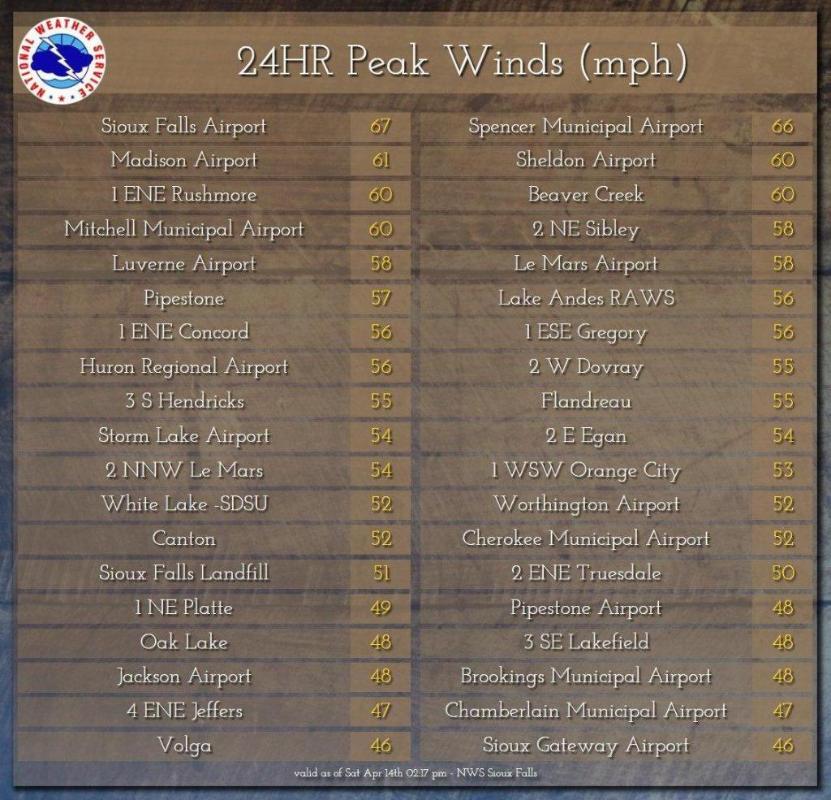
Record Setting Snowfall and Very Strong Winds
Photos & Video:
Thank you to our Facebook Friends for providing these photos. This is just a small sampling of the hundreds of photos we received from this event!
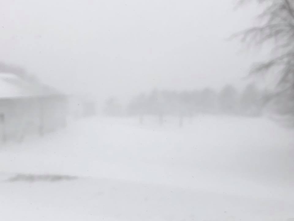
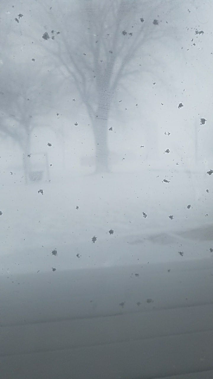
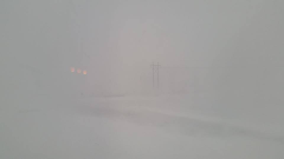
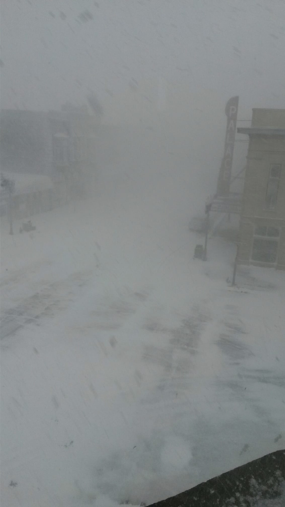
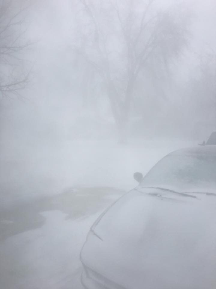
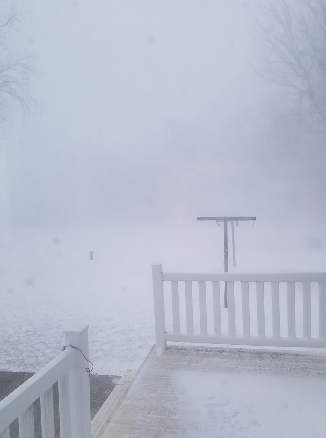
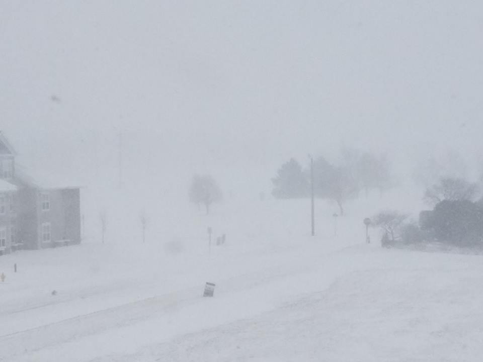
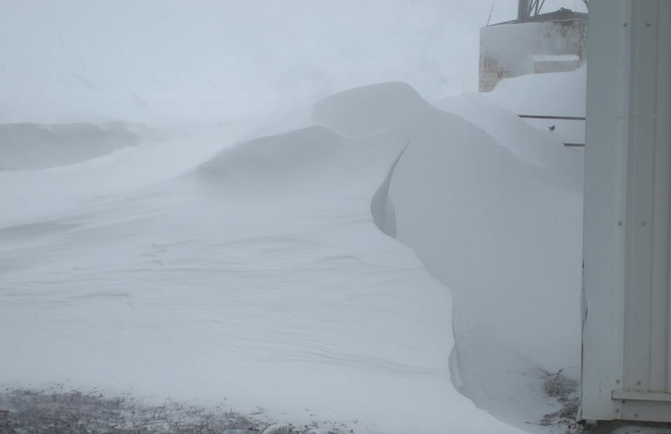
Very Low Visibility During the Blizzard |
|||
 |
 |
 |
 |
|
Chandler, MN -Julie Susan Brossard |
Davis, SD - Danny Pulscher |
EROS Facility - Garretson, SD - Karen Harvey Krietlow |
Luverne, MN - Downtown - Angie Tofteland |
 |
 |
 |
 |
|
Sibley, IA - Rochelle Jacobsma |
Verdi, MN - Jennifer Kronke |
West of Ruthven, IA - Heather Terveer Ruehle |
Yankton, SD - Heidi Harms Henson |
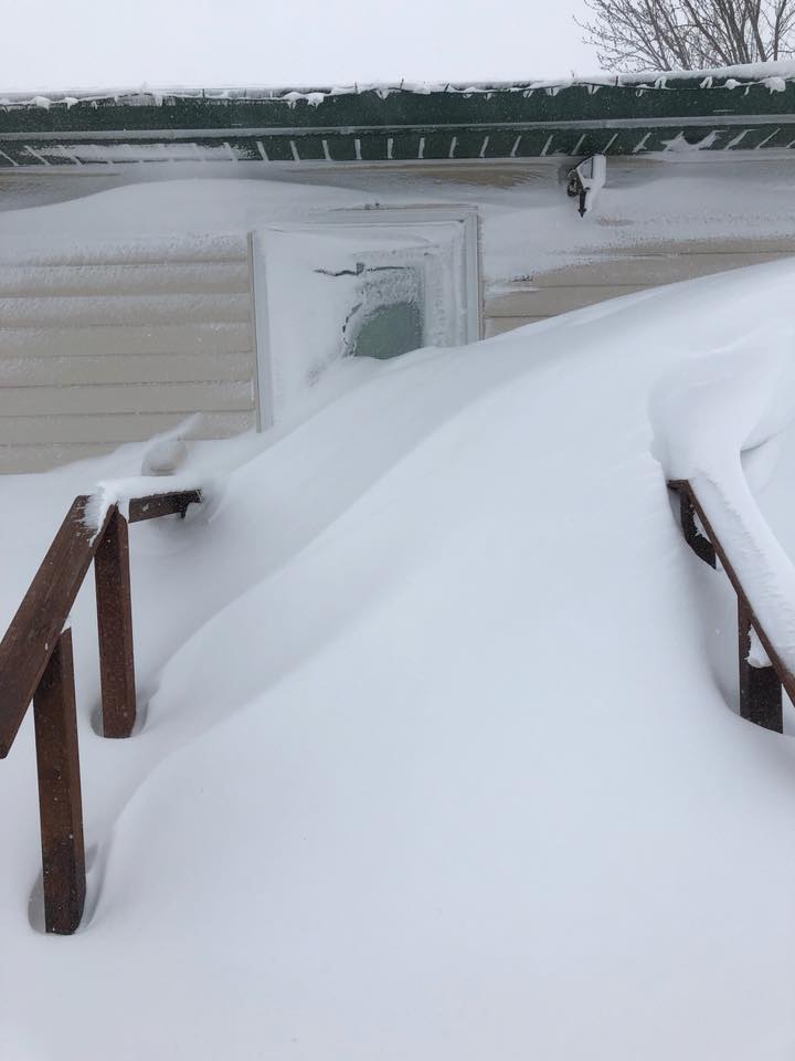
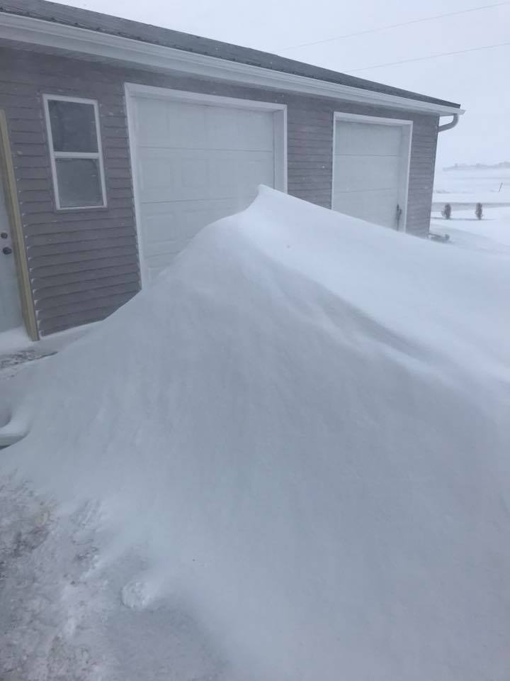
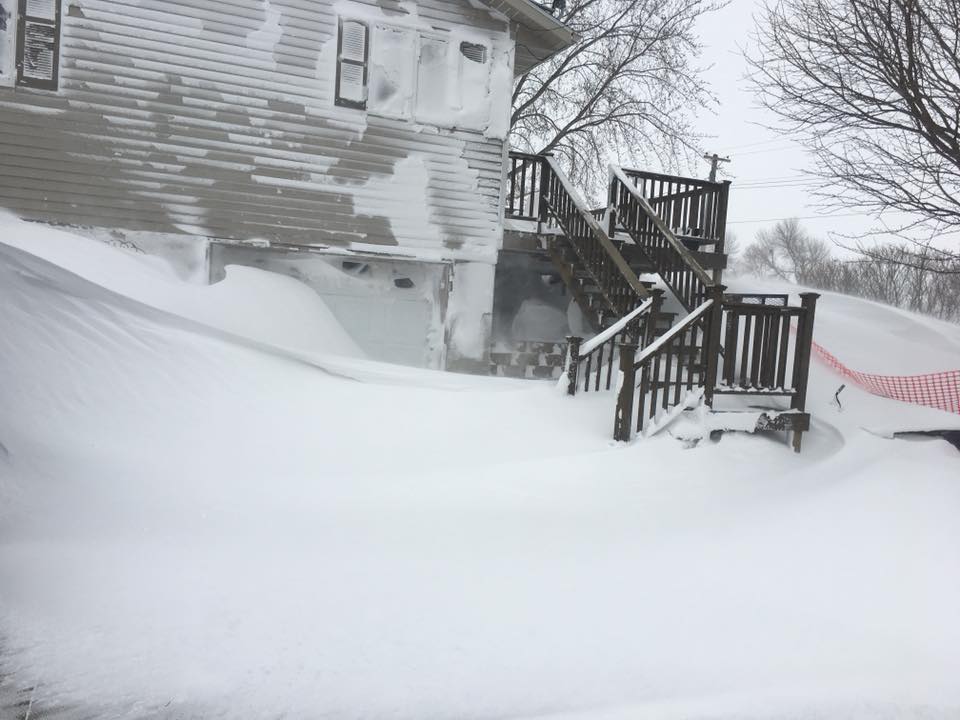
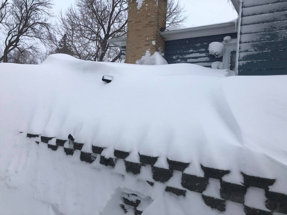
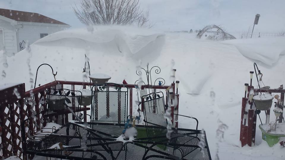
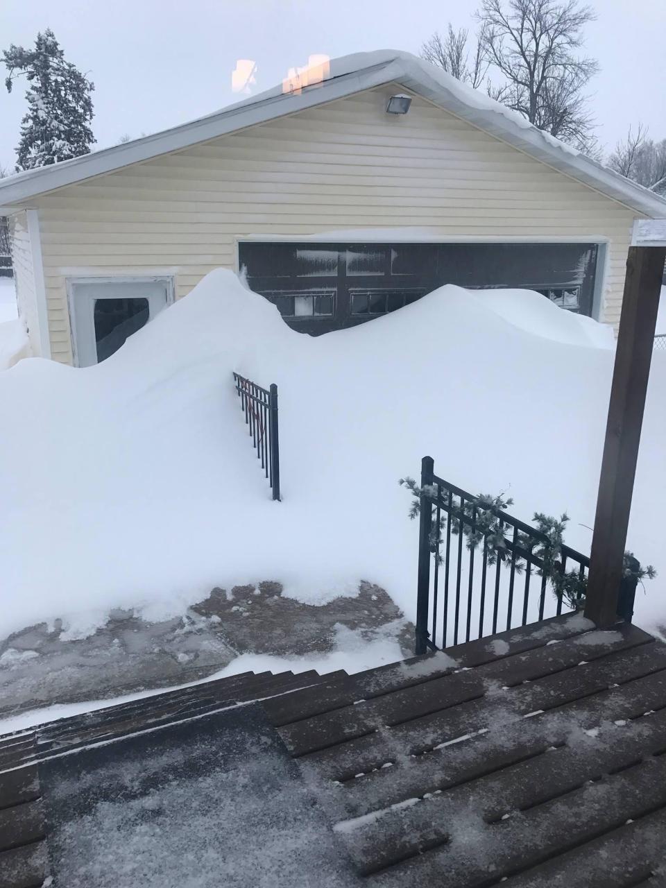
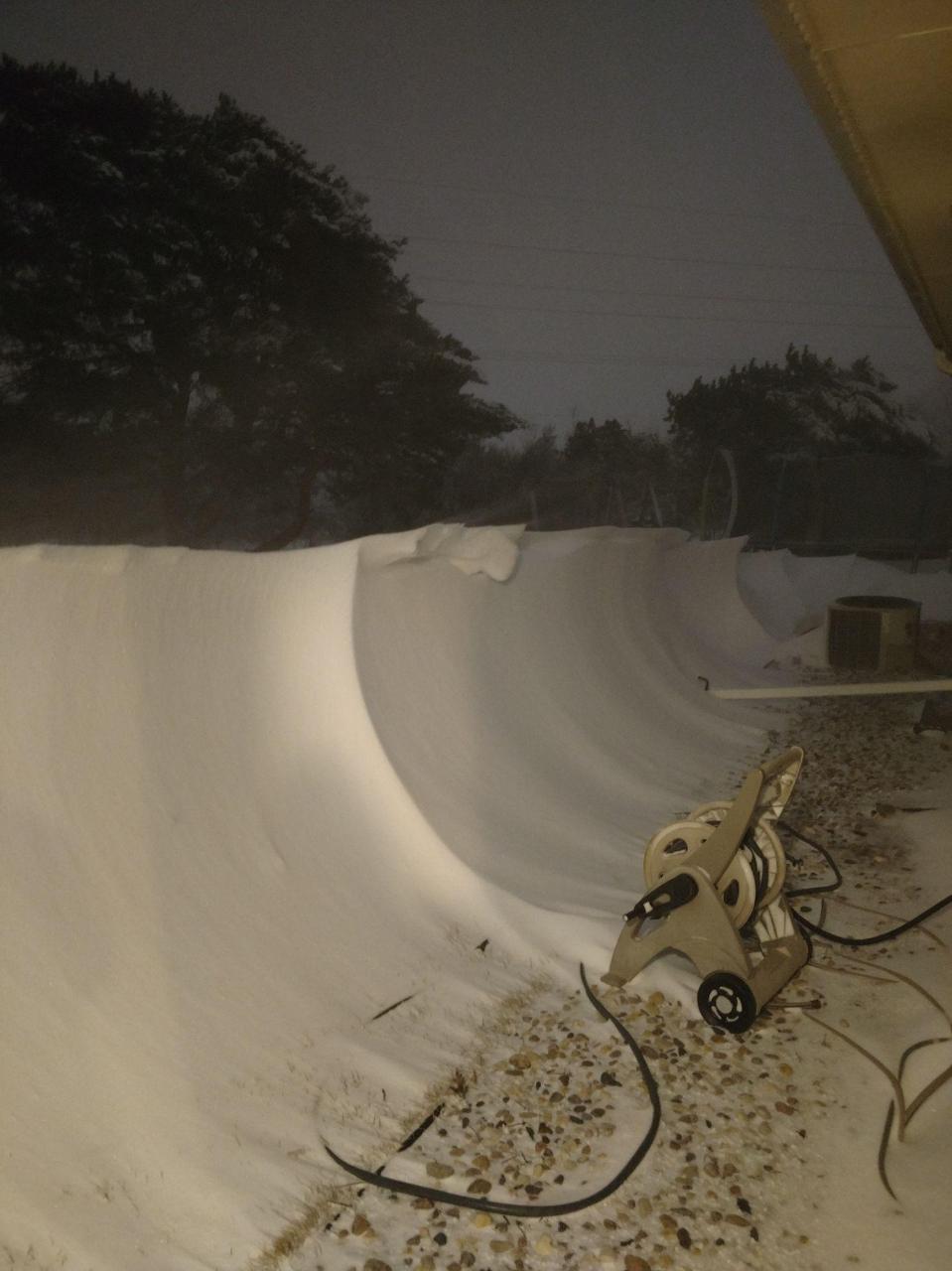
Impressive Drifts and Snow Piles were common after the snow ended on Sunday, April 15. |
|||
 |
 |
 |
 |
|
Alpena, SD - DestaInks Haibeck |
Cherokee, IA - Tammy Paschal Jones |
Hayti, SD - Darci Burch |
Lake Benton, MN - Cara Bloom Bressler |
 |
 |
 |
 |
|
Winner, SD - Mabel Schmit |
Round Lake, MN - Ida Reimer |
Tyler, MN - Vanessa Reese Bedow |
Sioux Falls, SD - Rob Langdon |
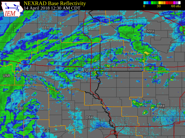
Radar Loop from around midnight April 14, to 6am April 15, 2018
 |
Media use of NWS Web News Stories is encouraged! Please acknowledge the NWS as the source of any news information accessed from this site. |
|


 Weather Story
 Weather Map
 Local Radar