Overview
|
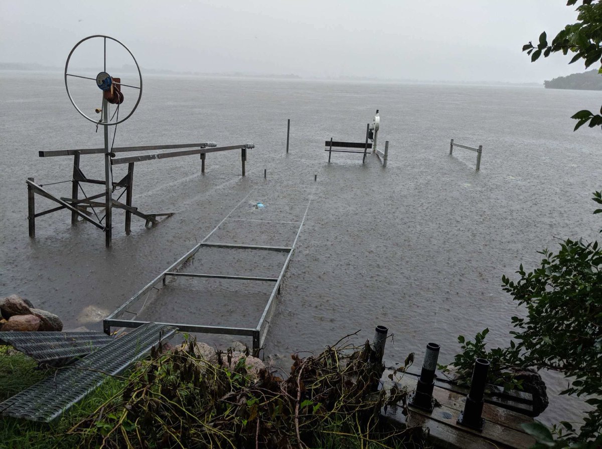
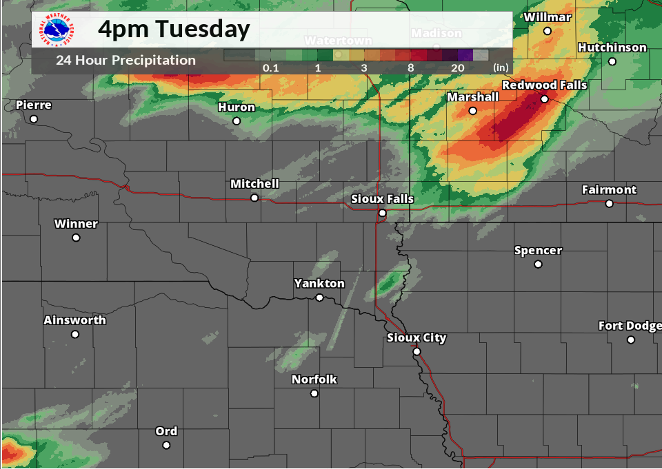
Very slow moving and training thunderstorms brought very heavy rainfall to portions of southwest Minnesota the morning of July 3rd. Some locations picked up several inches of rain in the matter of just a couple hours. Numerous roads were flooded or impassible due to the flash flooding, including in the city of Marshall. The Lake Shetek area was also hit particularly hard with the lake swelling out of its banks. This prompted the issuance of a Flash Flood Emergency. |
(Picture Courtesy of Tim Moline) |
Flooding
Hydrographs
 |
 |
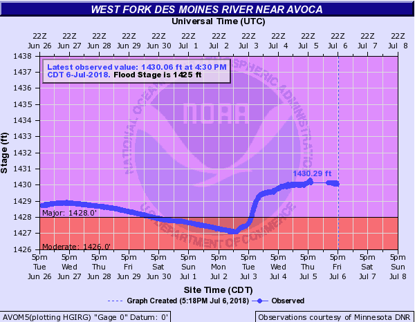 |
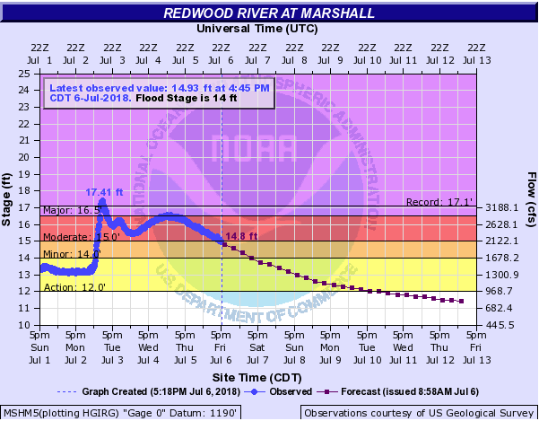
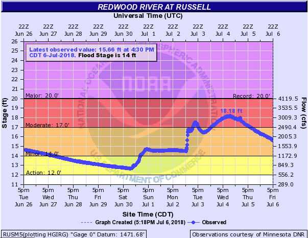
| Hydrograph of the Redwood River near Marshall | Hydrograph of the Redwood River near Russell | Hydrograph of the West Fork of the Des Moines River near Avoca |
Photos & Video:
Header
 |
 |
 |
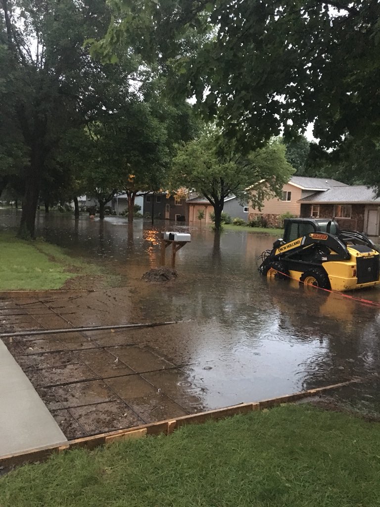 |
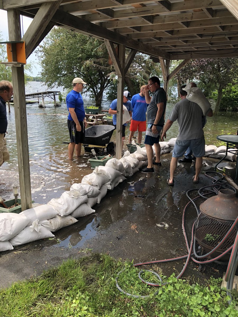
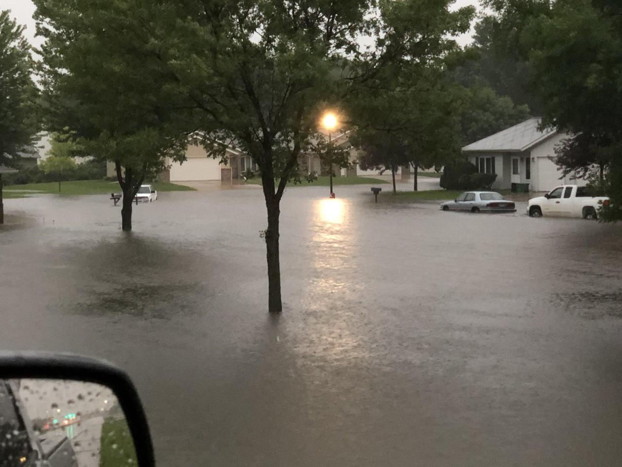
| Lake Sarah, MN (Picture Courtesy Nick Ratzloff) |
Tracy, MN (Picture Courtesy Misten Long) |
Lake Sarah, MN (Picture Courtesy Blaise Keller) |
Marshall, MN (Picture Courtesy of @jamesjr_25) |
Radar:
Header
 |
 |
 |
 |
| Radar loop from 7 pm of July 2nd thru 1 am of July 3rd | Radar loop from 1 am to 7 am of July 3rd | Radar loop from 7 am to 1 pm of July 3rd | GOES-16 IR Satellite Imagery |
Rain Reports
Observed Rainfall Reports (in inches) From Across SW MN
| Lake Shetek | 8.61 |
| Ghent | 6.50 |
| Marshall | 4.81 |
| Tracy | 4.52 |
| Marshall 0.6 S | 4.02 |
| Slayton | 2.33 |
| Minneota | 1.80 |
| Ivanhoe 5.7 E | 1.71 |
| Pipestone | 0.72 |
| Adrian 1.5 NW | 0.50 |
 |
Media use of NWS Web News Stories is encouraged! Please acknowledge the NWS as the source of any news information accessed from this site. |
|


 Weather Story
 Weather Map
 Local Radar