Overview
|
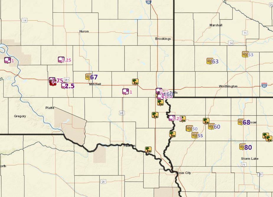
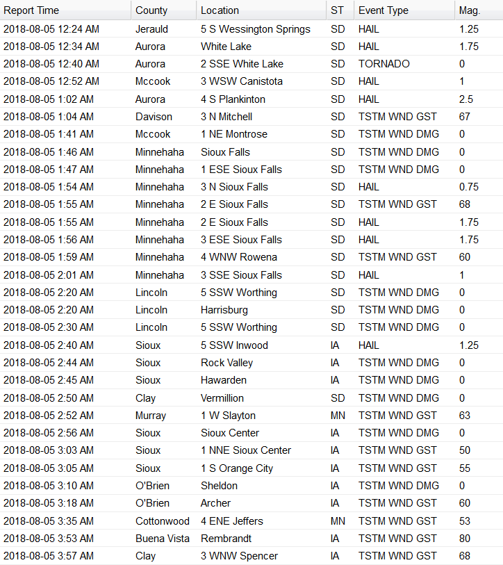
A line of storms quickly moved across southeast South Dakota, southwest Minnesota and northwest Iowa in the early morning hours of August 5, 2018. One weak tornado and hail to the size of tennis balls was reported with the initial storms near White Lake and Plankinton, SD. This was followed by several reports of tree damage and associated property and power line damage caused by fallen trees, as the line of storms moved through Sioux Falls, South Dakota, and on toward Hawarden, Sioux Center, and Sheldon, Iowa. Wind gusts in excess of 65 mph were measured in several locations. |
 Radar Loop of Storms in the early morning hours of August 5, 2018 |
Tornadoes:
|
Tornado - 2 miles south-southeast of White Lake, SD
Radar Image 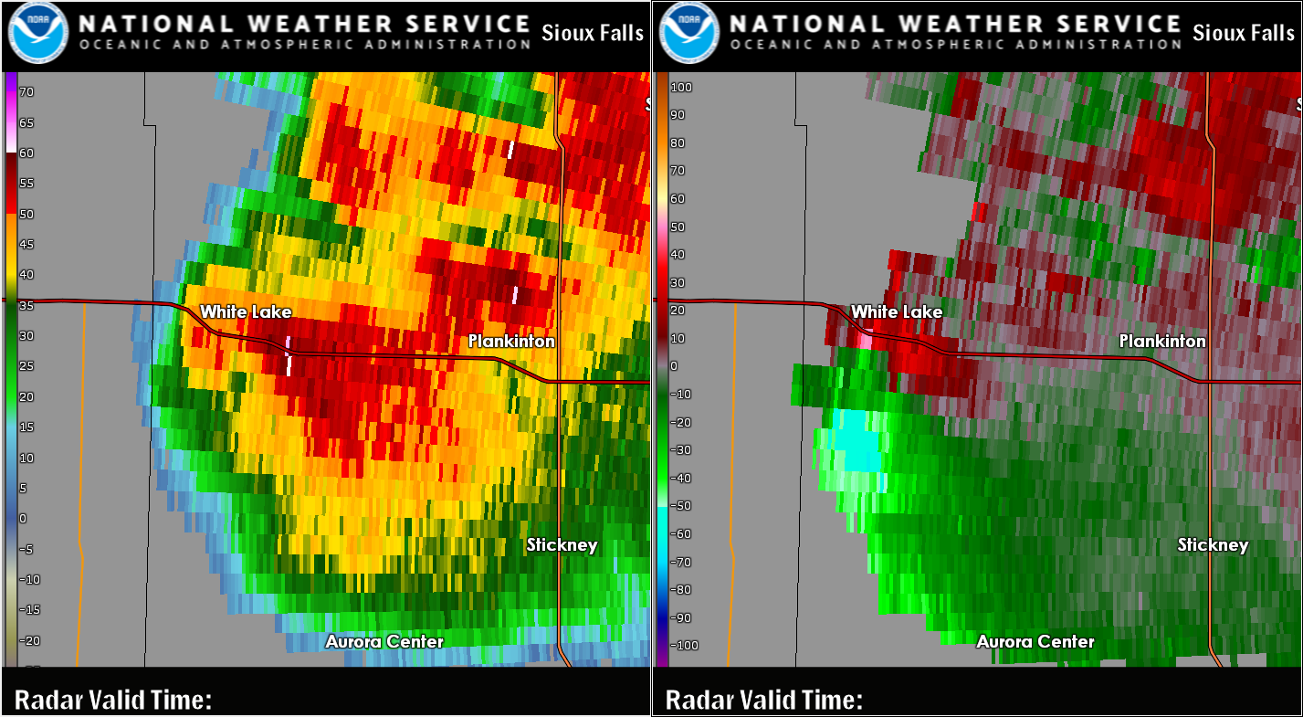
|
||||||||||||||||
The Enhanced Fujita (EF) Scale classifies tornadoes into the following categories:
| EF0 Weak 65-85 mph |
EF1 Moderate 86-110 mph |
EF2 Significant 111-135 mph |
EF3 Severe 136-165 mph |
EF4 Extreme 166-200 mph |
EF5 Catastrophic 200+ mph |
 |
|||||
Wind & Hail:
Wind
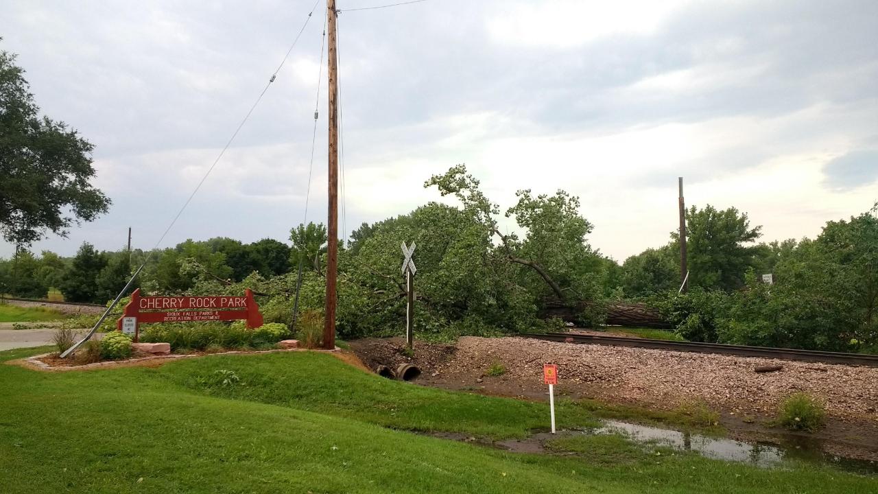
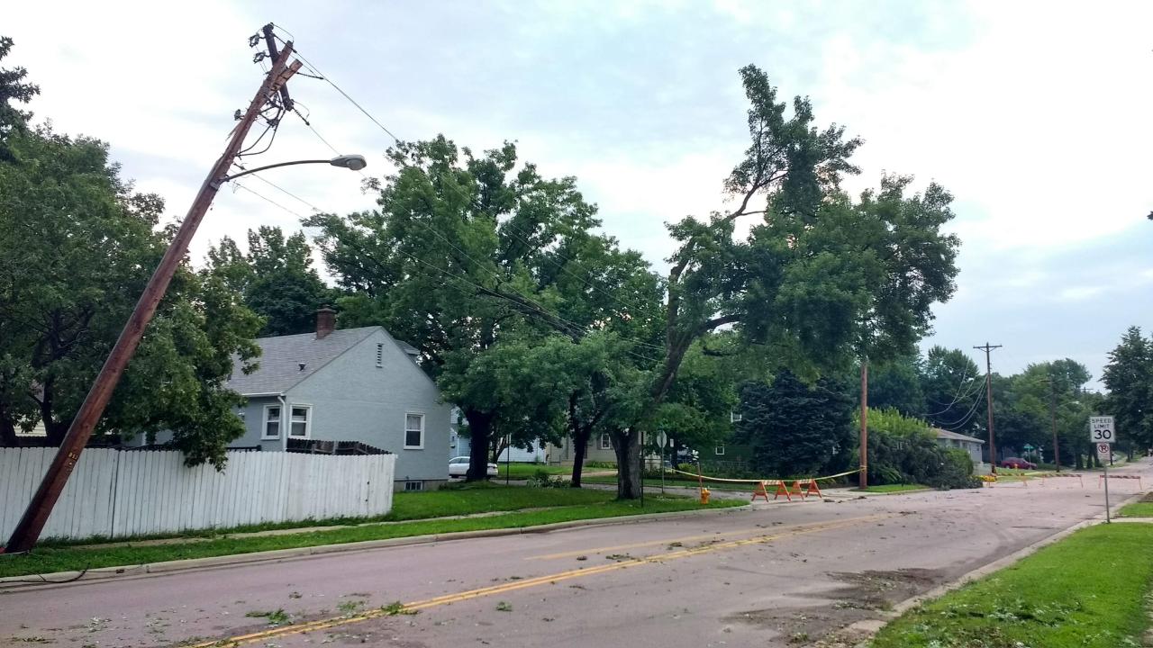
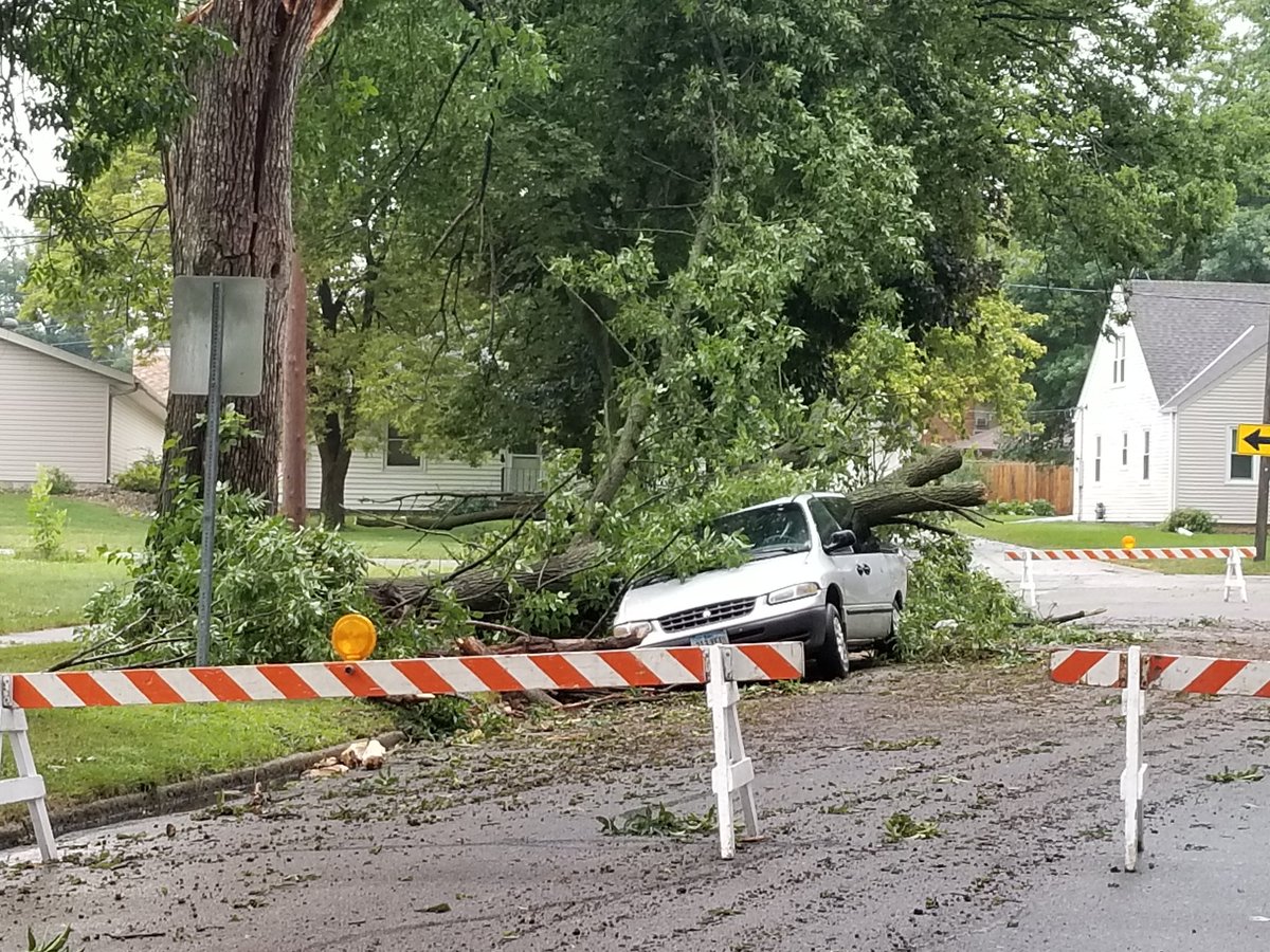
Wind gusts of 50 to 70+ mph caused primarily tree damage in several communities. The fallen trees did result in associated property and power line damage in some locations.
 |
 |
 |
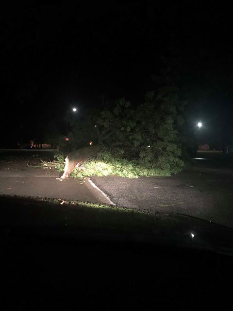 |
| Fallen tree at entrance to Cherry Rock Park in Sioux Falls | Fallen trees damage power lines in Sioux Falls | Tree damage to minivan in Sheldon, Iowa | Tree damage in Sheldon, Iowa (courtesy of Sami Anderson) |
Hail
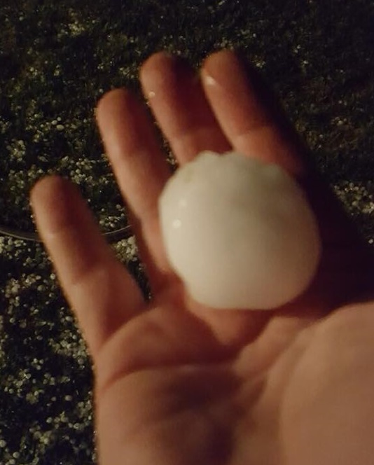
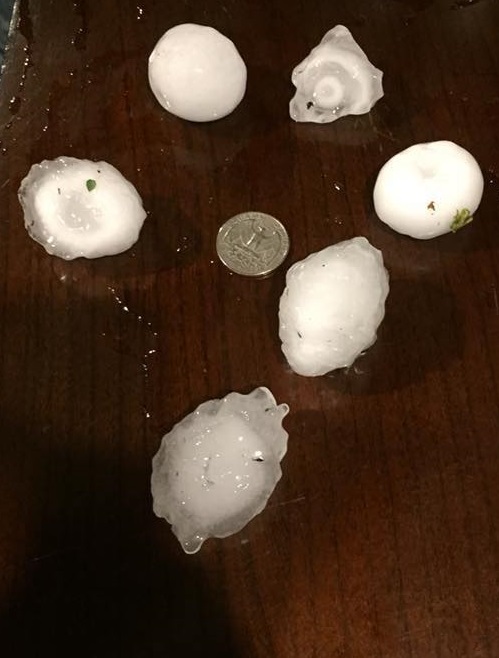
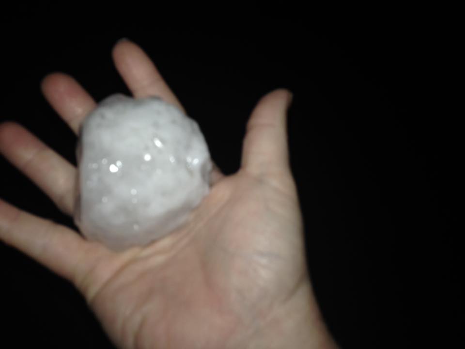
Hail up to tennis ball size was reported near Plankinton, South Dakota, with several reports of smaller hail as the storm continued to move east.
 |
 |
 |
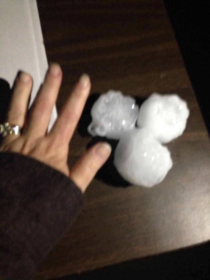 |
| Hail in White Lake (courtesy of Dixie Falk) |
Hail in White Lake (courtesy of Dixie Falk) |
Hail south of Plankinton (courtesy of Angie Hill Heezen) |
Hail south of Plankinton (courtesy of Angie Hill Heezen) |
Radar:
Header
|
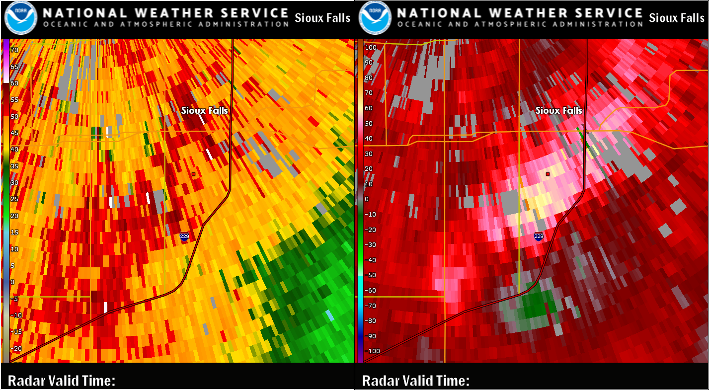 |
| Radar Reflectivity and Storm Relative Velocity near the time of the tornado southeast of White Lake, SD | Radar Image near the time of tree damage at Cherry Rock Park in Sioux Falls, SD |
Storm Reports
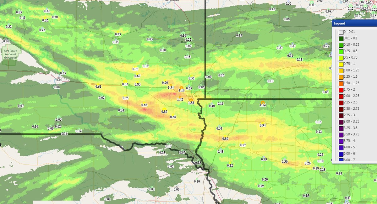
Rain Reports
 |
Media use of NWS Web News Stories is encouraged! Please acknowledge the NWS as the source of any news information accessed from this site. |
|



 Weather Story
 Weather Map
 Local Radar
 Follow us on X
 Follow us on Facebook
 Follow us on YouTube
 FSD RSS Feed