Overview
|
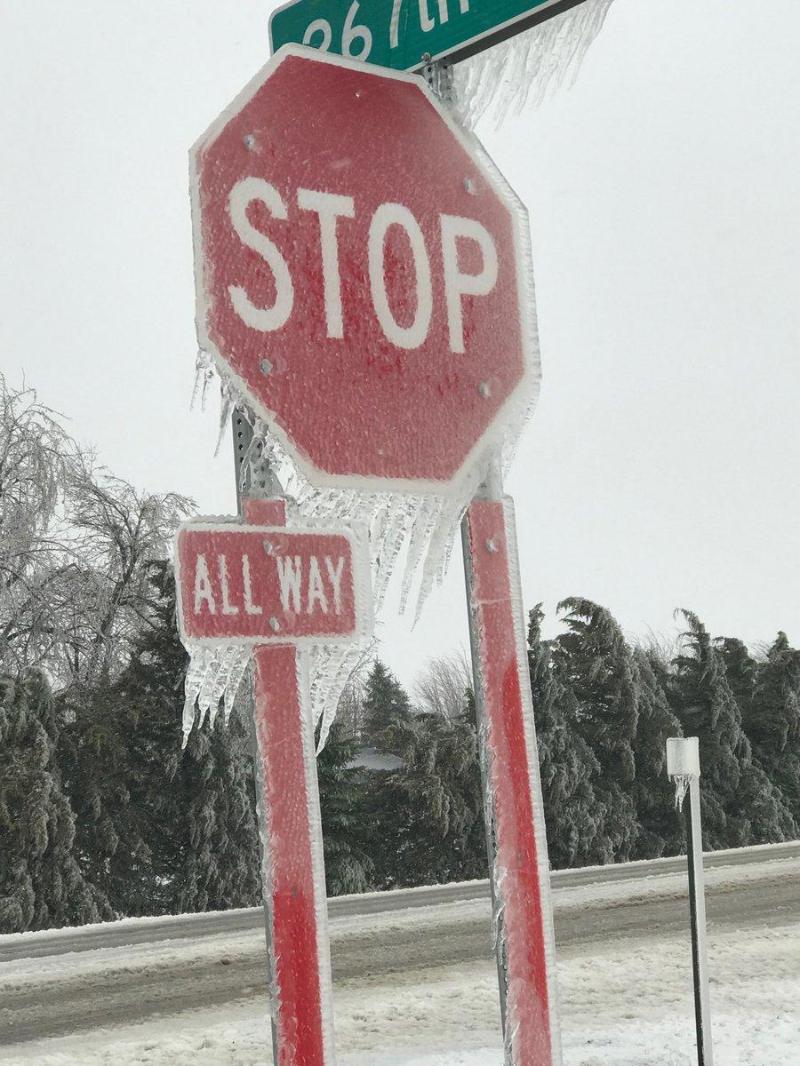
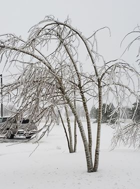
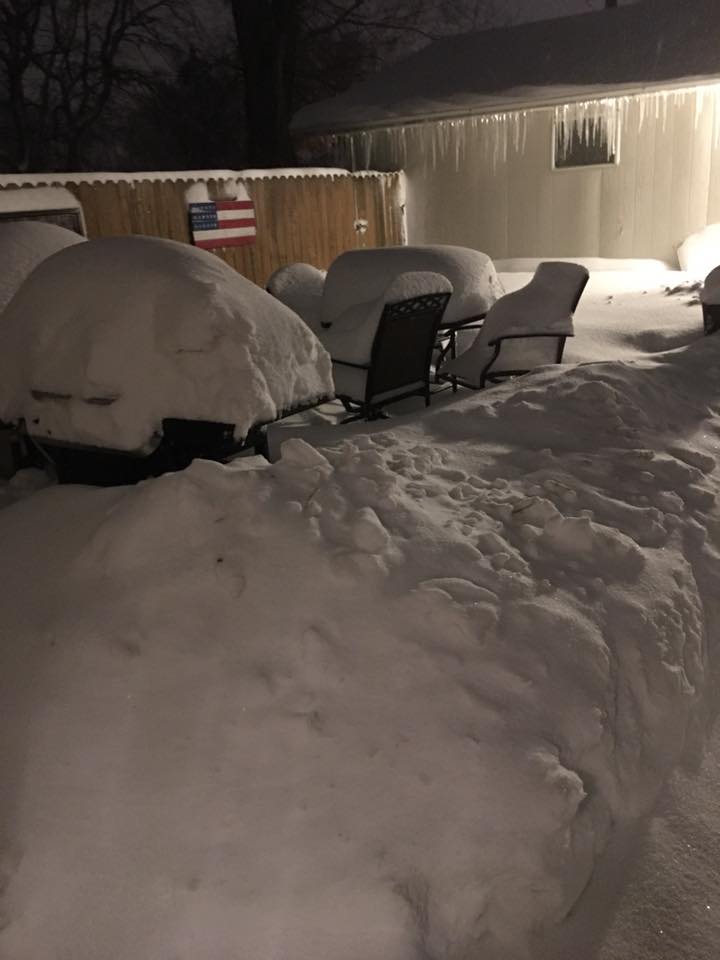
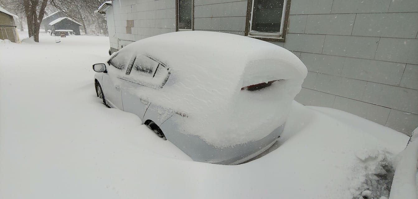
A significant late winter/early spring winter storm impacted during the second week of April. The strong low pressure system brought snow amounts measured in feet to areas of central into northeast South Dakota. Significant freezing rain and icing was observed in portions of southeast South Dakota, southwest Minnesota and northwest Iowa. Additionally, thunderstorms produced small hail and plentiful lightning to some areas. Strong winds during the event resulted in blizzard conditions in areas that received the heavy snow and numerous power outages in areas that received icing. |
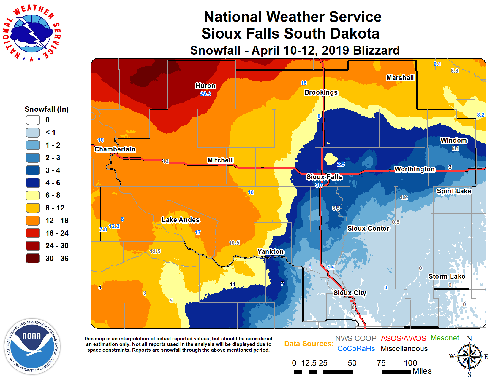 Snowfall Totals from April 10-12th, 2019 |
Wind:
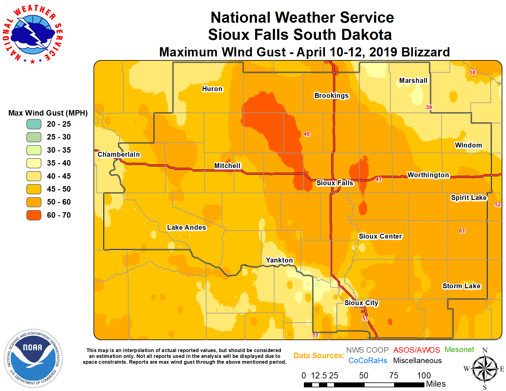 |
| Peak Wind Gusts Values from April 10-12, 2019 |
Location                     Speed     Time/Date       Lat/Lon
Mitchell Municipal Airport   69 MPH    1039 AM 04/11   43.77N/98.02W
Storm Lake Airport           62 MPH    0655 AM 04/11   42.60N/95.22W
Spencer Municipal Airport    61 MPH    0805 AM 04/11   43.17N/95.22W
Sioux Falls Airport          59 MPH    0213 AM 04/11   43.58N/96.75W
Lake Benton                  59 MPH    0301 AM 04/11   44.27N/96.32W
Le Mars Airport              55 MPH    0315 AM 04/11   42.77N/96.20W
Sheldon Airport              55 MPH    0455 AM 04/11   43.22N/95.82W
Sioux Gateway Airport        54 MPH    0223 AM 04/11   42.38N/96.38W
Huron Regional Airport       51 MPH    0929 AM 04/11   44.38N/98.23W
Ida Grove                    50 MPH    0520 AM 04/11   42.35N/95.48W
Alton                        50 MPH    0400 AM 04/11   43.00N/96.08W
Worthington Airport          49 MPH    0444 AM 04/11   43.63N/95.57W
Beaver Creek                 48 MPH    0220 AM 04/11   43.61N/96.38W
Cherokee Municipal Airport   47 MPH    0455 AM 04/11   42.73N/95.55W
Dovray                       47 MPH    0215 AM 04/11   44.06N/95.60W
2 ENE Truesdale              47 MPH    0741 AM 04/11   42.75N/95.15W
Hendricks                    46 MPH    0850 AM 04/11   44.46N/96.44W
Spencer                      46 MPH    0701 AM 04/11   43.13N/95.09W
2 NE Sibley                  44 MPH    1120 AM 04/11   43.43N/95.71W
Brookings Municipal Airport  43 MPH    0229 AM 04/11   44.28N/96.82W
Concord 2E                   43 MPH    0200 AM 04/11   42.39N/96.96W
Madison Airport              41 MPH    0135 PM 04/11   44.02N/97.08W
Marshall Municipal Airport   39 MPH    0932 AM 04/11   44.45N/95.82W
Yankton Municipal Airport    39 MPH    0549 AM 04/11   42.92N/97.37W
Luverne Airport              36 MPH    1156 AM 04/11   43.62N/96.22W
Snow/Ice
Snow Amounts
Location                     Amount    Time/Date       Lat/Lon
De Smet                      24.0 IN   0700 AM 04/12   44.38N/97.54W
2 SSE Huron                  23.0 in   1100 PM 04/11   44.34N/98.20W
3 NNE Huron                  22.0 in   0930 PM 04/11   44.40N/98.20W
1 NE Huron                   20.5 in   0510 PM 04/11   44.37N/98.20W
Wessington Springs           20.0 in   0700 AM 04/12   44.08N/98.57W
Cavour                       18.0 in   0530 PM 04/11   44.37N/98.04W
Woonsocket                   18.0 in   0700 AM 04/12   44.05N/98.27W
4 NE Badger                  17.0 in   0530 PM 04/11   44.52N/97.14W
Mount Vernon                 17.0 in   0800 PM 04/11   43.71N/98.26W
Marshall                     15.0 in   0700 AM 04/12   44.45N/95.79W
Mitchell                     15.0 in   0700 PA 04/12   43.73N/98.04W
6 SSW Mitchell               15.0 in   0600 PM 04/11   43.65N/98.07W
Bruce 5 W                    14.5 in   0800 AM 04/12   44.43N/97.00W
2 S Armour                   14.0 in   0815 PM 04/11   43.30N/98.34W
1 W Dimock                   14.0 in   0700 PM 04/11   43.47N/98.01W
2 ESE Mitchell               14.0 in   0650 PM 04/11   43.72N/97.99W
Ivanhoe                      14.0 in   0530 PM 04/11   44.46N/96.25W
Plankinton                   13.8 in   0600 PM 04/11   43.72N/98.49W
Howard                       13.0 in   0700 AM 04/12   44.01N/97.52W
2 N Lake Andes               13.0 in   0545 PM 04/11   43.18N/98.53W
Burke 4 SW                   12.2 in   0700 AM 04/12   43.14N/99.35W
White Lake                   12.0 in   0700 AM 04/12   43.73N/98.72W
Alexandria                   12.0 in   1200 AM 04/12   43.65N/97.78W
2 N Lake Andes               12.0 in   0645 PM 04/11   43.19N/98.54W
10 W Dimock                  12.0 in   0700 AM 04/11   43.48N/98.19W
Bonesteel                    12.0 in   0700 AM 04/11   43.08N/98.95W
Ghent                        11.0 in   0630 PM 04/11   44.51N/95.89W
White Lake                   12.0 in   0700 AM 04/12   43.73N/98.72W
Chamberlain 1 W              10.8 in   0530 AM 04/12   43.81N/99.33W
6 SSE Tabor                  10.5 in   0645 PM 04/11   42.87N/97.60W
Delmont                      10.5 in   0530 PM 04/11   43.27N/98.16W
Tyndall                      10.5 in   0700 PM 04/11   42.99N/97.87W
Emery 11 S                   10.0 in   0600 AM 04/12   43.45N/97.66W
Menno                        10.0 in   0700 AM 04/11   43.24N/97.57W
Marion                        9.8 in   0700 AM 04/12   43.42N/97.25W
Brookings                     8.5 in   0700 AM 04/12   44.30N/96.79W
Academy 2 NE                  8.0 in   0900 AM 04/11   43.49N/99.06W
1 W Alexandria                8.0 in   0600 PM 04/11   43.65N/97.80W
Dallas 9 S                    7.8 in   0700 AM 04/12   43.11N/99.50W
Canton                        5.5 in   0700 AM 04/12   43.31N/96.59N
Sioux Falls Airport           4.9 in   0700 AM 04/12   43.58N/96.73W
Windom                        4.5 in   0700 AM 04/12   43.86N/95.12W
Yankton                       4.0 in   0700 AM 04/12   42.88N/97.37W
Worthington 2 NE              2.0 in   0700 AM 04/12   43.65N/95.58W
Rock Rapids                   1.0 in   0700 AM 04/12   43.20N/96.31W
Ice Amounts
Lakefield, MN 0.75 in
6 SW Humbolt, SD 0.50 in
Plankinton, SD 0.50 in
Mountain Lake, MN 1.00 in
4 SW Wentworth, SD 0.50 in
Irene, SD 0.50 in
Fulda, MN 0.75 in
Windom, MN 0.75 in
Jasper, MN 0.25 in
Sioux Falls, SD 0.37 in
Hartford, SD 0.50 in
2 NE Worthington, MN 0.50 in
4 NW Okoboji, IA 0.20 in
3 S Lake Park, IA 0.25 in
Jackson, MN 0.30 in
Lismore, MN 0.25 in
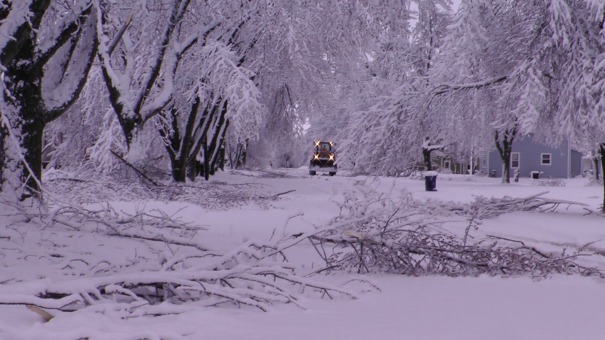
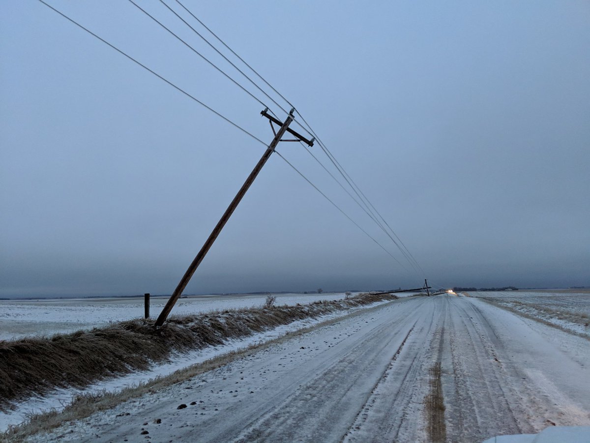
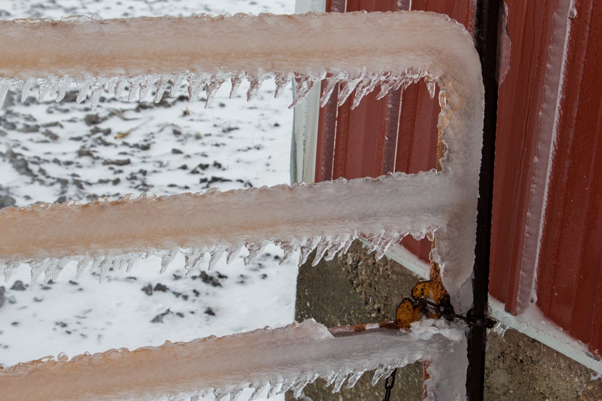
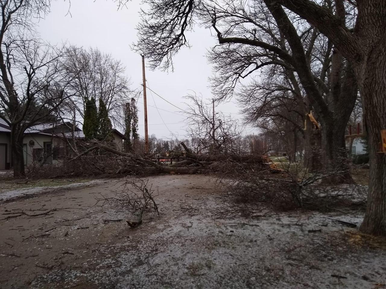
Photos & Video
Header
 |
 |
 |
 |
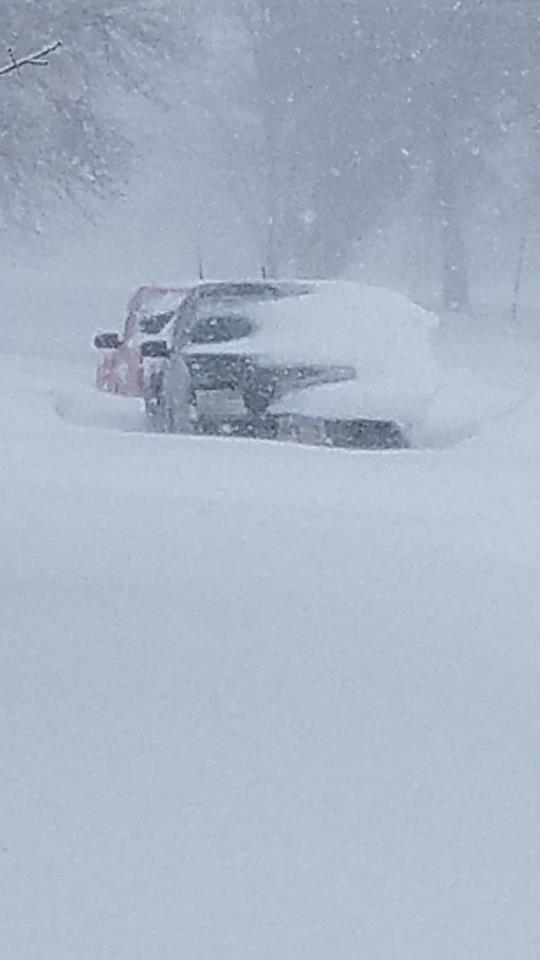
| Minnehaha County, SD (Sheriff Dept) |
Madison, SD (Nick Hauser) |
Dickinson County, IA (Mike Erhet) |
Dickinson County, IA (Mike Erhet) |
 |
 |
 |
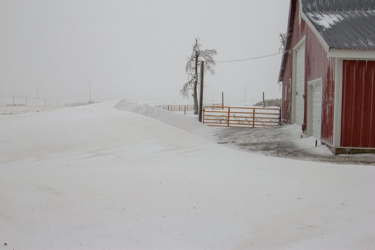 |
| Ruthton, MN (Pete Bouman) |
Fostoria, IA (Jewlie Secord) |
Mitchell, SD (Lorri Tucker) |
Ruthton, MN (Pete Bouman) |
 |
 |
 |
 |
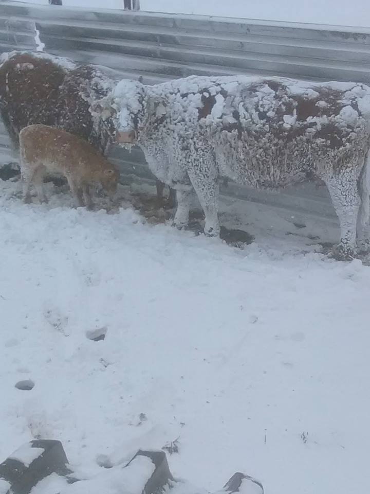
| Lake Andes, SD (Steven Stluka) |
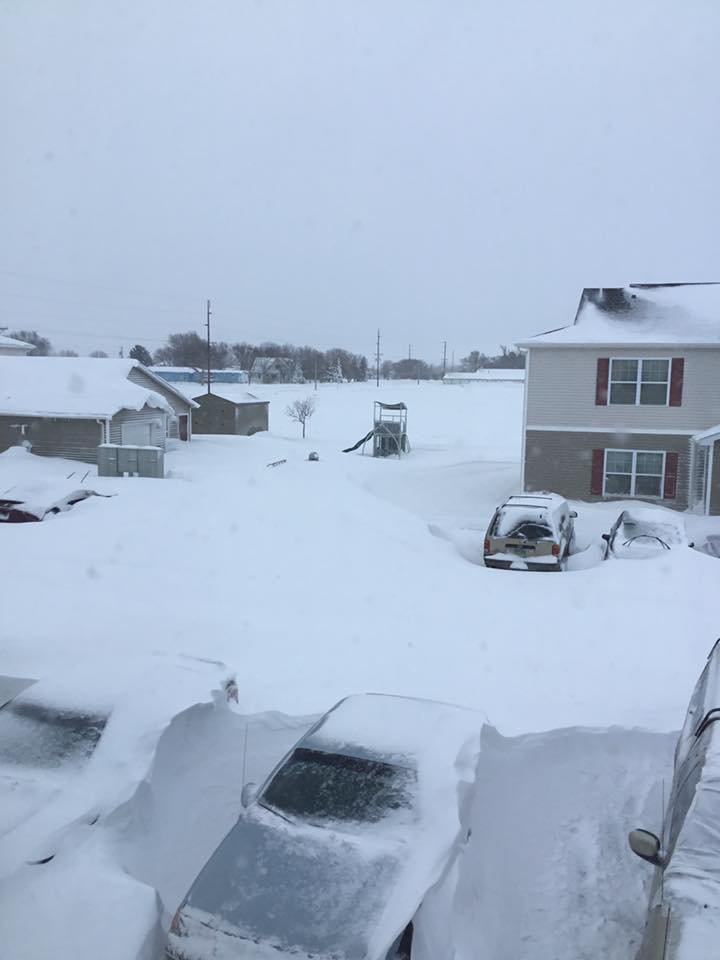
Huron, SD (Norma Torres Ortiz) |
Huron, SD (Carla Picek) |
Huron, SD (Bradley Ptak) |
Radar/Satellite
Header
 |
 |
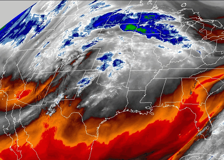 |
| Radar Loop from April 9-12th, 2019 | Satellite Loop from April 10-12th, 2019 | Satellite Loop from April 10-12th, 2019 |
 |
Media use of NWS Web News Stories is encouraged! Please acknowledge the NWS as the source of any news information accessed from this site. |
|


 Weather Story
 Weather Map
 Local Radar