Overview
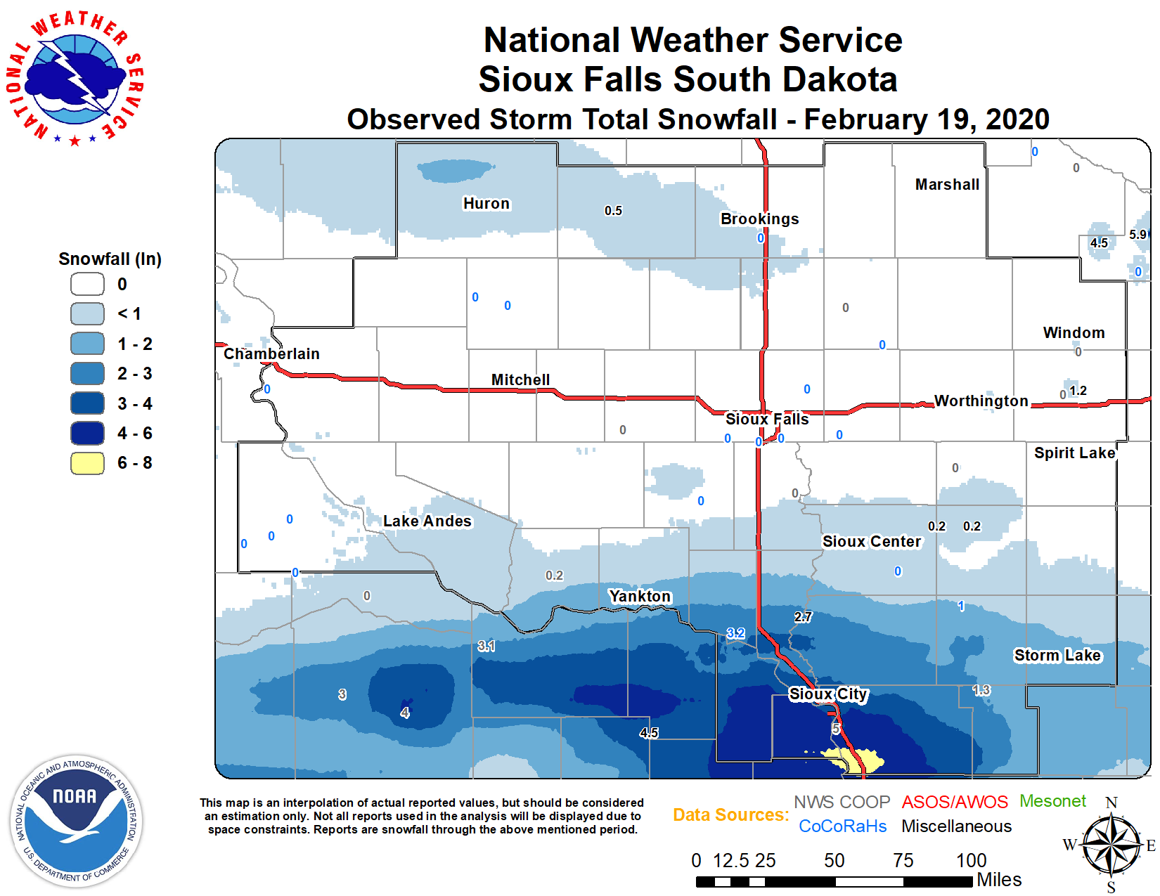
A relatively narrow band of moderate snow developed from northern Nebraska into northwest and west central Iowa on Wednesday, February 19, 2020, producing a swath of 3 to 6 inches of snow. Fortunately, not much wind occurred with this system, so the primary travel impacts were due to reduced visibility in falling snow (as low as 1/4 to 1/2 mile at times), and slick roads due to the compacted snow and sub-freezing temperatures. The night following this snow became clear with light winds, allowing temperatures over the snow band to fall into the teens below zero in some locations.
Storm Reports
PRELIMINARY LOCAL STORM REPORT
NATIONAL WEATHER SERVICE SIOUX FALLS SD
1039 AM CST THU FEB 20 2020

..TIME...   ...EVENT...      ...CITY LOCATION...     ...LAT.LON...
..DATE...   ....MAG....      ..COUNTY LOCATION..ST.. ...SOURCE....
            ..REMARKS..

0800 AM     SNOW             1 ENE CHEROKEE          42.76N 95.54W
02/20/2020  M2.0 INCH        CHEROKEE           IA   CO-OP OBSERVER

            EVENT TOTAL SNOWFALL FOR 2/19. CO-OP OBSERVER STATION
            CKPI4 0.9 NE CHEROKEE.

0700 AM     SNOW             3 N HORNICK             42.28N 96.10W
02/20/2020  M4.5 INCH        WOODBURY           IA   CO-OP OBSERVER

            EVENT TOTAL SNOWFALL FOR 2/19. CO-OP OBSERVER STATION
            HLYI4 3.4 N HORNICK.

0600 AM     SNOW             1 SE VERMILLION         42.77N 96.91W
02/20/2020  M3.2 INCH        CLAY               SD   COCORAHS

            EVENT TOTAL SNOWFALL FOR 2/19. COCORAHS STATION
            SD-CY-10 VERMILLION 1.4 SE.

0500 PM     SNOW             2 E CONCORD             42.38N 96.96W
02/19/2020  M4.6 INCH        DIXON              NE   CO-OP OBSERVER

            EVENT TOTAL SNOWFALL FOR 2/19. CO-OP OBSERVER STATION
            NESN1 CONCORD.

0300 PM     SNOW             1 SSE VERMILLION        42.76N 96.92W
02/19/2020  M2.6 INCH        CLAY               SD   CO-OP OBSERVER

            EVENT TOTAL SNOWFALL FOR 2/19. CO-OP OBSERVER STATION
            VRMS2 1.4 S VERMILLION.

0600 PM     SNOW             SERGEANT BLUFF          42.40N 96.36W
02/19/2020  M5.5 INCH        WOODBURY           IA   OFFICIAL NWS OBS

            EVENT TOTAL SNOWFALL FOR 2/19.


&&
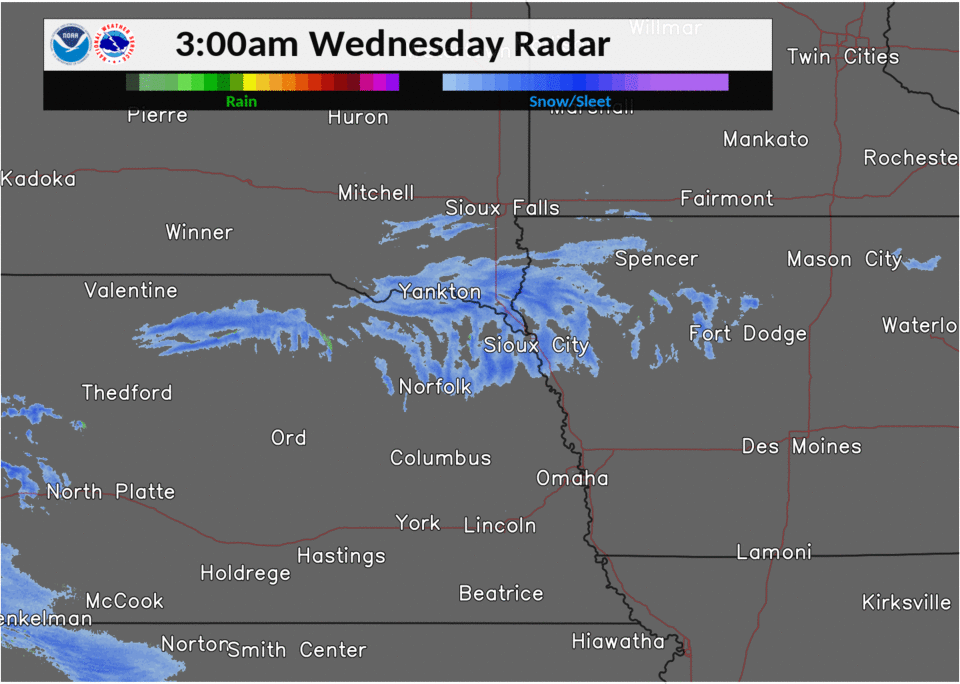
Radar
 |
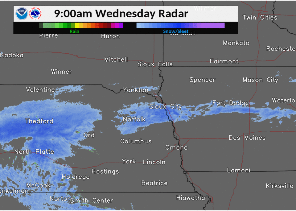 |
| Radar from 3 am to 9 am | Radar from 9 am to 3 pm |
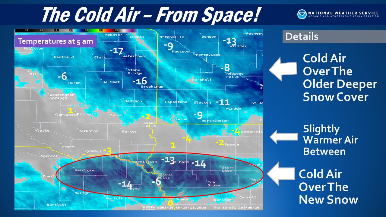
Cold Night Following Snowfall
With clear skies following the snowfall, and light winds to allow for optimal radiational cooling over the fresh snow, the snowfall band became quite apparent on infrared satellite imagery.
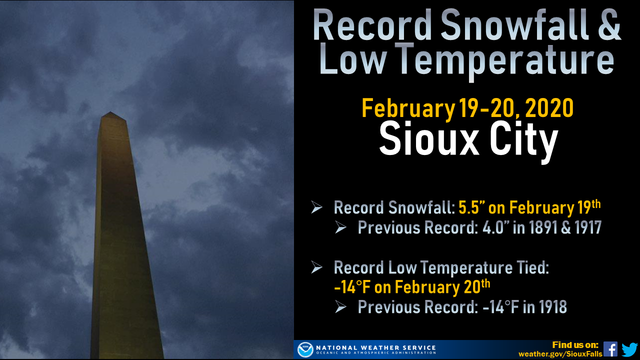
Sioux City, Iowa, also saw multiple records tied or broken.
 |
Media use of NWS Web News Stories is encouraged! Please acknowledge the NWS as the source of any news information accessed from this site. |
|


 Weather Story
 Weather Map
 Local Radar