Overview
|
Scattered thunderstorms developed by late afternoon across southeast South Dakota and slowly moved eastward into the evening hours. Some of the stronger storms produced hail up to the size of golf balls. By late evening, an additional round of storms began to develop and prompted several warnings for damaging winds, large hail and flash flooding into the overnight hours. |
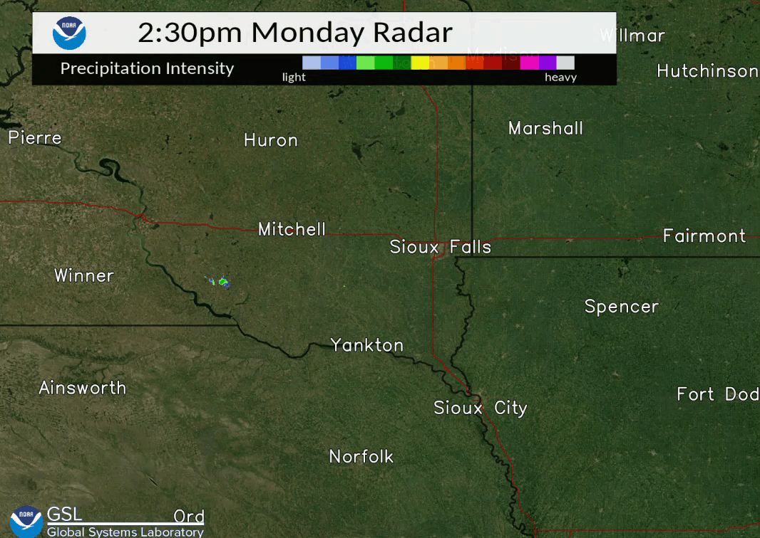 Radar From August 30th into 31st |
Storm Reports
..TIME...   ...EVENT...      ...CITY LOCATION...     ...LAT.LON...
..DATE...   ....MAG....      ..COUNTY LOCATION..ST.. ...SOURCE....
            ..REMARKS..

1228 PM     HAIL             6 E PARKSTON            43.40N 97.87W
08/30/2021  E0.88 INCH       HUTCHINSON         SD   PUBLIC

            HEAVY RAIN AND HAIL UP TO THE SIZE OF
            NICKELS.

0441 PM     HAIL             8 NW ETHAN              43.62N 98.11W
08/30/2021  E1.00 INCH       DAVISON            SD   TRAINED SPOTTER

            QUARTER SIZED HAIL AND HEAVY RAIN.

0503 PM     HAIL             3 NNW ETHAN             43.58N 98.01W
08/30/2021  E1.00 INCH       DAVISON            SD   TRAINED SPOTTER

            LOTS OF VARIABLE SIZED HAIL AND HEAVY RAIN,
            WITH BIGGEST STONES AS BIG AS QUARTERS.

0513 PM     HAIL             1 NE ETHAN              43.55N 97.97W
08/30/2021  E0.88 INCH       DAVISON            SD   TRAINED SPOTTER

            HEAVY RAIN AND HAIL UP TO THE SIZE OF
            NICKELS.

0518 PM     HAIL             6 N MENNO               43.33N 97.58W
08/30/2021  E1.25 INCH       HUTCHINSON         SD   PUBLIC

            PICTURE VIA SOCIAL MEDIA. TIME ESTIMATED VIA
            RADAR, LOCATION ESTIMATED VIA GENERAL
            LOCATION ON SOCIAL MEDIA.

0527 PM     HAIL             5 SW FREEMAN            43.30N 97.49W
08/30/2021  E1.75 INCH       HUTCHINSON         SD   PUBLIC

            LIGHT RAIN AND MOSTLY SMALL HAIL, BUT A FEW
            STONES AS BIG AS GOLF BALLS.

0529 PM     HAIL             6 S ALEXANDRIA          43.57N 97.79W
08/30/2021  E0.88 INCH       HANSON             SD   PUBLIC

            REPORT FROM SOCIAL MEDIA.

0538 PM     HAIL             2 W CLAYTON             43.44N 97.69W
08/30/2021  E1.25 INCH       HUTCHINSON         SD   TRAINED SPOTTER

            HAIL UP TO THE SIZE OF HALF DOLLARS, AND
            VERY LITTLE RAINFALL.

0548 PM     HAIL             1 S CLAYTON             43.44N 97.66W
08/30/2021  M1.00 INCH       HUTCHINSON         SD   PUBLIC


0706 PM     HAIL             HAWARDEN                43.00N 96.49W
08/30/2021  E1.00 INCH       SIOUX              IA   PUBLIC

            PICTURE VIA SOCIAL MEDIA.

0732 PM     HAIL             6 S BERESFORD           42.99N 96.77W
08/30/2021  E1.75 INCH       UNION              SD   PUBLIC


0738 PM     HAIL             7 SW ALCESTER           42.94N 96.71W
08/30/2021  E0.75 INCH       UNION              SD   PUBLIC


0758 PM     HAIL             6 S BRIDGEWATER         43.46N 97.51W
08/30/2021  E1.00 INCH       HUTCHINSON         SD   PUBLIC

            CORRECTS PREVIOUS HAIL REPORT FROM 6 S
            BRIDGEWATER. MOSTLY PEA SIZED HAIL, BUT A
            FEW QUARTER SIZED STONES, AND HEAVY RAIN.

0930 PM     HAIL             3 SSW FREEMAN           43.31N 97.46W
08/30/2021  E0.88 INCH       HUTCHINSON         SD   PUBLIC


0936 PM     HAIL             2 SW FREEMAN            43.33N 97.45W
08/30/2021  E0.75 INCH       HUTCHINSON         SD   PUBLIC

            CORRECTS PREVIOUS HAIL REPORT FROM 1 NW
            FREEMAN.

0954 PM     HAIL             2 SE IDA GROVE          42.32N 95.44W
08/30/2021  E0.75 INCH       IDA                IA   TRAINED SPOTTER

            HEAVY RAIN AND MOSTLY PEA SIZED HAIL, BUT A
            FEW STONES AS BIG AS PENNIES.

1002 PM     HAIL             6 S ARTHUR              42.25N 95.35W
08/30/2021  E1.75 INCH       IDA                IA   TRAINED SPOTTER

            GOLF BALL SIZED HAIL SHREDDED AND POUNDED
            CROPS IN THE FIELD.

1208 AM     HAIL             2 SSE STICKNEY          43.56N 98.42W
08/31/2021  E1.00 INCH       AURORA             SD   TRAINED SPOTTER

            HEAVY RAIN AND HAIL UP TO THE SIZE OF
            QUARTERS.

0141 AM     TSTM WND GST     2 WSW PICKSTOWN         43.05N 98.57W
08/31/2021  M55 MPH          GREGORY            SD   MESONET

            MESONET STATION 244 SD RWIS FT. RANDALL DAM.

0158 AM     TSTM WND GST     1 E WAGNER              43.08N 98.28W
08/31/2021  M50 MPH          CHARLES MIX        SD   MESONET

            PERSONAL WEATHER STATION RECORDED WIND GUST
            OF 50 MPH.
Rain Reports
...24 HOUR PRECIPITATION REPORTS...
Location Amount Time/Date Provider
SD RWIS Kimball 4.27 in 0640 PM 08/31 SDDOT
Pukwana 2.5 W 3.75 in 0800 AM 08/31 COCORAHS
Kimball 3.9 ENE 3.40 in 0700 AM 08/31 COCORAHS
SD RWIS Tripp 3.02 in 0640 PM 08/31 SDDOT
SD RWIS Plankinton 2.93 in 0640 PM 08/31 SDDOT
Pukwana 1.9 S 2.92 in 0700 AM 08/31 COCORAHS
North Sioux City 2.87 in 0640 PM 08/31 SDDOT
Tyndall 2.55 in 0800 AM 08/31 COOP
Menno 2.51 in 0600 PM 08/31 COOP
SD RWIS Beresford 2.42 in 0640 PM 08/31 SDDOT
Lake Andes RAWS 2.23 in 0541 PM 08/31 RAWS
Jefferson 1.1 E 2.23 in 0712 AM 08/31 COCORAHS
Hawarden 2.22 in 0636 PM 08/31 CWOP
3.1 W Geddes 2.16 in 0641 PM 08/31 UCOOP
Parkston 0.1 NW 2.15 in 0800 AM 08/31 COCORAHS
SD RWIS Gayville 2.14 in 0640 PM 08/31 SDDOT
Arthur 3.7 SSW 2.07 in 0830 AM 08/31 COCORAHS
Jefferson 2.1 WNW 2.05 in 0700 AM 08/31 COCORAHS
Stickney 3.8 SW 1.95 in 0700 AM 08/31 COCORAHS
Chamberlain 1.89 in 0635 PM 08/31 ASOS
4.3 SE Olivet 1.87 in 0630 PM 08/31 COOP
Platte-Winner Bridge 1.84 in 0640 PM 08/31 SDDOT
Vermillion 0.6 SE 1.84 in 0800 AM 08/31 COCORAHS
Springfield 7.6 WNW 1.78 in 0700 AM 08/31 COCORAHS
Dimock 10.2 W 1.75 in 0700 AM 08/31 COCORAHS
Parkston 6.6 S 1.73 in 0700 AM 08/31 COCORAHS
Bridgewater 1.72 in 0800 AM 08/31 COOP
Elk Point 5.6 NNE 1.72 in 0700 AM 08/31 COCORAHS
SD RWIS Montrose 1.67 in 0640 PM 08/31 SDDOT
Gregory 8.7 N 1.65 in 0700 AM 08/31 COCORAHS
Marion 4.8 NNW 1.59 in 0800 AM 08/31 COCORAHS
Plankinton 3.8 W 1.55 in 0700 AM 08/31 COCORAHS
Loess Hills Tnc Broken 1.53 in 0611 PM 08/31 RAWS
1.4 S Vermillion 1.53 in 0300 PM 08/31 COOP
Jefferson 2.9 SW 1.52 in 0700 AM 08/31 COCORAHS
1.2 N Sioux City 1.51 in 0600 PM 08/31 COOP
Armour 4.6 W 1.49 in 0700 AM 08/31 COCORAHS
Alexandria 6.4 N 1.48 in 0700 AM 08/31 COCORAHS
Alexandria 0.4 WNW 1.46 in 0700 AM 08/31 COCORAHS
Worthing 2.0 W 1.42 in 0700 AM 08/31 COCORAHS
Academy 2 NE 1.40 in 0900 AM 08/31 COOP
Mitchell 7.3 S 1.39 in 0700 AM 08/31 COCORAHS
Platte 1.35 in 0631 PM 08/31 CWOP
2 S Mitchell 1.35 in 0700 AM 08/31 COCORAHS
1 S Centerville 1.33 in 0640 PM 08/31 AWS
Mitchell 3.4 SSE 1.28 in 0800 AM 08/31 COCORAHS
Platte 1.0 N 1.25 in 0700 AM 08/31 COCORAHS
Woonsocket 0.2 WSW 1.25 in 0800 AM 08/31 COCORAHS
Hubbard 0.1 NW 1.23 in 0730 AM 08/31 COCORAHS
Parker 6.8 WSW 1.22 in 0700 AM 08/31 COCORAHS
Parkston 6.5 WSW 1.21 in 0700 AM 08/31 COCORAHS
Ponca 2.5 NW 1.20 in 0800 AM 08/31 COCORAHS
Viborg 12.1 WNW 1.20 in 0700 AM 08/31 COCORAHS
Gregory 1.18 in 0700 AM 08/31 HADS
6.2 NW Hinton 1.18 in 0545 PM 08/31 UCOOP
Kimball 6.7 SE 1.16 in 0700 AM 08/31 COCORAHS
1.4 SE North Sioux City 1.13 in 0630 PM 08/31 HADS
3.4 N Hornick 1.12 in 0700 AM 08/31 COOP
Yankton 2.8 ESE 1.12 in 0700 AM 08/31 COCORAHS
Sioux Gateway Airport 1.10 in 0552 PM 08/31 ASOS
Pickstown 4 SSW 1.10 in 0700 AM 08/31 COOP
Hubbard 3.1 SW 1.09 in 0700 AM 08/31 COCORAHS
South Sioux City 1.06 in 0631 PM 08/31 CWOP
Concord 4.23 S 1.04 in 0700 AM 08/31 COCORAHS
Fedora 10 S 1.04 in 0800 AM 08/31 UCOOP
Platte 1.04 in 0640 PM 08/31 CWOP
Parker 7.2 N 1.04 in 0700 AM 08/31 COCORAHS
Fulton 9.4 N 1.04 in 0800 AM 08/31 COCORAHS
Canton 1.03 in 0700 AM 08/31 COOP
2 N Bonesteel 1.00 in 0640 PM 08/31 AWS
Chamberlain 7.5 NNE 1.00 in 0700 AM 08/31 COCORAHS
Mitchell 0.9 SSE 1.00 in 0700 AM 08/31 COCORAHS
 |
Media use of NWS Web News Stories is encouraged! Please acknowledge the NWS as the source of any news information accessed from this site. |
|


 Weather Story
 Weather Map
 Local Radar