Overview
|
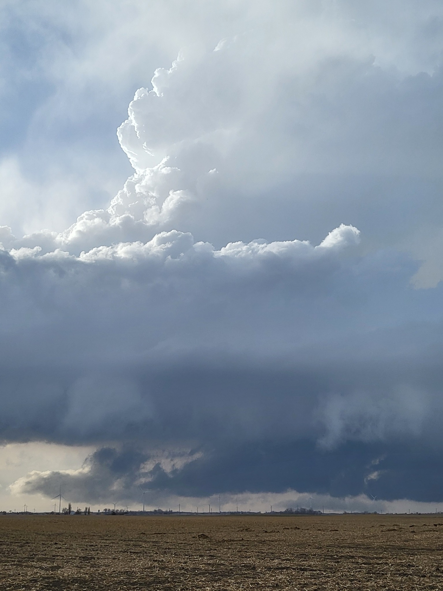
On the afternoon of 12 April 2022, convection began across south central South Dakota. Storms quickly became severe, and then weakened as they approached the eastern boarder of South Dakota. They re-intensified as they crossed into Minnesota, and began to form in northwestern Iowa. Several storms produced large hail up to baseball size. Strong winds were common with these storms as well. |
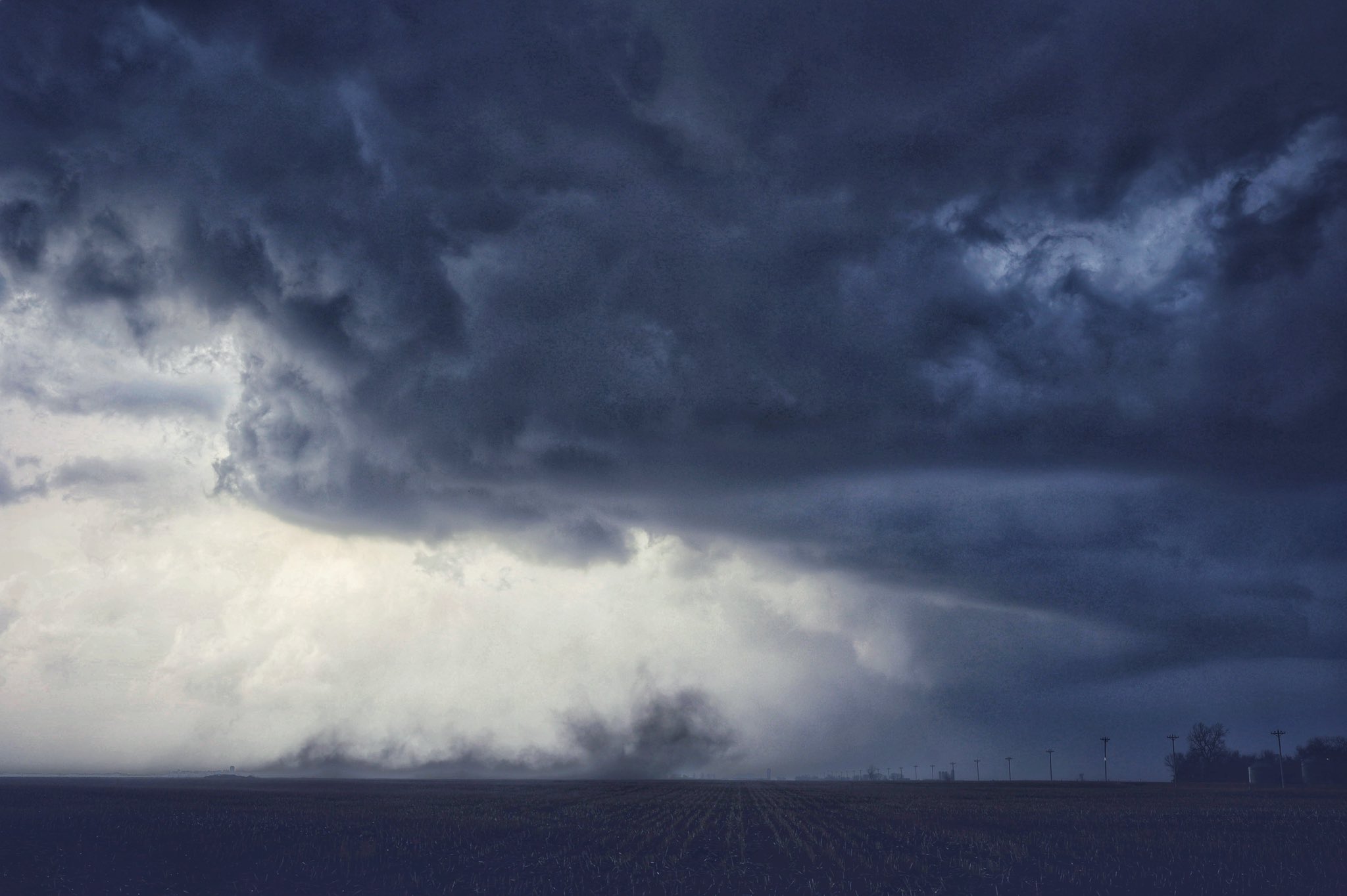 Thunderstorm west of Freeman, SD - Chris Allington |
Photos & Video
Header
 |
 |
 |
 |
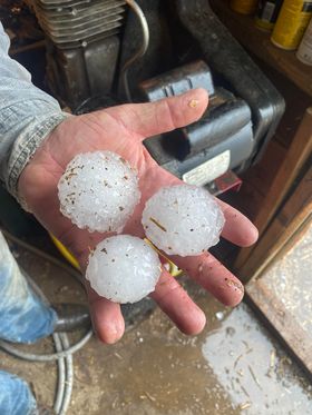
| Hail near Milltown,SD (Andrew Stainbrook) |
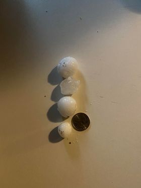
Hail near Balaton, SD (Jacob Chapa) |
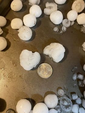
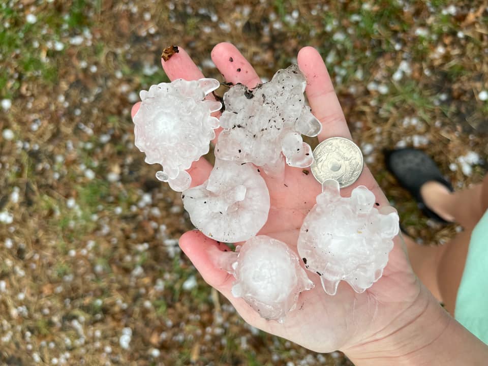
Hail near Jackson, MN (Kimberly Roland) |
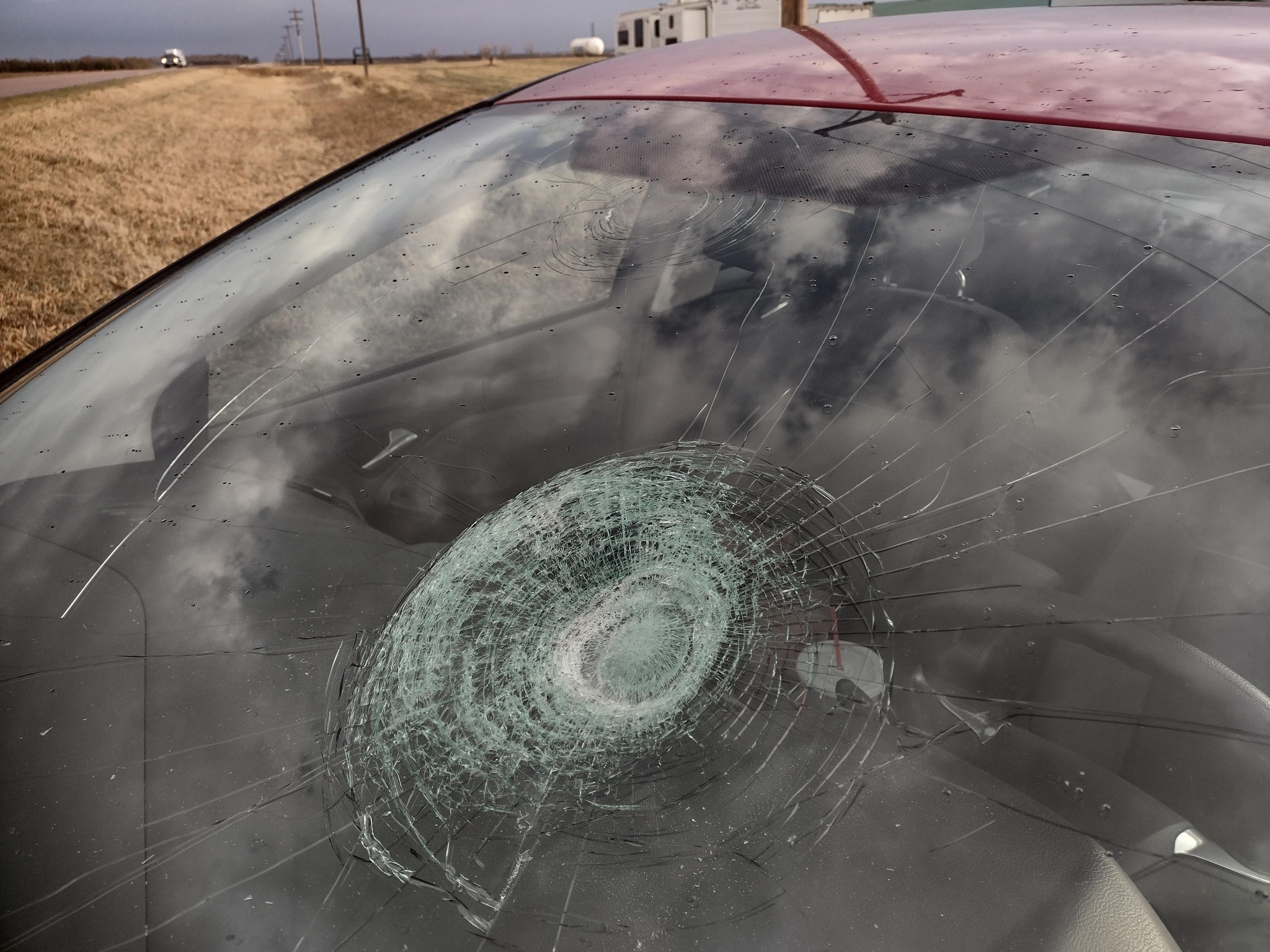
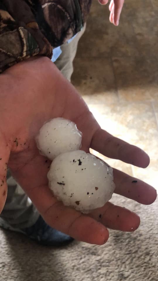
Hail damaged car windshield, Clayton SD (Marcus Stoltenburg) |
 |
 |
 |
 |
| Spikey ping pong ball hail, Trimont MN (Trevor Yochim) |
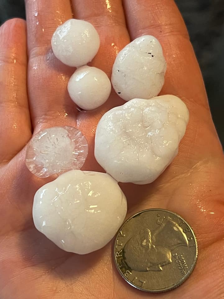
Quarter to half dollar sized hail, Sherbern MN (Samantha Wendt) |
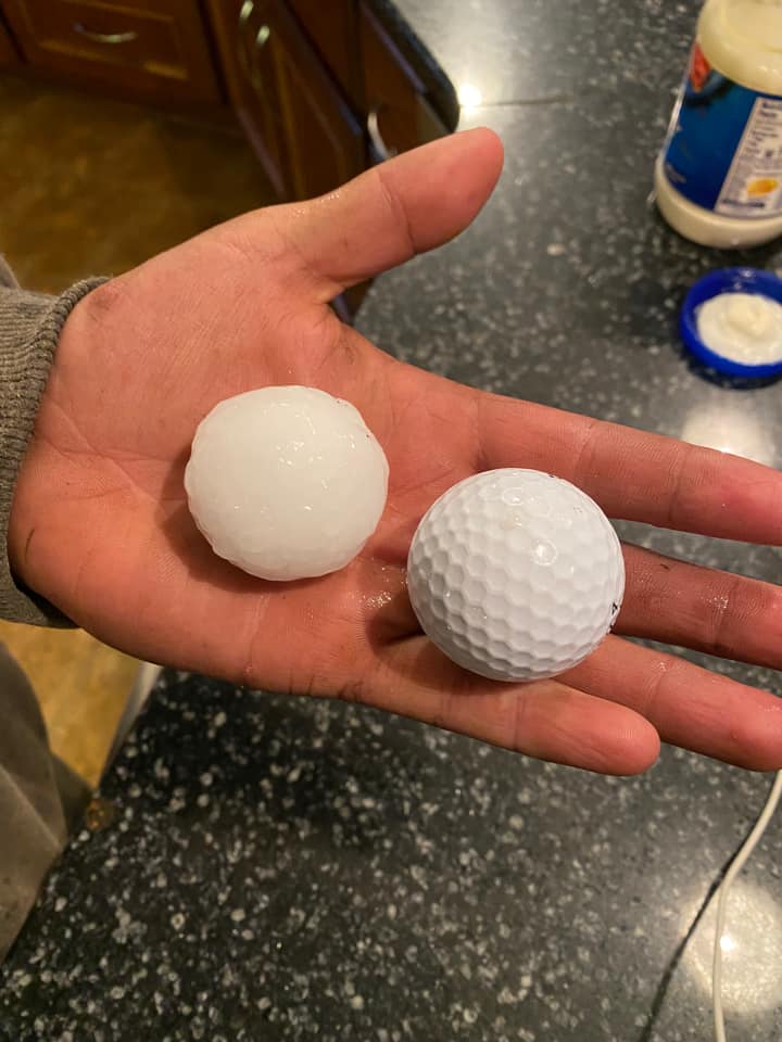
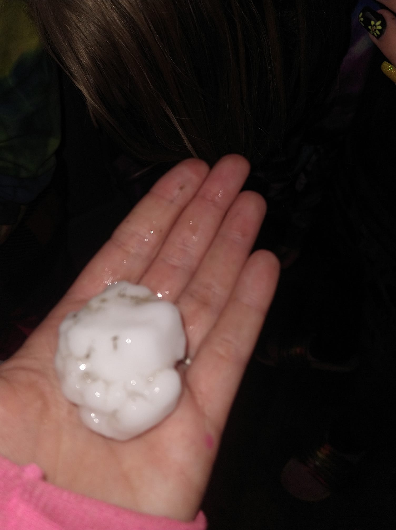
Golf ball next to hail stone, Hatfield MN (Berlinda Vander Wal) |
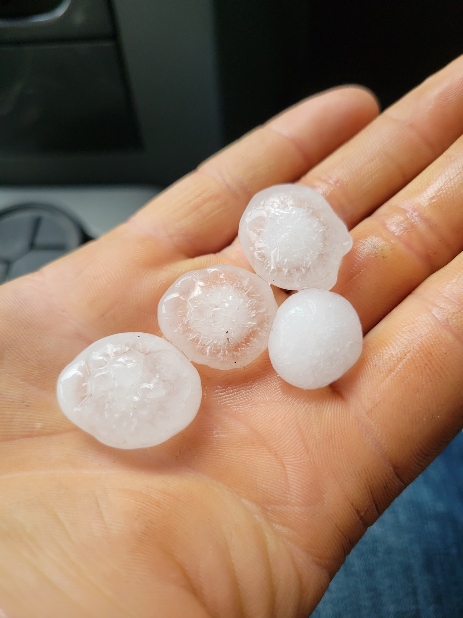
Ping pong ball hail and half dollar hail, Parkston SD (Sara Duvall) |
 |
 |
 |
 |
| Quarter sized hail, Fonda IA (Abby Voss) |
Golf ball hail stone, 5 miles east Parkston SD (Bridget Linn) |
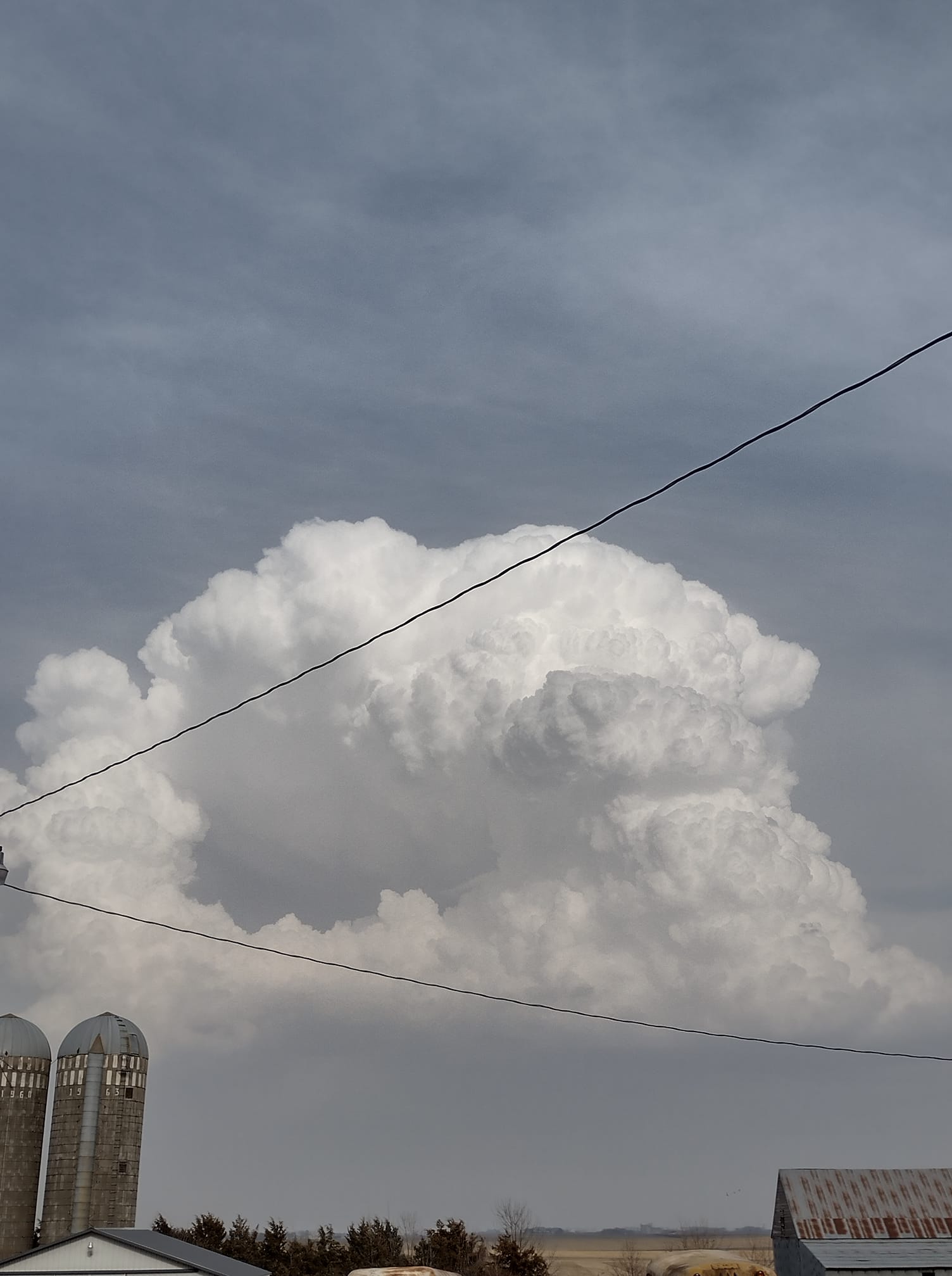
Cumulonimbus cloud, Newkirk IA (Debra Hoogland) |
Super cell, Tripp SD (Jon Wiederrich) |
Radar
Header
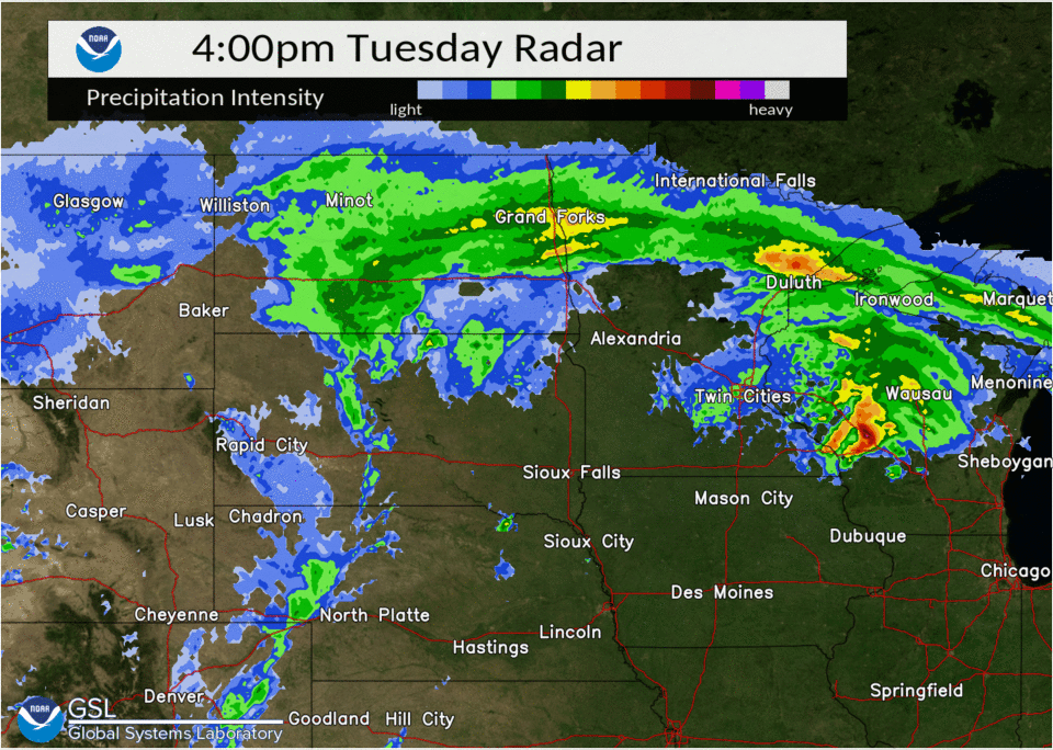 |
|||
| April 12 Radar Loop | Caption | Caption | Caption |
Storm Reports
Insert storm reports here. Copy in PNS or paste map.
PRELIMINARY LOCAL STORM REPORT...SUMMARY
NATIONAL WEATHER SERVICE SIOUX FALLS SD
1001 PM CDT WED APR 13 2022

..TIME...   ...EVENT...      ...CITY LOCATION...     ...LAT.LON...
..DATE...   ....MAG....      ..COUNTY LOCATION..ST.. ...SOURCE....
            ..REMARKS..

0515 PM     HAIL             CORRECTIONVILLE         42.48N 95.78W
04/12/2022  M1.75 INCH       WOODBURY           IA   FIRE DEPT/RESCUE

            TRAINED SPOTTER WITH THE FIRE DEPARTMENT
            REPORTED QUARTER TO GOLF BALL SIZED HAIL.

0522 PM     HAIL             HORNICK                 42.23N 96.10W
04/12/2022  E1.00 INCH       WOODBURY           IA   PUBLIC

            REPORT RECEIVED VIA SOCIAL MEDIA.

0524 PM     HAIL             3 N HORNICK             42.27N 96.09W
04/12/2022  E1.50 INCH       WOODBURY           IA   PUBLIC

            REPORT RECEIVED VIA SOCIAL MEDIA.

0531 PM     HAIL             ARMOUR                  43.32N 98.34W
04/12/2022  E1.00 INCH       DOUGLAS            SD   EMERGENCY MNGR

            QUARTER SIZE HAIL ON THE NORTHSIDE OF
            ARMOUR.

0540 PM     HAIL             8 NE ARMOUR             43.39N 98.21W
04/12/2022  E1.75 INCH       DOUGLAS            SD   EMERGENCY MNGR

            CORRECTS PREVIOUS HAIL REPORT FROM 8 NE
            ARMOUR. TIME ESTIMATED FROM RADAR.

0541 PM     HAIL             MILFORD                 43.33N 95.15W
04/12/2022  E0.88 INCH       DICKINSON          IA   EMERGENCY MNGR


0544 PM     HAIL             6 NE HORNICK            42.29N 96.01W
04/12/2022  E1.50 INCH       WOODBURY           IA   PUBLIC


0548 PM     HAIL             5 E ARNOLDS PARK        43.37N 95.04W
04/12/2022  M1.50 INCH       DICKINSON          IA   PUBLIC


0548 PM     HAIL             5 E ARNOLDS PARK        43.37N 95.04W
04/12/2022  E1.00 INCH       DICKINSON          IA   PUBLIC


0549 PM     HAIL             3 NW DELMONT            43.30N 98.20W
04/12/2022  E1.75 INCH       DOUGLAS            SD   PUBLIC

            TIME ESTIMATED FROM RADAR.

0553 PM     HAIL             2 ESE CHANCELLOR        43.37N 96.95W
04/12/2022  E0.88 INCH       TURNER             SD   FIRE DEPT/RESCUE

            NICKEL SIZE HAIL 2 TO 3 MILES EAST OF
            CHANCELLOR ALONG HIGHWAY 44.

0557 PM     HAIL             IDA GROVE               42.34N 95.47W
04/12/2022  E1.00 INCH       IDA                IA   PUBLIC


0558 PM     HAIL             WAHPETON                43.37N 95.17W
04/12/2022  E0.88 INCH       DICKINSON          IA   EMERGENCY MNGR


0600 PM     HAIL             5 E PARKSTON            43.39N 97.89W
04/12/2022  E2.00 INCH       HUTCHINSON         SD   PUBLIC


0600 PM     HAIL             PARKSTON                43.39N 97.99W
04/12/2022  E1.75 INCH       HUTCHINSON         SD   PUBLIC

            TIMING BASED ON RADAR.

0603 PM     HAIL             IDA GROVE               42.34N 95.47W
04/12/2022  M1.00 INCH       IDA                IA   PUBLIC

            SOCIAL MEDIA REPORT WITH PICTURE, 1 INCH
            HAIL.

0605 PM     HAIL             2 N LINN GROVE          42.92N 95.24W
04/12/2022  E1.25 INCH       CLAY               IA   PUBLIC

            SOCIAL MEDIA REPORT WITH PICTURE AND A
            PLASTIC EGG FOR COMPARISON.

0607 PM     HAIL             10 NE ARMOUR            43.42N 98.20W
04/12/2022  E1.75 INCH       DOUGLAS            SD   EMERGENCY MNGR

            PH SENT PICTURES OF PING PONG TO GOLF BALL
            SIZED HAIL.

0607 PM     HAIL             SPENCER                 43.15N 95.15W
04/12/2022  E0.70 INCH       CLAY               IA   PUBLIC


0609 PM     HAIL             PARKSTON                43.39N 97.99W
04/12/2022  E2.00 INCH       HUTCHINSON         SD   PUBLIC

            CORRECTS PREVIOUS HAIL REPORT FROM PARKSTON.
            SOCIAL MEDIA REPORT WITH PICTURE OF 2 INCH
            HAIL.

0614 PM     HAIL             1 ENE PARKSTON          43.40N 97.97W
04/12/2022  E1.50 INCH       HUTCHINSON         SD   PUBLIC

            REPORT FROM MPING: PING PONG BALL (1.50
            IN.).

0615 PM     HAIL             1 ENE SIOUX FALLS       43.55N 96.71W
04/12/2022  E1.00 INCH       MINNEHAHA          SD   PUBLIC

            SOCIAL MEDIA REPORT WITH PICTURE.

0615 PM     HAIL             DIMOCK                  43.48N 97.99W
04/12/2022  M2.50 INCH       HUTCHINSON         SD   PUBLIC

            EMAIL WITH PICTURE AND RULER.

0621 PM     HAIL             8 W CLAYTON             43.46N 97.81W
04/12/2022  E1.25 INCH       HUTCHINSON         SD   PUBLIC

            SOCIAL MEDIA REPORT WITH PICTURE.

0622 PM     HAIL             7 W CLAYTON             43.45N 97.80W
04/12/2022  E1.75 INCH       HUTCHINSON         SD   PUBLIC

            CORRECTS PREVIOUS HAIL REPORT FROM 7 W
            CLAYTON.

0623 PM     HAIL             SPENCER                 43.15N 95.15W
04/12/2022  E0.88 INCH       CLAY               IA   PUBLIC


0630 PM     HAIL             4 SW CLAYTON            43.40N 97.71W
04/12/2022  E2.75 INCH       HUTCHINSON         SD   LAW ENFORCEMENT

            BASEBALL SIZE HAIL SMASHED COUNTY DEPUTY
            SHERIFFS WINDSHIELD.

0630 PM     HAIL             2 S CLAYTON             43.41N 97.66W
04/12/2022  E2.75 INCH       HUTCHINSON         SD   PUBLIC


0645 PM     HAIL             3 E EMERY               43.61N 97.56W
04/12/2022  E1.75 INCH       MCCOOK             SD   LAW ENFORCEMENT

            GOLF BALL SIZE HAIL AND 50 MPH WIND GUST.

0645 PM     HAIL             8 S JACKSON             43.51N 94.99W
04/12/2022  E1.25 INCH       JACKSON            MN   PUBLIC

            KR SOCIAL MEDIA REPORT OF HALF DOLLAR SIZED
            HAIL, WITH PICTURE AND QUARTER FOR
            COMPARISON.

0655 PM     HAIL             2 SE PIPESTONE          43.98N 96.29W
04/12/2022  E1.00 INCH       PIPESTONE          MN   PUBLIC

            SOCIAL MEDIA REPORT WITH PICTURE AND COIN
            FOR COMPARISON.

0659 PM     HAIL             1 WSW HATFIELD          43.95N 96.21W
04/12/2022  E1.50 INCH       PIPESTONE          MN   PUBLIC

            SOCIAL MEDIA POST WITH PICTURE AND GOLF BALL
            FOR COMPARISON.

0705 PM     HAIL             2 N HATFIELD            43.98N 96.19W
04/12/2022  E1.75 INCH       PIPESTONE          MN   PUBLIC

            SOCIAL MEDIA REPORT WITH PICTURE AND GOLF
            BALL FOR COMPARISON.

0715 PM     HAIL             3 W VOLGA               44.33N 96.98W
04/12/2022  E1.00 INCH       BROOKINGS          SD   PUBLIC

            TIME ESTIMATED FROM RADAR.

0730 PM     HAIL             BALATON                 44.24N 95.88W
04/12/2022  E1.50 INCH       LYON               MN   PUBLIC

            REPORT FROM MPING: PING PONG BALL (1.50 IN.)
            TIME ESTIMATED FROM RADAR.

0731 PM     HAIL             BALATON                 44.24N 95.87W
04/12/2022  M1.25 INCH       LYON               MN   PUBLIC

            SOCIAL MEDIA PICTURES SHOWED QUARTER TO
            HALF-DOLLAR SIZED HAIL MEASURED BY A RULER.

0802 PM     TSTM WND DMG     1 ESE IDA GROVE         42.34N 95.45W
04/12/2022                   IDA                IA   TRAINED SPOTTER

            CORRECTS PREVIOUS TSTM WND DMG REPORT FROM 1
            ESE IDA GROVE. LOTS OF BRANCHES DOWN, ONE
            APPROXIMATELY 8 INCH PINE TREE SPLIT.

0822 PM     NON-TSTM WND GST 1 WNW SERGEANT BLUFF    42.40N 96.38W
04/12/2022  E63 MPH          WOODBURY           IA   ASOS


0825 PM     NON-TSTM WND DMG 1 SSE SALIX             42.30N 96.28W
04/12/2022                   WOODBURY           IA   LAW ENFORCEMENT

            TREES AND POWER LINES DOWN.

0826 PM     NON-TSTM WND DMG DAKOTA CITY             42.42N 96.42W
04/12/2022                   DAKOTA             NE   EMERGENCY MNGR

            TREES DOWN AROUND 08:20 FROM NW WINDS BEHIND
            COLD FRONT.


&&

$$
 |
Media use of NWS Web News Stories is encouraged! Please acknowledge the NWS as the source of any news information accessed from this site. |
|


 Weather Story
 Weather Map
 Local Radar