Overview
|
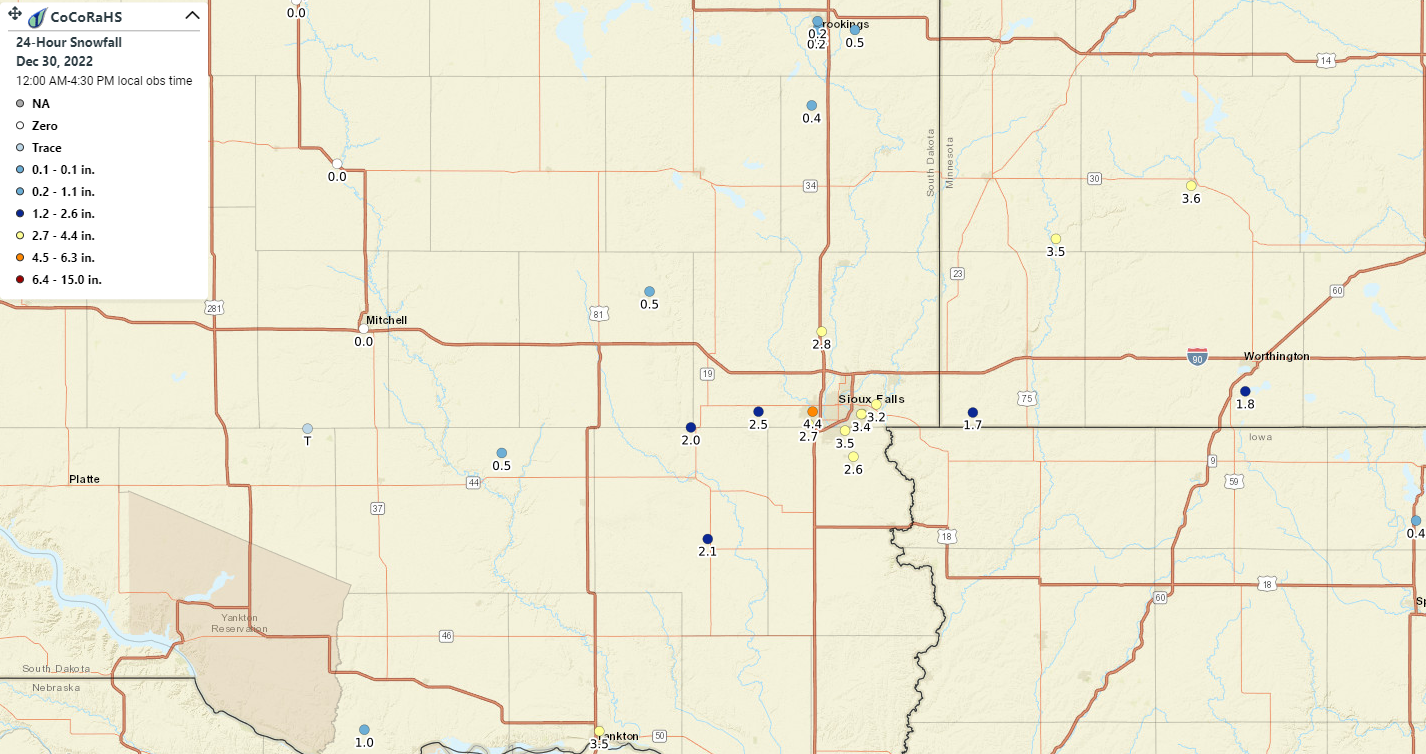
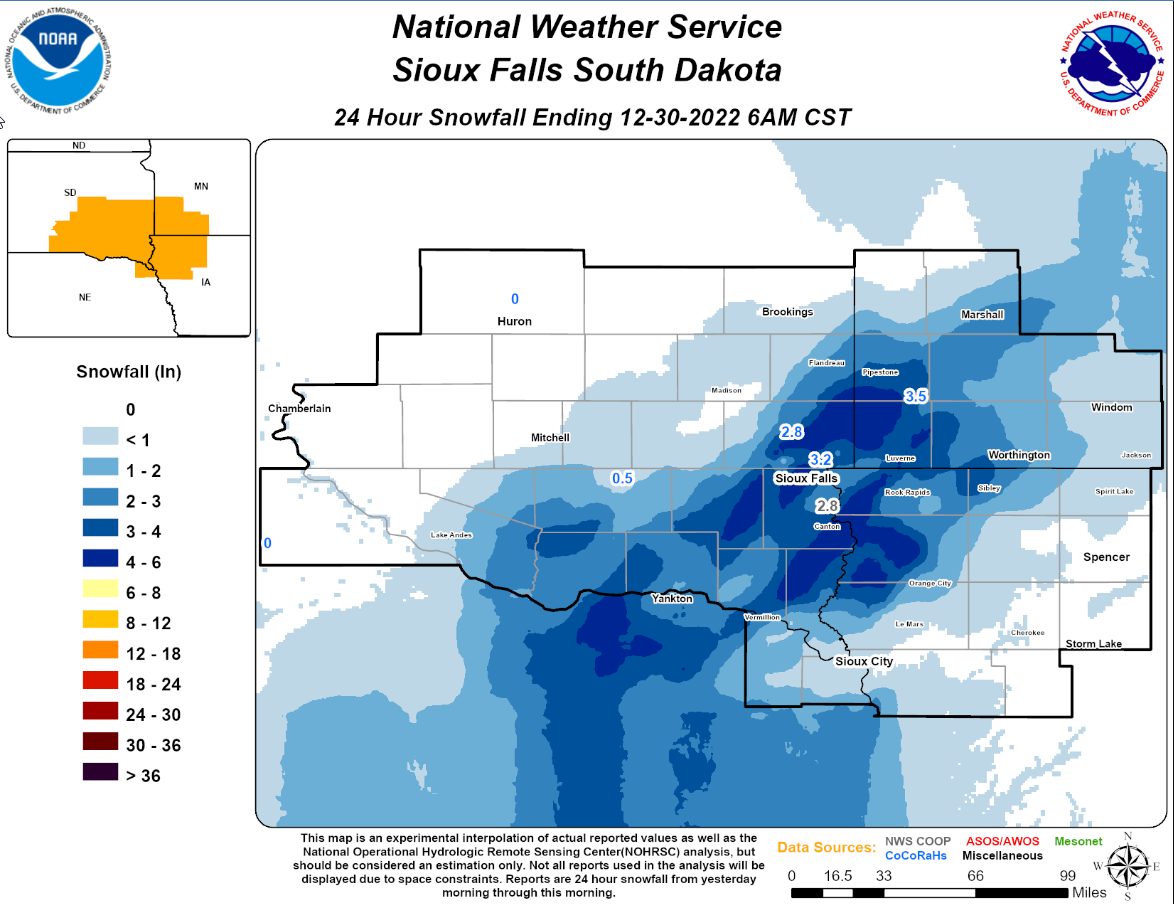
A fast moving winter system brought widespread snow and some mixed precipitation to portions of southeastern SD, southwestern MN, northwestern IA, and extreme northeastern NE. While snowfall accumulations only ranged from 1 to 4 inches, a concentrated band of light to moderate snow set up along a line extending from Yankton SD to Sioux Falls, SD to Marshall, MN causing hazardous driving conditions and periods of reduced visibility. |
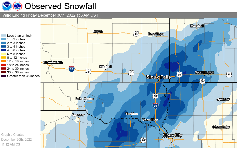 Snowfall Totals Across the Area |
Photos & Video
 |
 |
 |
|
|
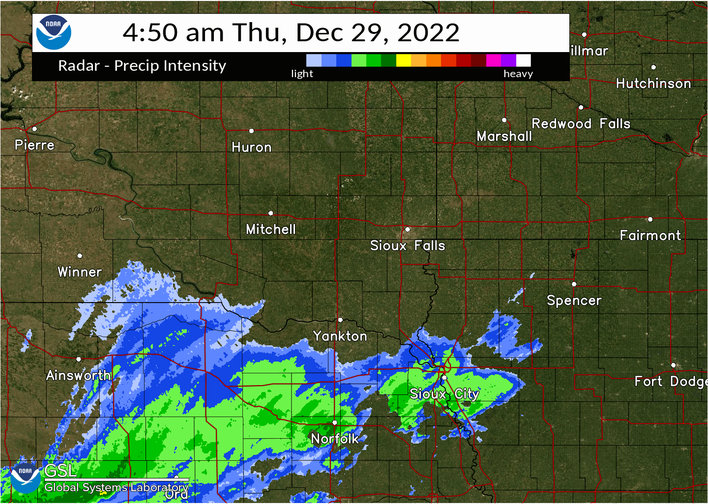
Radar Composite: 5am - 11am Light snow begins to develop south of the Missouri River and spreads northeastward |
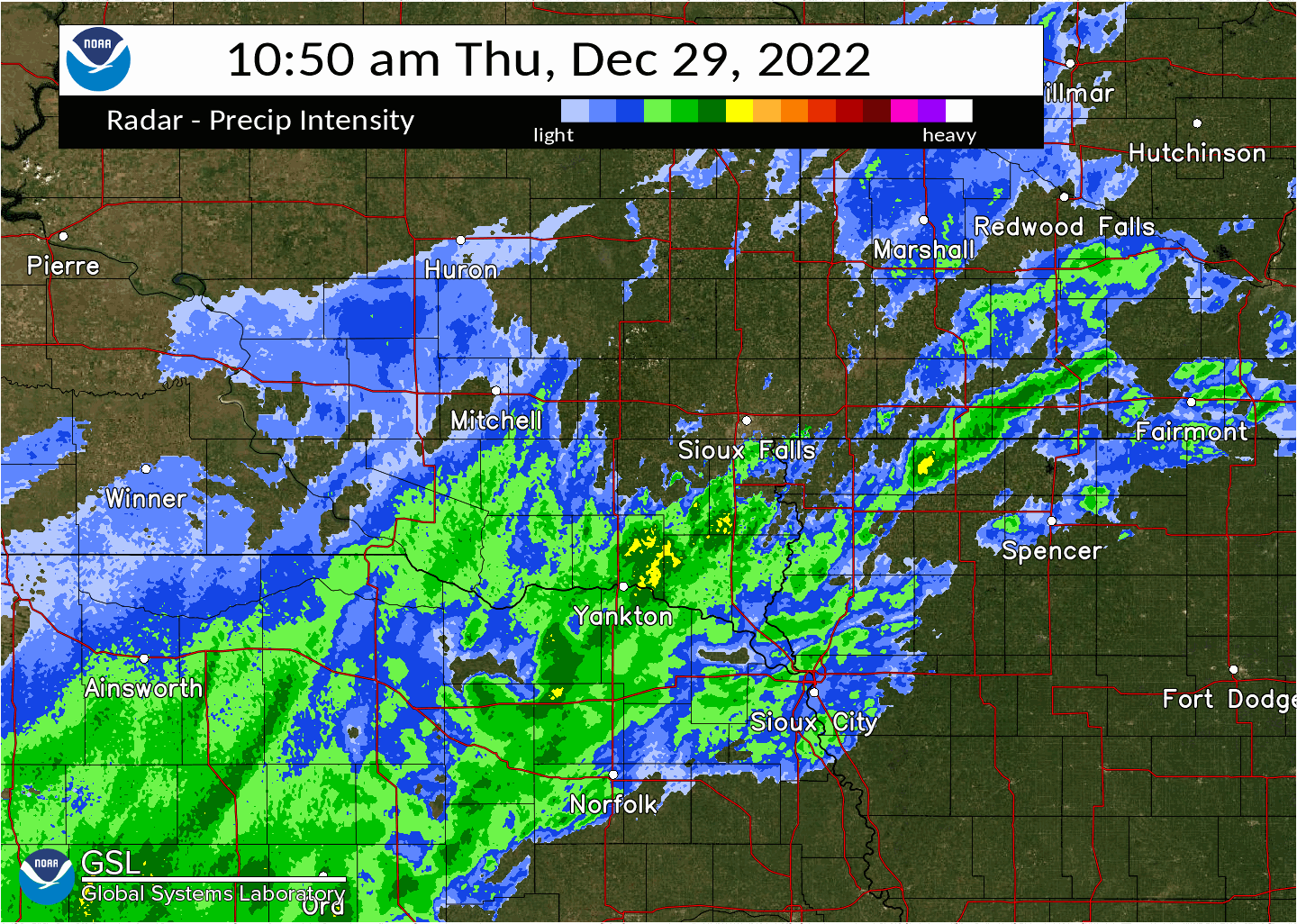
Radar Composite:11am - 5pm The band of snow starts to narrow and intensify over portion of southeastern SD and southwestern MN. |
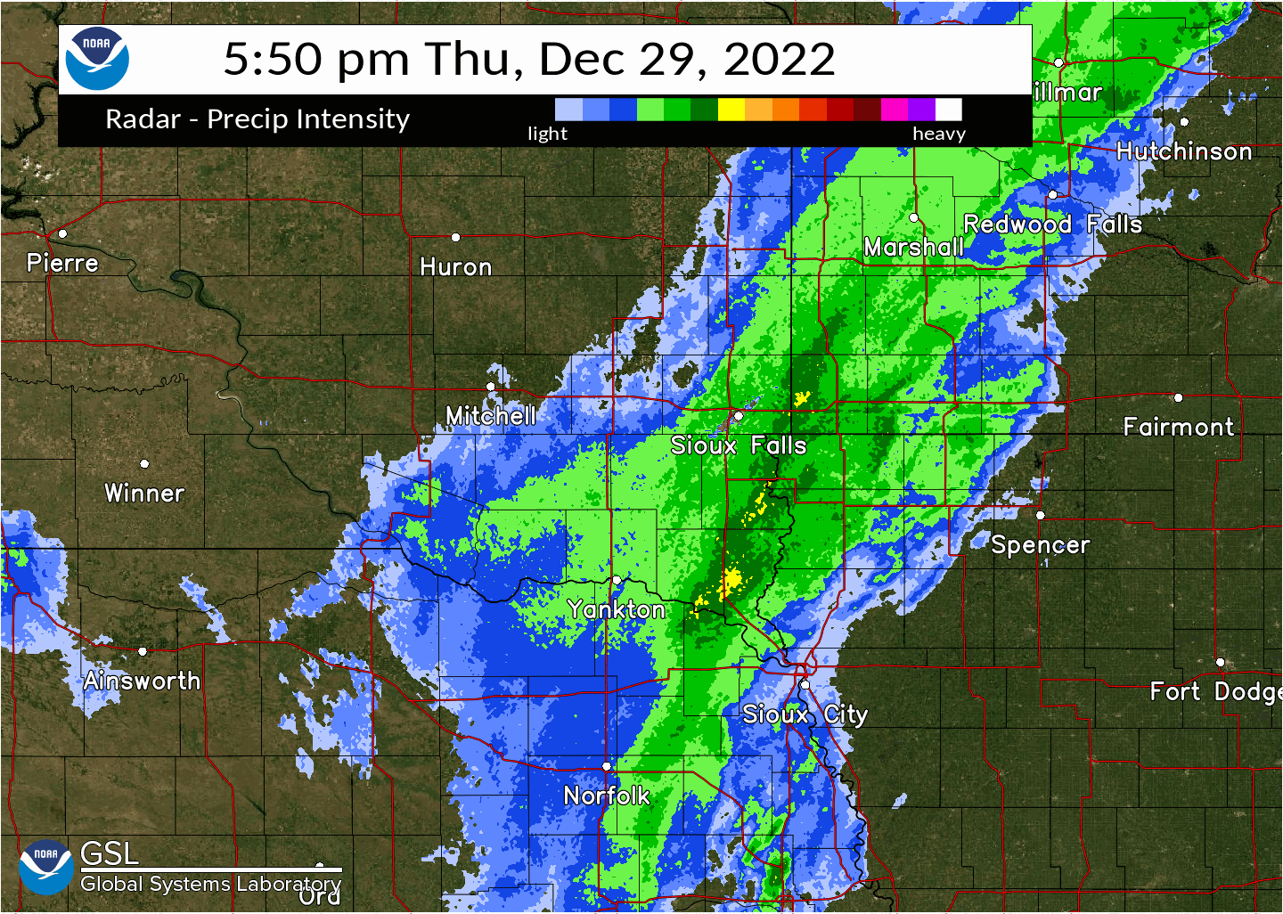
Radar Composite: 5pm - 10pm The band begins to push eastward then weaken as it heads into southwestern MN and northwestern IA |
Storm Reports
|
|
|
|
 |
Media use of NWS Web News Stories is encouraged! Please acknowledge the NWS as the source of any news information accessed from this site. |
|


 Weather Story
 Weather Map
 Local Radar