Overview
|
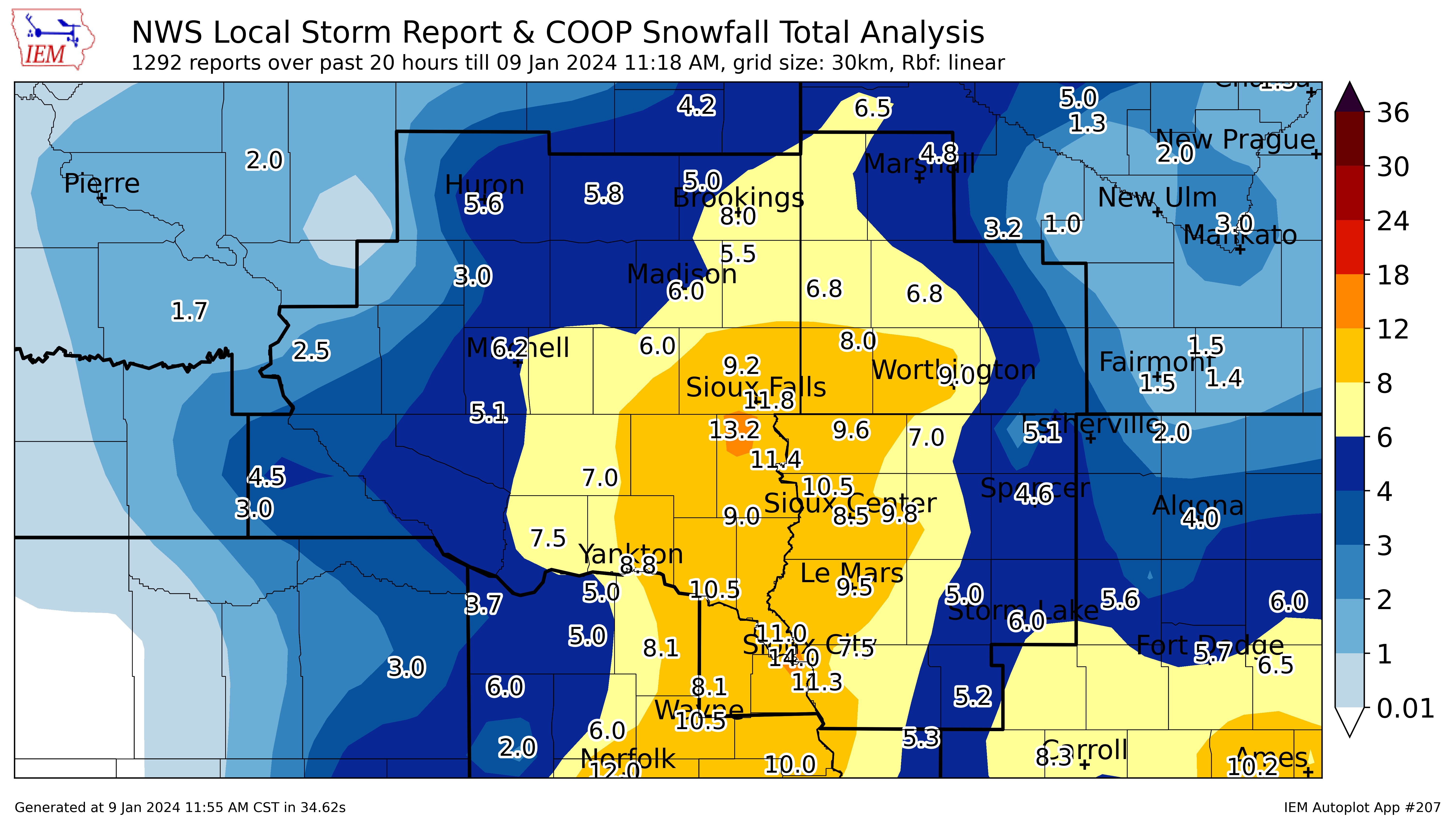
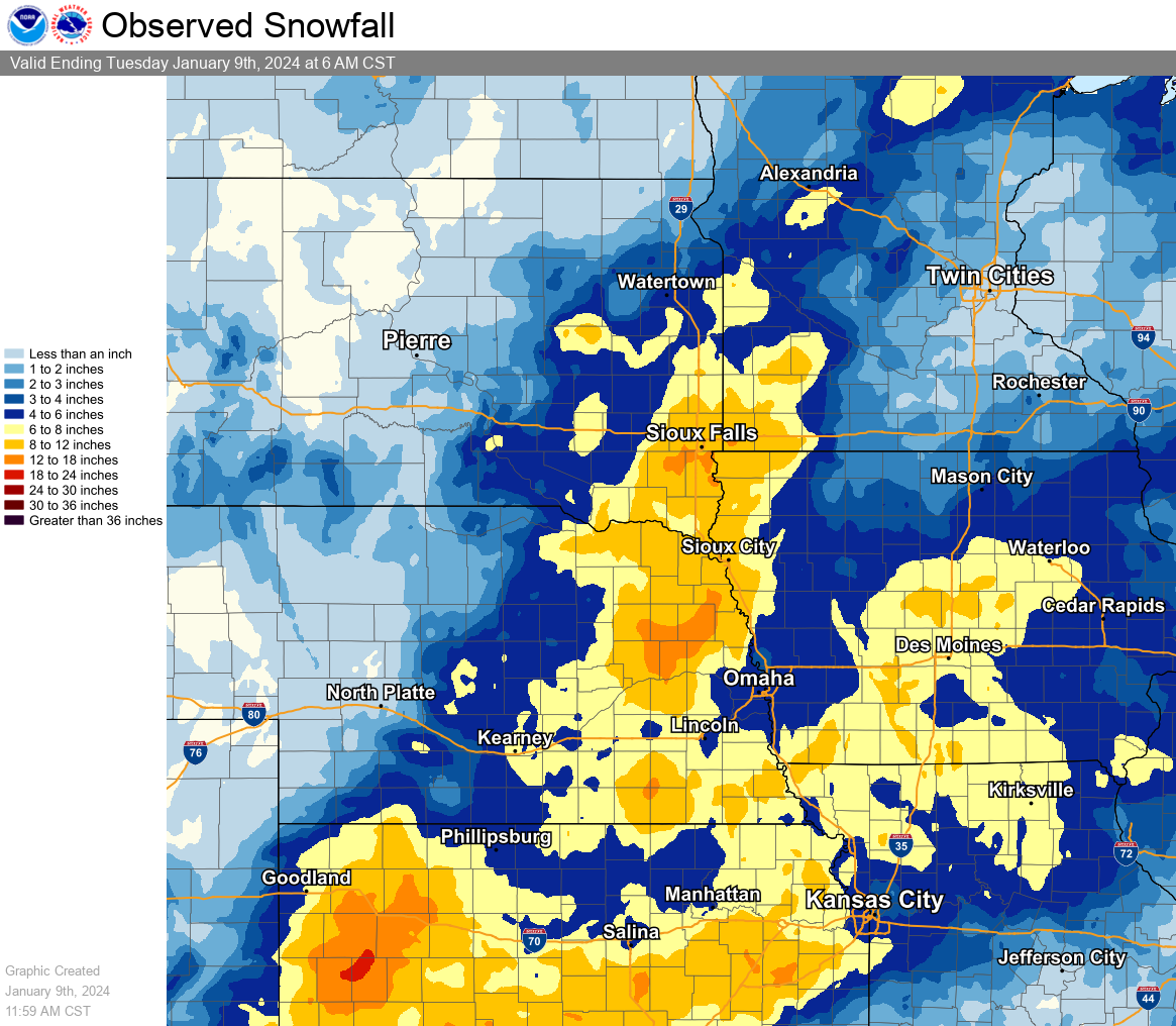
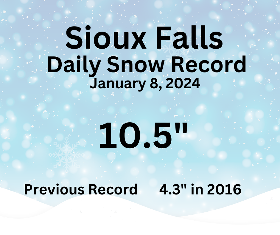
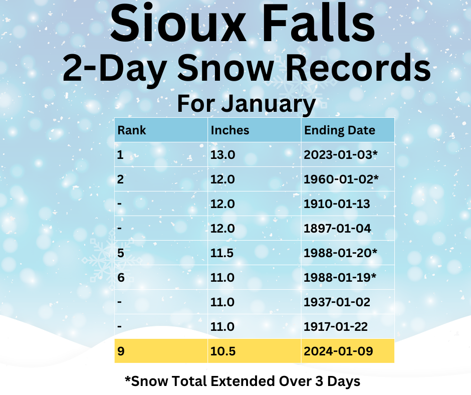
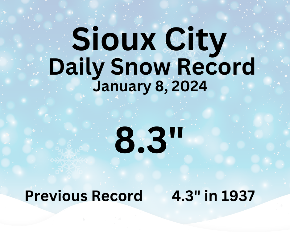
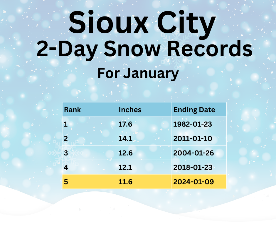
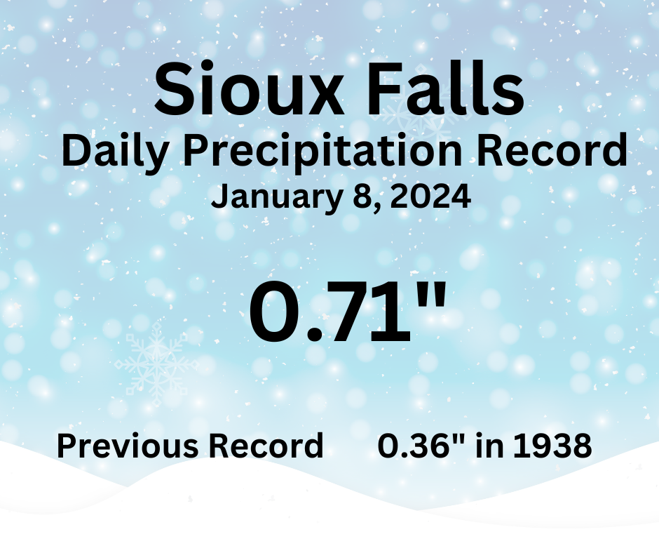
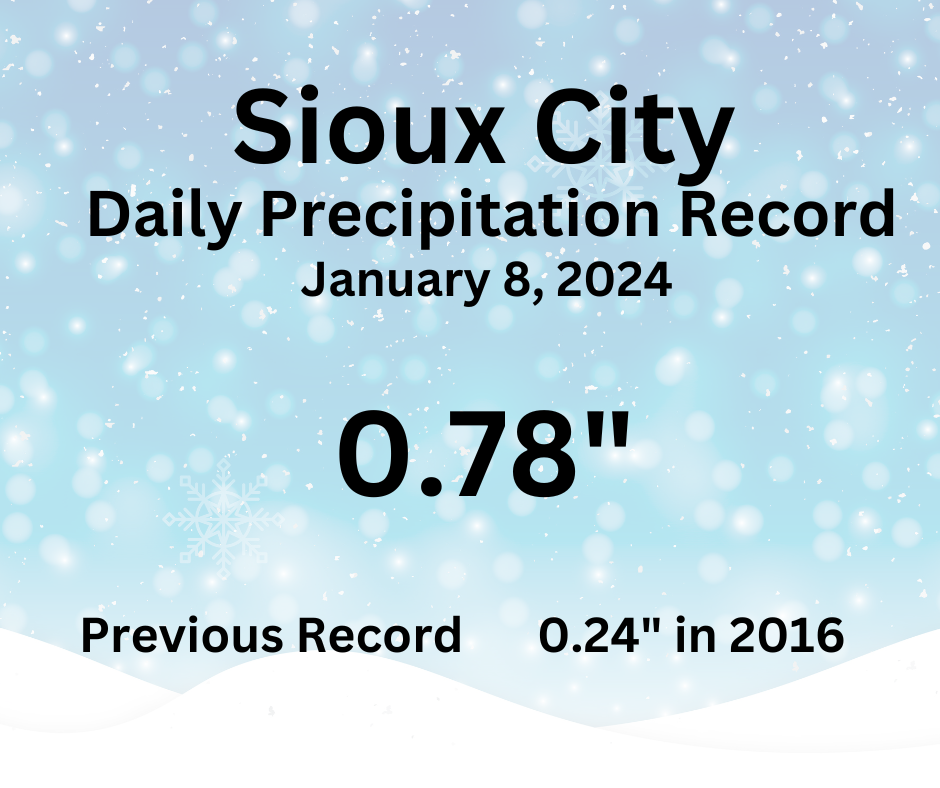
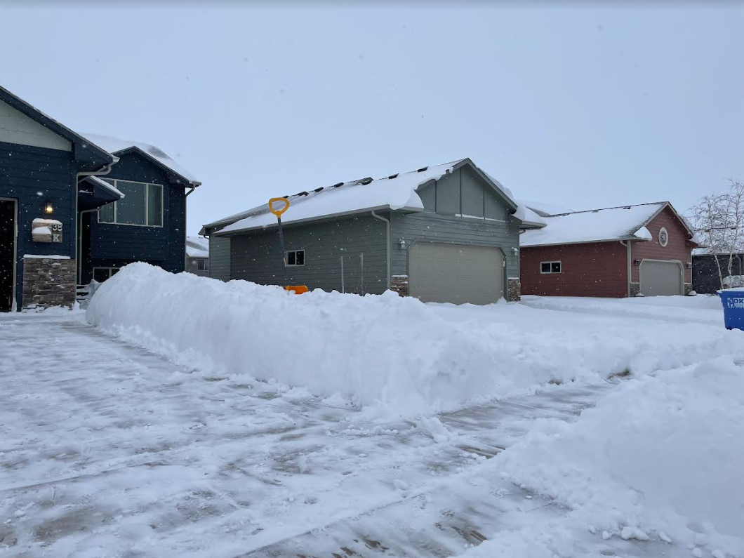
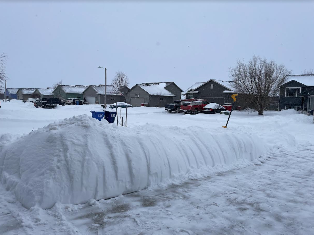
The first major Winter storm of the 2023-24 winter season moved through the region beginning on January 8, 2024 and ended early on January 9th. Snow developed early in the morning of the 8th, bringing an intense band of snowfall into the Tri-State area, with upwards of 1-2" per hour snowfall rates. A rapid accumulation of 4 to 8 inches of snow was reported by mid-morning of the 8th during part one of this winter storm. After a short pause in the precipitation during the late morning, a second round of snow then developed during the afternoon and continued through the overnight hours on the 9th. Once again, heavy snowfall rates were observed in the region. As the storm started to move east of the area, temperatures fell and strong wind gusts of 25 to 35 mph developed. This led to areas of blowing and drifting snow throughout the region. Storm total snowfall ranged from a few inches in central South Dakota, to a large area of 6 to 12 inches aligned along the I-29 corridor. For the cities of Sioux Falls and Sioux City, the daily snowfall total on January 8th established new daily records. Precipitation records were also broken for the date. The two-day totals for Sioux Falls and Sioux City both ranked in the top 10 heaviest snowfall on record for January. |
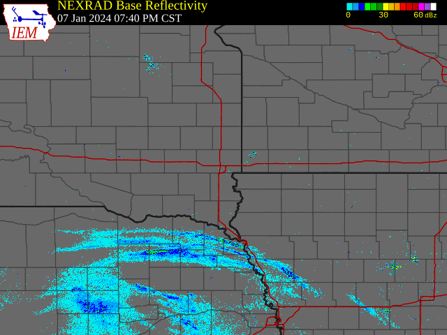 48 Hour Radar Summary |
 |
 |
.png) |
| Storm Total Snowfall (larger image) | Regional Snowfall Totals Through 10am 1/9/24 | 2 day Snowfall Rankings For Sioux Falls |
Here's a look at local and regional snowfall totals. Several records were broken during this event, including daily precipitation and snowfall totals for Sioux Falls and Sioux City.
Storm Total Snowfall (click for larger image) |
||||||||||||||||||||||||||||||||||||||||||||||||||||||||||||||||||||||||||||||||||||||||||||||||||||||||||||||||||||||||||||||||||||||||||||||||||||||||||||||||||||||||||||||||||||||||||||||||||||||||||||||||||||||||||||||||||||||||||||||||||||||||||||||||||||||||||||||||||||||||||||||||||||||||||||||||||||||||||||||||||||||||||||||||||||||||||||||||||||||||||||||||||||||||||||||||||||||||||||||||||||||||||||||||||||||||||||||||||||||||||||||||||||||||||||||||||||||||||||||||||||||||||||||||||||||||||||||||||||||||||||||||||||||||||||||||||||||||||||||||||||||||||||||||||||||||||||||||||||||||||||||||||||||||||||||||||||||||||||||||||||||||||||||||||||||||||||||||||||||||||||||||||||||||||||||||||||||||||||||||||||||||
 |
 |
 |
 |
|||||||||||||||||||||||||||||||||||||||||||||||||||||||||||||||||||||||||||||||||||||||||||||||||||||||||||||||||||||||||||||||||||||||||||||||||||||||||||||||||||||||||||||||||||||||||||||||||||||||||||||||||||||||||||||||||||||||||||||||||||||||||||||||||||||||||||||||||||||||||||||||||||||||||||||||||||||||||||||||||||||||||||||||||||||||||||||||||||||||||||||||||||||||||||||||||||||||||||||||||||||||||||||||||||||||||||||||||||||||||||||||||||||||||||||||||||||||||||||||||||||||||||||||||||||||||||||||||||||||||||||||||||||||||||||||||||||||||||||||||||||||||||||||||||||||||||||||||||||||||||||||||||||||||||||||||||||||||||||||||||||||||||||||||||||||||||||||||||||||||||||||||||||||||||||||||||||||||||||||||||||
| Sioux Falls Daily Snow Record | Sioux Falls Top 2-day January Snow | Sioux City Record Snow Snowfall | Sioux City Top 2-day Snow in January | |||||||||||||||||||||||||||||||||||||||||||||||||||||||||||||||||||||||||||||||||||||||||||||||||||||||||||||||||||||||||||||||||||||||||||||||||||||||||||||||||||||||||||||||||||||||||||||||||||||||||||||||||||||||||||||||||||||||||||||||||||||||||||||||||||||||||||||||||||||||||||||||||||||||||||||||||||||||||||||||||||||||||||||||||||||||||||||||||||||||||||||||||||||||||||||||||||||||||||||||||||||||||||||||||||||||||||||||||||||||||||||||||||||||||||||||||||||||||||||||||||||||||||||||||||||||||||||||||||||||||||||||||||||||||||||||||||||||||||||||||||||||||||||||||||||||||||||||||||||||||||||||||||||||||||||||||||||||||||||||||||||||||||||||||||||||||||||||||||||||||||||||||||||||||||||||||||||||||||||||||||||
 |
 |
|||||||||||||||||||||||||||||||||||||||||||||||||||||||||||||||||||||||||||||||||||||||||||||||||||||||||||||||||||||||||||||||||||||||||||||||||||||||||||||||||||||||||||||||||||||||||||||||||||||||||||||||||||||||||||||||||||||||||||||||||||||||||||||||||||||||||||||||||||||||||||||||||||||||||||||||||||||||||||||||||||||||||||||||||||||||||||||||||||||||||||||||||||||||||||||||||||||||||||||||||||||||||||||||||||||||||||||||||||||||||||||||||||||||||||||||||||||||||||||||||||||||||||||||||||||||||||||||||||||||||||||||||||||||||||||||||||||||||||||||||||||||||||||||||||||||||||||||||||||||||||||||||||||||||||||||||||||||||||||||||||||||||||||||||||||||||||||||||||||||||||||||||||||||||||||||||||||||||||||||||||||||
| Sioux Falls Daily Precipitation Record | Sioux City Daily Precipitation Record | |||||||||||||||||||||||||||||||||||||||||||||||||||||||||||||||||||||||||||||||||||||||||||||||||||||||||||||||||||||||||||||||||||||||||||||||||||||||||||||||||||||||||||||||||||||||||||||||||||||||||||||||||||||||||||||||||||||||||||||||||||||||||||||||||||||||||||||||||||||||||||||||||||||||||||||||||||||||||||||||||||||||||||||||||||||||||||||||||||||||||||||||||||||||||||||||||||||||||||||||||||||||||||||||||||||||||||||||||||||||||||||||||||||||||||||||||||||||||||||||||||||||||||||||||||||||||||||||||||||||||||||||||||||||||||||||||||||||||||||||||||||||||||||||||||||||||||||||||||||||||||||||||||||||||||||||||||||||||||||||||||||||||||||||||||||||||||||||||||||||||||||||||||||||||||||||||||||||||||||||||||||||
| 2 Day Storm Total Snowfall - Reports Ending the Morning of January 9th | ||||||||||||||||||||||||||||||||||||||||||||||||||||||||||||||||||||||||||||||||||||||||||||||||||||||||||||||||||||||||||||||||||||||||||||||||||||||||||||||||||||||||||||||||||||||||||||||||||||||||||||||||||||||||||||||||||||||||||||||||||||||||||||||||||||||||||||||||||||||||||||||||||||||||||||||||||||||||||||||||||||||||||||||||||||||||||||||||||||||||||||||||||||||||||||||||||||||||||||||||||||||||||||||||||||||||||||||||||||||||||||||||||||||||||||||||||||||||||||||||||||||||||||||||||||||||||||||||||||||||||||||||||||||||||||||||||||||||||||||||||||||||||||||||||||||||||||||||||||||||||||||||||||||||||||||||||||||||||||||||||||||||||||||||||||||||||||||||||||||||||||||||||||||||||||||||||||||||||||||||||||||||
|
||||||||||||||||||||||||||||||||||||||||||||||||||||||||||||||||||||||||||||||||||||||||||||||||||||||||||||||||||||||||||||||||||||||||||||||||||||||||||||||||||||||||||||||||||||||||||||||||||||||||||||||||||||||||||||||||||||||||||||||||||||||||||||||||||||||||||||||||||||||||||||||||||||||||||||||||||||||||||||||||||||||||||||||||||||||||||||||||||||||||||||||||||||||||||||||||||||||||||||||||||||||||||||||||||||||||||||||||||||||||||||||||||||||||||||||||||||||||||||||||||||||||||||||||||||||||||||||||||||||||||||||||||||||||||||||||||||||||||||||||||||||||||||||||||||||||||||||||||||||||||||||||||||||||||||||||||||||||||||||||||||||||||||||||||||||||||||||||||||||||||||||||||||||||||||||||||||||||||||||||||||||||
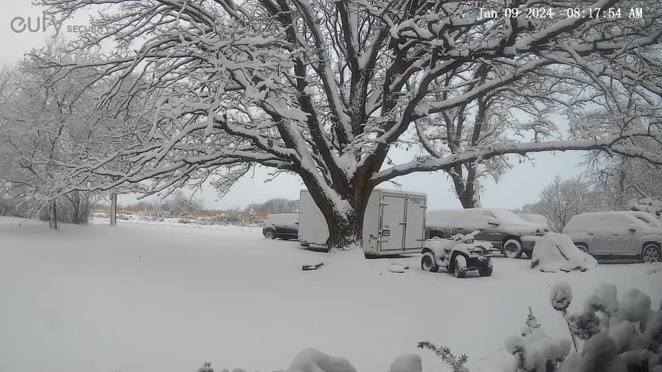
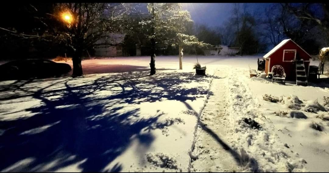
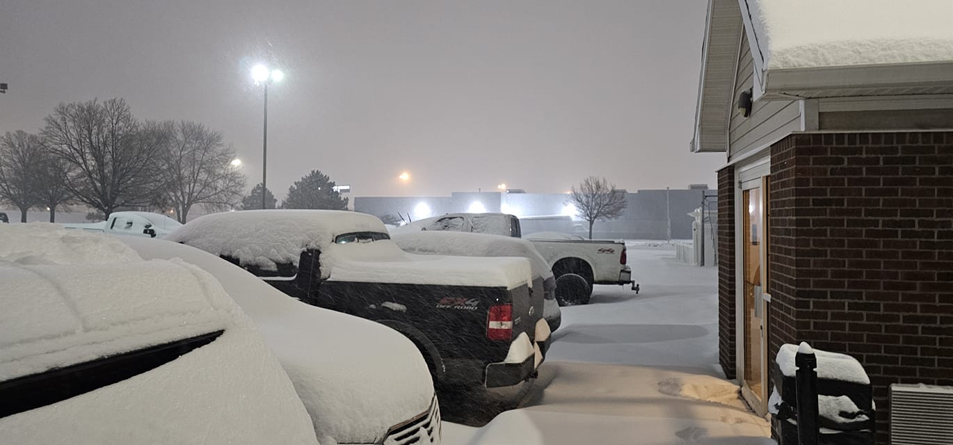
Photos & Video
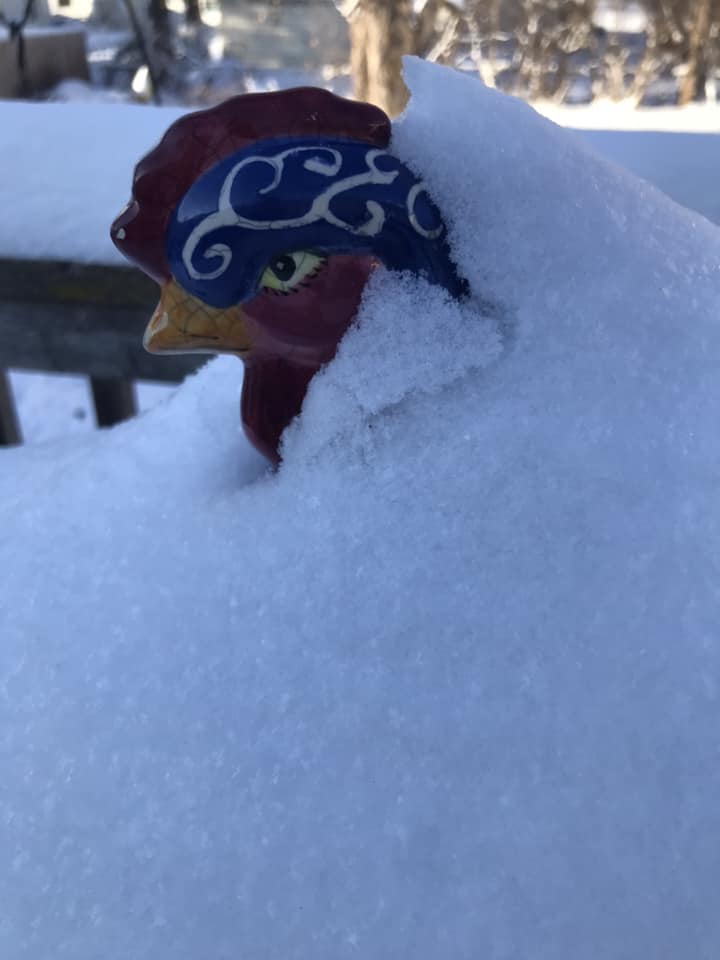
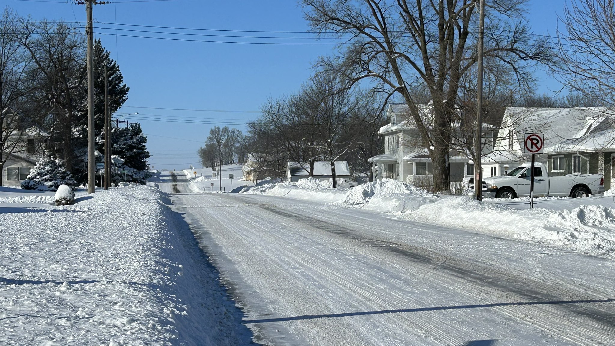
A collection of storm photos from the Tri-State Region
 |
 |
 |
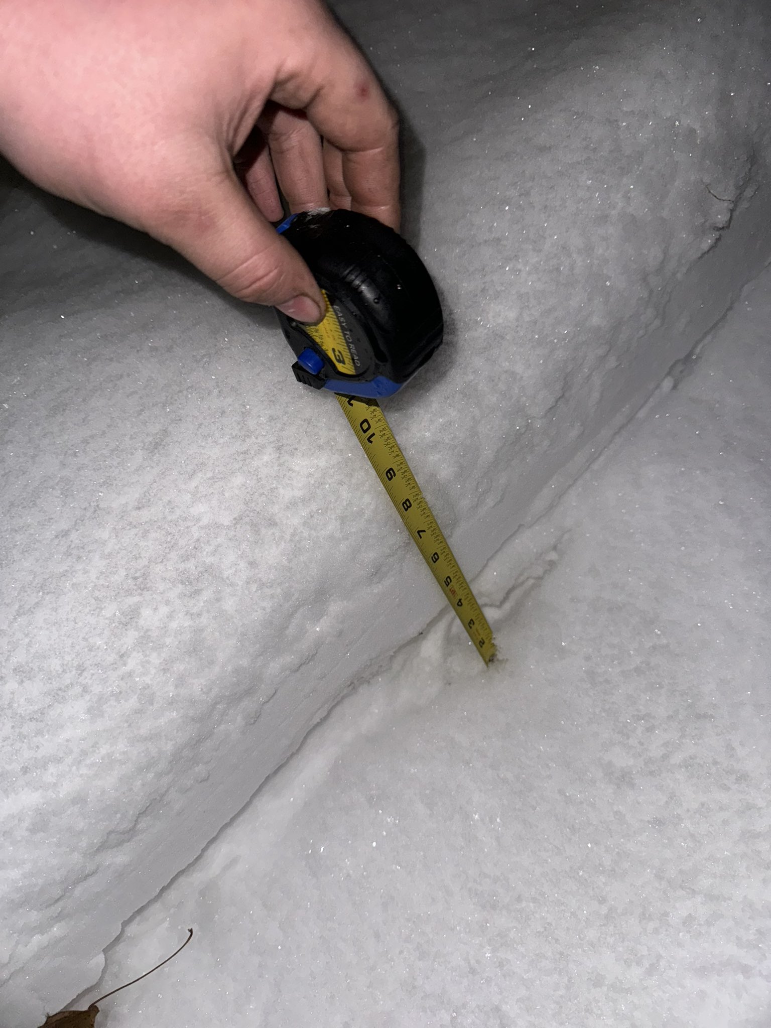 |
| Cherokee, IA (Credit Teri Chaffin) |
Melvin, IA (Credit: Christy Year) |
Sioux Falls Empire Mall (Credit: Quincy McGuire) |
Sheldon, IA (Credit: Jason Kruger) |
 |
 |
 |
 |
| Sioux Falls, SD (Credit Jill Callison) |
Harrisburg, SD (Credit: NWS Employee) |
Harrisburg, SD (Credit: NWS Employee) |
Concord, NE (Credit: Joe R.) |
Environment
A collection of Atmospheric Data from the Storm
 |
 |
 |
 |
|
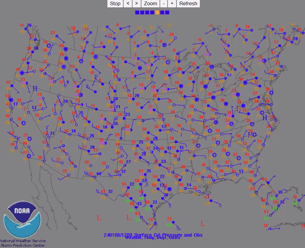
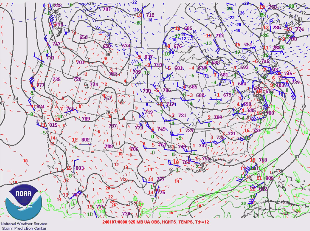
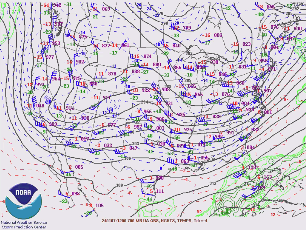
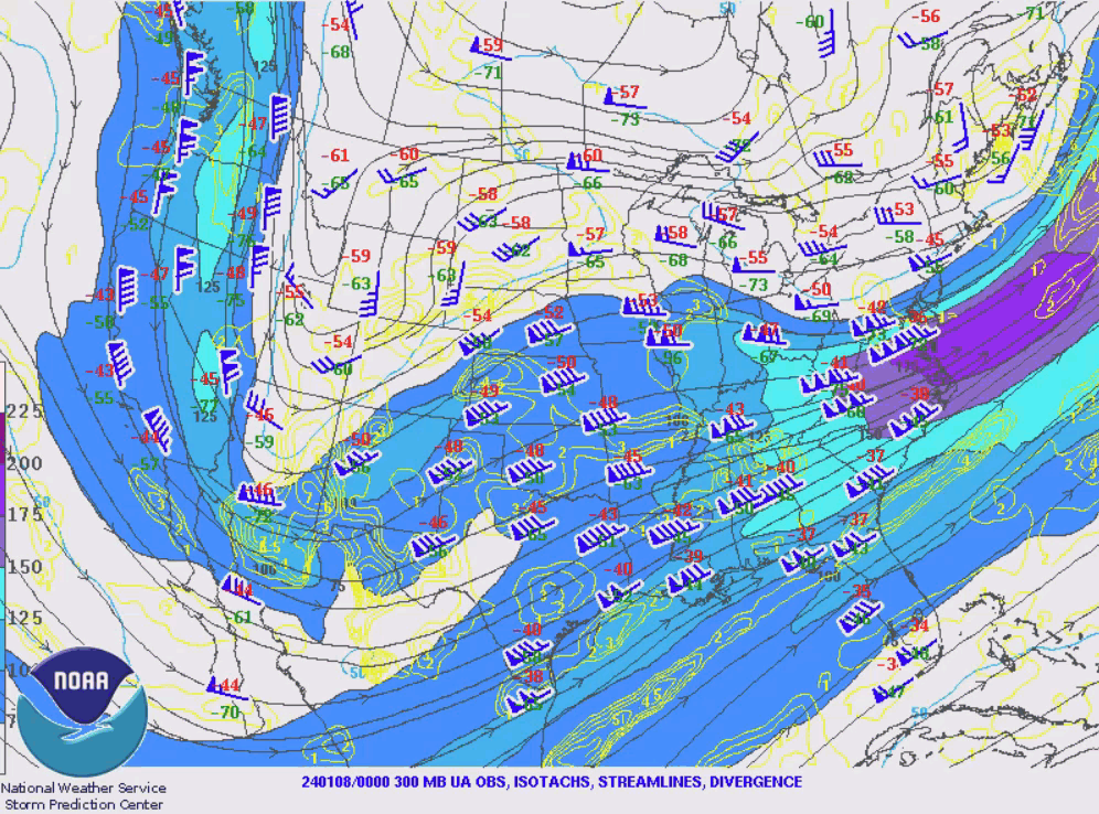
| Surface Observation Loop | 925 mb Upper Air Maps | 700 mb Upper Air Maps | 300 mb Upper Air Maps | |
| Forecast Parameter through 15Z 1/8 | ||||
 |
 |
 |
 |
|
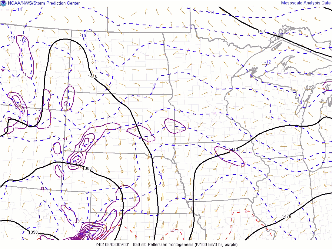
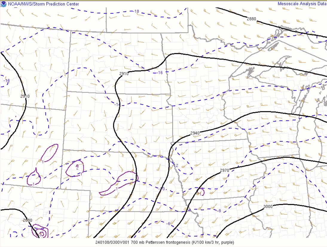
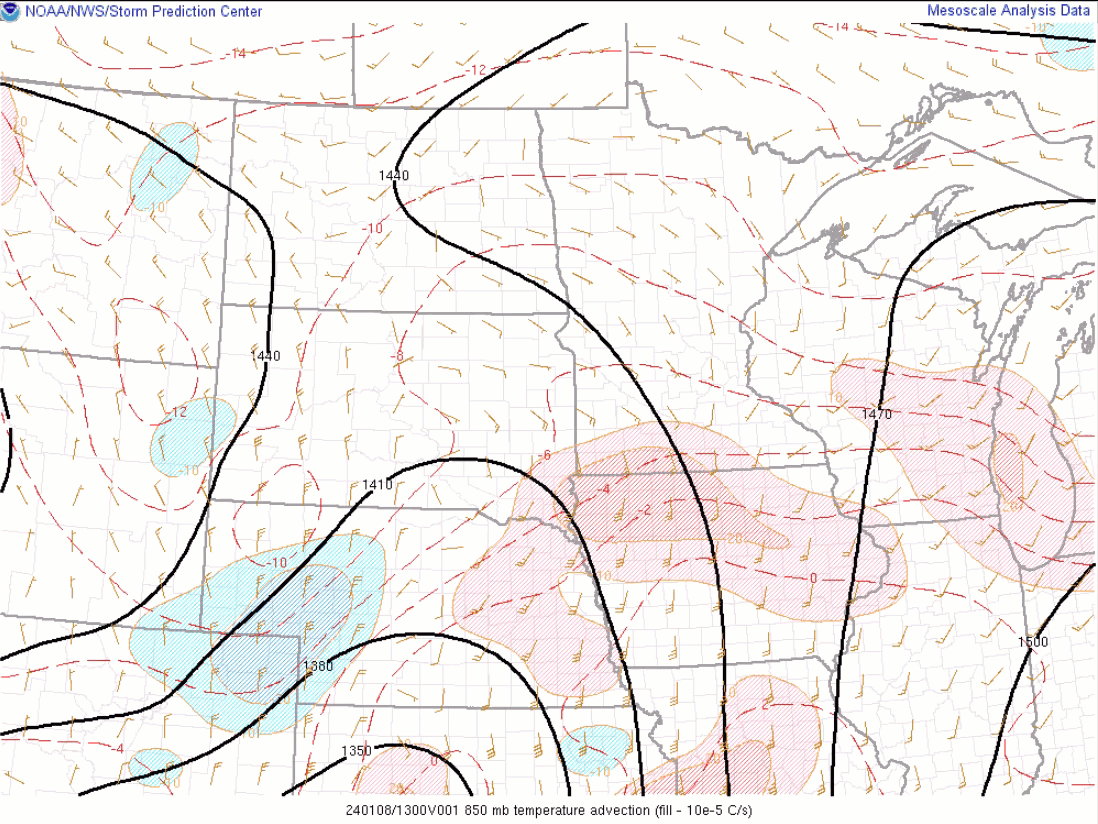
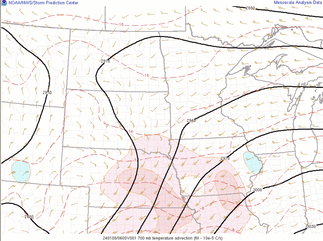
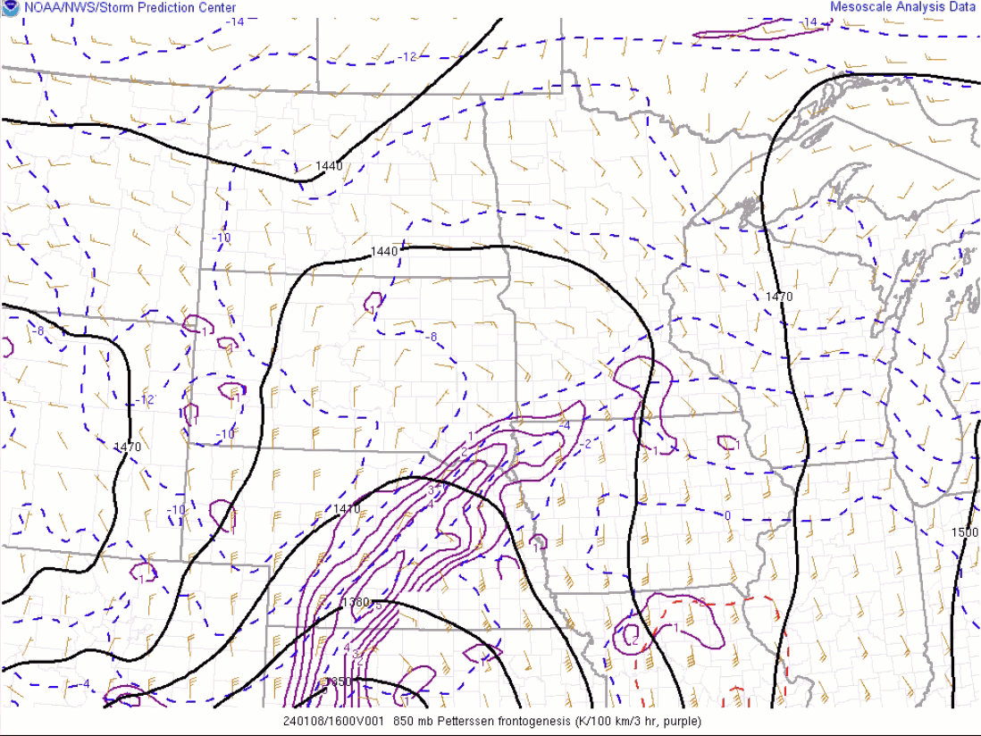
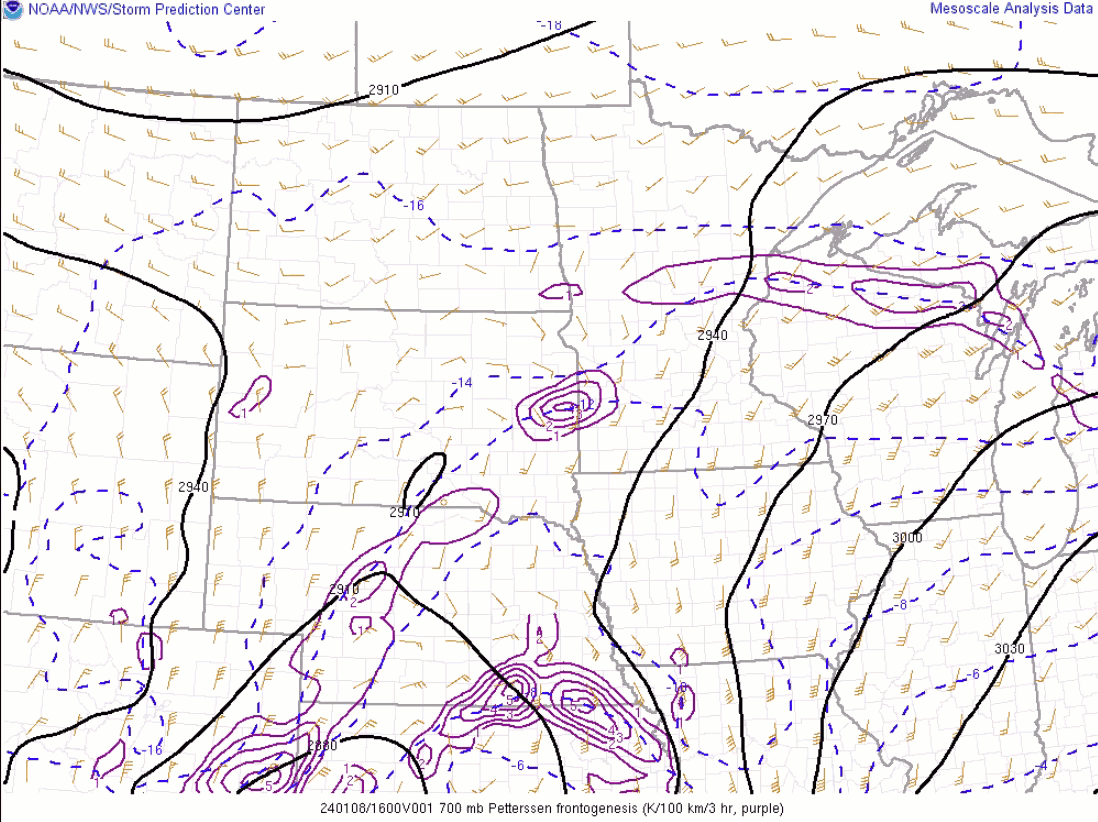
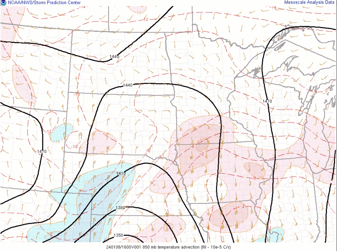
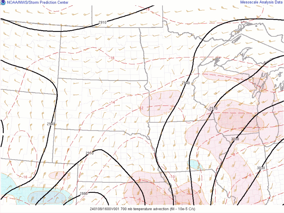
| 850 MB Frontogenesis (through 15Z/8) | 700 MB Frontogenesis (through 15Z/8) | 850 MB Temperature Advection (through 15Z/8) | 700 MB Temperature Advection (through 15Z/8) | |
 |
 |
|||
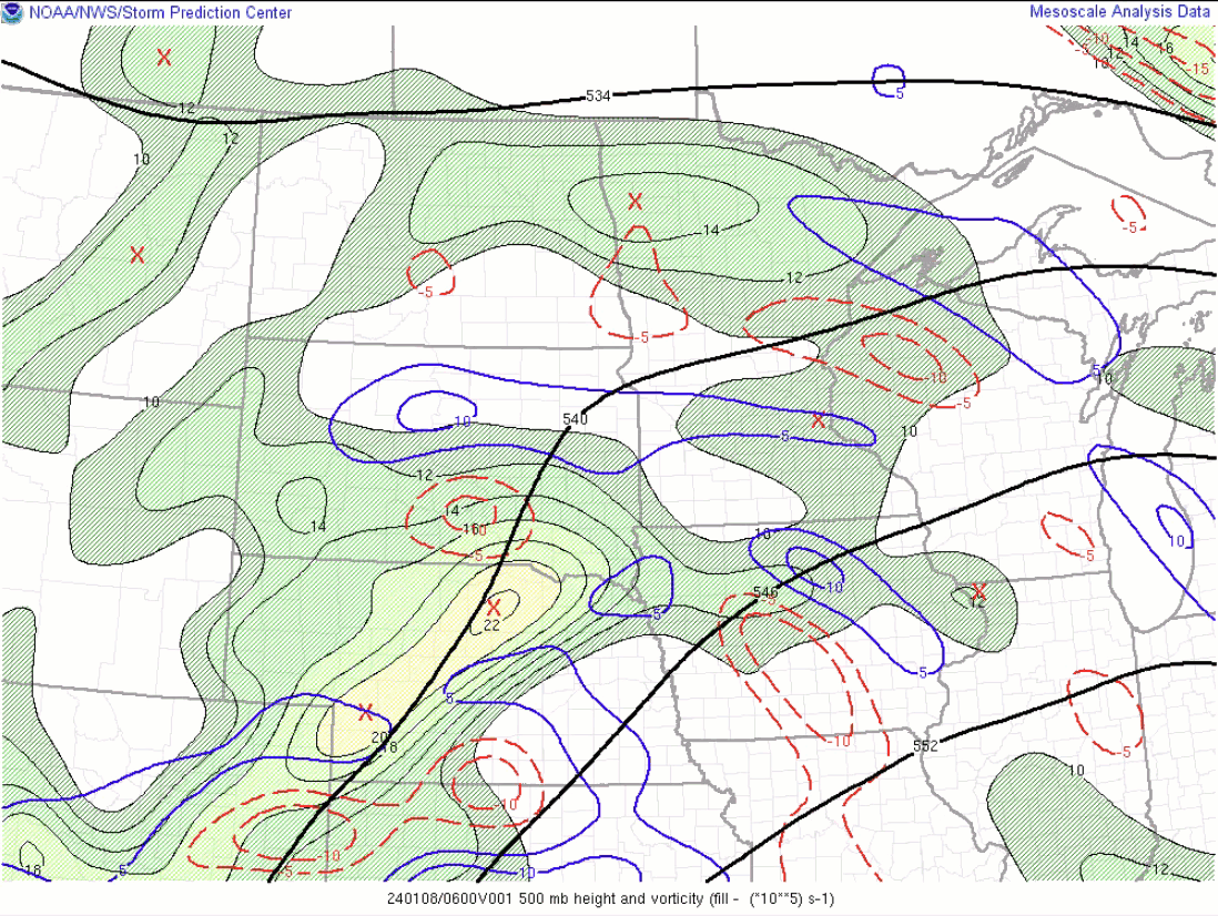
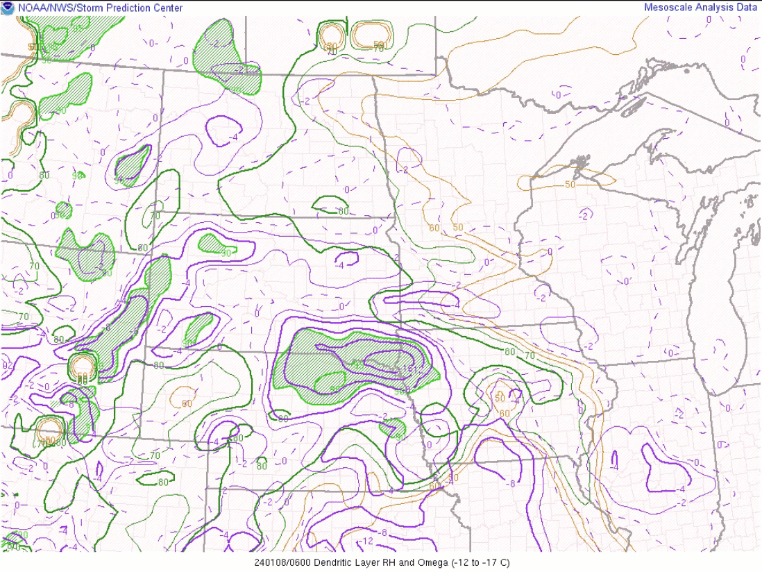
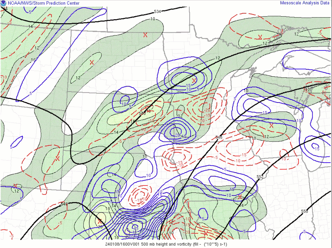
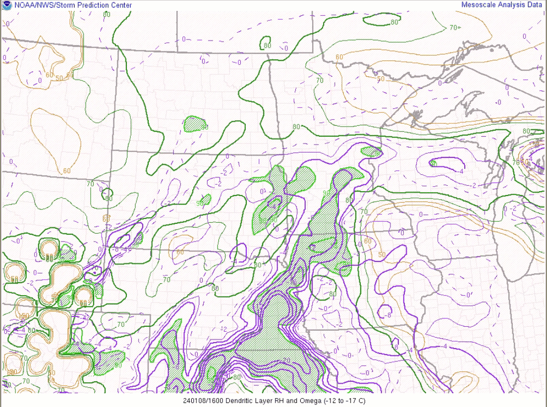
| 500 MB Vorticity (through 15Z/8) | Dendritic Layer and Omega (through 15Z/8) | |||
| Forecast Parameters 15Z 1/8 to 06Z 1/9 | ||||
 |
 |
 |
 |
|
| 850 MB Frontogenesis (through 06z/9) | 700 MB Frontogenesis (through 06z/9) | 850 MB Temperature Advection (through 06z/9) | 700 MB Temperature Advection (through 06z/9) | |
 |
 |
|||
| 500 MB Vorticity (through 06z/9) | Dendritic Layer and Omega (through 06z/9) | |||
 |
Media use of NWS Web News Stories is encouraged! Please acknowledge the NWS as the source of any news information accessed from this site. |
|


 Weather Story
 Weather Map
 Local Radar