Overview
|
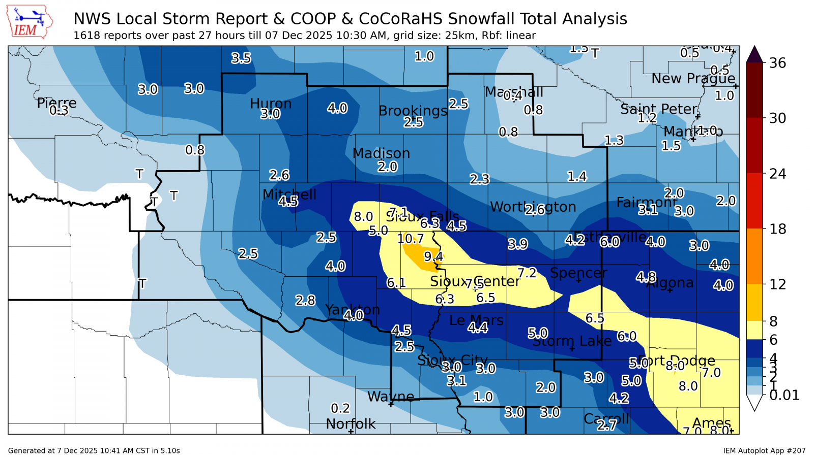
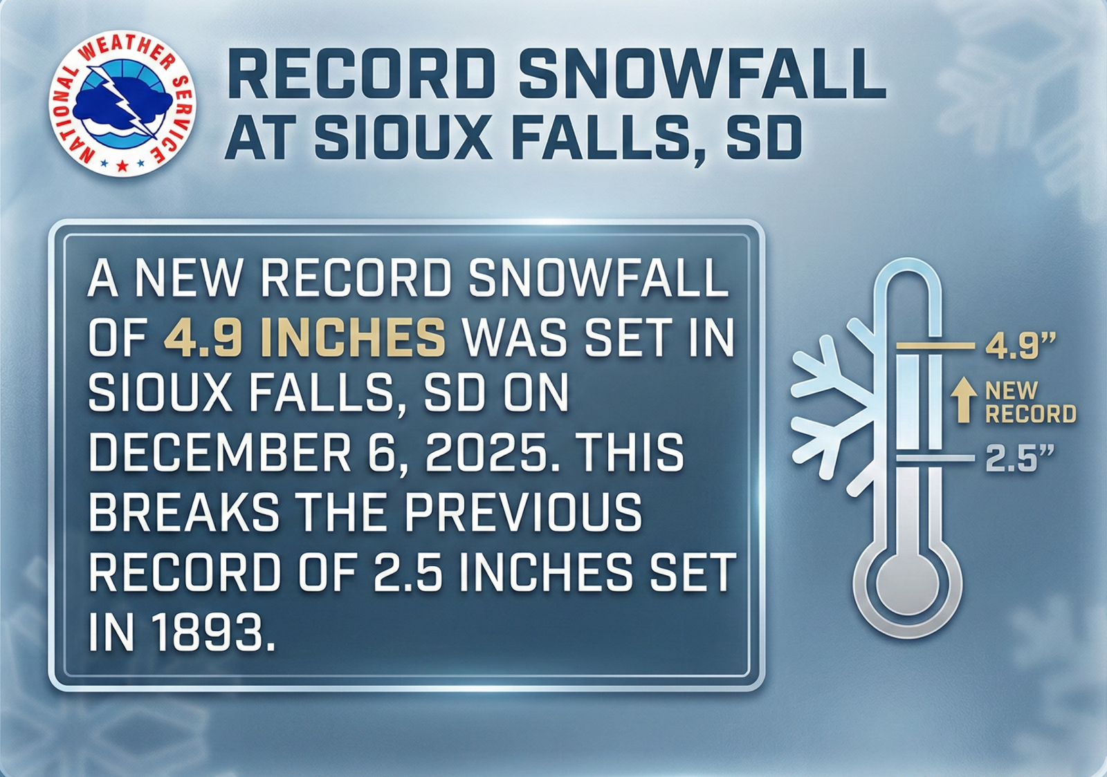
A fast-moving winter storm swept through the Tri-State area on Saturday, December 6, 2025, leaving a blanket of heavy snow and leaving broken records in its wake. The storm's rapid intensity caused significant travel disruptions throughout the day across parts of South Dakota, Nebraska, Minnesota, and Iowa. The snowfall began shortly after daybreak across central South Dakota and Nebraska, gaining momentum as it tracked eastward. By the afternoon hours, weather observers reported snowfall rates of 1 to 2 inches per hour across eastern South Dakota and northwestern Iowa, quickly accumulating impressive totals. The bulk of the snow moved out and dissipated through the evening; however, the storm’s final act was a light freezing drizzle reported across the region overnight. After the storms exit, 2 to 8 inches of snow fell across the entire Tri-State region with some locally higher amounts. Sioux Falls Sets Century-Old RecordThe city of Sioux Falls, South Dakota set a new daily snowfall record. The total recorded accumulation of 4.9 inches surpassed the previous daily record of 2,5 inches, a mark that had stood since 1893. |
 Radar Image - December 6, 2025 |
 |
 |
|
| Preliminary Snowfall Accumulations - December 6, 2025 | Daily Snowfall Record in Sioux Falls | |
Storm Reports
Below is a listing of storm total snowfall reports from December 6, 2025. An interactive map can be found here.
|
Snowfall Accumulations - December 6, 2025 |
...SNOWFALL REPORTS... Location Amount Time/Date Provider ...Iowa... ...Buena Vista County... Marathon 6.5 in 0850 AM 12/07 Public ...Cherokee County... Cherokee 5.0 in 0945 AM 12/07 Emergency Mngr ...Dickinson County... 4.0 N Wahpeton 4.2 in 1200 AM 12/07 UCOOP Lake Park 3.2 SSE 1.8 in 0700 AM 12/07 COCORAHS ...Ida County... Ida Grove 2.0 in 0130 PM 12/06 Public ...Lyon County... Larchwood 1.2 NNE 3.0 in 0800 AM 12/07 COCORAHS ...OBrien County... Sanborn 0.4 N 7.2 in 1000 AM 12/07 COCORAHS ...Osceola County... Sibley 3.9 in 0800 AM 12/07 COOP ...Plymouth County... 1 ENE Le Mars 4.4 in 0749 AM 12/07 CO-OP Observer Remsen 4.3 in 0800 AM 12/07 Trained Spotter ...Sioux County... 3 N Sioux Center 7.5 in 0900 PM 12/06 Public Orange City 0.4 WNW 6.5 in 0800 AM 12/07 COCORAHS Hull 6.5 in 0800 AM 12/07 Public Hawarden 6.3 in 0700 PM 12/06 Public Rock Valley 6.2 in 0900 PM 12/06 Trained Spotter Orange City 6.1 in 0551 PM 12/06 CO-OP Observer Rock Valley 6.0 in 0800 AM 12/07 Public ...Woodbury County... Sergeant Bluff 3.1 in 0704 AM 12/07 Official NWS Obs 1 WSW Sioux City 3.0 in 0439 PM 12/06 Broadcast Media Moville 3.0 in 0800 AM 12/07 Public ...Minnesota... ...Cottonwood County... 2.6 NW Windom 1.4 in 0800 AM 12/07 COOP ...Lincoln County... Hendricks 8.0 SE 2.5 in 0700 AM 12/07 COCORAHS ...Nobles County... Worthington 2 NNE 2.6 in 0700 AM 12/07 COOP ...Pipestone County... Edgerton 0.2 WSW 2.3 in 0700 AM 12/07 COCORAHS Edgerton 2.0 in 0800 AM 12/07 Public ...Rock County... Hills 0.2 NW 4.5 in 0700 AM 12/07 COCORAHS ...Nebraska... ...Dixon County... Newcastle 2.5 in 0600 AM 12/07 COOP ...South Dakota... ...Beadle County... 2 S Huron 3.0 in 0708 AM 12/07 Official NWS Obs ...Bon Homme County... Tyndall 2.8 in 0700 AM 12/07 COOP ...Brookings County... Brookings 1.6 S 2.5 in 0700 AM 12/07 COCORAHS Brookings 6.5 NNW 1.3 in 0700 AM 12/07 COCORAHS Bruce 5.3 W 1.0 in 0800 AM 12/07 COCORAHS ...Clay County... Vermillion 1.4 SE 4.5 in 0600 AM 12/07 COCORAHS ...Davison County... Mitchell 4.5 in 1100 PM 12/06 COOP ...Douglas County... Armour 4.6 W 2.5 in 0700 AM 12/07 COCORAHS ...Hutchinson County... Menno 4.0 in 0600 PM 12/06 CO-OP Observer Emery 10.8 S 2.5 in 0600 AM 12/07 COCORAHS ...Kingsbury County... De Smet 4.0 in 0800 AM 12/07 CO-OP Observer ...Lake County... 4 SE Madison 2.0 in 0900 AM 12/07 Public ...Lincoln County... 1 SE Tea 10.7 in 0800 AM 12/07 Public Canton 9.4 in 0730 AM 12/07 COOP Tea 9.0 in 0800 AM 12/07 Public 2 SW Worthing 8.0 in 0800 AM 12/07 Public Lennox 8.0 in 0900 AM 12/07 Public 1 NNE Harrisburg 7.6 in 0415 PM 12/06 NWS Employee Harrisburg 0.8 NNE 7.6 in 0700 AM 12/07 COCORAHS Harrisburg 1.1 WSW 7.5 in 0700 AM 12/07 COCORAHS 4 SSE Sioux Falls 6.8 in 0500 PM 12/06 Public Sioux Falls 4.2 S 6.5 in 0700 AM 12/07 COCORAHS 4 NNW Harrisburg 6.5 in 0800 AM 12/07 NWS Employee ...McCook County... Canistota 8.0 in 0900 AM 12/07 Public Parker 7.2 N 5.0 in 0700 AM 12/07 COCORAHS Montrose 5.0 in 0900 AM 12/07 COOP ...Minnehaha County... Hartford 0.5 N 7.1 in 0600 AM 12/07 COCORAHS 1 SSE Sioux Falls 7.0 in 0421 PM 12/06 Public 1 SW Sioux Falls 7.0 in 0900 AM 12/07 Public Sioux Falls 5.0 SE ARPT 6.8 in 0700 AM 12/07 COCORAHS 5 WSW Sioux Falls 6.8 in 0800 AM 12/07 NWS Employee Sioux Falls 5.2 E 6.3 in 0700 AM 12/07 COCORAHS 5 W Rowena 6.0 in 0600 PM 12/06 Public Sioux Falls 5.5 in 0400 PM 12/06 Public 3 E Sioux Falls 5.5 in 0616 PM 12/06 Public Sioux Falls 3.3 E 5.5 in 0700 AM 12/07 COCORAHS 3 N Sioux Falls 4.9 in 0600 AM 12/07 Official NWS Obs Renner 4.1 NW 4.1 in 0700 AM 12/07 COCORAHS 5 W Garretson 3.5 in 0700 AM 12/07 COCORAHS ...Sanborn County... Letcher 0.5 E 2.6 in 0700 AM 12/07 COCORAHS ...Turner County... Centerville 6.1 in 0800 AM 12/07 Public ...Union County... 3 S North Sioux City 3.0 in 0330 PM 12/06 Broadcast Media ...Yankton County... 1 S Yankton 4.0 in 0950 AM 12/07 Emergency Mngr Observations are collected from a variety of sources with varying equipment and exposures. We thank all volunteer weather observers for their dedication. Not all data listed are considered official. |
 |
Media use of NWS Web News Stories is encouraged! Please acknowledge the NWS as the source of any news information accessed from this site. |
|


 Weather Story
 Weather Map
 Local Radar