Overview | Damage path | Damage photos | Radar images | Survey Summary
Two brief tornadoes touched down near the city of Volga and Brookings, SD on the evening of August 6, 2015. The first tornado developed 3 miles northwest of Volga around 633 pm CDT and briefly touched down in a corn field producing minor damage. This tornado was rated EF-0.
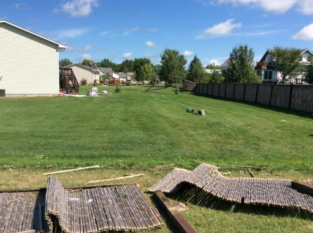
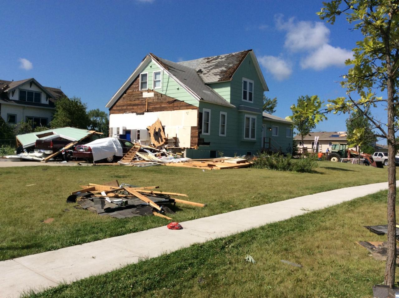
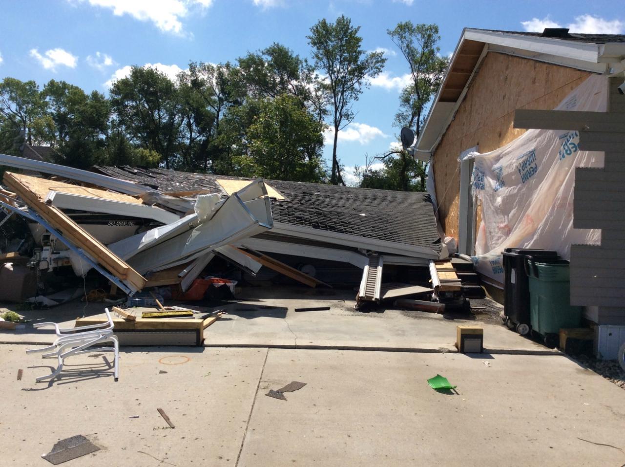
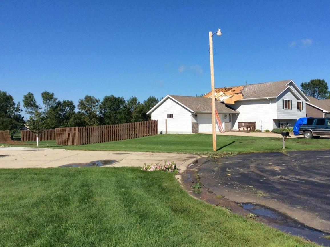
A second tornado touched down 1 mile south of the Brookings airport around 7 pm CDT, producing damage to trees, fences, and minor roof/shingle/siding damage. Two attached garages were also destroyed. The track of this second tornado was just under 1 mile in length with an estimated width at 50 yards. The tornado was estimated to be on the ground less than 10 minutes. This tornado was rated as an EF-0, with winds as high as 85 mph.
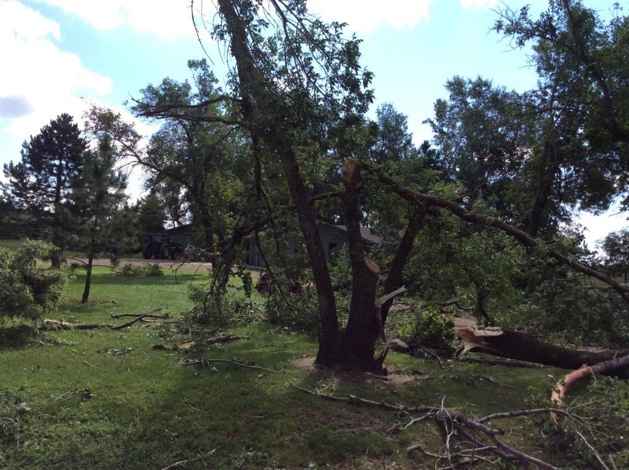
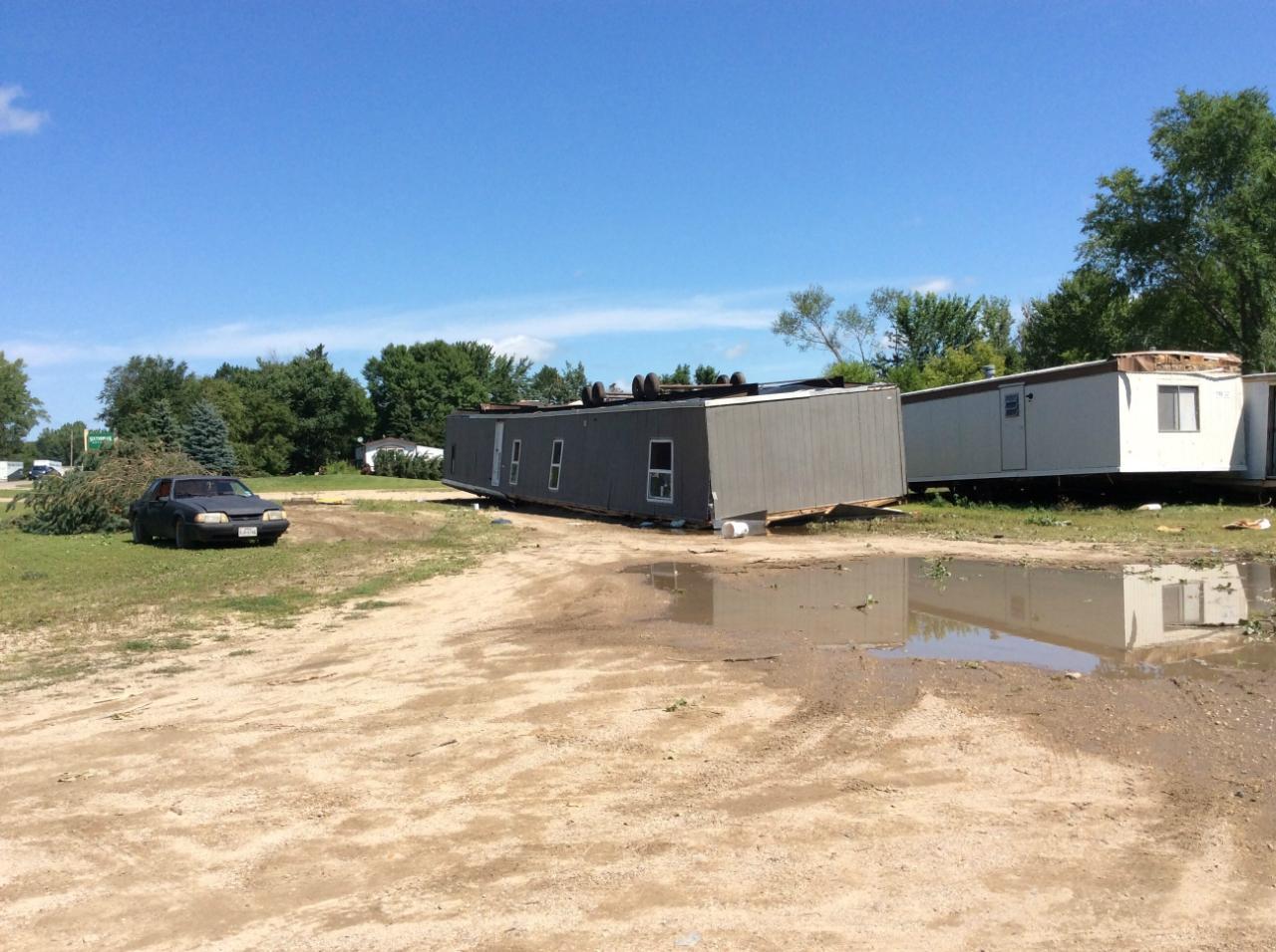
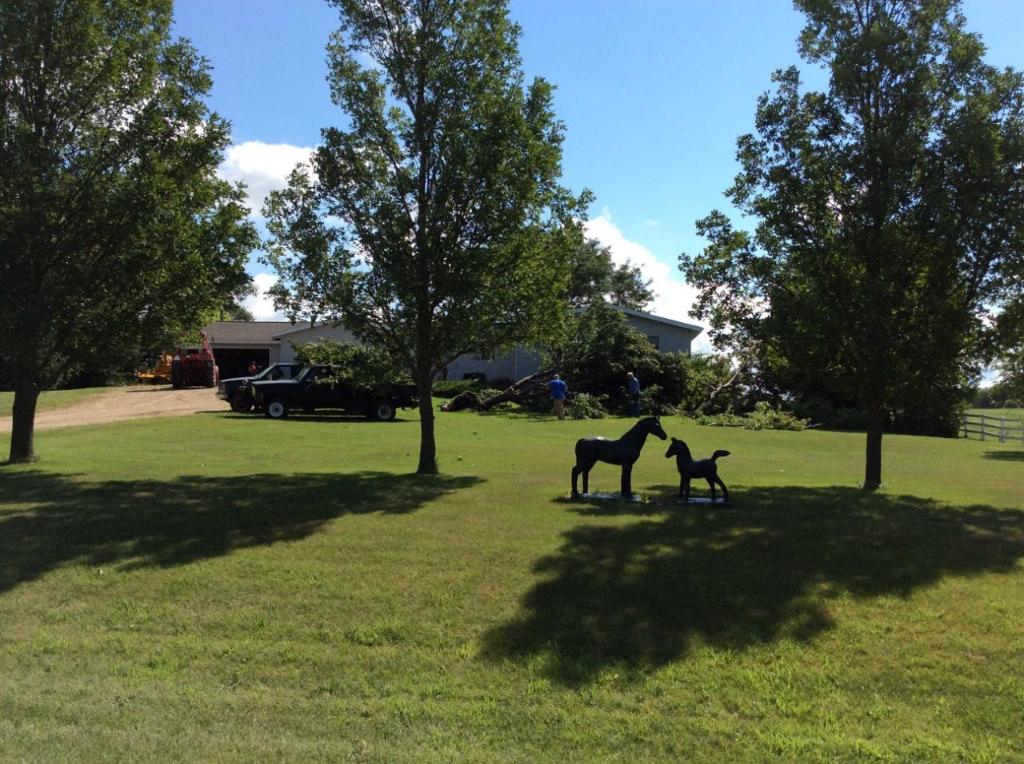
After the second tornado lifted, significant straight line winds developed. Winds were estimated at 80 to 90 mph resulting in widespread tree and minor home damage. Many of these trees and object were blown over in a southeasterly direction. These winds also flipped over a vacant mobile home south of Brookings. In both of these tornadoes and in straight line wind damage, there were no reported deaths or injuries.
It should be noted that additional strong winds were reported across the city of Brookings, with a 69 mph wind gust reported from an easterly direction prior to the arrival of the tornadic circulation. This winds caused sporadic tree damage in other parts of the local area.
Click to go to the National Weather Service Damage Assessment Toolkit viewer.
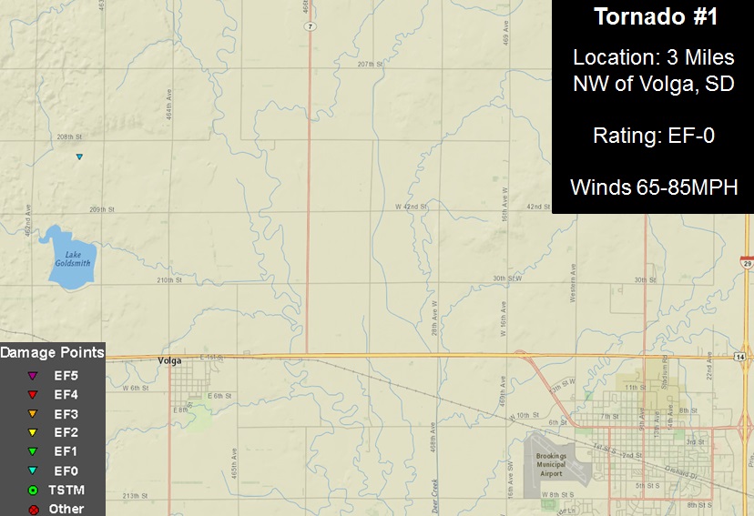
Click on the map for a larger version of this image.
This map shows the track of the brief tornado and straight line wind damage in the southern and southwestern portions of Brookings, SD. Straight line wind speeds were estimated between 80 and 90 mph.
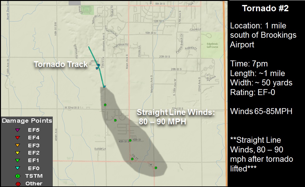
Click on the map for a larger version of this image.
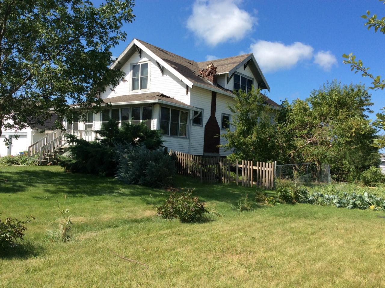
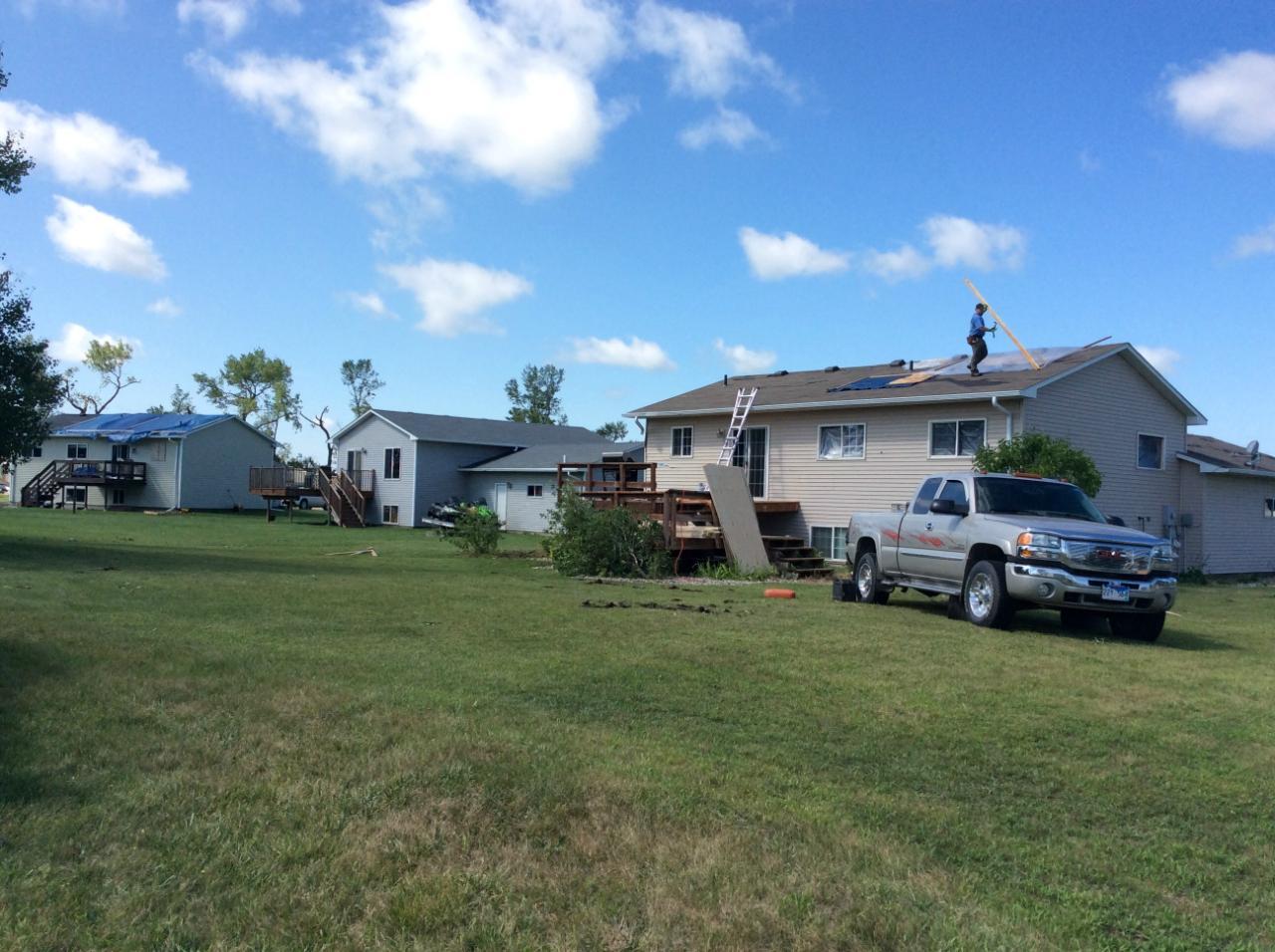
Below are a few photos taken during the National Weather Service Damage Assessment conducted on the afternoon of August 7, 2015.
 |
 |
 |
 |
 |
 |
Straight Line Wind Damage
 |
 |
 |
|
Radar Loop of the Tornadic Thunderstorm
Survey Summary:
...NWS DAMAGE SURVEY FOR 08/06/15 TORNADO EVENT

.SOUTH BROOKINGS TORNADO...

RATING:                 EF-0
ESTIMATED PEAK WIND:    65-85 MPH
PATH LENGTH /STATUTE/:  0.9 MILES
PATH WIDTH /MAXIMUM/:   50 YARDS
FATALITIES:             0
INJURIES:               0

START DATE:             AUG 6 2015
START TIME:             700 PM CDT
START LOCATION:         1 MILE SOUTH OF BROOKINGS AIRPORT
START LAT/LON:          44.2856 / -96.8155

END DATE:               AUG 6 2015
END TIME:               707 PM CDT
END LOCATION:           2 MILES SOUTH OF BROOKINGS AIRPORT
END_LAT/LON:            44.2743 / -96.8092

SUMMARY: A BRIEF TORNADO DEVELOPED SOUTH OF BROOKINGS AIRPORT
AROUND 700 PM CDT. SEVERAL HOMES RECEIVED DAMAGE TO ROOFS WITH
DESTRUCTION OF TWO GARAGES. AFTER THE TORNADO LIFTED
SIGNIFICANT STRAIGHT LINE WINDS DEVELOPED AND WINDS WERE ESTIMATED BETWEEN
80 AND 90 MPH. THESE WINDS PRODUCED ADDITIONAL TREE AND ROOF DAMAGE
AFTER THE TORNADO LIFTED.

ADDITIONAL INFORMATION: A SECOND TORNADO ALSO BRIEFLY TOUCHED
DOWN NORTH OF LAKE GOLDSMITH OR 3 MILES NORTHWEST OF VOLGA AT 633
PM CDT. ONLY DAMAGE INDICATED WAS TO NEARBY CROPS.


EF SCALE: THE ENHANCED FUJITA SCALE CLASSIFIES
TORNADOES INTO THE FOLLOWING CATEGORIES.

EF0...WEAK......65 TO 85 MPH
EF1...WEAK......86 TO 110 MPH
EF2...STRONG....111 TO 135 MPH
EF3...STRONG....136 TO 165 MPH
EF4...VIOLENT...166 TO 200 MPH
EF5...VIOLENT...>200 MPH


 Weather Story
 Weather Map
 Local Radar