Overview
|
A very active several days of weather brought multiple rounds of severe thunderstorms to the region. Large hail, damaging winds, and locally heavy rain were all observed over the period of June 27th through July 3rd. The period began with a line of storms moving from west to east that brought widespread strong winds near and south of I-90 during the overnight hours of June 27th into the morning of June 28th. Another round of storms during the evening hours of June 29th into the morning of June 30th brought up to golf ball size hail to the Sioux City metro and strong winds to portions of northwest Iowa and southwest Minnesota. Some of the strongest winds were observed across Osceola, Dickinson, and Cottonwood Counties where up to 80 mph winds were observed. The night of June 30th into July 1st brought yet another round of strong winds to areas near and south of I-90. A final round of widespread severe weather was observed during the afternoon of July 2nd into the early morning of July 3rd. Some of the more notable reports from this period were a few tornadoes along the Buffalo/Jerauld County line in South Dakota, and a brief tornado followed by destructive winds in Huron, where a gust to 106 mph was observed at the Huron Regional Airport. |
|
Tornadoes
Select a tornado from the table to zoom into the track and view more information. The default table view is limited to 8 tracks, but can be scrolled by a mouse wheel or dynamically expanded. Additionally, the table can fill the entire window by clicking the small circular expanding arrow icon at the very top right of the table and returned to its original size by clicking the button again. The side information panel that opens over the map can be closed using the "X" on the upper right corner of the pop-up. Zoom into the map and click damage points to see detailed information and pictures from the surveys.
|
NOTE: times shown below are local to your device's time zone. |

The Enhanced Fujita (EF) Scale classifies tornadoes into the following categories:
| EF0 Weak 65-85 mph |
EF1 Moderate 86-110 mph |
EF2 Significant 111-135 mph |
EF3 Severe 136-165 mph |
EF4 Extreme 166-200 mph |
EF5 Catastrophic 200+ mph |
 |
|||||
| Tornadoes that fail to impact any ratable damage indicators on the EF-Scale are rated EF-Unknown (EF-U) | |||||
Storm Reports
 |
 |
 |
 |
 |
| Storm Reports from June 27th into morning of June 28th | Storm Reports from June 29th into morning of June 30th | Storm Reports from June 30th into morning of July 1st | Storm Reports from July 1st into morning of July 2nd | Storm Reports from July 2nd into morning of July 3rd |
| Report Time (Local) | County | Location | Event Type | Mag. | Remark |
| 2026/06/28 01:00 | Gregory | 1 ESE Dallas | TSTM WND GST | 60 | Mesonet station 307 SD RWIS Dallas. |
| 2026/06/28 01:30 | Gregory | Herrick | TSTM WND GST | 71 | Personal Weather Station. |
| 2026/06/28 01:43 | Charles Mix | 9 SW Platte | TSTM WND GST | 60 | Personal Weather Station. |
| 2026/06/28 01:51 | Gregory | 2 WSW Pickstown | TSTM WND GST | 58 | Mesonet station 244 SD RWIS Ft. Randall Dam. |
| 2026/06/28 01:54 | Charles Mix | 2 NW Platte | TSTM WND DMG | Time estimated via radar. Blown down barn. | |
| 2026/06/28 02:25 | Charles Mix | 1 ENE Wagner | TSTM WND GST | 61 | Personal weather station 1 ENE of Wagner SD. |
| 2026/06/28 02:35 | Charles Mix | 4 NE Dante | TSTM WND GST | 65 | Mesonet station 324 SD RWIS WAGNER. |
| 2026/06/28 02:39 | Bon Homme | 3 E Avon | TSTM WND GST | 60 | South Dakota State mesonet 3 E Avon. |
| 2026/06/28 02:51 | Douglas | 3 S Corsica | TSTM WND GST | 68 | Mesonet station 304 SD RWIS Corsica. |
| 2026/06/28 03:39 | McCook | Canistota | TSTM WND GST | 61 | |
| 2026/06/28 04:22 | Minnehaha | 3 NNW Sioux Falls | TSTM WND GST | 63 | |
| 2026/06/28 04:27 | Minnehaha | 2 ESE Baltic | TSTM WND DMG | Dairy farm sustained significant damage to numerous outbuildings. | |
| 2026/06/28 04:27 | Clay | 4 E Irene | TSTM WND GST | 60 | |
| 2026/06/28 04:27 | Minnehaha | 2 ESE Baltic | TSTM WND DMG | Dairy farm sustained significant damage to numerous outbuildings. Time estimated via radar. | |
| 2026/06/28 04:30 | Minnehaha | 3 E Baltic | TSTM WND DMG | Silo and farm outbuilding destroyed. | |
| 2026/06/28 04:34 | Minnehaha | 3 W Dell Rapids | TSTM WND GST | 59 | Mesonet station 17 SD RWIS DELL RAPIDS. |
| 2026/06/28 04:38 | Minnehaha | 4 N Valley Springs | TSTM WND DMG | Damage to large branches. | |
| 2026/06/28 04:40 | Lincoln | 2 SSE Lennox | TSTM WND GST | 67 | |
| 2026/06/28 05:00 | Rock | Hardwick | TSTM WND DMG | Reports of numerous trees down around town and a few outbuildings damaged. | |
| 2026/06/28 05:26 | Sioux | 1 SW Rock Valley | HAIL | 0.75 | |
| 2026/06/28 05:28 | Sioux | 2 WNW Hull | HAIL | 1.5 | |
| 2026/06/28 05:35 | Sioux | Hull | HAIL | 1 | |
| 2026/06/28 06:09 | O'Brien | Sanborn | HAIL | 1 | |
| 2026/06/28 06:34 | Clay | 4 WNW Spencer | TSTM WND GST | 68 | ASOS station KSPW Spencer Municipal Airport. |
| 2026/06/28 07:14 | Clay | Webb | HAIL | 1.5 | |
| 2026/06/29 19:52 | Yankton | 3 W Yankton | HAIL | 1 | |
| 2026/06/29 20:04 | Yankton | 2 S Mission Hill | HAIL | 1 | |
| 2026/06/29 21:38 | Nobles | 4 NE Adrian | TSTM WND GST | 55 | Via personal weather station. Time estimated. |
| 2026/06/29 21:45 | Sioux | 3 SSW Sioux Center | TSTM WND GST | 52 | Via personal weather station. |
| 2026/06/29 21:45 | Sioux | Sioux Center | TSTM WND DMG | Several large tree branches down across town ranging from 5 inches in diameter to as large as 13 inches in diameter. | |
| 2026/06/29 21:46 | Sioux | 2 SE Sioux Center | TSTM WND GST | 52 | Via personal weather station. |
| 2026/06/29 22:09 | Murray | 1 WSW Slayton | TSTM WND GST | 55 | AWOS station KDVP Slayton Municipal Airport. |
| 2026/06/29 22:25 | Murray | 3 W Dovray | TSTM WND GST | 51 | Mesonet station MN038 T.h.30 - Dovray - Mp 49. |
| 2026/06/30 01:14 | Dakota | 2 NW Homer | HAIL | 1.75 | A couple stones as large as golf ball but mostly dime to quarter size. |
| 2026/06/30 01:30 | Woodbury | 2 SE Sioux City | HAIL | 1 | |
| 2026/06/30 01:31 | Woodbury | 2 E South Sioux City | HAIL | 1 | |
| 2026/06/30 01:35 | Woodbury | 4 ESE Sioux City | HAIL | 1 | |
| 2026/06/30 01:35 | Woodbury | 4 SSE Sioux City | HAIL | 1.25 | Relayed through Broadcast Media with photo. |
| 2026/06/30 01:51 | Sioux | Sioux Center | TSTM WND GST | 57 | Davis Personal Weather Station. |
| 2026/06/30 01:53 | Sioux | 3 NNW Granville | TSTM WND DMG | Tree and outbuilding damage to a couple of farmsteads. | |
| 2026/06/30 01:53 | Turner | 3 ESE Parker | TSTM WND GST | 56 | Mesonet station 310 SD RWIS Parker. |
| 2026/06/30 01:55 | Sioux | 1 NE Maurice | TSTM WND GST | 56 | AWOS station KSXK 1 NE Maurice. |
| 2026/06/30 02:10 | Osceola | Ashton | TSTM WND GST | 67 | Davis Personal Weather Station. |
| 2026/06/30 02:17 | Osceola | 3 ENE Melvin | TSTM WND GST | 67 | Davis Personal Weather Station. |
| 2026/06/30 02:19 | Osceola | 3 SE Little Rock | TSTM WND GST | 61 | Davis Personal Weather Station. |
| 2026/06/30 02:23 | Osceola | 3 ESE Ocheyedan | TSTM WND DMG | Metal storage shed destroyed. Time estimated via radar. | |
| 2026/06/30 02:26 | Osceola | 2 SE Harris | TSTM WND DMG | Large machine shed destroyed. Other outbuildings in area damaged as well. | |
| 2026/06/30 02:34 | Clay | 3 WNW Spencer | TSTM WND GST | 66 | Automated Equipment at Spencer Airport. |
| 2026/06/30 02:35 | Dickinson | 3 SSE Lake Park | TSTM WND GST | 64 | |
| 2026/06/30 02:35 | Dickinson | Lake Park | TSTM WND DMG | Grain leg down on power lines and numerous branches down on city streets in Lake Park. Also tree damage to a camper and truck on the south side of Silver Lake. No injuries. | |
| 2026/06/30 02:36 | Dickinson | 1 S Arnolds Park | TSTM WND GST | 59 | Ambient Personal Weather Station. |
| 2026/06/30 02:38 | Dickinson | 2 N Fostoria | TSTM WND GST | 75 | Davis Personal Weather Station. |
| 2026/06/30 02:40 | Dickinson | 1 NNE Orleans | TSTM WND GST | 74 | Ambient Personal Weather Station. |
| 2026/06/30 02:48 | Jackson | 1 NNE Jackson | TSTM WND GST | 58 | Davis Personal Weather Station. |
| 2026/06/30 02:50 | Jackson | 4 SE Lakefield | TSTM WND GST | 62 | Mesonet station MN008 I-90 - Lakefield - Mp 67. |
| 2026/06/30 02:55 | Jackson | 1 ENE Jackson | TSTM WND GST | 73 | AWOS station KMJQ Jackson Airport. |
| 2026/06/30 02:56 | Jackson | 5 SE Wilder | TSTM WND DMG | Several trees down. Roofs with missing shingles and one outbuilding damaged. Time estimated via radar. | |
| 2026/06/30 02:59 | Jackson | 2 SW Bergen | TSTM WND GST | 71 | Davis Personal Weather Station. |
| 2026/06/30 03:02 | Jackson | 2 WNW Bergen | TSTM WND DMG | Damage to barn as well as several large tree branches down. | |
| 2026/06/30 03:02 | Jackson | 4 NNW Bergen | TSTM WND GST | 80 | Corrects previous tstm wnd gst report from 4 NNW Bergen. NDAWN Station. |
| 2026/06/30 03:04 | Cottonwood | 2 S Mountain Lake | TSTM WND GST | 63 | Ambient Personal Weather Station. |
| 2026/06/30 03:06 | Jackson | 1 NW Bergen | TSTM WND DMG | Lots of tree damage and possibly some structural damage to house. Will assess further in daylight. | |
| 2026/06/30 03:08 | Cottonwood | 3 SSE Mountain Lake | TSTM WND GST | 71 | Ambient Personal Weather Station. |
| 2026/06/30 03:09 | Cottonwood | 2 W Mountain Lake | TSTM WND GST | 62 | Davis Personal Weather Station. |
| 2026/06/30 03:10 | Cottonwood | 2 ENE Bingham Lake | TSTM WND GST | 76 | Mesonet station MN150 T.h.60 - Mountain Lake - Mp 48. |
| 2026/06/30 03:10 | Jackson | 4 NNW Bergen | TSTM WND GST | 67 | NDAWN Station. |
| 2026/07/01 02:00 | Plymouth | Le Mars | TSTM WND GST | 65 | Corrects previous tstm wnd gst report from Le Mars. Fire chief called to report multiple large trees down, buildings damaged, power out, and that the airport sensor was down. He said wind began approximately 2:00 am CDT. |
| 2026/07/01 02:00 | Plymouth | Le Mars | TSTM WND GST | 65 | Fire chief called to report multiple large trees down, buildings damaged, power out, and that the airport sensor was down. He said wind began approximately 2:00 am CDT. |
| 2026/07/01 02:04 | Gregory | 1 WSW Fairfax | TSTM WND GST | 66 | Personal weather station reported 66 mph wind gust at 2:04 am CDT. |
| 2026/07/01 02:08 | Plymouth | 5 W Brunsville | TSTM WND GST | 58 | Davis Personal weather station. |
| 2026/07/01 02:09 | Charles Mix | 5 NE Dante | TSTM WND GST | 64 | SDDOT report of 64 mph gust at 2:09 am CDT. |
| 2026/07/01 02:09 | Plymouth | 5 W Brunsville | TSTM WND GST | 58 | Personal weather station reported 58 mph gust at 2:09 am CDT. |
| 2026/07/01 02:10 | Bon Homme | 8 NE Dante | TSTM WND GST | 60 | Personal weather station report of 60 mph gust at 2:10 am CDT. |
| 2026/07/01 02:13 | Sioux | 1 NE Maurice | TSTM WND GST | 64 | AWOS station KSXK 1 NE Maurice. |
| 2026/07/01 02:15 | Sioux | 2 NE Maurice | TSTM WND GST | 64 | ASOS reported gust of 64 mph at 2:15 am CDT. |
| 2026/07/01 02:21 | Plymouth | 4 NNW Oyens | TSTM WND GST | 61 | Personal weather station reported gust of 61 mph at 2:21 am CDT. |
| 2026/07/01 02:21 | Sioux | 1 SSW Sioux Center | TSTM WND GST | 59 | Personal weather station reported gust of 59 mph at 2:21 am CDT. |
| 2026/07/01 02:23 | Charles Mix | 10 W Platte | TSTM WND GST | 61 | Personal weather station reported gust of 61 mph at 2:23 am CDT. |
| 2026/07/01 02:23 | Gregory | 13 NE Burke | TSTM WND GST | 61 | Personal weather station reported 61 mph wind gust at 2:23 am CDT. |
| 2026/07/01 02:23 | Sioux | 1 SW Sioux Center | TSTM WND GST | 59 | Davis personal weather station. |
| 2026/07/01 02:24 | Sioux | Sioux Center | TSTM WND DMG | EM reports tree branches down in Sioux Center. Time estimated via radar. | |
| 2026/07/01 02:26 | Sioux | 2 NW Orange City | TSTM WND GST | 59 | Davis personal weather station. |
| 2026/07/01 02:27 | Douglas | 8 N Delmont | TSTM WND GST | 67 | Personal weather station report of 67 mph gust at 2:27 am CDT. |
| 2026/07/01 02:30 | Sioux | 7 NNW Ireton | TSTM WND GST | 63 | Personal weather station reported gust of 63 mph at 2:30 am CDT. |
| 2026/07/01 02:30 | Sioux | 2 NW Orange City | TSTM WND GST | 59 | Personal weather station reported gusts of 59 mph at 2:30 am CDT. |
| 2026/07/01 02:32 | Sioux | 2 NNW Ireton | TSTM WND GST | 66 | Personal weather station reported gust of 66 mph at 2:32 am CDT. |
| 2026/07/01 02:33 | Sioux | 2 NNW Ireton | TSTM WND GST | 76 | Personal weather station reported gust of 76 mph at 2:33 am CDT. |
| 2026/07/01 02:36 | Union | 5 SSW Hudson | TSTM WND GST | 60 | Personal weather station reported a gust of 60 mph at 2:36 am CDT. |
| 2026/07/01 02:37 | Sioux | 4 N Hawarden | TSTM WND GST | 58 | Personal weather station report of 58 mph at 2:37 am CDT. |
| 2026/07/01 02:37 | Union | 5 SSW Hudson | TSTM WND GST | 58 | Personal weather station reported gust of 58 mph at 2:37 am CDT. |
| 2026/07/01 02:38 | Douglas | 5 W Armour | TSTM WND GST | 67 | Personal weather station reported wind gust of 75 mph at 2:38 am CDT. |
| 2026/07/01 02:42 | Hutchinson | 7 ENE Dimock | TSTM WND GST | 58 | Personal weather station reported a wind gusts of 60 mph at 2:42 am CDT. |
| 2026/07/01 03:01 | Turner | Parker | TSTM WND DMG | Big branches and trees down in Parker. Time estimated via radar. | |
| 2026/07/01 03:05 | Lyon | 2 ESE Larchwood | TSTM WND GST | 64 | Personal weather station reported gust of 64 mph at 3:05 am CDT. |
| 2026/07/01 03:07 | Lyon | Larchwood | TSTM WND DMG | Multiple 8 to 10 inch diameter branches down around town. Time estimated via radar. | |
| 2026/07/01 03:09 | Minnehaha | 3 E Sioux Falls | TSTM WND DMG | Multiple reports of large tree branches down on the east side of Sioux Falls. Time estimated via radar. | |
| 2026/07/01 03:10 | Charles Mix | Wagner | TSTM WND GST | 70 | Personal weather station reported wind gust of 70 mph at 3:10 am CDT. |
| 2026/07/01 03:11 | Minnehaha | Valley Springs | TSTM WND DMG | Several reports of large tree branches down. Time estimated via radar. | |
| 2026/07/01 03:23 | Minnehaha | 4 NNE Brandon | TSTM WND GST | 60 | Personal weather station reported gust of 60 mph at 3:23 am CDT. |
| 2026/07/01 04:16 | Minnehaha | 3 E Sioux Falls | TSTM WND DMG | Corrects previous tstm wnd dmg report from 3 E Sioux Falls. Multiple reports of large tree branches down on the east side of Sioux Falls. Time estimated via radar. | |
| 2026/07/01 07:27 | Sioux | Hawarden | TSTM WND DMG | Multiple 8 to 10 inch diameter branches down around town. Time estimated via radar. | |
| 2026/07/01 20:00 | Woodbury | 1 SW Oto | TORNADO | Multiple videos of a brief tornado touchdown near Oto. Location estimated from video. | |
| 2026/07/02 04:45 | Aurora | 10 W Letcher | TSTM WND DMG | Power lines down north of Storla. | |
| 2026/07/02 06:40 | Plymouth | Kingsley | TSTM WND GST | 66 | Wind gust via Davis weather station. Emergency manager reported some 4-6 inch diameter tree branches down in Kingsley as well. |
| 2026/07/02 07:19 | Jackson | 4 SE Jackson | HAIL | 0.75 | Report from mPING: Dime (0.75 in.). |
| 2026/07/02 07:19 | Jackson | 3 S Jackson | TSTM WND GST | 57 | Via personal weather station. |
| 2026/07/02 07:19 | Jackson | 4 SSE Jackson | TSTM WND DMG | Photos via social media of large tree branches down including one on a house. | |
| 2026/07/02 08:50 | Sioux | Sioux Center | TSTM WND GST | 59 | Via personal weather station. |
| 2026/07/02 08:50 | Sioux | 1 SSW Sioux Center | TSTM WND GST | 57 | Via personal weather station. |
| 2026/07/02 08:50 | Sioux | Sioux Center | TSTM WND DMG | Trees and large branches down across town. | |
| 2026/07/02 09:00 | Sioux | 4 W Hospers | TSTM WND GST | 58 | Via personal weather station. |
| 2026/07/02 09:02 | Sioux | 2 NNW Ireton | TSTM WND GST | 56 | Via personal weather station. |
| 2026/07/02 13:35 | Brule | 4 NE Chamberlain | HAIL | 1.75 | Windshields broken on two vehicles. |
| 2026/07/02 13:56 | Brule | 10 NNE Pukwana | HAIL | 2.75 | Severe damage to gutters on home. |
| 2026/07/02 14:10 | Brule | 10 NNE Pukwana | HAIL | 2.5 | Extended period of hail with continued larger hail at times. |
| 2026/07/02 15:30 | Jerauld | 13 W Wessington Springs | TORNADO | Tornado sighted by numerous chasers. | |
| 2026/07/02 16:00 | Brule | 1 S Kimball | TSTM WND GST | 73 | Mesonet station 25 SD RWIS Kimball. |
| 2026/07/02 16:36 | Jerauld | 1 W Lane | TSTM WND GST | 73 | Mesonet station 305 SD RWIS Lane. |
| 2026/07/02 16:44 | Davison | 9 NNW Mount Vernon | TSTM WND GST | 64 | |
| 2026/07/02 16:45 | Beadle | 4 SW Huron | FUNNEL CLOUD | ||
| 2026/07/02 16:50 | Davison | 1 WNW Mount Vernon | TSTM WND GST | 60 | Mesonet station VNMS2 Mount Vernon (SD Mesonet). |
| 2026/07/02 16:54 | Aurora | 4 WNW Mount Vernon | HAIL | 1.5 | Report via social media. Time estimated via radar. |
| 2026/07/02 16:54 | Sanborn | 8 E Alpena | TSTM WND GST | 90 | Mesonet station 328 SD RWIS ALPENA. |
| 2026/07/02 16:56 | Beadle | 2 NNW Huron | TSTM WND GST | 90 | ASOS station KHON Huron Regional Airport. |
| 2026/07/02 17:02 | Beadle | 2 S Huron | TSTM WND GST | 60 | Personal weather station. |
| 2026/07/02 17:03 | Beadle | 2 NNW Huron | TSTM WND GST | 106 | ASOS station KHON Huron Regional Airport. |
| 2026/07/02 17:03 | Beadle | 1 NNE Huron | TSTM WND DMG | Roof damage to several buildings between Market Street and 15th Street on the north side of Huron. | |
| 2026/07/02 17:03 | Beadle | Huron | TSTM WND DMG | Numerous trees and power lines down across Huron. | |
| 2026/07/02 17:10 | Sanborn | 6 N Artesian | TSTM WND GST | 60 | SD Mesonet site. |
| 2026/07/02 17:10 | Beadle | Cavour | TSTM WND DMG | Picture of overturned camper via social media. Time estimated via radar. | |
| 2026/07/02 17:11 | Beadle | 5 SW Iroquois | TSTM WND GST | 67 | Personal weather station. |
| 2026/07/02 17:15 | Kingsbury | 5 NE Iroquois | TSTM WND DMG | Damage to grain bins and outbuildings. Photos via social media. Time estimated via radar. | |
| 2026/07/02 17:17 | Kingsbury | Iroquois | TSTM WND DMG | Damage to grain bin. | |
| 2026/07/02 17:29 | Kingsbury | De Smet | TSTM WND DMG | Tree down in De Smet. | |
| 2026/07/02 17:29 | Beadle | 5 SW Iroquois | TSTM WND GST | 72 | Personal weather station. |
| 2026/07/02 17:31 | Kingsbury | 4 SSW Bancroft | TSTM WND GST | 69 | Measured by personal weather station. |
| 2026/07/02 17:40 | Beadle | 9 N Yale | TSTM WND GST | 59 | SD Mesonet site 7 SW Carpenter. |
| 2026/07/02 17:46 | Kingsbury | 4 W Erwin | TSTM WND GST | 72 | Mesonet station DTMS2 De Smet 7N (SD Mesonet). |
| 2026/07/02 17:53 | Kingsbury | 4 W Erwin | TSTM WND GST | 82 | Mesonet station DTMS2 De Smet 7N (SD Mesonet). |
| 2026/07/02 18:00 | Kingsbury | 3 NNW De Smet | TSTM WND GST | 66 | AWOS station K6E5 3 NNW De Smet. |
| 2026/07/02 18:01 | Kingsbury | 5 WSW Lake Preston | TSTM WND GST | 58 | Measured by personal weather station. |
| 2026/07/02 18:21 | Lake | 3 WSW Madison | TSTM WND DMG | Tree down in Lake Herman State Park. | |
| 2026/07/02 18:27 | Hutchinson | 3 SE Dimock | TSTM WND GST | 66 | Measured on personal weather station. |
| 2026/07/02 18:40 | Lake | 4 NW Chester | TSTM WND GST | 61 | Measured on a personal weather station. |
| 2026/07/02 18:43 | Lake | 5 ENE Orland | TSTM WND GST | 65 | Mesonet station MDMS2 Madison 6S (SD Mesonet). |
| 2026/07/02 19:21 | Pipestone | 8 SW Lake Benton | HAIL | 1 | |
| 2026/07/02 19:30 | McCook | 6 NNE Monroe | TSTM WND GST | 60 | Measured on personal weather station. |
| 2026/07/02 20:28 | McCook | 3 NE Emery | HAIL | 1 | |
| 2026/07/02 21:00 | Nobles | 2 NE Rushmore | TSTM WND GST | 63 | Mesonet station MN007 I-90 - Rushmore - Mp 35. |
| 2026/07/03 02:20 | Dakota | 1 N South Sioux City | FLASH FLOOD | Water flowing and over the curb in the 1400 block of B street. Report from social media video. |
Rain Reports

| State | Location | Station Type | Rain Total |
| SD | ASTORIA 2.2 SSE | CoCoRaHS | 0.88 |
| SD | DE SMET 0.2 SSE | CoCoRaHS | 1.06 |
| IA | ARTHUR 3.7 SSW | CoCoRaHS | 1.07 |
| IA | HORNICK 4 NNE | COOP | 1.13 |
| IA | CHEROKEE 5.1 S | CoCoRaHS | 1.33 |
| SD | YANKTON 1.7 NNE | CoCoRaHS | 1.4 |
| SD | YANKTON MUNI AP | WBAN | 1.4 |
| SD | TYNDALL | WBAN | 1.5 |
| SD | YANKTON 0.3 ENE | CoCoRaHS | 1.53 |
| SD | MENNO | COOP | 1.79 |
| SD | CHAMBERLAIN 7.5 SSW | CoCoRaHS | 1.8 |
| SD | MITCHELL AP | WBAN | 2.05 |
| SD | MITCHELL 1.8 SE | CoCoRaHS | 2.05 |
| SD | MITCHELL 1.0 SE | CoCoRaHS | 2.06 |
| SD | BROOKINGS 5.3 N | CoCoRaHS | 2.08 |
| SD | BROOKINGS | WBAN | 2.16 |
| MN | PIPESTONE | COOP | 2.18 |
| IA | SIOUX CITY AP | WBAN | 2.23 |
| MN | SLAYTON 0.8 SSW | CoCoRaHS | 2.27 |
| MN | CHANDLER 2.7 SSE | CoCoRaHS | 2.27 |
| IA | SIOUX CITY ANG | COOP | 2.27 |
| SD | ETHAN 4.5 WSW | CoCoRaHS | 2.32 |
| IA | SPENCER MUNICIPAL AP | WBAN | 2.41 |
| MN | LUVERNE | COOP | 2.46 |
| SD | VERMILLION 1.9 N | CoCoRaHS | 2.49 |
| IA | SPENCER 7.0 S | CoCoRaHS | 2.49 |
| SD | AURORA 0.3 NNE | CoCoRaHS | 2.53 |
| SD | HARTFORD 0.5 N | CoCoRaHS | 2.57 |
| MN | BALATON 2.1 SE | CoCoRaHS | 2.58 |
| MN | MARSHALL RYAN FIELD | WBAN | 2.59 |
| SD | PLATTE | COOP | 2.62 |
| SD | BURKE 10.5 SSE | CoCoRaHS | 2.64 |
| SD | LENNOX 3.3 NE | CoCoRaHS | 2.66 |
| MN | WORTHINGTON MUNICIPAL AIRPORT | WBAN | 2.71 |
| SD | BROOKINGS 2 NE | COOP | 2.75 |
| SD | GREGORY | COOP | 2.83 |
| NE | EMERSON | COOP | 2.83 |
| MN | EDGERTON 0.2 WSW | CoCoRaHS | 2.86 |
| SD | FLANDREAU | COOP | 2.87 |
| SD | MONTROSE | COOP | 2.9 |
| SD | DALLAS 8.8 S | CoCoRaHS | 2.94 |
| SD | CHAMBERLAIN 0.3 W | CoCoRaHS | 2.97 |
| SD | ALEXANDRIA 2.6 SSW | CoCoRaHS | 2.99 |
| NE | HUBBARD 3.1 SW | CoCoRaHS | 3.05 |
| SD | YANKTON 9.1 W | CoCoRaHS | 3.07 |
| MN | COTTONWOOD 4.7 S | CoCoRaHS | 3.08 |
| MN | WORTHINGTON 2NNE | COOP | 3.1 |
| SD | ALEXANDRIA 6.4 N | CoCoRaHS | 3.13 |
| SD | SIOUX FALLS 1.6 SW | CoCoRaHS | 3.17 |
| SD | MADISON 0.8 NE | CoCoRaHS | 3.21 |
| SD | BROOKINGS 0.2 SSW | CoCoRaHS | 3.22 |
| SD | SIOUX FALLS 4.1 WSW | CoCoRaHS | 3.26 |
| SD | HARRISBURG 0.8 NNE | CoCoRaHS | 3.28 |
| SD | SPENCER 5.6 NW | CoCoRaHS | 3.3 |
| SD | DELL RAPIDS 7.6 W | CoCoRaHS | 3.31 |
| MN | BREWSTER 0.1 SW | CoCoRaHS | 3.31 |
| SD | ACADEMY 2NE | COOP | 3.33 |
| SD | BROOKINGS 1.6 S | CoCoRaHS | 3.34 |
| SD | SIOUX FALLS 1.9 SSW | CoCoRaHS | 3.35 |
| SD | HOWARD 5.3 W | CoCoRaHS | 3.41 |
| IA | ORANGE CITY 1.2 SSE | CoCoRaHS | 3.43 |
| SD | PARKSTON 6.5 WSW | CoCoRaHS | 3.46 |
| MN | WORTHINGTON 4.0 S | CoCoRaHS | 3.46 |
| NE | CONCORD | COOP | 3.49 |
| IA | LAKE PARK 3SSE | COOP | 3.5 |
| IA | LAKE PARK 3.2 SSE | CoCoRaHS | 3.5 |
| IA | WESTFIELD 6.1 SE | CoCoRaHS | 3.54 |
| SD | SIOUX FALLS 4.9 ESE | CoCoRaHS | 3.56 |
| SD | LETCHER 0.5 E | CoCoRaHS | 3.58 |
| SD | SIOUX FALLS WFO AP | COOP | 3.62 |
| SD | ARLINGTON 9.0 SSW | CoCoRaHS | 3.64 |
| MN | MARSHALL | COOP | 3.65 |
| SD | JEFFERSON 2.1 WNW | CoCoRaHS | 3.68 |
| SD | MADISON 2SE | COOP | 3.68 |
| IA | SPIRIT LAKE | COOP | 3.69 |
| SD | SIOUX FALLS FOSS FIELD | WBAN | 3.76 |
| SD | GARRETSON 1.7 WSW | CoCoRaHS | 3.77 |
| MN | WORTHINGTON 1.9 SW | CoCoRaHS | 3.77 |
| SD | VERMILLION 1.4 SE | CoCoRaHS | 3.83 |
| SD | SIOUX FALLS 1.1 SSE | CoCoRaHS | 3.83 |
| IA | ORANGE CITY 0.4 NNE | CoCoRaHS | 3.87 |
| SD | VERMILLION 2 SE | COOP | 3.88 |
| SD | SIOUX FALLS 5.5 N | CoCoRaHS | 3.91 |
| IA | PRIMGHAR | COOP | 3.98 |
| SD | PARKER 7.2 N | CoCoRaHS | 4 |
| SD | SIOUX FALLS 2.6 ESE | CoCoRaHS | 4.13 |
| SD | SIOUX FALLS 3.6 SSE | CoCoRaHS | 4.19 |
| SD | SIOUX FALLS 3.3 E | CoCoRaHS | 4.21 |
| SD | SIOUX FALLS 5.0 SE ARPT | CoCoRaHS | 4.25 |
| SD | BRIDGEWATER | COOP | 4.32 |
| SD | JEFFERSON 1.1 E | CoCoRaHS | 4.39 |
| MN | BIGELOW 1.8 NW | CoCoRaHS | 4.46 |
| IA | LAKE PARK 0.2 N | CoCoRaHS | 4.5 |
| IA | SIBLEY | COOP | 4.51 |
| SD | SIOUX FALLS 3.4 ESE | CoCoRaHS | 4.54 |
| MN | HILLS 0.2 NW | CoCoRaHS | 4.59 |
| SD | EMERY 10.8 S | CoCoRaHS | 4.64 |
| SD | SIOUX FALLS 3.3 E | CoCoRaHS | 4.69 |
| IA | IRETON 5.5 N | CoCoRaHS | 4.73 |
| SD | CANTON | COOP | 4.78 |
| SD | SIOUX FALLS 3.6 S | CoCoRaHS | 4.79 |
| SD | GARRETSON 6.9 W | CoCoRaHS | 4.8 |
| SD | SIOUX FALLS 3.0 S | CoCoRaHS | 4.81 |
| IA | LE MARS 1.0 E | CoCoRaHS | 4.83 |
| SD | RENNER 3.0 N | CoCoRaHS | 5 |
| IA | LE MARS | COOP | 5.04 |
| SD | SIOUX FALLS 14 NNE | WBAN | 5.06 |
| IA | REMSEN NO. 2 | COOP | 5.18 |
| SD | GARRETSON 5.5 W | CoCoRaHS | 5.45 |
| SD | CROOKS 0.2 S | CoCoRaHS | 5.54 |
| SD | RENNER 4.1 NW | CoCoRaHS | 5.67 |
| SD | CROOKS 0.7 WSW | CoCoRaHS | 5.67 |
Photos & Video
Header
| Caption (source) |
Caption (source) |
Caption (source) |
Caption (source) |
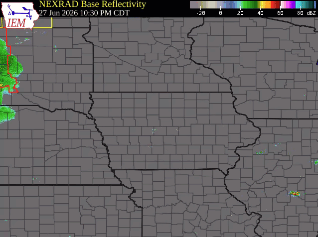
Radar
 |
 |
 |
 |
| June 27th into Morning of June 28th | June 29th into Morning of June 30th | June 30th into Morning of July 1st | July 2nd into Morning of July 3rd |
Additional Information
 |
 |
 |
 |
| June 27th Severe Weather Outlook (Morning Issuance) | June 29th Severe Weather Outlook (Morning Issuance) | June 30th Severe Weather Outlook (Morning Issuance) | July 1st Severe Weather Outlook (Morning Issuance) |
 |
 |
 |
 |
| July 2nd Severe Weather Outlook (Morning Issuance) | July 3rd Severe Weather Outlook (Morning Issuance) |
 |
 |
 |
 |
 |
 |
 |
 |
 |
 |
 |
 |
 |
 |
 |
 |
 |
 |
 |
 |
 |
Media use of NWS Web News Stories is encouraged! Please acknowledge the NWS as the source of any news information accessed from this site. |
|


 Weather Story
 Weather Map
 Local Radar