On Sunday May 3, a small tornado touched down 2 miles east of Terril, Iowa in Dickinson County. The tornado occurred between 5:34 and 5:36 pm CDT on Sunday evening. Based upon eye witness reports as well as video taken by those near the area, the tornado remained over an open field and no damage has been reported to the National Weather Service in Sioux Falls, South Dakota. Because no damage was reported, the tornado is rated EF-0. An EF-0 tornado has wind speeds of 65 to 85 mph.
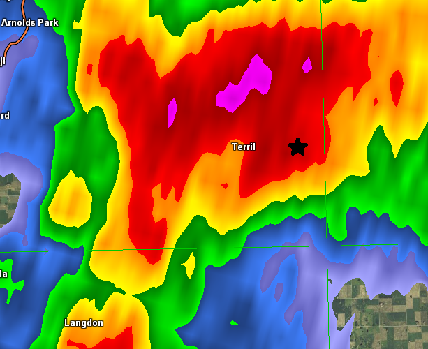
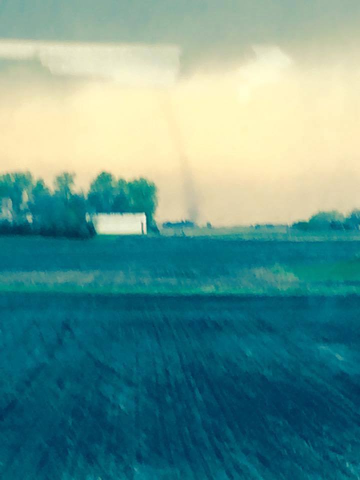
Below is a radar image from 5:33 pm. The star represents the approximate location of the tornado that occurred 1 minute later. The tornado was located on the leading edge of the storm. Also, based upon observations, this was also very close to where a cold front was located at the time. A second photo taken by Eric Tigges from near Lake Center, IA shows the tornado over an open field extending from the cloud base. This photo was taken south of the tornado and notice that there is not any precipitation near the tornado and the tornado has a cylindrical shape. Based upon where the tornado was located and how it looked in photos, the tornado is a landspout.
A landspout is a tornado that develops as a thunderstorms goes from the towering cumulus stage to the cumulonimbus (mature) stage of thunderstorm development. Below is a depiction of the life cycle of an ordinary thunderstorm. An examination of the radar imagery between 5:30 pm and 5:40 pm shows that a new updraft was forming east of Terriil when the tornado occurred. The typical landspout lasts only a few minutes and is less than 100 yards wide. Because they occur away from any significant rainfall, they can be viewed from large distances. In this case, witnesses observed this tornado from several miles away.
|
Radar picture from NWS Sioux Falls radar at 533 pm CDT. The star denotes the approximately location of the tornado |
|
Photograph by Eric Tigges taken from near Lake Center, Iowa around 5;35 pm. |

A depiction of the life cycle of an ordinary thunderstorm.


 Weather Story
 Weather Map
 Local Radar