Sioux Falls, SD
Weather Forecast Office
During the evening of Thursday, July 23rd, a "classic" supercell developed over portions of Sanborb, Beadle, and Miner counties that produced multiple tornadoes. The strongest tornado occurred approximately eight miles south of Huron along South Dakota Highway 37. Upon the completion of the damage survey, the tornado that was responsible for damaging a home along Highway 37 and nearby crops was rated an EF-1 torndo with wind of 110 mph.

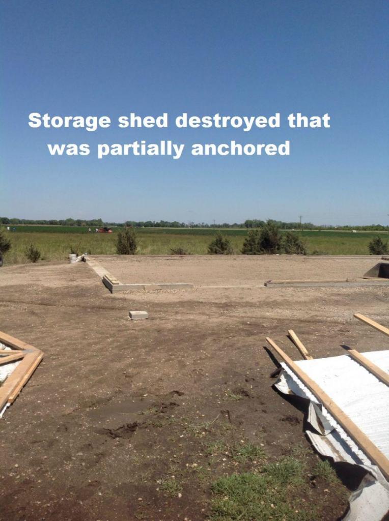
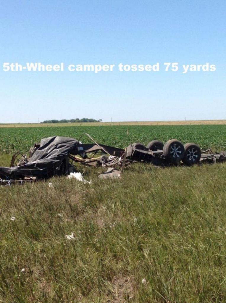
Much of the damage with this tornado was to crops, but it did destroy an out-building. The tornado initially developed just south of the homestead. It also tossed a 5th Wheel camper 75 yards.
As it crossed South Dakota Highway 37, you can see how the corn was scoured by the tornado!

Also that evening, three other tornadoes developed between 10 and 11 PM CDT Thursday almost parellel to South Dakota Highway 34. Thankfully these tornadoes occurred in open rural areas, but did result in quite a bit of crop damage. With this in mind, these tornadoes have been officially rated EF-0 due to the limited amount of damage.

If you have any questions concerning these tornadoes and the results of the damage survey, please feel free to contact Warning Coordination Meteorologist, Todd Heitkamp.
Popular Pages
Past Weather Events
Regional Weather Roundup
Daily Temp/Precip
Hazardous Weather
Local Climate Archives
Climate Graphs and Data
Seasonal
EvapoTranspiration
Fire Weather
Grassland Fire Danger
Flooding (River)
Summer Weather
Travel Forecasts
Winter Weather
Winter Preparedness
Forecast Snowfall Graphic
Winter Temp Climatology
US Dept of Commerce
National Oceanic and Atmospheric Administration
National Weather Service
Sioux Falls, SD
26 Weather Lane
Sioux Falls, SD 57104-0198
605-330-4247
Comments? Questions? Please Contact Us.


 Weather Story
 Weather Map
 Local Radar