Sioux Falls, SD
Weather Forecast Office
| Go Back to the West |
 |
Continue to the East |
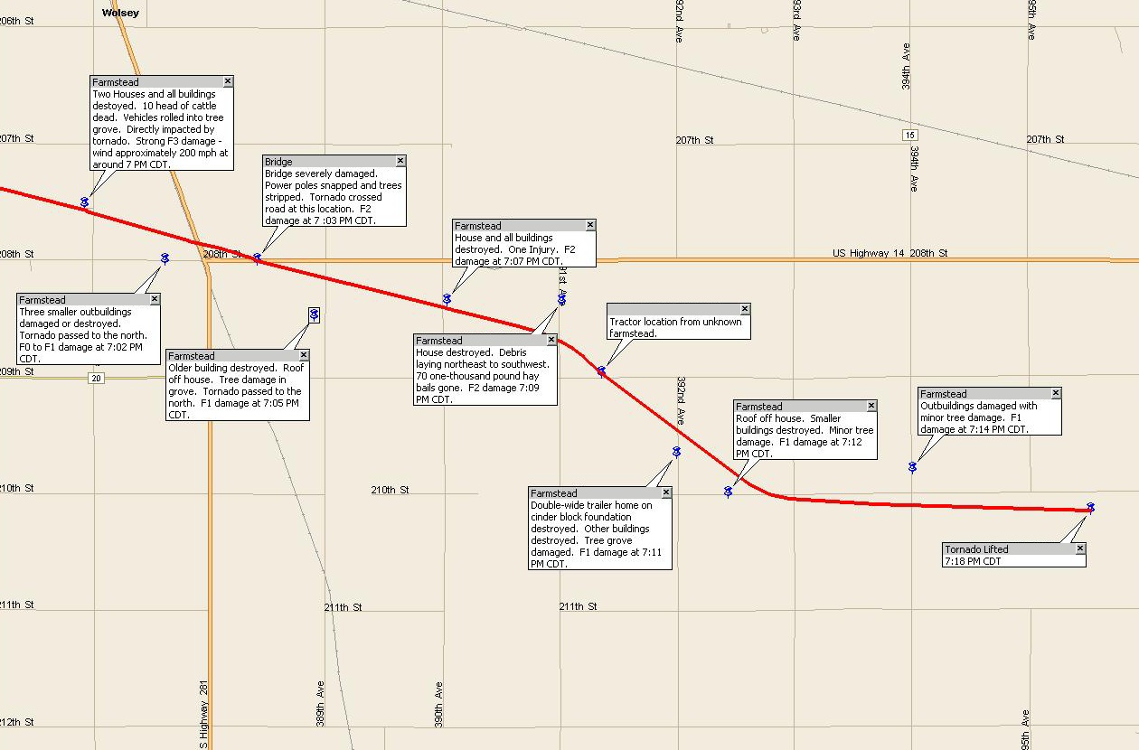
The following photo was taken by Todd Heitkamp, Warning Coordination Meteorologist at NWS Sioux Falls. Click on any of the maps/images for a larger view.
 This Chevy S10 pick-up was flipped on top of the foundation of a destroyed building. This damage was two miles south of Wolsey, SD. |
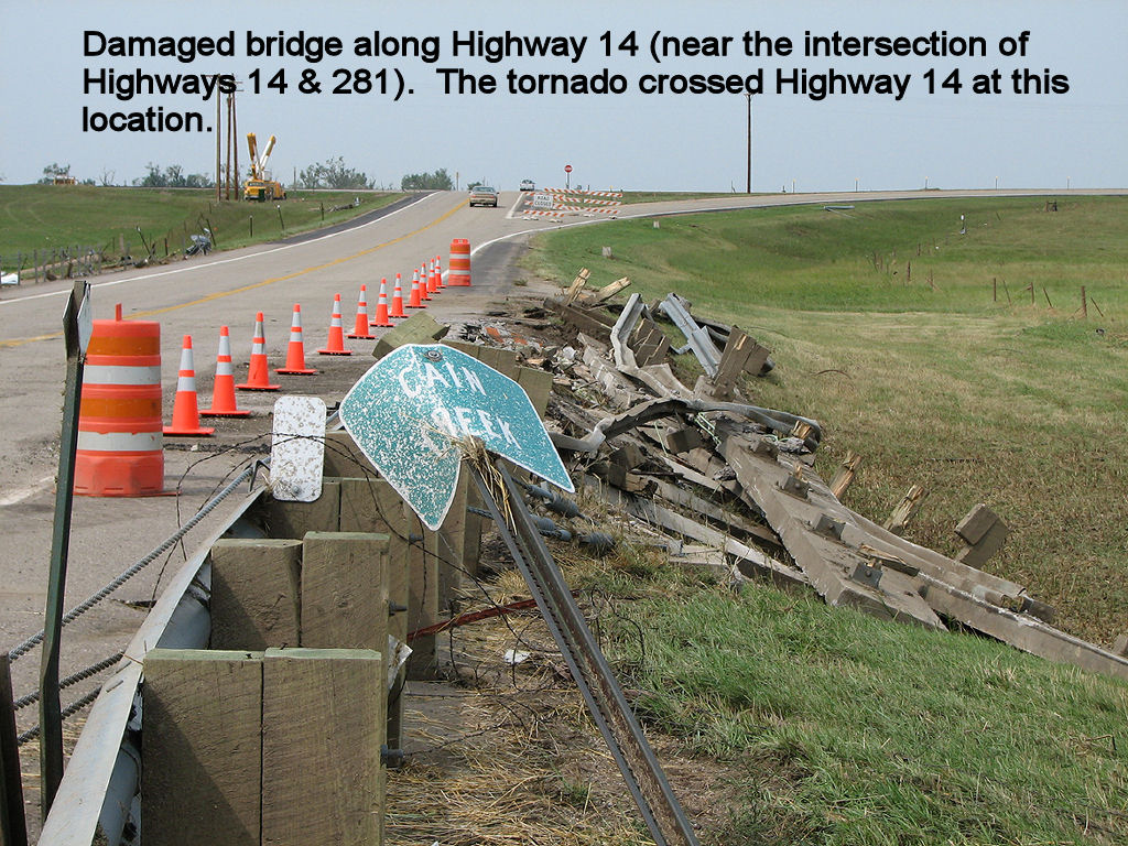 This bridge, near the intersection of Highways 14 and 281, was destroyed as the tornado crossed Highway 14. This bridge, near the intersection of Highways 14 and 281, was destroyed as the tornado crossed Highway 14. |
Popular Pages
Past Weather Events
Regional Weather Roundup
Daily Temp/Precip
Hazardous Weather
Local Climate Archives
Climate Graphs and Data
Seasonal
EvapoTranspiration
Fire Weather
Grassland Fire Danger
Flooding (River)
Summer Weather
Travel Forecasts
Winter Weather
Winter Preparedness
Forecast Snowfall Graphic
Winter Temp Climatology

US Dept of Commerce
National Oceanic and Atmospheric Administration
National Weather Service
Sioux Falls, SD
26 Weather Lane
Sioux Falls, SD 57104-0198
605-330-4247
Comments? Questions? Please Contact Us.


 Weather Story
 Weather Map
 Local Radar
 Follow us on X
 Follow us on Facebook
 Follow us on YouTube
 FSD RSS Feed