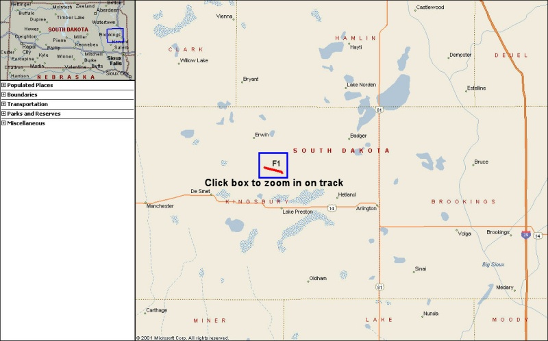
On 2 May 2006, an F1 tornado moved across portions of eastern Kingsbury County in eastern South Dakota. The tornado was located 4 miles north of Lake Preston, South Dakota. The tornado moved to the east-southeast and was on the ground for approximately 7 minutes from 6:19 - 6:27 pm CDT.
Below is a map of the Kingsbury County area. If you click on the blue box, you can view a zoomed-in image of the path of the tornado, as well as the Fujita scale rating along the path. While the tornado was generally F0 throughout its life, there were a couple of periods where it approached F1 intensity. The structure and evolution of this tornado was similar to a landspout, which are short-lived and smaller tornadoes. For more information on landspouts, please see this web page which discusses the meteorological environment associated with the tornado.
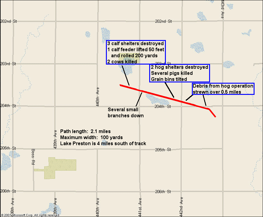
As the tornado formed around 6:19 pm CDT, a farmer noticed that dirt was beginning to swirl about 0.5 miles west of 441st St. The tornado moved across the pasture, and 3 calf shelters were lifted 50 to 100 feet in the air, broken up and dropped to the ground. Some debris was carried over 0.25 miles, with 1"x3" wood boards driven into the ground near the shelter belt on the other side of 441st Street. There was also some tin from the roof of the shelter found in the field between 441st St. and 442nd St. In addition to destroying the three shelters, a calf feeder was lifted off the ground and dropped, then rolled approximately 200 yards to the west side of 441st St. As the tornado continued to move east-southeast, some small branches were broken off the trees in the shelter belt east of 441st St. The circulation appeared to weaken as it moved east from the shelter belt, as little dirt was picked up across the pasture for the next 0.5 miles.
As the tornado approached another farm, it appears to have strengthened as more debris was noted by several eyewitnesses just west of the farm. The tornado then hit two outbuildings, including a hog confinement building. At least 3 bins were tipped westward, one building was toppled and the hog confinement building lost the middle section of the roof. While much of the debris from the farm, including tin roofing and insulation, was found across fields over the next 0.5 miles, some of the rafters were thrown over 100 feet to the west of the farm. As the tornado continued to move southeast, it crossed 204th Ave. about 0.4 miles from the farm. Based upon damage and debris, the tornado appears to have dissipated shortly after crossing south of 204th Ave.


 Weather Story
 Weather Map
 Local Radar