The National Weather Service in Sioux Falls completed a survey of the most significant damage that resulted from the 25 tornadoes that occurred on Saturday, May 5 2007...across Southeast South Dakota. A map of each track is followed by a description of the damage along each path. A reminder...the old Fujita scale (named after University of Chicago's Theodore Fujita) has been revised as of February 1, 2007, and is now the Enhanced Fujita scale. This new scale provides the surveyors with more damage indicators, which in turn provides a less subjective rating.
Yankton County
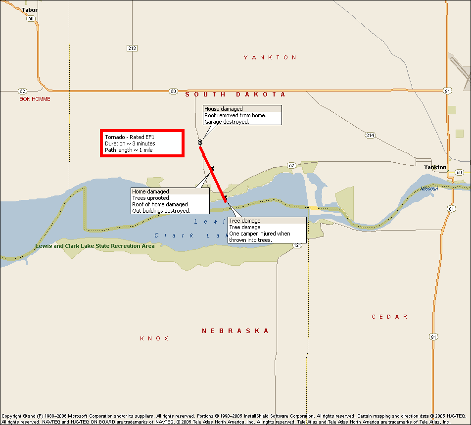
The survey began at the Gavin’s Point Dam area in Yankton County. The tornado began at the Lewis and Clark Recreation Area and resulted in considerable tree damage...as well as damage to homes. A camper was thrown into the trees at the campground which resulted in one injury. This tornado traveled north-northwest and was on the ground for approximately four miles. For a period of time this tornado was joined by a second tornado from the same storm. These tornadoes have been determined to be an EF-1 (86-110 mph) on the Enhanced Fujita (EF) scale based upon the damage to some of the homes along Highway 52.
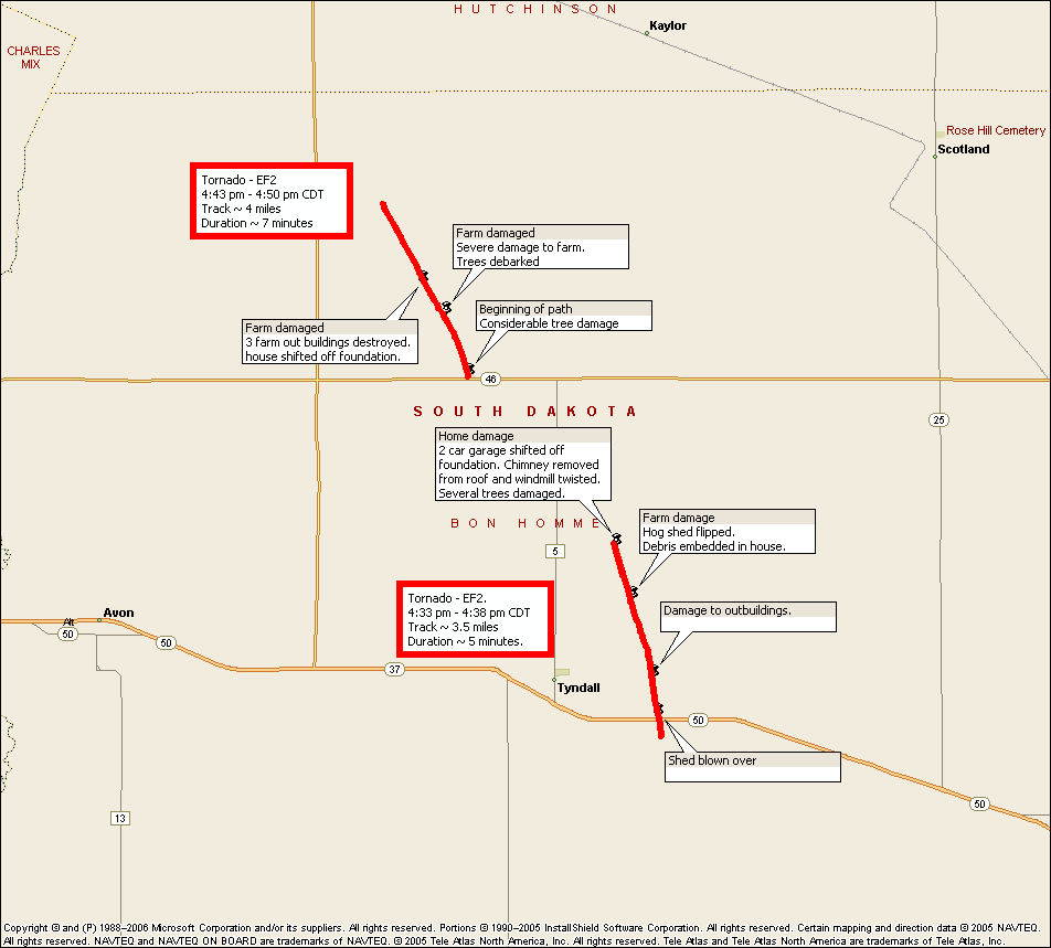
Another tornado began seven miles north and two miles west of Tyndall in Bon Homme County. This tornado traveled north-northwest and was on the ground for six miles. Many homes...barns...various out-buildings...and trees were severely damaged. The resultant damage led the Weather Service to give it an EF-2 (111-135 mph) rating on the EF-scale.
Aurora County
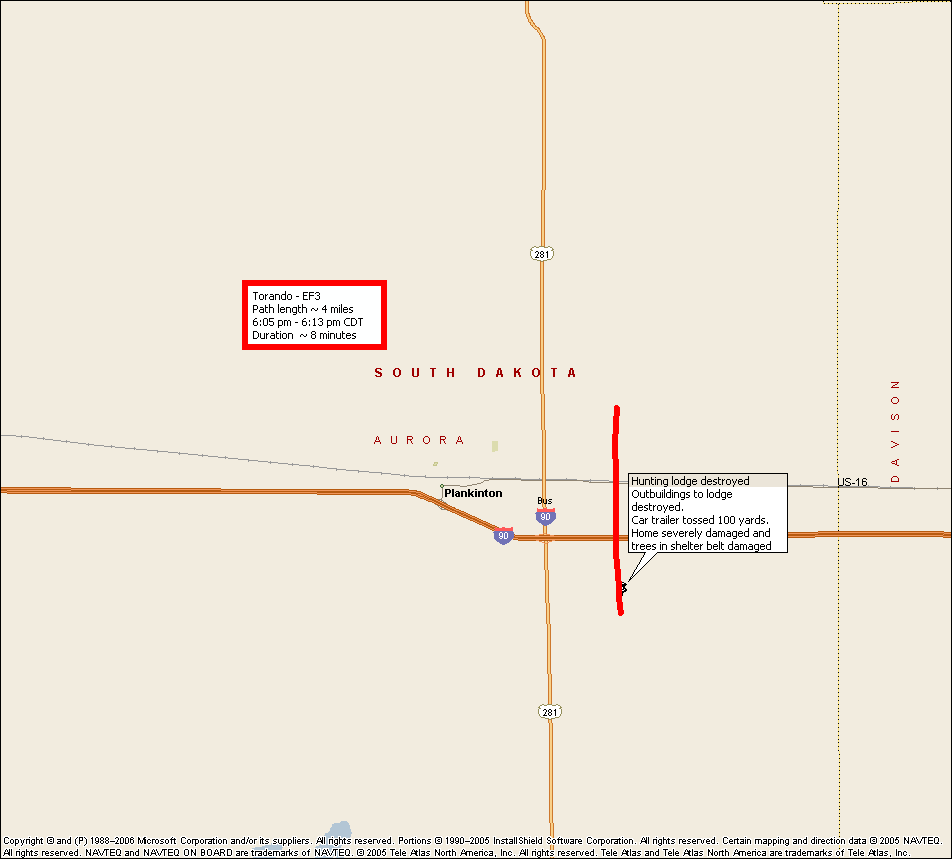
The strongest tornado occurred in Aurora County...approximately five miles southeast of Plankinton. This tornado was on the ground for five miles and traveled due north. The most significant damage was done to a pheasant hunting lodge/preserve...where numerous buildings and trees were severely damaged. An empty car trailer was rolled a distance of 100 yards before coming to rest. Besides the structural damage...numerous adult and chick pheasants were lost. This tornado also crossed Interstate 90 before dissipating two miles north of I-90. The observed damage resulted in this tornado being rated an EF-3 with estimated winds around 140 mph.
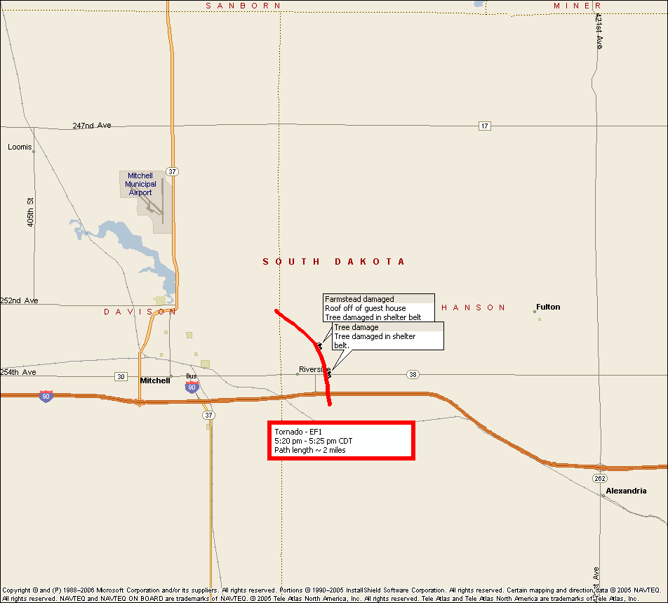
An EF-1 (86-110 mph) tornado occurred in western Hanson County along riverside road east of Mitchell. This tornado also crossed Interstate 90 and Highway 38 along its three mile track. Trees were damaged and a building lost its roof.
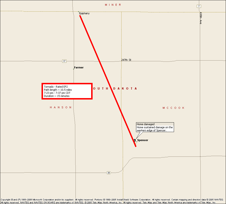
The final survey was conducted in Spencer. The tornado developed two miles south of Spencer and traveled through the western half of Spencer and continued to the north-northwest. This tornado was observed to be very large before it dissipated four miles northwest of Spencer. Most of the damage was to trees and a junk yard. This tornado was rated an EF-2 (111-135 mph).


 Weather Story
 Weather Map
 Local Radar