Severe thunderstorms capable of damaging winds will be possible from the Ozark Plateau east into the Tennessee Valley Saturday. Rounds of heavy thunderstorms ahead of a slow moving front will continue locally heavy rainfall and scattered flash flooding potential from the Ozarks to the Ohio and Tennessee Valleys Saturday. Extreme heat will continue for the Intermountain West and Plains. Read More >
 |
|
 |
 |
|
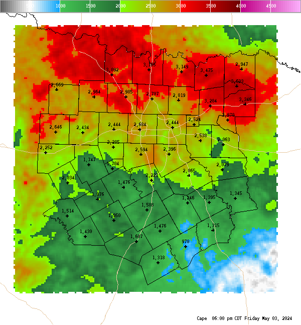
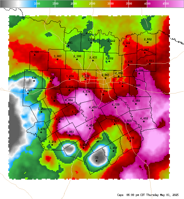
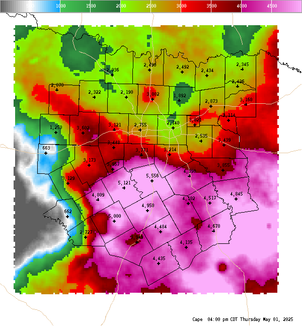
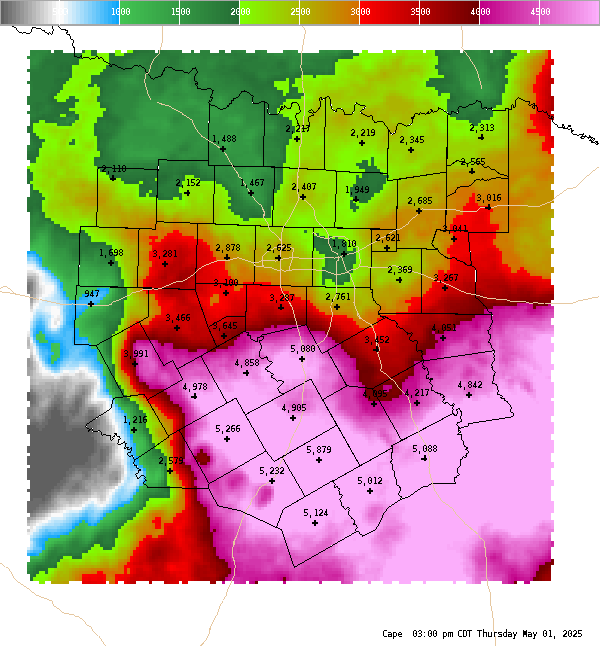
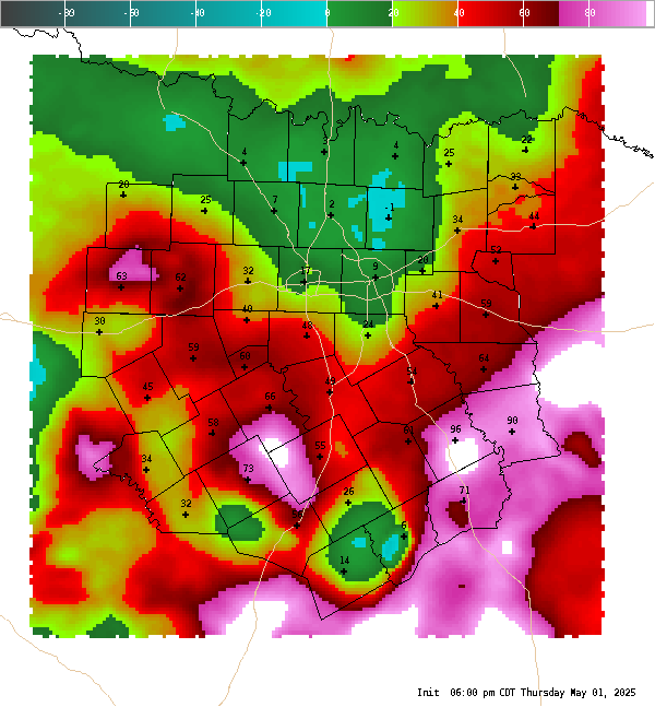
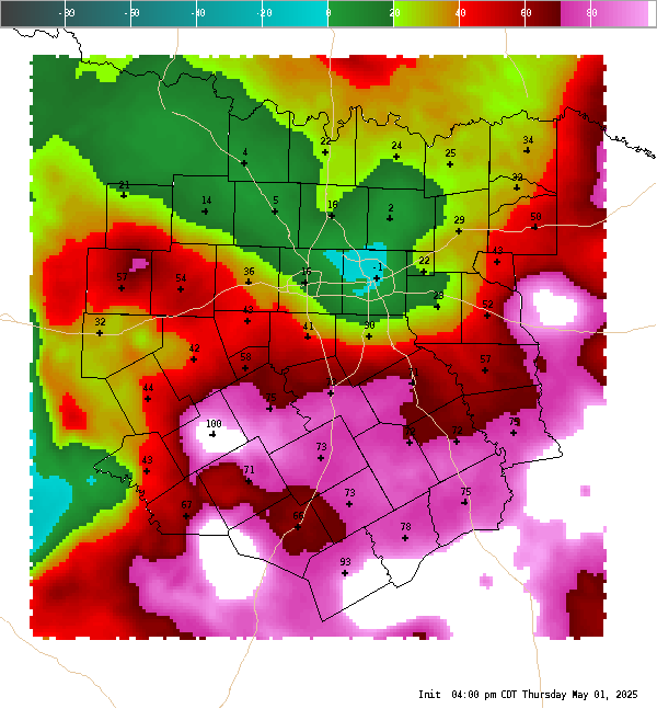
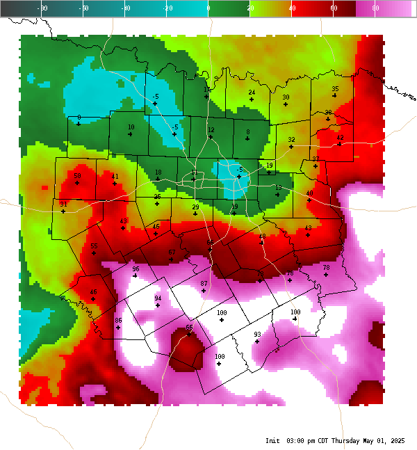
CAPE This is a surface based Convective Available Potential Energy (CAPE) measurement only. In the cool season, elevated instability may be much higher than surface based cape. On average, CAPE of 1000 J/Kg is usually sufficient for strong to severe storms. CAPE of 3,000 to 4,000 J/Kg or higher is usually a signal of a very volatile atmosphere that could produce severe storms if other environmental parameters are in place. |
|
 |
|
 |
 |
|
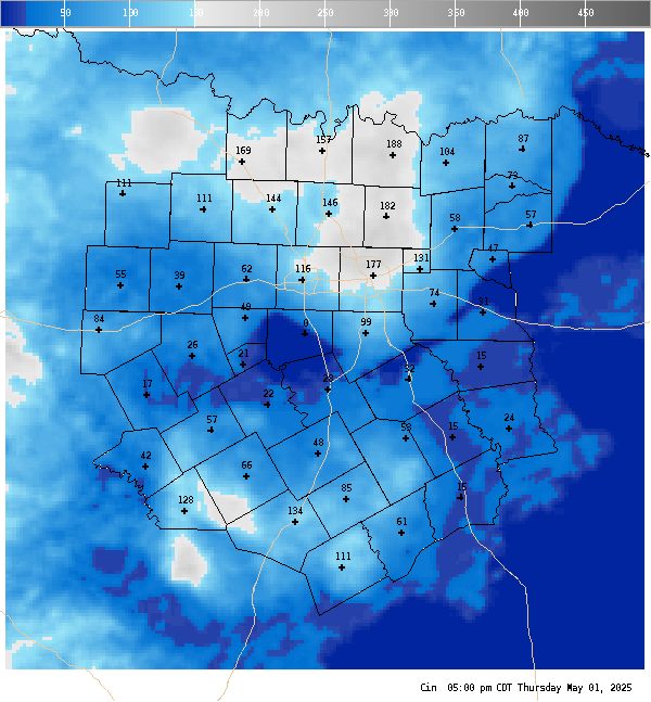
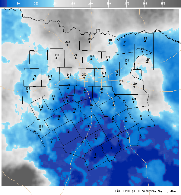
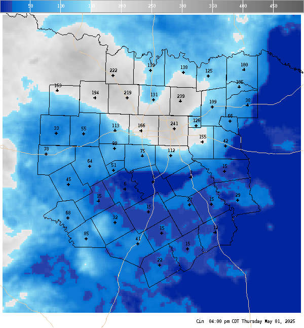
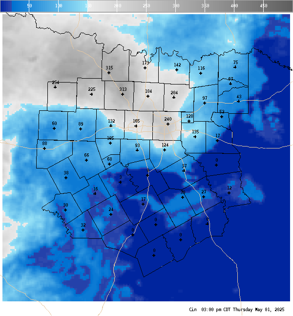
CIN This is a surface based measurement of Convective INhibition (CIN) or what is sometimes more commonly referred to as the strength of the cap. The value is capped off at 500 J/KG and in cases where there is no surface based CAPE available this parameter is set to 500 J/KG. In general, the Cap is said to be breakable when CIN is 20 J/Kg or less. |
|
 |
|
 |
 |
|
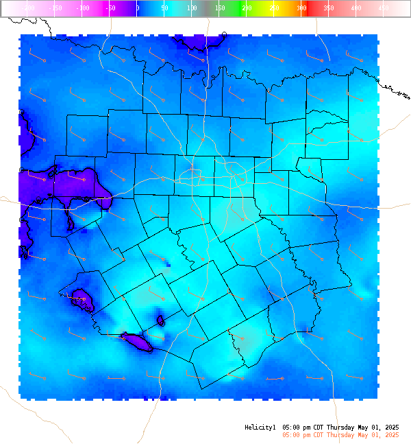
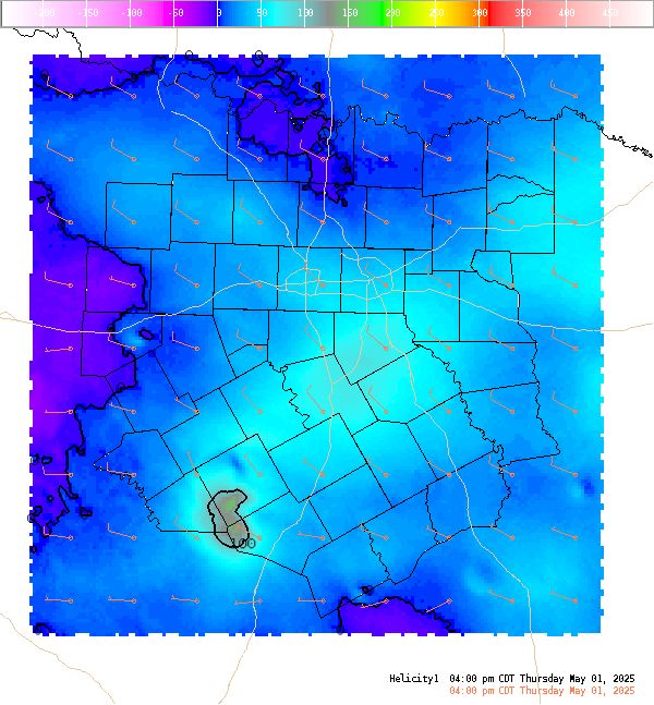
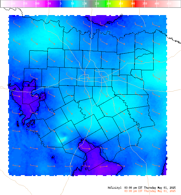
Helicity (0-1 Km) This is the 0-1 km (approximately 0-3,000 Ft. AGL) storm relative helicity which is a measure of the amount of low level wind shear available for tornadogenesis. This is not a good indicator of supercell potential which is related more strongly to 0-6 KM vertical shear. Values greater than 100 m**2/s**2, do suggest an increased threat of tornadoes provided a supercell is present. Larger values are generally better, but there are no clear "boundaries" between non-tornadic and significant tornadic supercells. |
|
 |
|
 |
 |
|
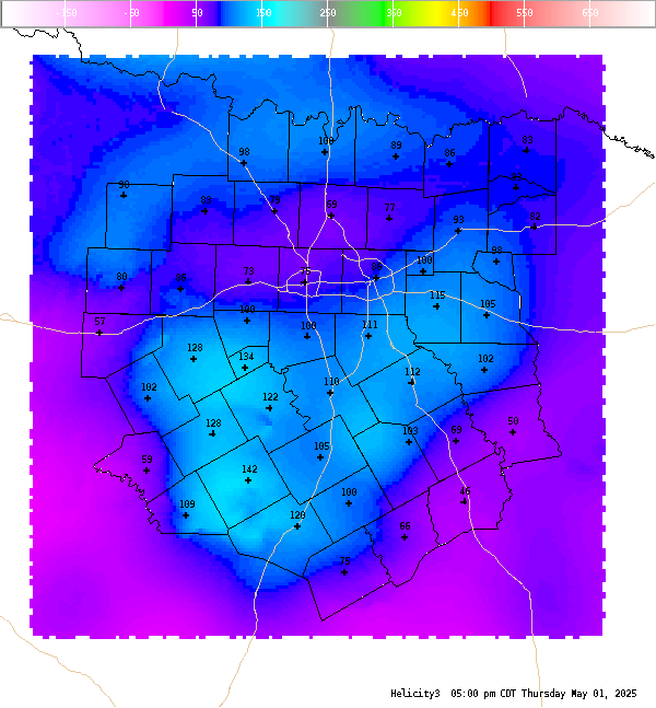
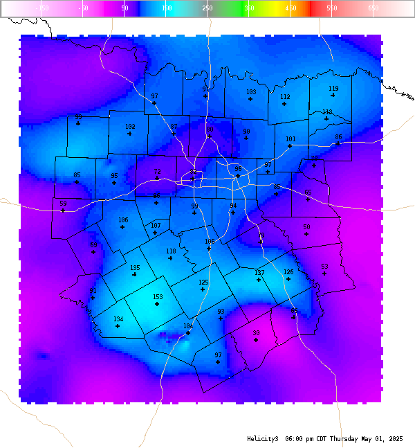
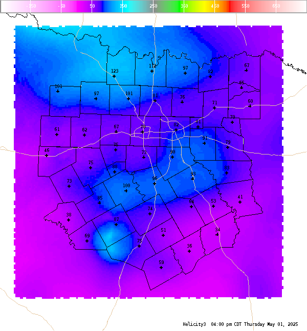
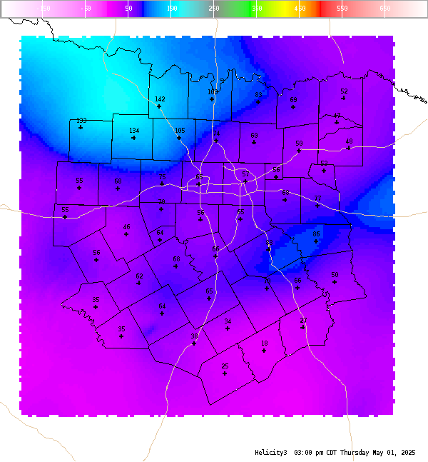
Helicity (0-3 Km) This is the 0-3 km (0-10,000 Ft. AGL) storm relative helicity which is a measure of the amount of wind shear available from the ground to roughly 700 MB. Values greater than 250 m**2/s**2 suggest an increased threat of tornadoes, but high values with this index do not necessarily suggest that the environment is supportive of supercell structures (look at 0-6 km shear). Larger values are generally better, but there are no clear "boundaries" between non-tornadic and significant tornadic supercells. Negative values suggest that anti-cylonic (left moving) supercells will dominate. |
|
 |
|
 |
 |
|
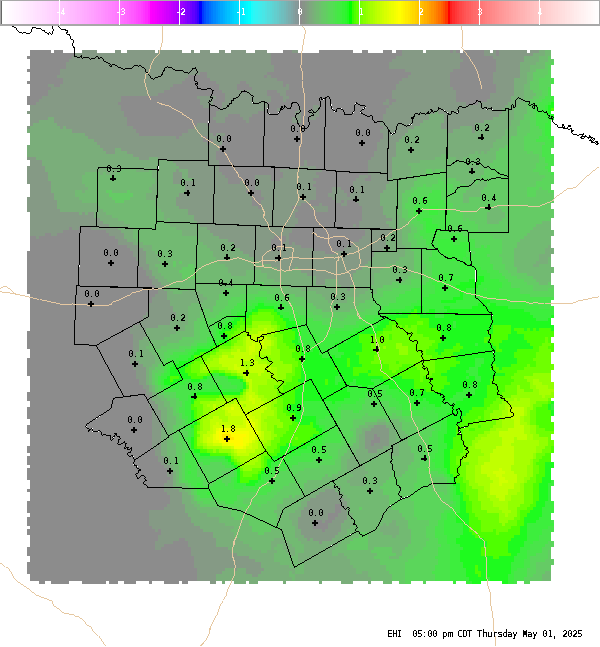
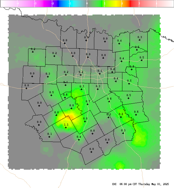
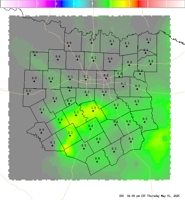
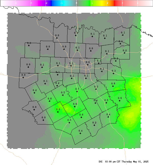
EHI The Energy Helicity Index (EHI) is a number which represents the combination of instability and storm relative helicity. Our calculation uses surface based CAPE and 0-3 km storm relative helicity. Values greater than 2 or 3 have been correlated to cyclonic supercells with increased tornadic potential. Negative values are indicative of an environment favorable for anti-cyclonic (left moving) supercells, but tornadoes associated with anti-cyclonic supercells are extremely rare. |
|
 |
|
 |
 |
|
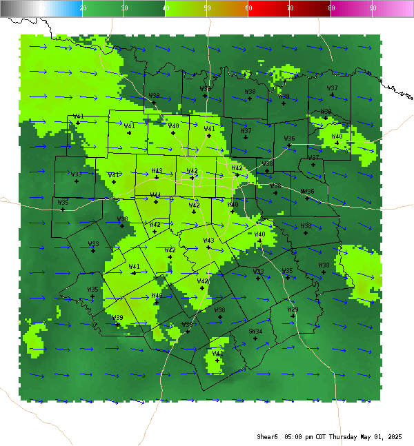
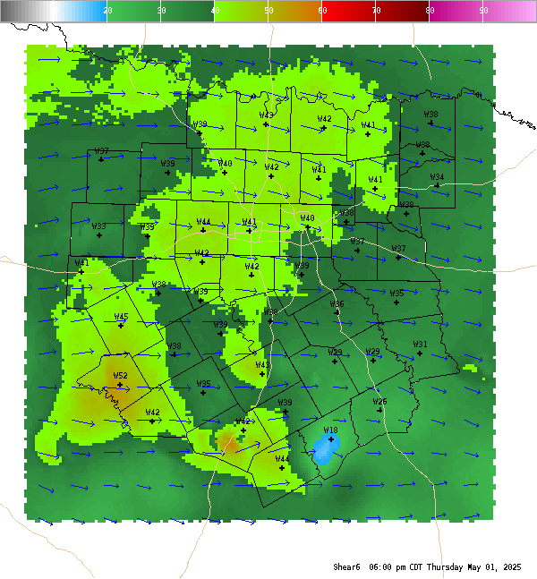
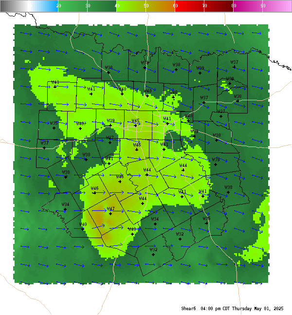
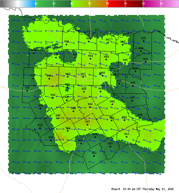
Shear (0-6Km) The 0-6 km shear vector. Values generally greater than 40 knots are supportive of supercells, although in high instability environments this can be as low as 30 knots. |
|
 |
|
 |
 |
|
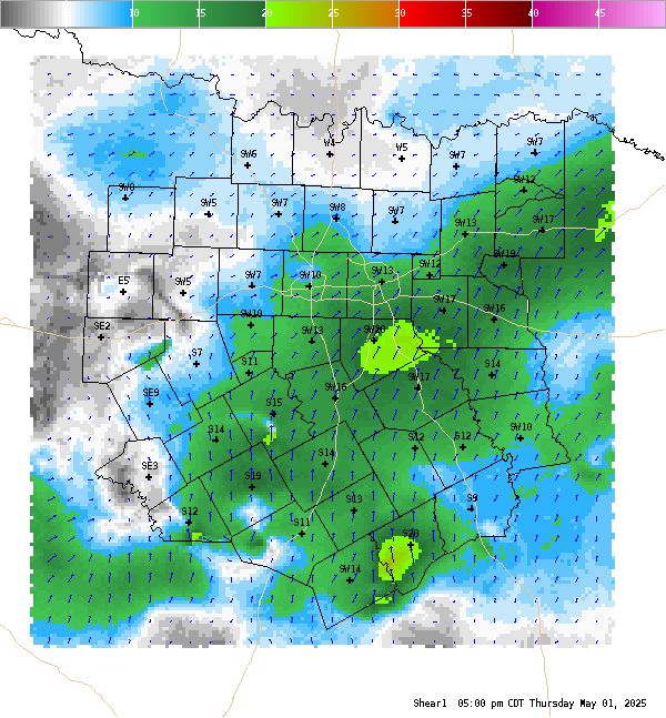
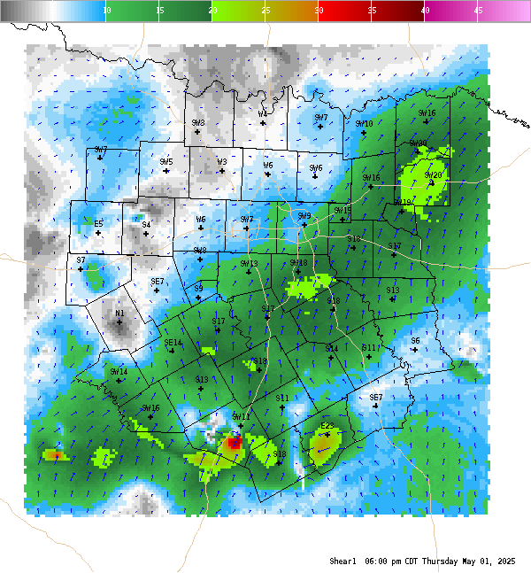
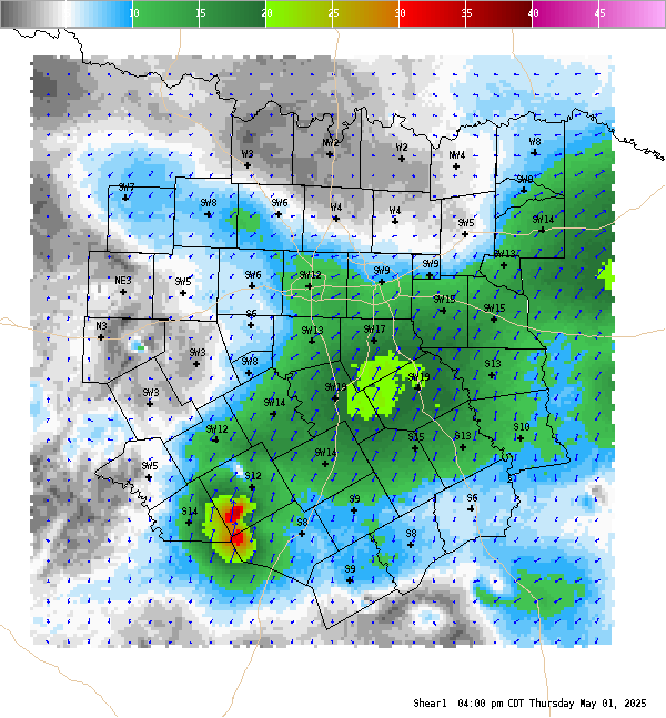
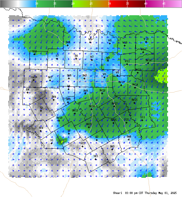
Shear (0-1km) Surface-1-km Vertical Shear is the difference between the surface wind and the wind at 1-km above ground level. These data are plotted as vectors with shear magnitudes contoured. 0-1-km shear magnitudes greater than 15-20 knots tend to favor supercell tornadoes. |
|
 |
|
 |
 |
|
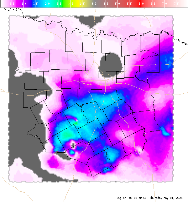
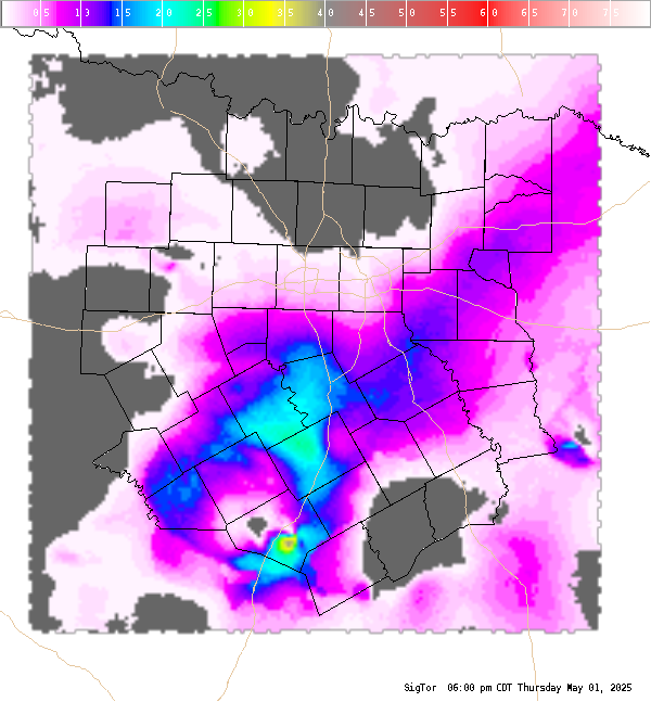
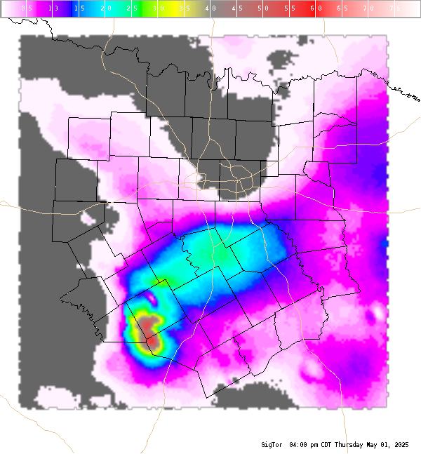
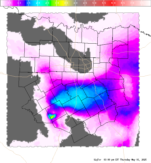
Significant Tornado (SigTor) A composite index that includes 0-6 km bulk wind shear, 0-1 km storm-relative helicity, surface based CAPE, surface parcel CIN, and surface parcel LCL height. Values greater than 1 are indicative of increased potential of significant tornadoes. |
|
 |
|
 |
 |
|
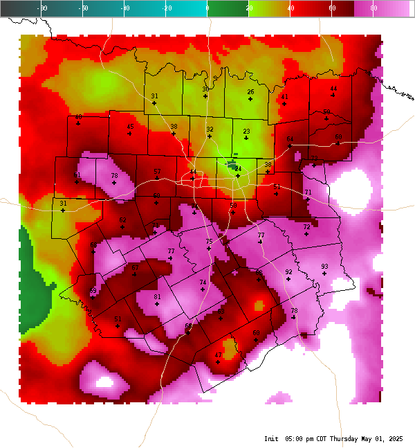
Convective Interest This is a highly experimental index which attempts to show areas where surface based convection is favorable or may initiate within the next hour. The index uses a combination of several fields, (CAPE, CIN, low level lapse rates, moisture convergence, satellite, and most unstable LI) to develop a number between -100 and 100. Negative values are indicative of an environment not supportive of surface based convection. The higher the value, the more favorable the environment is for surface based convection. Values greater than 70 are suggestive that convective initiation will likely occur within the next hour in that region. This index works best in regimes of airmass (or pulse) convection or on days where the cap is the primary inhibiting factor for convection. |
|