Wildfire smoke will push into the Midwest, worsening air quality. A frontal system brings severe storms from the Northern Plains to the Mid‑Atlantic the next few days. Heavy Gulf Coast rain is possible as Tropical Depression Two has formed, while monsoonal storms persist in the Southwest with heavy rainfall. Hazardous heat expands from the Plains into the Lower Mississippi Valley. Read More >
|
March 2011 Review
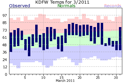
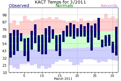
The warm weather during the latter half of February continued largely unabated during March. At DFW Airport, there were 19 days during the month with highs in the 70s or 80s. Waco reached a record high of 94°F on March 26, Waco's first 90-degree day of the year. Despite an unseasonably cool conclusion to the month, there were only a handful of below normal days in March. Both DFW and Waco ended the month 4 degrees above normal.
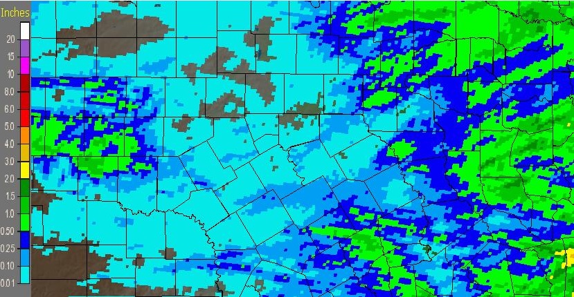
Some areas east of I-35 picked up a half-inch or more of rainfall during March, but many areas saw little or no measurable precipitation the entire month. The image below shows estimated precipitation for the month of March.
March 2011 Precipitation
For both DFW and Waco, March 2011 ranks among the driest on record. It was the driest March since 1925 in Dallas/Fort Worth and the driest since 1972 at Waco.
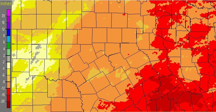
6-Month Precipitation Deficits (October 2010 - March 2011)
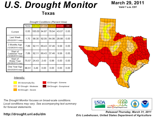
Drought continues to intensify across the region. For the first time in 2 years, the entire state of Texas is classified as at least abnormally dry. Almost 95% of the state has some drought classification. The extent of extreme drought statewide has not been matched since 2006. For more information about the ongoing drought across North Texas, see our Drought Information Statement.
|
||||||||||||||||||||||||||||||||||||||||||||||||||||||||||||||||||||||||||||||||||||||||||||||||||||||||||||||||||||||||||||||||||||||||||||||||||||||||||||||||||||||||||||||||||||||||||||||||||||||||||||||