A heat wave over the Southwest will intensify this week, peaking and expanding into the Intermountain West and northern High Plains this weekend. Critical to extremely critical fire weather conditions are forecast from the Northwest and the northern Great Basin this weekend. Particularly Dangerous Situation Red Flag Warnings have been issued. Read More >
Tornadoes Strike Navarro County
Wednesday, September 5, 2007
Based on eyewitness reports, survey information from emergency management officials, and radar data, it appears that two tornadoes developed in southern portions of Navarro County on the morning of Wednesday, September 5, 2007.
The first tornado developed at approximately 7:42 am. The first damage was observed 6.4 miles south-southeast of the community of Richland. The tornado moved northeast and caused minor tree damage to the west of Highway 14. This tornado will be rated an EF-0 on the Enhanced Fujita scale. Maximum winds were likely in the 70-80 mph range. The path length of the twister was 0.8 miles with an average path width of 40 yards.
|
|
|
|
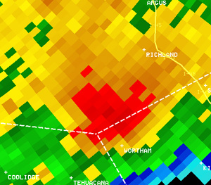
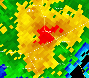
Reflectivity image (left) and velocity image (right) of the tornadic storm southwest of Richland, near the Freestone County line, at 7:35 am. In the velocity image, red indicates motion away from the radar in Fort Worth, and green indicates motion toward the radar. |
|
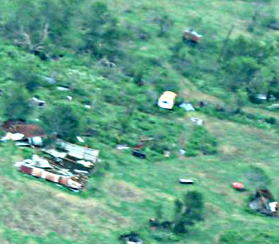
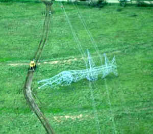
The second tornado formed at 7:47 am, roughly 2 miles east-southeast of the first tornado. The first damage was noted along County Road 2410, just north of the Freestone County line. This twister was more significant than the first. It uprooted trees and snapped trunks and large limbs as it moved northeast. The tornado destroyed a barn approximately 1 mile west of Interstate 45 and damaged two metal transmission line towers 1/2 mile west of the Interstate. The tornado dissipated shortly after crossing Interstate 45. Based on the transmission tower and tree damage, as well as damage surrounding these areas, the tornado will be rated a low EF-2 on the Enhanced Fujita Scale. Maximum winds were likely in the 110-120 mph range. The twister path length was 6.1 miles with an average path width of 80 yards.
 |
 |
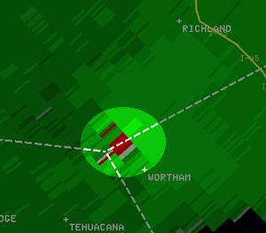
| Reflectivity image (left) and velocity image (right) of the tornadic storm south of Richland, along I-45, at 7:51 am. In the velocity image, red indicates motion away from the radar in Fort Worth, and green indicates motion toward the radar. | |
 |
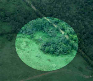 |
| Damage to metal transmission line towers 1/2 mile west of Interstate 45: | Tree damage near the Navarro/Freestone County Line: |
|
|
|
Structural Damage near Interstate 45: |
|
|
|
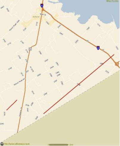
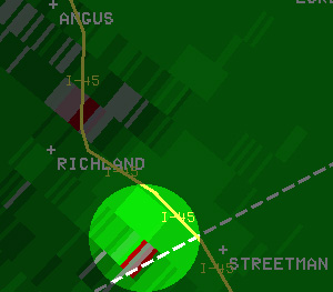
Red lines indicate tornado paths between the community of Richland and the Freestone County Line: |
This event was a reminder to all of us in North Texas that tornadoes can, and do, occur any time of the day and any time of the year. These storms reinforce the need to have a severe weather plan in place and practice it frequently. Furthermore, now is the time to get your NOAA weather radio ready. Weather radios will alert you of hazardous weather...whenever it strikes!
For more details on the Enhanced Fujita Scale, visit www.spc.noaa.gov/efscale/
Special thanks to Eric Meyers, Navarro County Emergency Management Coordinator, for the aerial photos. All photos are copyright and courtesy of Navarro County Emergency Management.